The Mullerthal, Luxembourg's country of sandstone and mills
The Mullerthal (Mëllerdall) is the tourist region in eastern Luxembourg, on the German border, nicknamed Little Switzerland for its sandstone gorges and wooded valleys. Its 14 communes are centred on Echternach. It holds two UNESCO labels, the Mëllerdall geopark and the Echternach dancing procession, and the 112 km Mullerthal Trail runs through it.
In 30 seconds
Full read: 4 min
The Mullerthal (Mëllerdall) is eastern Luxembourg's tourist region, known as Little Switzerland.
It has 14 communes around Echternach, with sandstone gorges, woods and old mill valleys.
Eleven communes form the Natur- & Geopark Mëllerdall, a UNESCO Global Geopark since 2022.
The 112 km Mullerthal Trail crosses it in three circular routes.
If you like walking, this is the region I'd put first outside the capital. I'd stay in Echternach or Berdorf and give the rocks two full days, because a day trip from the city only really gets you the waterfall and a car park.
Sergio LeponeMy advice
Before you go
What I would keep in mind
01 Most beautiful
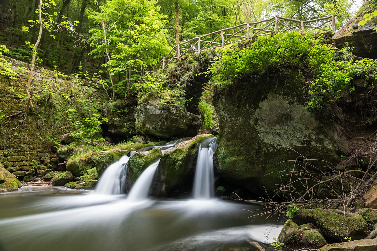
The waterfall with the little bridge
The Schiessentümpel, with its 1879 stone bridge over the Black Ernz, is what the regional tourist office calls the most photographed spot in the Mullerthal. It's just outside the hamlet of Müllerthal.
The Wolfsschlucht, the Perekop, the Hohllay and the Schiessentümpel cost nothing to visit, and the bus out from Luxembourg City is free within the country. Your money goes on the bed, not the scenery.
Hotel guests in the Mullerthal stayed 1.79 nights on average in 2025. I'd stay at least two, so a full Trail route doesn't have to be squeezed into a day trip.
The Mullerthal Trail website lists the direct 201, or the 211 and 212, from Kirchberg Luxexpo to Echternach every half hour. Check mobiliteit.lu on the day.
My own marks out of 10, weighing how unusual each place is for Luxembourg and how easily you can reach it on foot. Everything here is free apart from the Echternach museums and Beaufort Castle.
Castle ruins on a sandstone spur looming over the village and the White Ernz valley.
7.6 out of 10
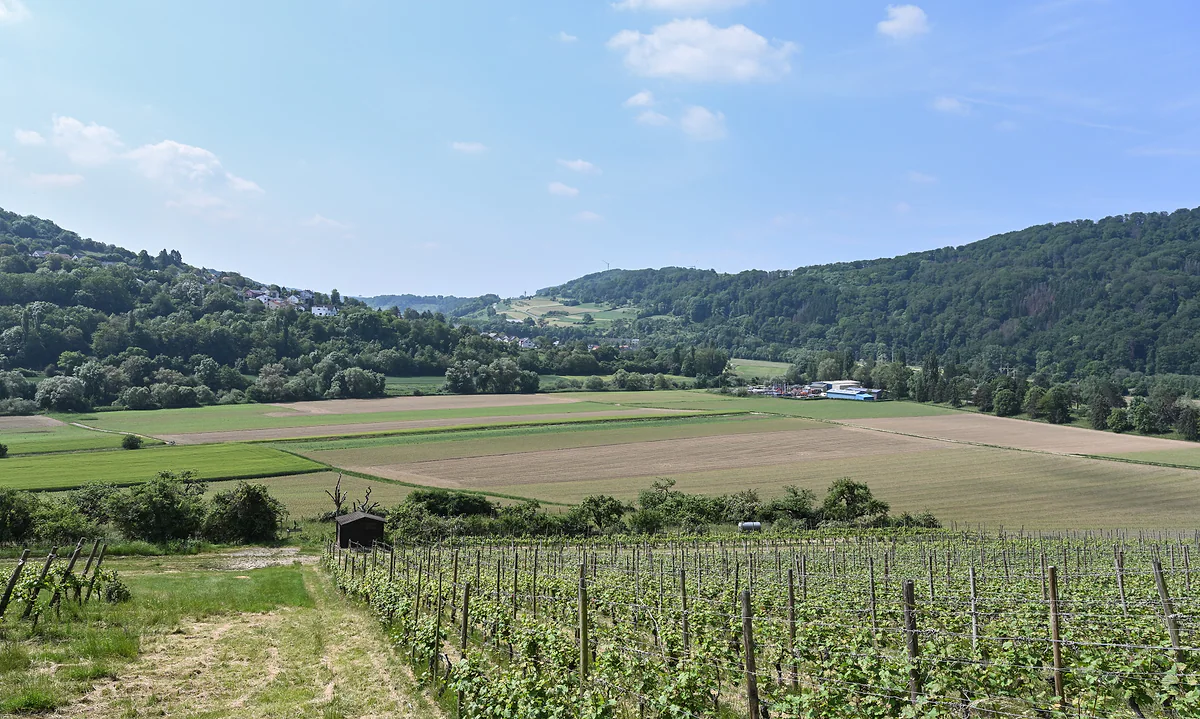
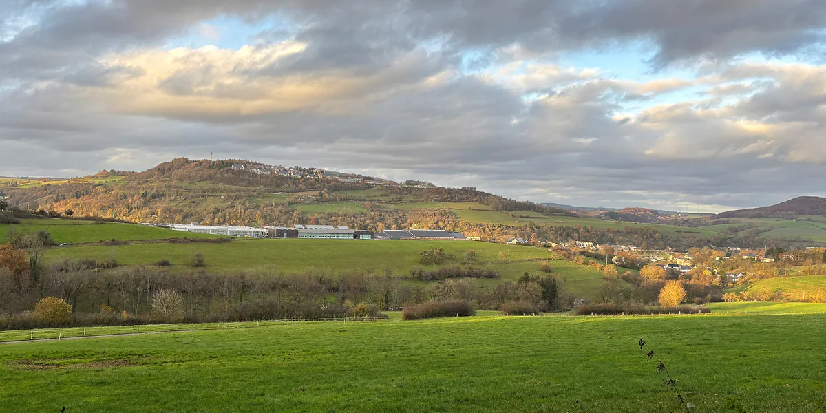
Luxembourg has a reputation for being flat and full of banks, and the Mullerthal undoes both ideas within ten minutes of walking. In the east of the country, right on the German border, the ground breaks up into blocks of mossy sandstone, corridors between rock walls and streams that once drove mill wheels. That’s where the Little Switzerland nickname comes from. It oversells the mountains, but I can see why it stuck.
Two Mullerthals, one name
The word covers two things. One is the tourist region run by the regional office in Echternach, which lists 14 communes, from Echternach and Berdorf to Larochette, Junglinster and the Vallée de l’Ernz (the full list is in the table). The other is the hamlet of Müllerthal, in Waldbillig, a handful of houses in the Black Ernz valley that lent its name to everything else. In Luxembourgish it’s Mëllerdall, the valley of the millers.
Eleven of those communes also make up the Natur- & Geopark Mëllerdall, set up in 2016 over 256 km² with 22 geosites. It joined UNESCO’s Global Geoparks network in April 2022. Add the Echternach dancing procession, inscribed in 2010, and the region holds two UNESCO labels. Those in the rest of the country are gathered in Luxembourg UNESCO World Heritage.
What I like most about the Mëllerdall UNESCO Global Geopark is that it has no fences. visitluxembourg explains that it’s both a nature park, a status Luxembourg law reserves for regions with a special cultural and natural heritage, and a geopark because of its sandstone, one of the most imposing landscapes of its kind in Western Europe. You’ll spot the signs with its logo along the main roads, and the quickest way to make sense of it is its free exhibition in Beaufort, close to Beaufort Castle.
Where the Little Switzerland look comes from
It’s all about the rock. The government portal explains that more than 200 million years ago this was seabed, the sea withdrew and rivers cut down through the Luxembourg sandstone to leave today’s landscape. The same source ranks the sandstone of the Black Ernz, White Ernz and Lower Sûre valleys among the most striking formations in western Europe, and it also stores the region’s drinking water.
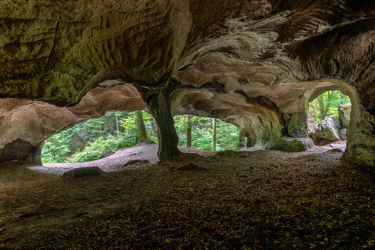
On the ground that means gorges like the Wolfsschlucht gorge, 40 m deep, cracks you climb with iron ladders, caves where millstones were cut and passages so narrow and dark that the Trail website tells you to bring a torch. There are no peaks. What you get is dense beech wood, damp air and rocks shaped oddly enough that every one of them has a name.
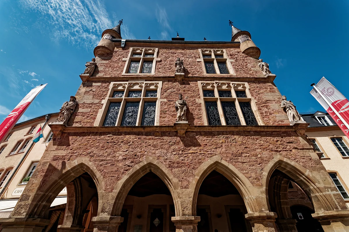
The region’s main town is Echternach, Luxembourg’s oldest, on the Sûre and facing Germany. It grew up around the abbey Willibrord founded in 698, and the basilica holds his tomb. Every Whit Tuesday the dancing procession sets off from there. On the edge of town there’s a 30-hectare lake with free swimming in summer and what’s left of a large Roman villa.
Two of the three Mullerthal Trail routes start in the town too, so it’s the obvious base. You’ve got restaurants, shops and a tourist office opposite the basilica, and twenty minutes on foot puts you among the rocks.
Walking is the point
The Mullerthal Trail is 112 km of waymarked path in three circular routes, with the European Ramblers Association’s Leading Quality Trails - Best of Europe label. Route 2, from Echternach through Berdorf, Müllerthal and Consdorf, is the rock route. Route 3 links the Black Ernz valley with the castles at Beaufort and Larochette. Route 1 heads along the Sûre to Rosport and the Girsterklaus chapel.
If a 36 to 40 km loop sounds like too much, every village has shorter local circuits. Berdorf alone advertises 50 km of its own paths. The government portal also lists five mountain-bike trails, 16 road-cycling circuits and five national cycle paths, the flat, wide kind that work for families.
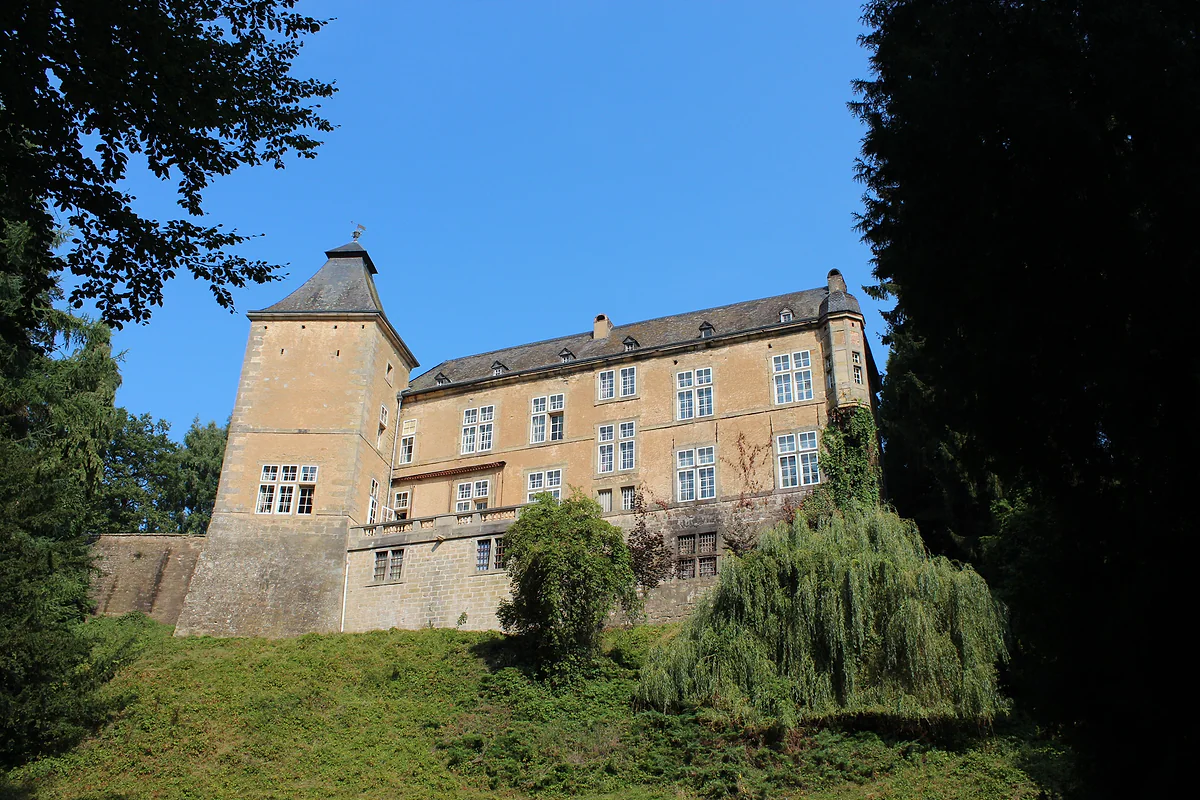
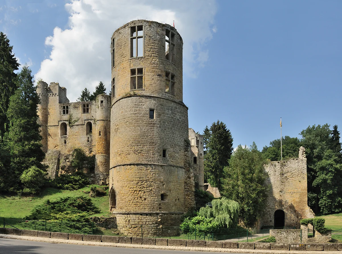
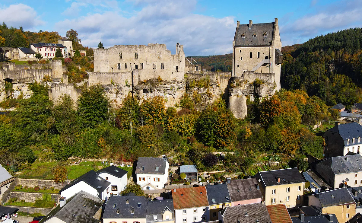
The rocks aren’t the whole story. Beaufort has two castles, a medieval ruin by a pond and a 17th-century Renaissance house beside it. Larochette’s ruin sits on its spur above the village, and Bourglinster has a well-known restaurant inside its walls. Rosport has the Tudor Museum, about the pioneer of the lead-acid battery. Up on the plateau there are fruit trees everywhere, and Berdorf’s cheese is known well beyond the border.
When to go and how long to stay
STATEC counted 20 hotels and 19 campsites in its Mullerthal region in 2025, with more than 12,000 camping places against fewer than 900 hotel beds. That tells you who comes here. Hotel stays averaged 1.79 nights. I’d book early for summer and for Whitsun week, when the procession fills Echternach, and compare the hotels in Echternach with the villages on the Trail.
One practical tip from the Trail website itself. In the hunting season, check geoportail.lu to see whether there’s a shoot in the woods you plan to walk that day. It’s not something a travel guide usually mentions, but here the forest is most of the map. Within the region, Junglinster has more than 250 km of waymarked paths, one of the largest networks in the area according to its council.
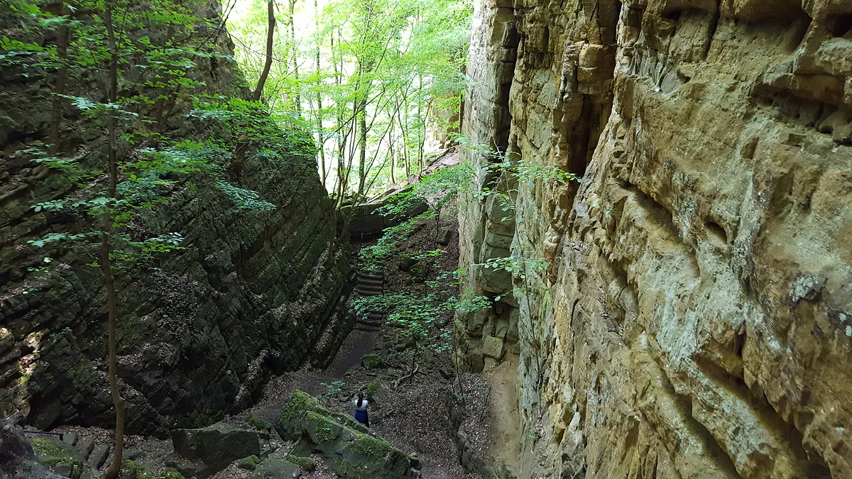
The Wolfsschlucht, or Wolf's Gorge, near Echternach, a narrow passage between tall mossy sandstone walls
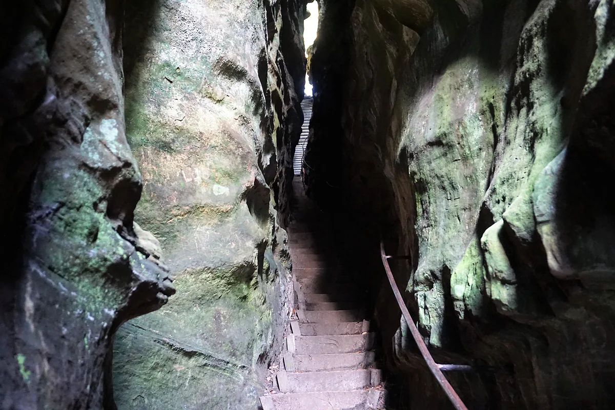
The staircase climbing through the narrow cleft of the Perekop at Berdorf, between greenish sandstone walls
The ruins of Beaufort's medieval castle, with its large round sandstone tower among trees
The ruins of Larochette Castle on the rock, with the slate-roofed village at its foot in autumn
The 14 communes of the Mullerthal region
Commune
What's there
Echternach
Regional centre, basilica, abbey, lake and Roman villa
Berdorf
Perekop, Hohllay, rock climbing and Berdorf cheese
Waldbillig
Müllerthal hamlet, Schiessentümpel and Heringer Millen
Beaufort
Two castles and the geopark's Geo-Expo
Consdorf
Kuelscheier, Rittergang and Déiwepëtz rock passages
Larochette
Castle ruins above the village
Rosport-Mompach
Tudor Museum and Girsterklaus chapel
Bech
The Bildchen, an oak with a statue of Mary in its trunk
Junglinster
Bourglinster Castle
Fischbach, Heffingen, Nommern, Reisdorf, Vallée de l'Ernz
Farming villages in the west of the region
List from the regional tourist office (mullerthal.lu). Eleven of them make up the Natur- & Geopark Mëllerdall; Vallée de l'Ernz, Junglinster and Reisdorf are outside it.
Accommodation in STATEC's Mullerthal tourist region, 2025
Type
Establishments
Bed places
Hotels and similar
20
893
Campsites
19
12,477
STATEC, accommodation capacity by tourist region. STATEC does not publish which communes its Mullerthal region covers.
Test yourself
True or false?
0/3Pick before you peek.
All 14 communes of the Mullerthal tourist region are part of the Mëllerdall geopark.
See the answer
False. Only 11 are. Vallée de l'Ernz, Junglinster and Reisdorf are in the tourist region but not the geopark, though Reisdorf has worked with it since 2021.
The Mullerthal's sandstone was laid down on the floor of a sea.
See the answer
True. The government portal explains the area lay under the sea more than 200 million years ago, and rivers later carved the rock landscape.
Berdorf is the main town of the Mullerthal region.
See the answer
False. That's Echternach, Luxembourg's oldest town. Berdorf is the rock village up on the plateau.
Communes in the tourist region
14
Area of the geopark
256 km²
Length of the Mullerthal Trail
112 km
Geosites in the geopark
22
Map
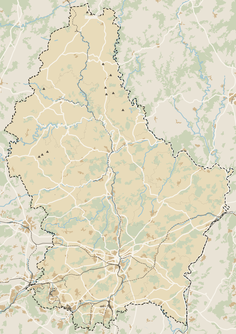
Where Mullerthal is
The thick dashed line is the border with Belgium, France and Germany, and the fine ones divide the twelve cantons. The Éislek lies to the north and the Moselle to the east. Every number opens its guide.
Because of its landscape of sandstone cliffs, gorges and steep wooded valleys, which looks nothing like the rest of Luxembourg. The government's tourism portal and the regional office both use the name.
Where is the Mullerthal region?
In eastern Luxembourg, along the German border, between the River Sûre and the valleys of the Black and White Ernz. Echternach, on the Sûre, is its main town.
How do I get to the Mullerthal from Luxembourg City?
By bus, which is free within Luxembourg. The Mullerthal Trail website gives the direct 201, or the 211 and 212, from Kirchberg Luxexpo to Echternach every half hour. Driving takes you out via Ettelbruck and Diekirch or from the east.
Can you visit the Mullerthal on a day trip?
Yes, but you'll see a slice of it. I'd do Echternach in the morning and then walk the 6.8 km past the Wolfsschlucht, the Perekop and the Hohllay to Berdorf, catching the bus back.
What does Mullerthal mean?
Mëllerdall means valley of the millers. Berdorf's tourist office says the many mills along its streams gave the name, and the hamlet of Müllerthal in Waldbillig passed it on to the whole region.
Is the Mullerthal a UNESCO site?
It has two UNESCO recognitions. The Natur- & Geopark Mëllerdall joined the Global Geoparks network in April 2022, and the Echternach dancing procession has been Intangible Heritage since 2010.
Tourism graduate with a master’s in Tourism Management and Planning from the University of Málaga, who has travelled across Europe. He writes every guide from official sources and his own judgement.

 1Echternach 2Berdorf 3Mullerthal 4Waldbillig 5Beaufort 6Consdorf 7Bech 8Rosport-Mompach 9Larochette 10Fischbach 11Heffingen 12Junglinster 13Nommern 14Vallée de l'Ernz 15Reisdorf