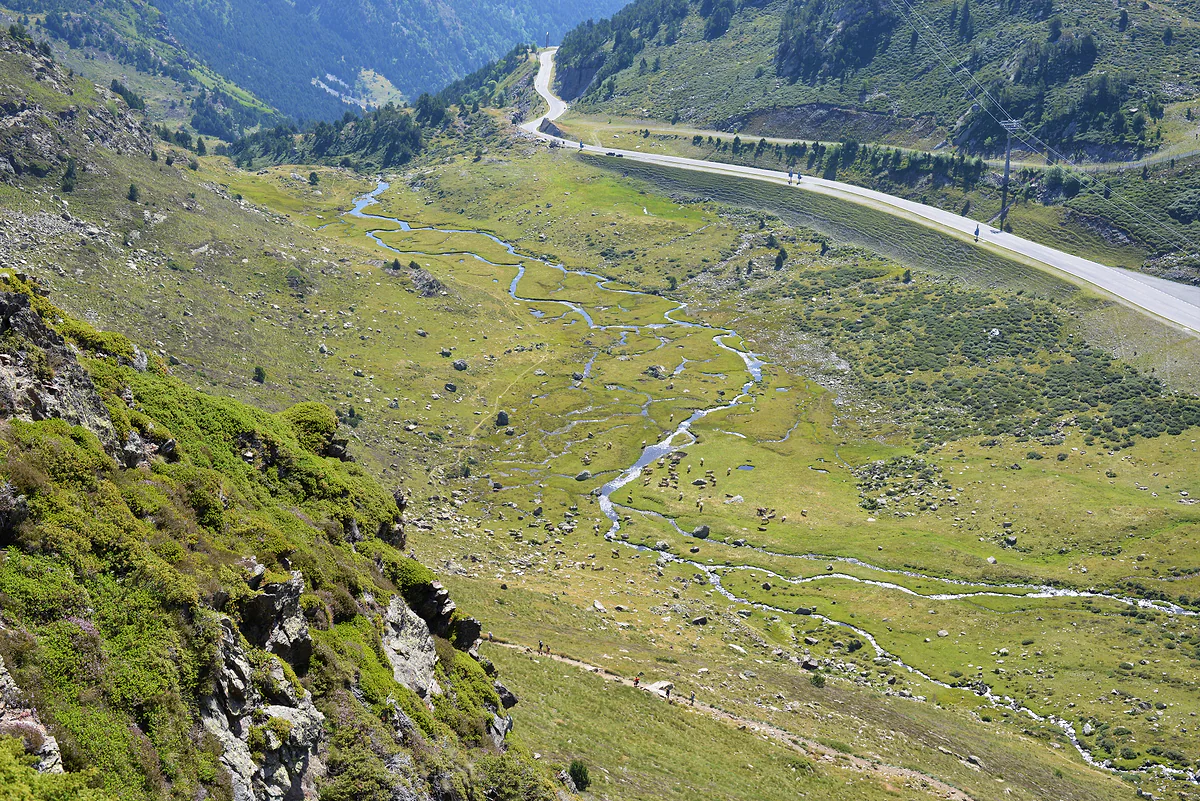
468 km², the sixth-smallest country in this guide
How big is Andorra?
Andorra covers 468 km², about 181 square miles, according to the Spanish foreign ministry. That's nearly one and a half times the size of Malta and almost three times Liechtenstein. But it's a vertical country, averaging 1,996 m above sea level, from a low of 840 m to Comapedrosa at 2,942 m. Its largest parish, Canillo, covers 120.86 km².
In 30 seconds
Full read: 3 min
- Andorra covers 468 km², about 181 square miles.
- That's roughly one and a half times Malta and almost three times Liechtenstein.
- Its average altitude is 1,996 m, between 840 m and Comapedrosa's 2,942 m.
- Canillo, at 120.86 km², is the largest parish; Andorra la Vella the smallest.
I wouldn't measure Andorra in square kilometres but in hairpin bends. On the map everything looks close, yet from Encamp to Pas de la Casa it's 25 km of mountain road, and in winter that changes any plan.

Before you go
What I would keep in mind
-
01 Most beautiful
More than 90% of it is wild
The tourist board says mountains, forests, rivers, lakes and meadows cover more than 90% of the country. Nearly all the building is squeezed onto the valley floors.
nature parks in Andorra -
02 My tip
One valley covers a tenth of the country
The Madriu-Perafita-Claror valley spans 4,247 hectares, close to 10% of Andorra, according to its official website. It's the country's only World Heritage site and has no roads.
Madriu valley -
03 Getting there
Small, but not quick to cross
The national bus links all seven parishes for €1.90 to €4.80 a ticket, but services run every 20 minutes to an hour. The high valleys reward a slower pace.
getting around Andorra
What I would book
Andorra’s area fits in a single line, 468 km², or roughly 181 square miles. What that number doesn’t tell you is more interesting. This is a vertical country, with its towns packed into a handful of valleys and the rest given over to mountain, forest and lake. Here’s the official figure, how to picture it, and why in practice the place feels bigger than the map suggests.
468 km², officially
The Spanish foreign ministry’s September 2026 profile gives 468 km², the same figure the Andorran tourist board uses. In square miles that’s about 181, by my conversion. In this guide, which works across Europe from smallest to largest, Andorra is country 6 of 47, after the Vatican, Monaco, San Marino, Liechtenstein and Malta, and it’s the biggest of that group of six.
For a British reader, the most useful yardstick is probably Malta, another favourite of British holidaymakers. Andorra is about one and a half times its size. It’s almost three times Liechtenstein, nearly eight times San Marino, and you could fit more than two hundred Monacos inside it. The big difference is that Andorra’s area is almost all slope.
A country measured in height
What really defines Andorra is altitude. The Spanish foreign ministry gives an average of 1,996 m, which is extraordinary for a whole country. Even its lowest point, where the Runer flows into the Valira by the southern border, sits at 840 m, and at the top stands Comapedrosa, 2,942 m. That’s a climb of more than 2,100 m from bottom to top. The peaks close to that height are in the mountains of Andorra.
That height turns short hops into long drives. Between the town of Encamp and Pas de la Casa, both in the same parish, there are 25 km of mountain road, and through the cold months, until mid-May, the car has to carry snow chains or run on winter tyres. That’s why I measure Andorra in time rather than square kilometres.
How big is each parish?
Here the official sources thin out. The tourist board gives Canillo at 120.86 km², the largest parish, accounting for one square kilometre in every four. Encamp’s comú mentions an area of about 82 km², nearly 18% of the country, on a page I could only read through its archive.org copy. Andorra la Vella is described only as the smallest, with no figure. For the rest I haven’t found an official number, so I won’t make one up. What each parish is like is in the parishes of Andorra.
How much of it is built on?
Less than it looks from the main road. The tourist board gives two different percentages on two different pages, 8% urbanised on one and around 4% built on the other, so I won’t treat either as fact. What both agree on is that natural land covers more than nine hectares in every ten.
The Madriu valley alone, at 4,247 hectares, takes up almost a tenth of Andorra, and there isn’t a single road in it. More in the Madriu valley.
What it means for your trip
You don’t need long to see the whole country, but you do need to plan. I’d group days by valley, one for Ordino and La Massana, one for Canillo and Encamp, and one for the capital and the Madriu. With that split, three or four days cover the essentials without half of each day spent behind the wheel.
The size also shapes where you land. There’s no airport inside the country, and the nearest, Andorra-La Seu, is in Spain with no confirmed 2026-27 routes, so British visitors normally fly to Toulouse or Barcelona and cover the last stretch by coach or hire car. The Foreign Office reminds drivers that a UK photocard licence is valid, and, as mentioned above, the winter-kit rule runs well into spring. Build that drive into your first and last days rather than squeezing it in.
National buses cover the whole country, but they run every 20 minutes on the shorter lines and hourly on the longer ones. How to get around without losing your morning is in getting around Andorra, and where everything sits is in the map of Andorra. The lesson I’d take away is simple, in Andorra the mountains set the distances, not the map. Exactly where it sits, between France and Spain and how far from the big cities, is in where Andorra is.
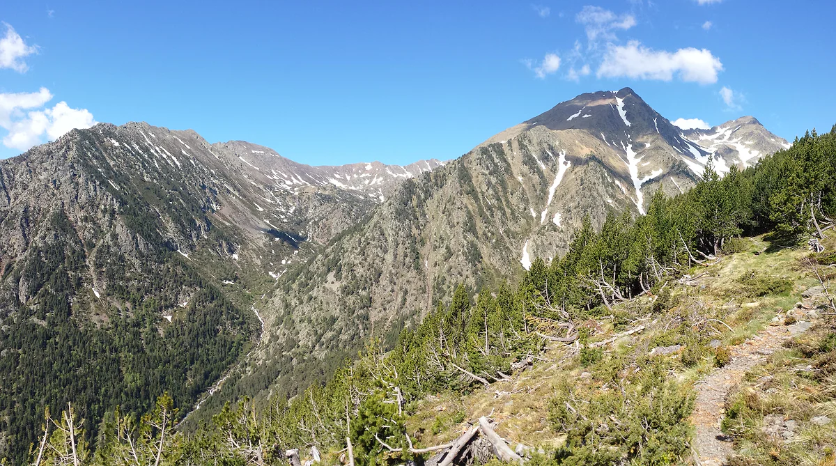
The Valls del Comapedrosa in La Massana, with rocky summits and late snow above the pine forest
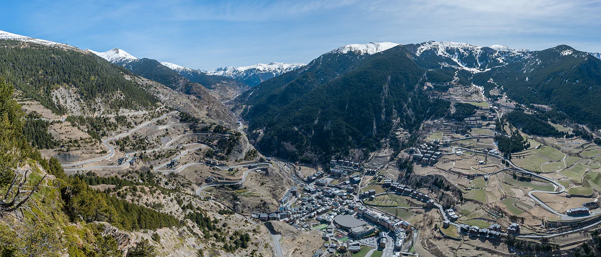
Canillo on the valley floor, with terraced meadows, zigzag roads and snowy peaks in the distance
Andorra compared
| Place | Area | Andorra by comparison |
|---|---|---|
| Andorra | 468 km² | Baseline |
| Malta | 316 km² | About 1.5 times bigger |
| Liechtenstein | 160 km² | About 2.9 times bigger |
| San Marino | 61 km² | About 7.7 times bigger |
| Monaco | 2.02 km² | More than 230 times bigger |
| Vatican City | 0.44 km² | More than 1,000 times bigger |
Areas from each country's official sources used in this guide. The ratios and the square-mile conversion (1 sq mi = 2.59 km²) are my own.
What's known about each parish
| Parish | Area | Source |
|---|---|---|
| Canillo | 120.86 km², the largest | Andorra tourist board |
| Encamp | About 82 km², nearly 18% of the country | Comú d'Encamp (archive.org copy) |
| Andorra la Vella | The smallest, no figure published | Andorra tourist board |
| Ordino, La Massana, Sant Julià and Escaldes | No official figure read | No source |
Test yourself
True or false?
0/4 Pick before you peek.
-
Andorra is bigger than Malta.
See the answer
True. Andorra covers 468 km² and Malta 316 km², so Andorra is about one and a half times the size.
-
Andorra's average altitude is above 1,900 metres.
See the answer
True. The Spanish foreign ministry puts it at 1,996 m, and even the lowest point is 840 m up.
-
Andorra la Vella is the largest parish.
See the answer
False. It's the smallest. The largest is Canillo, at 120.86 km², just over a quarter of the country.
-
Andorra covers more than 500 square miles.
See the answer
False. It covers 468 km², which is about 181 square miles.
- Area of the country
- 468 km²
- The same area in square miles
- 181 sq mi
- Average altitude
- 1,996 m
- Canillo, the largest parish
- 120.86 km²
0 of 269 Andorra guides
Your next stamp
- Canillo
- Where to stay
- Map
- Facts
- Mountains
- Skiing
- Places to visit
- Things to do
- Most beautiful places
- Prettiest villages
- Andorra la Vella
- UNESCO World Heritage
- Escaldes-Engordany
- Where is Andorra?
- Is Andorra a country?
- Parishes
- Casa de la Vall
- Margineda bridge
- Old town
- Santa Coloma church
- Towns and villages
- Population
- Language
- Andorra in one day
- Espai Columba
- History
- Margineda rock shelter
- Sant Esteve church
- Co-princes
- Soldeu
- Weekend break
- Andorra in 3 days
- El Tarter
- Political system
- Andorra in 4 days
- Flag
- Ransol
- A week in Andorra
- Prats
- El Forn
- Public holidays
- Sant Julià de Lòria
- Currency and payments
- L'Aldosa de Canillo
- Els Plans
- EU and Schengen
- Bordes d'Envalira
- Entry requirements
- Prices and budget
- On a budget
- Sant Joan de Caselles
- Santa Coloma
- Ski holidays
- Tourist tax
- Mobile and roaming
- Sant Serni de Canillo
- Tourist information
- Healthcare
- Meritxell Sanctuary
- With a dog
- Packing list
- Safety
- How to get there
- Scams
- From Barcelona
- Bus from Barcelona
- Day trip from Barcelona
- From Madrid
- From Toulouse
- Encamp
- Flights
- La Margineda
- La Massana
- Roc del Quer viewpoint
- Romanesque churches
- Andorra-La Seu airport
- Canillo Tibetan bridge
- Museums in Andorra
- Pal
- Pas de la Casa
- Arinsal
- Driving
- Grau Roig
- Mon(t) Magic
- Nearest airports
- By train
- Erts
- Les Bons
- Palau de Gel
- Road conditions
- Motorcycle Museum
- Parking
- Sispony
- Vila
- Anyós
- Incles valley
- La Mosquera
- Petrol
- El Tremat
- Getting around
- Juclar lakes
- L'Aldosa (La Massana)
- Buses
- Els Cortals d'Encamp
- Sant Climent de Pal
- Bus station
- Sant Cristòfol d'Anyós
- Casa Rull
- Shopping
- Farga Rossell
- Sant Vicenç d'Enclar
- Santa Eulàlia d'Encamp
- What to buy
- Customs allowances
- La Massana Còmic
- Sant Romà de les Bons
- Car Museum
- Cigarettes
- Comapedrosa
- Electronics
- Alcohol
- Casa Cristo
- Clothes and sports shops
- Iron Route
- Coll d'Ordino
- Perfume
- Sacred Art Museum
- Shopping centres
- Funicamp
- Supermarkets
- Avinguda Meritxell
- Encamp Tibetan bridge
- Avinguda Carlemany (Vivand)
- Envalira pass
- Auvinyà
- Bici Lab Andorra
- Ordino
- With kids
- Zip lines
- Fontaneda
- For couples
- La Cortinada
- Ski pass
- Via ferratas
- Climbing
- Llorts
- Nagol
- Nightlife
- Ski season
- El Serrat
- Grandvalira
- Horse riding
- Juberri
- Aixovall
- Mountain biking
- Pal Arinsal
- Sornàs
- Aixirivall
- Ansalonga
- Ordino Arcalís
- Road cycling
- Bixessarri
- Naturland
- Segudet
- Arans
- Llumeneres
- Tobotronc
- Casa d'Areny-Plandolit
- Cross-country skiing
- Miniature Museum
- Skiing with kids
- Cal Pal
- Free walking tour
- Pessons lakes
- Sant Serni de Nagol
- Ski lessons
- Canòlich Sanctuary
- Hotels in Andorra la Vella
- Sant Martí de la Cortinada
- Ski hire
- Hotels in Escaldes
- Juberri Gardens
- Llorts iron mine
- Webcams
- Hotels in Soldeu
- Snow report
- Sorteny valley
- Hotels in El Tarter
- Tristaina lakes
- Hotels in Canillo
- Night skiing
- Tristaina solar viewpoint
- Freeride
- Hotels in Encamp
- Hotels in Pas de la Casa
- Ski touring
- Hotels in La Massana
- Snowshoeing
- Hotels in Arinsal and Pal
- Snow activities
- Après-ski
- Engordany
- Hotels in Ordino
- Medieval bridges
- Nature parks
- Els Vilars
- Hotels in Sant Julià de Lòria
- Lakes
- Sant Romà dels Vilars
- Viewpoints
- Where to eat
- Caldea
- Restaurants in Andorra la Vella
- Borda restaurants
- Inúu
- Cheap hotels
- Food
- Hiking
- Spas and thermal baths
- Weather and climate
- Engolasters lake
- Pas de la Casa weather
- Spa hotels
- Trinxat
- Events
- Luxury hotels
- Sant Miquel d'Engolasters
- Ski resort weather
- Wine
- Best time to visit
- Family hotels
- Madriu valley
- All inclusive
- Estany de l'Illa
- In winter
- Apartments
- Coronallacs
- In spring
- Ski World Cup
- Christmas
- Hostels
- In summer
- Mountain huts
- Camping and rural stays
- Easy walks
- In autumn
- New Year
- Family walks
- Festes majors
- In January
- GR11 and other GRs
- In February
- National day
- Around Andorra
- GRP round Andorra
- In March
- Midsummer fire festival
- Carnival
- In April
- In May
- Travessa d'Encamp
- In June
- In July
- In August
- In September
- In October
- In November
- In December
Frequently asked questions
How big is Andorra in square miles?
About 181 square miles, from the official 468 km². That makes it the sixth-smallest of the 47 countries in this guide, after the Vatican, Monaco, San Marino, Liechtenstein and Malta.
Is Andorra bigger than Malta?
Yes. Andorra covers 468 km² and Malta 316 km², so Andorra is roughly one and a half times the size. It has far fewer people, though, with 90,105 residents in August 2026.
How high is Andorra?
Its average altitude is 1,996 m, according to the Spanish foreign ministry. The lowest point is 840 m, where the River Runer joins the Valira, and the highest is Comapedrosa at 2,942 m.
How long is Andorra's border?
63.7 km with Spain and 56.6 km with France, according to the Spanish foreign ministry, which makes 120.3 km in all by my sum.
How much of Andorra is built up?
Very little. The tourist board gives two different percentages on two pages, so I rely on the point both agree on, that more than 90% of the country is natural land.
What is the largest parish in Andorra?
Canillo, at 120.86 km², just over a quarter of the country. The smallest is Andorra la Vella, which is also the most populated.
By
Tourism graduate with a master’s in Tourism Management and Planning from the University of Málaga, who has travelled across Europe. He writes every guide from official sources and his own judgement.
Published on . Facts checked on .
Sources
Photos: Alberto-g-rovi (CC BY 3.0); Ferran Llorens (CC BY-SA 2.0); Krzysztof Golik (CC BY-SA 4.0), via Wikimedia Commons.