Andorra on foot
Hiking in Andorra, and how to pick a route that suits your legs
Andorra has well over a hundred hiking routes with official route sheets, from flat 3 km strolls to week-long hut-to-hut treks. For a first outing I'd pick a lake with modest climbing, such as Tristaina, Pessons or Juclar, and save the full Madriu or the Comapedrosa for later. High routes are recommended from late June to late September.
In 30 seconds
Full read: 3 min
- Andorra has over a hundred hiking routes with official sheets and downloadable GPS tracks.
- Start with a lake and a modest climb, such as Tristaina, Pessons or Juclar.
- High routes are recommended from late June to late September.
- The GHIC isn't valid in Andorra, so take insurance that covers mountain rescue.
My rule for Andorra is simple. Never go above 2,300 m on day one. Start with a lake and a modest climb, see how the altitude treats you, and keep the summits for day three.

Before you go
What I would keep in mind
-
01 My tip
Use the official route sheet as your map
Andorra Turisme publishes every route with distance, ascent, grade and a downloadable GPS track. Compare the ascent with what you walk at home, because each 100 m counts for more at this altitude.
-
02 To save money
Walking here is free
Paths, unstaffed huts and the mountain hut passport cost nothing. You pay only for some ways in, such as the summer train up the Incles valley or the ski lifts.
mountain huts in Andorra -
03 Most beautiful
If you only do one walk, make it a lake
The glacial lakes are the best of Andorra on foot, and Tristaina, Pessons and Juclar each fit into half a day from a car park.
lakes in Andorra -
04 Watch out
Your GHIC is no use here
Andorra is outside the EU and the UK health card doesn't apply, so a rescue or an A&E visit is billed. Buy travel insurance that names mountain rescue and hiking at altitude.
healthcare in Andorra
What I would book
You get Andorra far better on foot than from a car. More than 90% of the country is natural land, according to Andorra Turisme, and its official site lists well over a hundred hiking routes, each with distance, ascent and a GPS track to download. Finding a route is easy. The hard part is matching one to your fitness, the time of year and the days you have.
How the path network works
I think of it in three layers. First come the short strolls around the villages, old mule tracks, irrigation channels and themed circuits that take an hour or two. Then there are day walks to lakes, valleys and summits, which nearly always start from a mountain car park and take you above 2,000 m. Finally there are the multi-day treks, hut to hut.
For that last layer the country has five long-distance GR trails plus the Pyrenean Haute Route. The GR11 in Andorra crosses the north as part of the Senda Pirenaica, the GR7 runs from east to south, and the GRP loops right round the country in seven stages, which I cover in the GRP round Andorra. Between them they link about thirty mountain huts, four of them staffed.
Which walk suits your level?
If you walk little or you’re with older relatives, start on the flat. The Camí de les Pardines runs from Encamp to Engolasters lake in just over 3 km, and at Grau Roig a 1.5 km woodland path leads to the first Pessons lake. I’ve grouped the rest by area in easy walks in Andorra, and the ones that work with children in family walks in Andorra.
With some mountain miles behind you, the natural next step is the lakes. The Tristaina circuit gives you three lakes in 4.39 km, Juclar climbs 465 m to the largest lake in the country, and the Andorra la Vella viewpoints route covers 9 km in the shady woods above the capital, a relief in August.
The hard routes are a different game. The full Madriu valley route climbs 1,180 m over 13.6 km, the Pessons cirque to the col is graded hard despite being under 6 km, and the Comapedrosa from Arinsal is about 8 hours. This is where people come unstuck, reading short distances and ignoring the climbing.
Lakes, valleys and summits
Glacial lakes are what I’d put first. There are dozens across the country, and I compare them in lakes in Andorra. Next come the valleys, above all the Madriu, a World Heritage Site with no road, then Incles, with its electric train in summer, and Sorteny, with its botanical garden.
Summit collectors have a challenge of their own in Ordino, the estripagecs, iron grilles fixed on six peaks over 2,700 m. The Casamanya, at 2,740 m between Canillo and Ordino, starts from the top of the Coll d’Ordino road and is one of the most rewarding for the view.
When to go walking
Andorra Turisme advises keeping every route above 1,700 m for the weeks between late June and late September, with May and October possible if weather and ground allow. In practice nearly every lake sits above that line. In June snow can linger on high north-facing slopes, and in July and August the risk is afternoon thunderstorms.
That’s why I’d set off early. The Andorran police recommend avoiding the hottest hours, checking the forecast and being back while it’s light or packing a torch. In winter the same routes change sport and are done on snowshoes or touring skis.
What I’d carry, and who to call
The police advice is common sense and worth following to the letter. Walk with someone or leave word of your route and return time, wear proper boots and visible clothing, and take water, food, sun cream, a windproof, a first-aid kit, a whistle and a fully charged phone. In an emergency, the same advice gives 110 for the police, 112 for mountain rescue and 118 for the fire brigade.
One point British walkers often miss. Andorra isn’t in the EU, GOV.UK confirms the GHIC and EHIC aren’t valid there, and a rescue or a hospital visit will be billed. Buy travel insurance that explicitly covers hiking at altitude and helicopter rescue before you fly into Toulouse or Barcelona. With that sorted, all that’s left is choosing the right first day. To choose an area, the three protected spaces are in nature parks in Andorra, and clothing and boots in what to pack for Andorra.
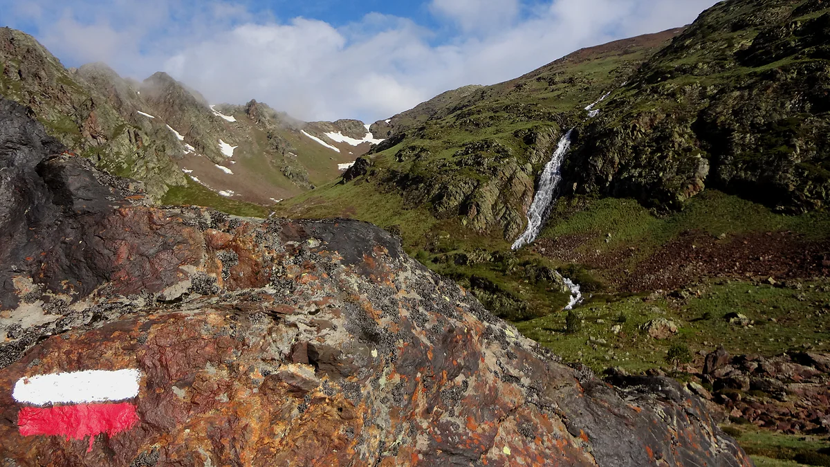
Red-and-white long-distance trail waymark on the climb to Comapedrosa, with a waterfall in the valley
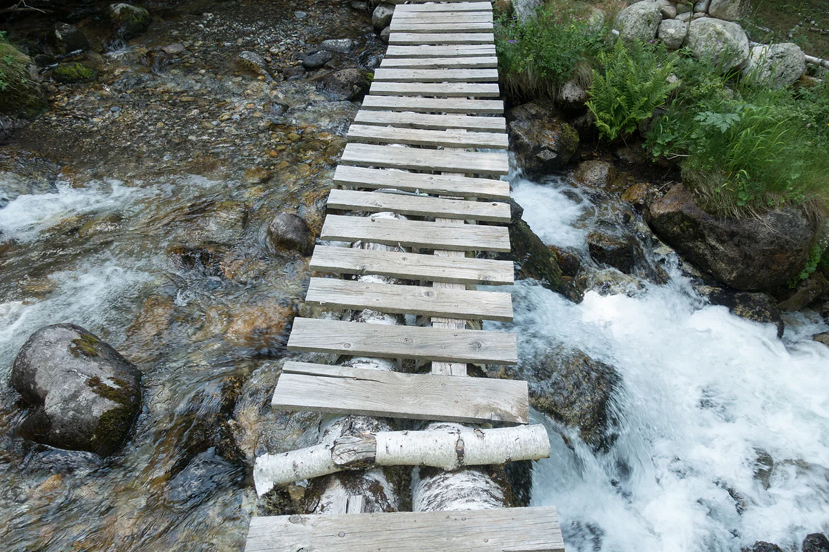
A wooden log footbridge over the Riu de Claror on a hiking route in the Madriu valley
Routes by level, easiest first
| Route | Area | Distance | Ascent | Official grade |
|---|---|---|---|---|
| Camí de les Pardines to Engolasters lake | Encamp and Escaldes | Just over 3 km | Flat | Easy |
| Estany Primer de Pessons | Grau Roig | 1.5 km | ±200 m | Easy |
| Tristaina lakes circuit | Ordino Arcalís | 4.39 km | +210 m | Moderate |
| Estany de Juclar | Incles valley | 4.57 km | +465 m | Moderate |
| Andorra la Vella viewpoints | Andorra la Vella | 9 km | +640 m | Moderate |
| Pessons lakes to the col | Grau Roig | 5.95 km | +707 m | Hard |
| Madriu valley route | Escaldes-Engordany | 13.6 km | +1,180 m | Hard |
| Alt del Comapedrosa | Arinsal | About 8 hours | No figure | Very hard |
Route sheets from Andorra Turisme and La Massana tourism, checked on 29-09-2026. Distances are one way or full circuit, as each sheet gives them.
Test yourself
True or false?
0/3 Pick before you peek.
-
In Andorra, routes above 1,700 m are recommended all year round.
See the answer
False. Andorra Turisme recommends them from late June to late September, extending to May and October if weather and ground allow.
-
Andorra's highest mountain is the Comapedrosa, at 2,942 m.
See the answer
True. That's the figure given by the natural park and La Massana council. The classic climb from Arinsal takes around 8 hours.
-
A UK GHIC covers mountain rescue in Andorra.
See the answer
False. Andorra isn't in the EU and GOV.UK is clear that the GHIC and EHIC don't apply there. You need travel insurance.
- Comapedrosa, the highest summit
- 2,942 m
- Long-distance GR trails
- 5
- Altitude above which high summer is advised
- 1,700 m
What to see
What to see in Hiking
0 of 269 Andorra guides
Your next stamp
- Easy walks
- GR11 and other GRs
- Where to stay
- A week in Andorra
- GRP round Andorra
- Estany de l'Illa
- Skiing
- Places to visit
- Things to do
- Most beautiful places
- Prettiest villages
- Andorra la Vella
- UNESCO World Heritage
- Map
- Escaldes-Engordany
- Where is Andorra?
- Is Andorra a country?
- Parishes
- Casa de la Vall
- Margineda bridge
- Old town
- Santa Coloma church
- Towns and villages
- Population
- Size
- Mountains
- Language
- Andorra in one day
- Canillo
- Espai Columba
- History
- Margineda rock shelter
- Sant Esteve church
- Co-princes
- Soldeu
- Weekend break
- Andorra in 3 days
- El Tarter
- Political system
- Andorra in 4 days
- Flag
- Ransol
- Facts
- Prats
- El Forn
- Public holidays
- Sant Julià de Lòria
- Currency and payments
- L'Aldosa de Canillo
- Els Plans
- EU and Schengen
- Bordes d'Envalira
- Entry requirements
- Prices and budget
- On a budget
- Sant Joan de Caselles
- Santa Coloma
- Ski holidays
- Tourist tax
- Mobile and roaming
- Sant Serni de Canillo
- Tourist information
- Healthcare
- Meritxell Sanctuary
- With a dog
- Packing list
- Safety
- How to get there
- Scams
- From Barcelona
- Bus from Barcelona
- Day trip from Barcelona
- From Madrid
- From Toulouse
- Encamp
- Flights
- La Margineda
- La Massana
- Roc del Quer viewpoint
- Romanesque churches
- Andorra-La Seu airport
- Canillo Tibetan bridge
- Museums in Andorra
- Pal
- Pas de la Casa
- Arinsal
- Driving
- Grau Roig
- Mon(t) Magic
- Nearest airports
- By train
- Erts
- Les Bons
- Palau de Gel
- Road conditions
- Motorcycle Museum
- Parking
- Sispony
- Vila
- Anyós
- Incles valley
- La Mosquera
- Petrol
- El Tremat
- Getting around
- Juclar lakes
- L'Aldosa (La Massana)
- Buses
- Els Cortals d'Encamp
- Sant Climent de Pal
- Bus station
- Sant Cristòfol d'Anyós
- Casa Rull
- Shopping
- Farga Rossell
- Sant Vicenç d'Enclar
- Santa Eulàlia d'Encamp
- What to buy
- Customs allowances
- La Massana Còmic
- Sant Romà de les Bons
- Car Museum
- Cigarettes
- Comapedrosa
- Electronics
- Alcohol
- Casa Cristo
- Clothes and sports shops
- Iron Route
- Coll d'Ordino
- Perfume
- Sacred Art Museum
- Shopping centres
- Funicamp
- Supermarkets
- Avinguda Meritxell
- Encamp Tibetan bridge
- Avinguda Carlemany (Vivand)
- Envalira pass
- Auvinyà
- Bici Lab Andorra
- Ordino
- With kids
- Zip lines
- Fontaneda
- For couples
- La Cortinada
- Ski pass
- Via ferratas
- Climbing
- Llorts
- Nagol
- Nightlife
- Ski season
- El Serrat
- Grandvalira
- Horse riding
- Juberri
- Aixovall
- Mountain biking
- Pal Arinsal
- Sornàs
- Aixirivall
- Ansalonga
- Ordino Arcalís
- Road cycling
- Bixessarri
- Naturland
- Segudet
- Arans
- Llumeneres
- Tobotronc
- Casa d'Areny-Plandolit
- Cross-country skiing
- Miniature Museum
- Skiing with kids
- Cal Pal
- Free walking tour
- Pessons lakes
- Sant Serni de Nagol
- Ski lessons
- Canòlich Sanctuary
- Hotels in Andorra la Vella
- Sant Martí de la Cortinada
- Ski hire
- Hotels in Escaldes
- Juberri Gardens
- Llorts iron mine
- Webcams
- Hotels in Soldeu
- Snow report
- Sorteny valley
- Hotels in El Tarter
- Tristaina lakes
- Hotels in Canillo
- Night skiing
- Tristaina solar viewpoint
- Freeride
- Hotels in Encamp
- Hotels in Pas de la Casa
- Ski touring
- Hotels in La Massana
- Snowshoeing
- Hotels in Arinsal and Pal
- Snow activities
- Après-ski
- Engordany
- Hotels in Ordino
- Medieval bridges
- Nature parks
- Els Vilars
- Hotels in Sant Julià de Lòria
- Lakes
- Sant Romà dels Vilars
- Viewpoints
- Where to eat
- Caldea
- Restaurants in Andorra la Vella
- Borda restaurants
- Inúu
- Cheap hotels
- Food
- Spas and thermal baths
- Weather and climate
- Engolasters lake
- Pas de la Casa weather
- Spa hotels
- Trinxat
- Events
- Luxury hotels
- Sant Miquel d'Engolasters
- Ski resort weather
- Wine
- Best time to visit
- Family hotels
- Madriu valley
- All inclusive
- In winter
- Apartments
- Coronallacs
- In spring
- Ski World Cup
- Christmas
- Hostels
- In summer
- Mountain huts
- Camping and rural stays
- In autumn
- New Year
- Family walks
- Festes majors
- In January
- In February
- National day
- Around Andorra
- In March
- Midsummer fire festival
- Carnival
- In April
- In May
- Travessa d'Encamp
- In June
- In July
- In August
- In September
- In October
- In November
- In December
Frequently asked questions
What are the best hikes in Andorra?
For me, the lake walks. Tristaina, Juclar and Pessons give you a lot of scenery for little ascent, and the Madriu valley has the most history. For a summit, the Comapedrosa (2,942 m) is the country's highest, but allow around 8 hours.
Is Andorra good for hiking?
Very. Most of the country is mountain, the paths are waymarked and every route has an official sheet with a GPS track. It's compact too, so you can base yourself in one town and reach most trailheads in under an hour's drive.
When is the best time to hike in Andorra?
Andorra Turisme recommends routes above 1,700 m from late June to late September, stretching to May and October if weather and ground allow. In winter the same areas are done on snowshoes.
Do I need travel insurance for hiking in Andorra?
Yes. Andorra isn't in the EU, the GHIC and EHIC aren't valid, and mountain rescue and hospital care are charged. Check your policy covers hiking at altitude and helicopter rescue.
What number do I call for mountain rescue in Andorra?
The Andorran police give 112 for mountain rescue, 110 for the police and 118 for the fire brigade. Keep your phone charged, as it's how rescuers find you.
Can you hike in Andorra without a guide?
On waymarked day routes, yes. For multi-day treks, summits with snow or if you have little mountain experience, I'd hire one. Either way, tell someone your route and when you expect to be back.
By
Tourism graduate with a master’s in Tourism Management and Planning from the University of Málaga, who has travelled across Europe. He writes every guide from official sources and his own judgement.
Published on . Facts checked on .
Sources
Photos: Simonjoan (CC BY-SA 4.0); Isidro Jabato (CC BY-SA 3.0); Kent Wang (CC BY-SA 2.0), via Wikimedia Commons.