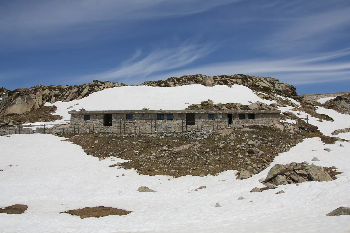
A circular high-mountain trek
Coronallacs, five days linking Andorra's staffed mountain huts
The Coronallacs is a 92 km circular trek in five stages linking Andorra's four staffed mountain huts, l'Illa, Juclar, Sorteny and Comapedrosa. It starts and finishes in Escaldes-Engordany and totals 6,449 m of ascent, with stages of 13 to 22 km. Andorra Turisme grades it very hard.
In 30 seconds
Full read: 3 min
- The Coronallacs is a 92 km five-stage loop through Andorra's four staffed mountain huts.
- It starts and finishes in Escaldes-Engordany and totals 6,449 m of ascent.
- Andorra Turisme grades it very hard; several stages take over ten hours.
- Walk it in summer, from late June to late September.
It's the trek I'd choose to really get to know Andorra in a week. I wouldn't attempt it without mountain experience or outside July and August, and I'd book all four huts before setting off, because sleeping in them is the whole point.

Before you go
What I would keep in mind
-
01 Most beautiful
Seven of the twelve Pessons lakes
Stage two climbs to the Collada de Pessons at 2,810 m and passes seven of the cirque's twelve lakes. For me it's the finest stretch of the whole loop.
Pessons lakes -
02 To save money
No need to carry a tent
Because you sleep in staffed huts, there's no tent or stove to carry. The official route sheet is designed around travelling light.
mountain huts in Andorra -
03 Worth the splurge
An extra night at l'Illa or Sorteny
The route sheet suggests a second night at l'Illa for the surrounding lakes or at Sorteny for the botanical garden. If you have the days, I would.
Estany de l'Illa -
04 My tip
Set off with food and water
Every stage in the official sheet repeats the same warning, carry enough water and food. There's nowhere to buy supplies between huts.
What I would book
5 days
The Coronallacs in five stages
- Day 1
Escaldes-Engordany to the l'Illa hut
12.6 km, +1,473 m, about 6 h 38, moderate. From the tourist office over the Tosca bridge and into the Madriu on the GR7, via Entremesaigües, Ràmio, Fontverd and La Farga. Night at 2,488 m.
- Day 2
L'Illa hut to the Juclar hut
19.4 km, +1,350 m and −1,527 m, about 10 h 35. Collada de Pessons at 2,810 m, Bordes d'Envalira, Port Dret and Siscaró. Night at Juclar, 2,310 m, with sunrise over the Coll de l'Alba.
- Day 3
Juclar hut to Borda de Sorteny
16.9 km, +1,425 m and −1,771 m, about 10 h 18. Cabana Sorda, a col at 2,600 m, Cóms de Jan and the Collada de Meners between the Serrera and Estanyó peaks. Night at 1,965 m.
- Day 4
Borda de Sorteny to the Comapedrosa hut
21.9 km, +1,904 m and −1,608 m, about 11 h 13, the toughest day. El Serrat, Llorts, Clot del Cavall, the Angonella hut, Pla de l'Estany and Aigüesjuntes. Night at 2,265 m.
- Day 5
Comapedrosa hut to Escaldes-Engordany
21.4 km, +716 m and −1,922 m, about 9 h 17. Portella de Sanfons, Port Negre, Coll de la Botella, the Cortals de Sispony, the Camí Ral and the Escalls bridge, past Caldea to the finish.
Times are a guide, based on the official opening hours checked for this guide.
There are plenty of ways to cross Andorra on foot, but the Coronallacs has a neat idea behind it. Link the country’s four staffed mountain huts in a single loop that leaves a street in Escaldes and returns to it five days later. If you have the legs and the experience, it’s the most complete way I know to understand the country from one side to the other.
What the Coronallacs is
Andorra Turisme describes it as a 92 km circular route through the Principality’s four staffed huts, designed so that you sleep in each and carry little weight. It’s split into five stages of 13 to 22 km, averaging 18.4 km a day, and totals 6,449 m of ascent and the same in descent. The grade is very hard. The Madriu listing rounds it to about 90 km, but the route’s own sheet gives 92.
It leaves central Escaldes-Engordany and passes through Encamp, Canillo, Ordino and La Massana before coming home. The line is high and exposed, which means views almost the whole way and a lot of exposure to the weather.
The five stages
Stage one leaves the Escaldes tourist office over the Tosca bridge and enters the Madriu valley on the GR7. It passes Entremesaigües, the Ràmio barns, Fontverd and La Farga, crosses the Pla de l’Ingla and ends at the l’Illa hut, 2,488 m. It’s 12.6 km with almost 1,500 m of ascent, the shortest day.
Stage two climbs to the Collada de Pessons at 2,810 m, passes seven of the twelve Pessons lakes, drops to Bordes d’Envalira, climbs again to Port Dret and ends at the Juclar hut, 2,310 m, beside the Juclar lakes. Stage three runs past Cabana Sorda and over the Collada de Meners to the Borda de Sorteny at 1,965 m, inside the Sorteny nature park.
Stage four is the hardest, 21.9 km with 1,904 m of ascent, from Sorteny to Comapedrosa via El Serrat, Llorts and the Angonella hut. You sleep at 2,265 m beneath the country’s highest peak. Stage five returns over the Portella de Sanfons, the Coll de la Botella and Sispony, follows the Camí Ral and enters Escaldes over the Escalls bridge and past Caldea.
What you see along the way
The official sheet notes what appears on each stage, and it gives a sense of the variety. On day one, mountain pine and broadleaf trees in the lower Madriu, and between Fontverd and Riu dels Orris, chamois, wild boar, mouflon and marmots. On day three, gneiss terraces by the Cabana Sorda lake and the iron-rich ground of Sorteny, where ore was once mined. On day five, from the Portella de Sanfons on the Spanish border, you can see the Aneto and the Pica d’Estats, then cross woodland with capercaillie, squirrels and roe deer before dropping to Sispony, home of the Casa Rull museum.
Who is it for?
It isn’t for everyone, and I’ll be blunt about that. Four stages involve more than nine hours of walking, and the official sheet repeats on each one that you must carry enough water and food. You need mountain experience, good fitness and the ability to read the ground. If you’re unsure, try a single stage first, such as the first one to the Estany de l’Illa, and spend the night there.
The upside is that you don’t need a tent or cooking kit. The staffed huts have showers, mattresses and basic meals, and I cover them all in mountain huts in Andorra. Information and bookings are at coronallacs.com, which I couldn’t read, so check prices and availability there.
When to go
Andorra Turisme advises keeping above 1,700 m only from the tail end of June until September is out, and the Coronallacs spends much of its time above 2,000 m. I’d go in July or August, with long days, and leave room for an extra night if the weather turns. The route sheet itself suggests a second night at l’Illa for the lakes or at Sorteny for the botanical garden.
One more thing. The GHIC and EHIC don’t work in Andorra, and on a trek like this I wouldn’t set out without travel insurance that includes mountain rescue. The emergency number is 112, and fire and rescue is 118.
And on the final day, after 92 km, the route walks you straight past Caldea. I wouldn’t need asking twice.
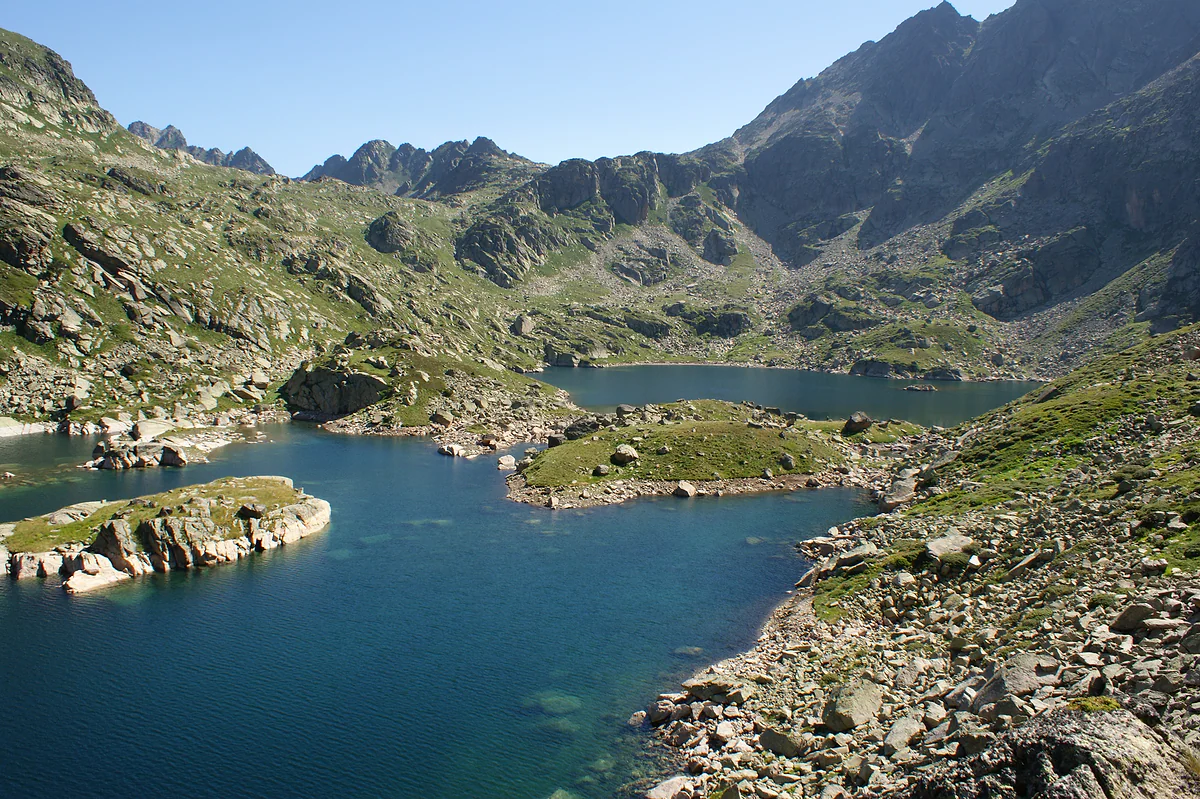
The Juclar lakes, a glacial lake of clear blue water dotted with islets and ringed by granite peaks
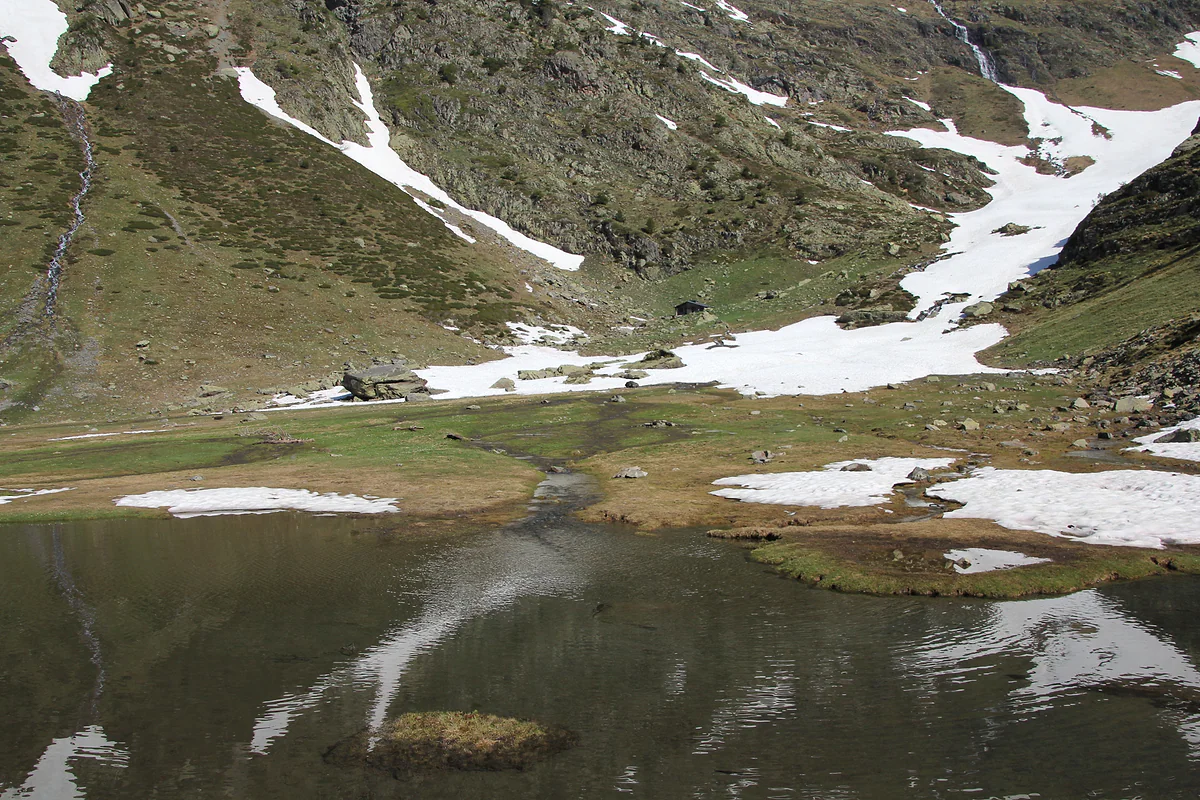
A small lake in the Comapedrosa park during the thaw, snowfields on the slopes reflected in the water
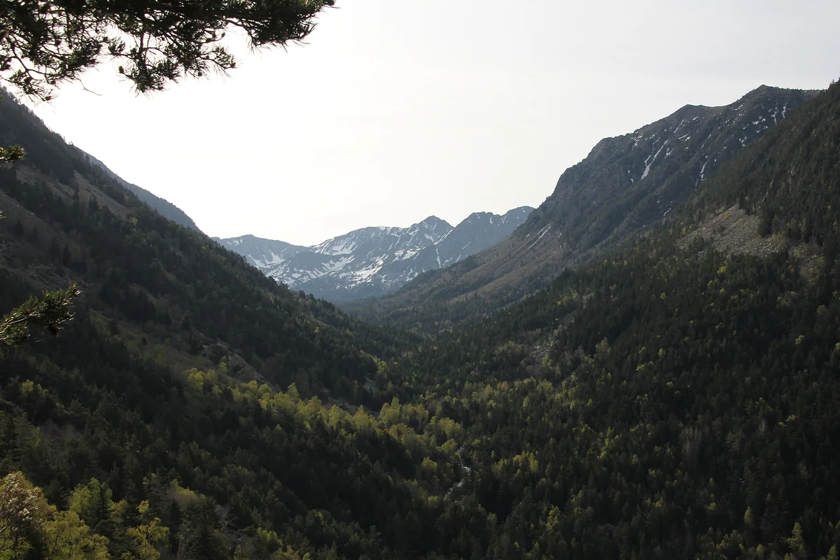
The Madriu-Perafita-Claror valley, a World Heritage site, with forested slopes and peaks beyond
Coronallacs stages
| Stage | Distance | Height gain | Time | Grade |
|---|---|---|---|---|
| 1. Escaldes to l'Illa | 12.6 km | +1,473 / −40 m | 6 h 38 | Moderate |
| 2. L'Illa to Juclar | 19.4 km | +1,350 / −1,527 m | 10 h 35 | Moderate to hard |
| 3. Juclar to Sorteny | 16.9 km | +1,425 / −1,771 m | 10 h 18 | Moderate to hard |
| 4. Sorteny to Comapedrosa | 21.9 km | +1,904 / −1,608 m | 11 h 13 | Hard |
| 5. Comapedrosa to Escaldes | 21.4 km | +716 / −1,922 m | 9 h 17 | Moderate |
Andorra Turisme, Coronallacs route sheet, checked on 29-09-2026. Information and bookings at coronallacs.com.
The four staffed huts
| Hut | Altitude | Area | Night |
|---|---|---|---|
| L'Illa | 2,488 m | Head of the Madriu | 1 |
| Juclar | 2,310 m | Canillo | 2 |
| Borda de Sorteny | 1,965 m | Ordino | 3 |
| Comapedrosa | 2,265 m | La Massana | 4 |
Altitudes from the Coronallacs route sheet (Andorra Turisme).
Test yourself
True or false?
0/3 Pick before you peek.
-
The Coronallacs visits all four of Andorra's staffed huts.
See the answer
True. That's the whole idea. It sleeps at l'Illa, Juclar, Borda de Sorteny and Comapedrosa.
-
The first stage of the Coronallacs is the longest.
See the answer
False. The first is the shortest, 12.6 km. The longest is the fourth, Sorteny to Comapedrosa, at 21.9 km.
-
The Coronallacs starts and finishes in the same place.
See the answer
True. It's a loop. It leaves the Escaldes-Engordany tourist office and returns via the Escalls bridge and Caldea.
- Total distance
- 92 km
- Total ascent
- 6,449 m
- Stages
- 5
- Staffed huts
- 4
0 of 269 Andorra guides
Your next stamp
- GRP round Andorra
- Hiking
- Mountain huts
- A week in Andorra
- Juclar lakes
- Madriu valley
- Andorra in 3 days
- Skiing
- Places to visit
- Things to do
- Most beautiful places
- Prettiest villages
- Andorra la Vella
- UNESCO World Heritage
- Map
- Escaldes-Engordany
- Where is Andorra?
- Is Andorra a country?
- Parishes
- Casa de la Vall
- Margineda bridge
- Old town
- Santa Coloma church
- Towns and villages
- Population
- Size
- Mountains
- Language
- Andorra in one day
- Canillo
- Espai Columba
- History
- Margineda rock shelter
- Sant Esteve church
- Co-princes
- Soldeu
- Weekend break
- El Tarter
- Political system
- Andorra in 4 days
- Flag
- Ransol
- Facts
- Prats
- El Forn
- Public holidays
- Sant Julià de Lòria
- Currency and payments
- L'Aldosa de Canillo
- Els Plans
- EU and Schengen
- Bordes d'Envalira
- Entry requirements
- Prices and budget
- On a budget
- Sant Joan de Caselles
- Santa Coloma
- Ski holidays
- Tourist tax
- Mobile and roaming
- Sant Serni de Canillo
- Tourist information
- Healthcare
- Meritxell Sanctuary
- With a dog
- Packing list
- Safety
- How to get there
- Scams
- From Barcelona
- Bus from Barcelona
- Day trip from Barcelona
- From Madrid
- From Toulouse
- Encamp
- Flights
- La Margineda
- La Massana
- Roc del Quer viewpoint
- Romanesque churches
- Andorra-La Seu airport
- Canillo Tibetan bridge
- Museums in Andorra
- Pal
- Pas de la Casa
- Arinsal
- Driving
- Grau Roig
- Mon(t) Magic
- Nearest airports
- By train
- Erts
- Les Bons
- Palau de Gel
- Road conditions
- Motorcycle Museum
- Parking
- Sispony
- Vila
- Anyós
- Incles valley
- La Mosquera
- Petrol
- El Tremat
- Getting around
- L'Aldosa (La Massana)
- Buses
- Els Cortals d'Encamp
- Sant Climent de Pal
- Bus station
- Sant Cristòfol d'Anyós
- Casa Rull
- Shopping
- Farga Rossell
- Sant Vicenç d'Enclar
- Santa Eulàlia d'Encamp
- What to buy
- Customs allowances
- La Massana Còmic
- Sant Romà de les Bons
- Car Museum
- Cigarettes
- Comapedrosa
- Electronics
- Alcohol
- Casa Cristo
- Clothes and sports shops
- Iron Route
- Coll d'Ordino
- Perfume
- Sacred Art Museum
- Shopping centres
- Funicamp
- Supermarkets
- Avinguda Meritxell
- Encamp Tibetan bridge
- Avinguda Carlemany (Vivand)
- Envalira pass
- Auvinyà
- Bici Lab Andorra
- Ordino
- With kids
- Zip lines
- Fontaneda
- For couples
- La Cortinada
- Ski pass
- Via ferratas
- Climbing
- Llorts
- Nagol
- Nightlife
- Ski season
- El Serrat
- Grandvalira
- Horse riding
- Juberri
- Aixovall
- Mountain biking
- Pal Arinsal
- Sornàs
- Aixirivall
- Ansalonga
- Ordino Arcalís
- Road cycling
- Bixessarri
- Naturland
- Segudet
- Arans
- Llumeneres
- Tobotronc
- Casa d'Areny-Plandolit
- Cross-country skiing
- Miniature Museum
- Skiing with kids
- Cal Pal
- Free walking tour
- Pessons lakes
- Sant Serni de Nagol
- Ski lessons
- Where to stay
- Canòlich Sanctuary
- Hotels in Andorra la Vella
- Sant Martí de la Cortinada
- Ski hire
- Hotels in Escaldes
- Juberri Gardens
- Llorts iron mine
- Webcams
- Hotels in Soldeu
- Snow report
- Sorteny valley
- Hotels in El Tarter
- Tristaina lakes
- Hotels in Canillo
- Night skiing
- Tristaina solar viewpoint
- Freeride
- Hotels in Encamp
- Hotels in Pas de la Casa
- Ski touring
- Hotels in La Massana
- Snowshoeing
- Hotels in Arinsal and Pal
- Snow activities
- Après-ski
- Engordany
- Hotels in Ordino
- Medieval bridges
- Nature parks
- Els Vilars
- Hotels in Sant Julià de Lòria
- Lakes
- Sant Romà dels Vilars
- Viewpoints
- Where to eat
- Caldea
- Restaurants in Andorra la Vella
- Borda restaurants
- Inúu
- Cheap hotels
- Food
- Spas and thermal baths
- Weather and climate
- Engolasters lake
- Pas de la Casa weather
- Spa hotels
- Trinxat
- Events
- Luxury hotels
- Sant Miquel d'Engolasters
- Ski resort weather
- Wine
- Best time to visit
- Family hotels
- All inclusive
- Estany de l'Illa
- In winter
- Apartments
- In spring
- Ski World Cup
- Christmas
- Hostels
- In summer
- Camping and rural stays
- Easy walks
- In autumn
- New Year
- Family walks
- Festes majors
- In January
- GR11 and other GRs
- In February
- National day
- Around Andorra
- In March
- Midsummer fire festival
- Carnival
- In April
- In May
- Travessa d'Encamp
- In June
- In July
- In August
- In September
- In October
- In November
- In December
Frequently asked questions
What is the Coronallacs?
A 92 km circular trek in five stages linking Andorra's four staffed mountain huts, l'Illa, Juclar, Borda de Sorteny and Comapedrosa. It starts and ends in Escaldes-Engordany.
How many days does the Coronallacs take?
It's designed for five days, with stages of 13 to 22 km averaging 18.4 km a day. The official sheet suggests extra nights at l'Illa or Sorteny if you have time.
How hard is the Coronallacs?
Andorra Turisme grades it very hard, with 6,449 m of total ascent. Several stages exceed ten hours, and the fourth, Sorteny to Comapedrosa, is the toughest with 1,904 m of climbing.
Do you need to book the huts on the Coronallacs?
The trek is built around sleeping in the staffed huts, so I'd book before setting off. The official sheet refers you to coronallacs.com for information and bookings.
When is the best time to walk the Coronallacs?
Summer. Andorra Turisme recommends routes above 1,700 m from late June to late September, and the whole loop runs through high mountain terrain.
Is the Coronallacs a good alternative to the GR11?
It's a different idea. The GR11 crosses the Pyrenees end to end, while the Coronallacs is a self-contained Andorran loop that starts and finishes in the same town and sleeps in staffed huts every night.
By
Tourism graduate with a master’s in Tourism Management and Planning from the University of Málaga, who has travelled across Europe. He writes every guide from official sources and his own judgement.
Published on . Facts checked on .
Sources
Photos: Ferran Llorens (CC BY-SA 2.0); Ferran Llorens (CC BY-SA 2.0); Ferran Llorens (CC BY-SA 2.0); Ferran Llorens (CC BY-SA 2.0), via Wikimedia Commons.