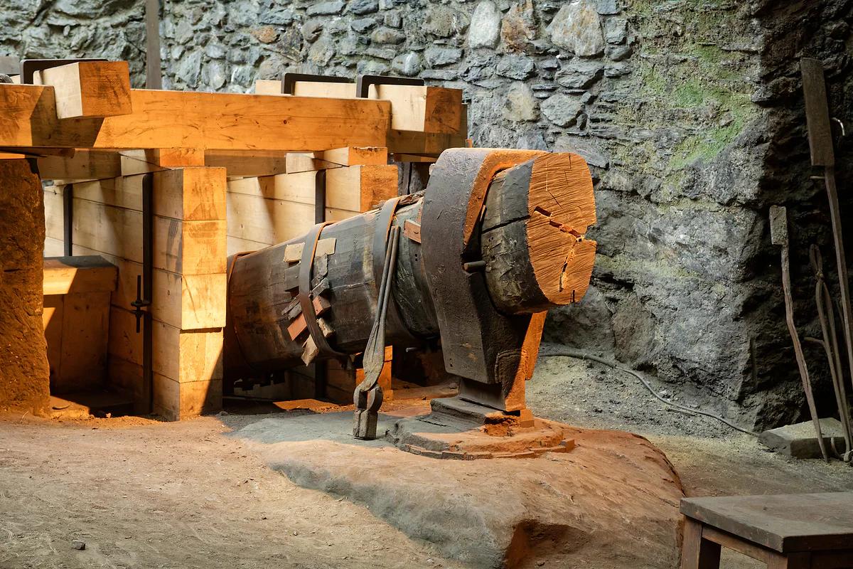
Council of Europe honourable mention, 2004
The Iron Route, three centuries of forges in one valley
Andorra's Iron Route is a cultural itinerary of about 10 km between the Farga Rossell forge in La Massana and the Llorts mine in Ordino, explaining the country's iron industry from the 17th to the 19th century. Its best-known walking section runs from Llorts to La Cortinada, 4.2 km on the GR 11 past iron sculptures, in just over two hours there and back.
In 30 seconds
Full read: 3 min
- The Iron Route explains Andorra's iron industry from the 17th to the 19th century.
- The full itinerary runs about 10 km from Farga Rossell (La Massana) to the Llorts mine (Ordino).
- The walking section, Llorts to La Cortinada, is 4.2 km each way with iron sculptures and 126 m of ascent.
- Best from June to October; Farga Rossell was closed for repairs on 29-9-2026.
I'd do the Llorts to La Cortinada walk with children in summer, starting with the Llorts mine. It's one of the few routes in Andorra that combines an easy stroll, history and art without anyone needing it explained.

Before you go
What I would keep in mind
-
01 Most beautiful
A path lined with iron sculptures
The muleteers' path honours the 'iron men' with works such as Rachid Khimoune's Família Jordino and a 12 m weathering-steel screen by Guy de Rougemont.
-
02 My tip
Start at the mine, in summer
The Llorts mine opens in the summer season, with about 30 m of gallery. Andorra Turisme recommends the route from June to October, and in May if the weather allows.
Llorts iron mine -
03 To save money
The walk itself is free
Walking from Llorts to La Cortinada costs nothing and follows the GR 11's red-and-white waymarks. You only pay if you go into the mine or the museums on the itinerary.
-
04 My tip
Farga Rossell is closed
The full itinerary's starting point was temporarily closed for repairs on 29-9-2026, according to museus.ad. Don't plan the day around it until a reopening is announced.
Farga Rossell
What I would book
My ranking, scored
Iron Route stops, by interest
My marks out of 10, weighing what each stop explains about Andorran iron and whether you can visit it today. Opinion, not an official rating.
0 of 5 seen
-
Llorts mine
About 30 m open in summer, explaining everything from prospecting to extraction. According to Andorra Turisme, no other mine in Andorra survives intact.
9.0 out of 10
-
The muleteers' path and its sculptures
The walking section with iron artworks honouring the 'iron men'. Easy, with a surprise round every bend.
8.6 out of 10
-
Sant Martí de la Cortinada
A 12th-century Romanesque church with grilles forged in Andorra's own ironworks. It marks the end of the walk.
8.2 out of 10
-
Casa d'Areny-Plandolit
Home of one of the great ironworks-owning families, the only noble family in Andorra according to museus.ad.
8.0 out of 10
-
Farga Rossell
The forge that worked from 1842 to 1876 and makes sense of it all. Marked down only because it's closed for repairs.
7.0 out of 10
Andorra usually sells itself on snow and shopping, and hardly anyone knows it lived off iron for three centuries. The Iron Route is the most pleasant way to find out, because it combines an easy riverside walk with a mine, a Romanesque church and a handful of sculptures in the middle of the woods.
A country that produced iron
Andorra Turisme explains that metalworking was one of the country’s most important economic activities between the 17th and 19th centuries. museus.ad adds that the itinerary covers the whole process, from mining to working and selling the iron, with mines, charcoal pits, remains of miners’ and ironworkers’ dwellings and forges spread across the territory.
The Andorran route is part of the Iron Route of the Pyrenees, a cross-border itinerary with Catalonia, Aquitaine, Ariège, Gipuzkoa and Biscay, which received an honourable mention from the Council of Europe in November 2004. It’s rare for a two-hour stroll to link you with half the Pyrenees.
Two scales, the walk and the full itinerary
Don’t confuse them. The full itinerary, according to museus.ad and Andorra Turisme, is about 10 km, from Farga Rossell in La Massana to the Llorts mine in Ordino. museus.ad presents it as a free-form route, done in any order, whole or in parts, and warns that you’ll need your own transport to do all of it.
The walk is something else. Andorra Turisme describes it as a linear path of about 4.2 km between Llorts and La Cortinada, 8.4 km there and back, downhill at first and gently uphill later, 126 m of ascent in total, just over two hours and the red-and-white waymarks of the GR 11. It’s the one I’d recommend to almost everyone.
What will you see along the way?
It starts at the Llorts mine, with about 30 m of gallery open in summer, explaining the iron process from prospecting and extraction onwards. Andorra Turisme calls it the only mine in the country still intact.
Next comes the muleteers’ path, the stretch museus.ad turns into a sculpture trail honouring the ‘iron men’. Along it are works such as Família Jordino by Rachid Khimoune, seven figures cast from moulds of city pavements in places like Tokyo, London and Paris; Gran carro de ferro i pic by Jordi Casamajor; Terra, ferro, aigua i foc by Satoru Sato; and Guy de Rougemont’s piece, a weathering-steel screen 12 m long and 3 m high that runs beside the torrent. In between you’ll pass traditional buildings such as the Ordino borda.
At the end stands Sant Martí de la Cortinada, a 12th-century Romanesque church extended in the 17th and 18th centuries, with grilles forged in Andorra’s own ironworks. It’s proof of what all that iron was for.
The stops you don’t walk to
Two more pieces lie off the path. Farga Rossell, the forge that turned ore into ingots from 1842 to 1876, was temporarily closed for repairs on 29 September 2026, so don’t count on it for now. And Casa d’Areny-Plandolit in Ordino was home to one of the great ironworks owners, the only noble family ever to live in Andorra according to museus.ad. Andorra Turisme also suggests the Homes de Ferro trail as an extra.
For riders, Andorra Turisme notes that the Iron Route can be done on horseback too, from Ransol to Arans via the Mina dels Meners.
The Camí Ral, the road that carries it
The walking section uses part of the Camí Ral, the old royal road. According to Andorra Turisme, it starts in the village of El Serrat and follows the river south through Ordino, La Massana and Escaldes-Engordany to Andorra la Vella. In La Massana its easiest stretch is flat, starting at the Prat del Molí car park and ending at the Romanesque bridge of Sant Antoni de la Grella. There are more routes in hiking in Andorra.
When to go
Andorra Turisme recommends the route from June to October, and in May if weather and ground allow. As the mine only opens in the summer season, high summer is when you’ll see everything together. And since a GHIC counts for nothing in Andorra, even on an easy route like this I’d make sure your travel insurance covers you there.
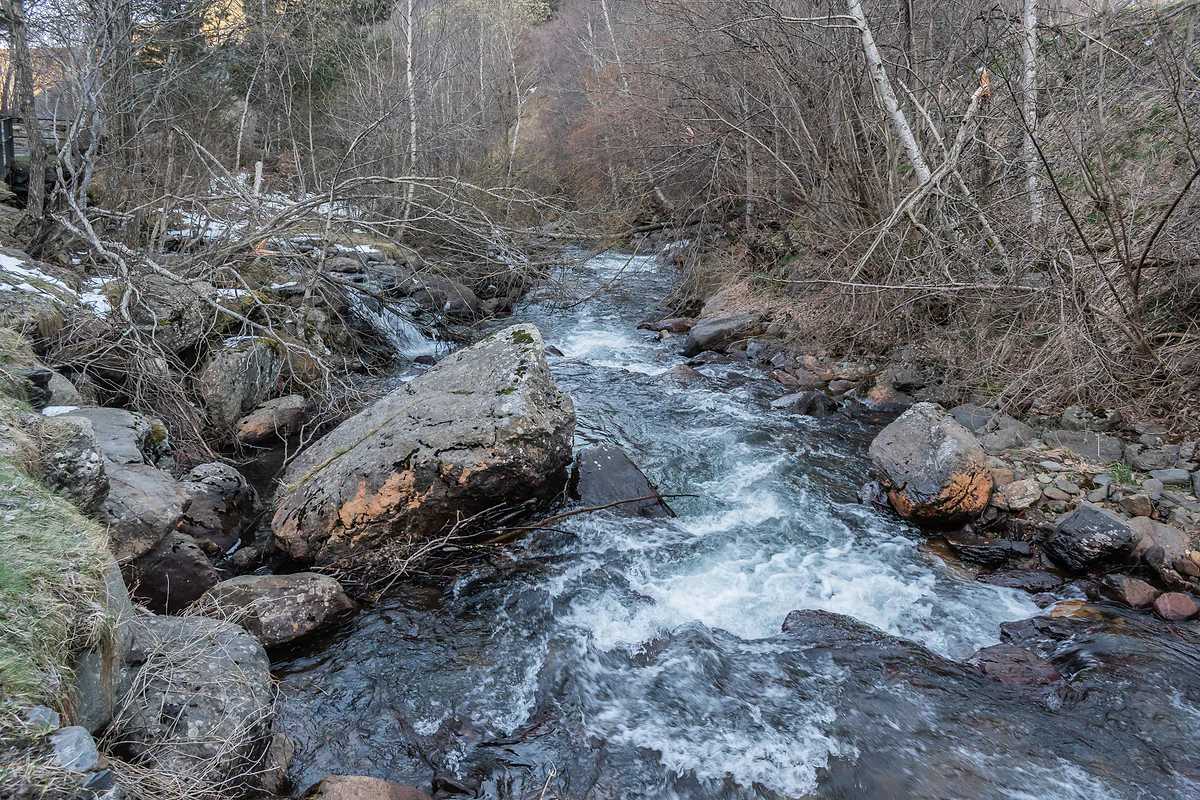
The Valira del Nord rushing between boulders and bare trees as it passes through Llorts in Ordino
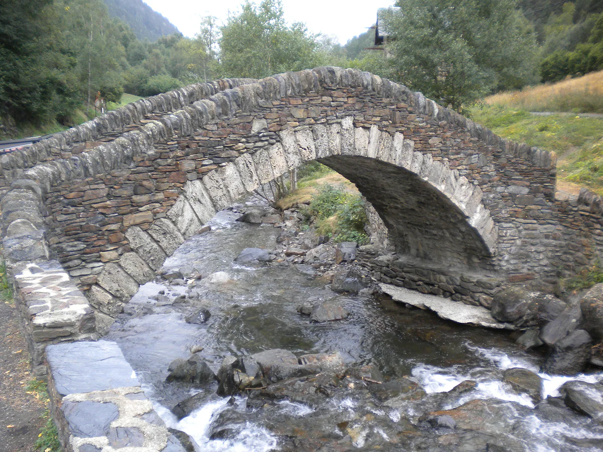
A steeply arched stone bridge over the Valira del Nord river as it flows through Ordino
The Iron Route at two scales
| Version | Route | Distance | How |
|---|---|---|---|
| Walking section | Llorts to La Cortinada and back | 4.2 km each way, 8.4 km in all | On foot, GR 11, just over 2 hr |
| Full itinerary | Farga Rossell (La Massana) to Llorts mine (Ordino) | About 10 km | Any order, in parts; whole thing needs your own transport |
| On horseback | Ransol to Arans via the Mina dels Meners | No distance published | With riding centres |
Andorra Turisme and museus.ad, checked on 29-9-2026. Recommended season June to October.
Sculptures along the path
| Work | Artist |
|---|---|
| Família Jordino | Rachid Khimoune |
| Gran carro de ferro i pic | Jordi Casamajor |
| Terra, ferro, aigua i foc | Satoru Sato |
| L'home-de-ferro-talp-que-camina | Guy de Rougemont |
A selection from the museus.ad itinerary. Rougemont's piece is a weathering-steel screen 12 m long and 3 m high.
Test yourself
True or false?
0/3 Pick before you peek.
-
Andorra's Iron Route received an honourable mention from the Council of Europe.
See the answer
True. In November 2004, as part of the Iron Route of the Pyrenees, according to Andorra Turisme.
-
The Llorts mine is open all year round.
See the answer
False. Only in the summer season, with about 30 m of gallery open to visitors, according to Andorra Turisme and museus.ad.
-
The Iron Route walk is a high-mountain trek.
See the answer
False. It's easy, with 126 m of ascent, and Andorra Turisme lists it among the best family walks in the country.
- Full itinerary
- 10 km
- Walking section, each way
- 4.2 km
- Ascent on the walk
- 126 m
- Council of Europe honourable mention
- 2004
0 of 269 Andorra guides
Your next stamp
- Llorts
- Llorts iron mine
- Arans
- La Cortinada
- Farga Rossell
- Hiking
- Margineda rock shelter
- Andorra in 3 days
- Places to visit
- Things to do
- Most beautiful places
- Prettiest villages
- Andorra la Vella
- UNESCO World Heritage
- Map
- Escaldes-Engordany
- Where is Andorra?
- Is Andorra a country?
- Parishes
- Casa de la Vall
- Margineda bridge
- Old town
- Santa Coloma church
- Towns and villages
- Population
- Size
- Mountains
- Language
- Andorra in one day
- Canillo
- Espai Columba
- History
- Sant Esteve church
- Co-princes
- Soldeu
- Weekend break
- El Tarter
- Political system
- Andorra in 4 days
- Flag
- Ransol
- A week in Andorra
- Facts
- Prats
- El Forn
- Public holidays
- Sant Julià de Lòria
- Currency and payments
- L'Aldosa de Canillo
- Els Plans
- EU and Schengen
- Bordes d'Envalira
- Entry requirements
- Prices and budget
- On a budget
- Sant Joan de Caselles
- Santa Coloma
- Ski holidays
- Tourist tax
- Mobile and roaming
- Sant Serni de Canillo
- Tourist information
- Healthcare
- Meritxell Sanctuary
- With a dog
- Packing list
- Safety
- How to get there
- Scams
- From Barcelona
- Bus from Barcelona
- Day trip from Barcelona
- From Madrid
- From Toulouse
- Encamp
- Flights
- La Margineda
- La Massana
- Roc del Quer viewpoint
- Romanesque churches
- Andorra-La Seu airport
- Canillo Tibetan bridge
- Museums in Andorra
- Pal
- Pas de la Casa
- Arinsal
- Driving
- Grau Roig
- Mon(t) Magic
- Nearest airports
- By train
- Erts
- Les Bons
- Palau de Gel
- Road conditions
- Motorcycle Museum
- Parking
- Sispony
- Vila
- Anyós
- Incles valley
- La Mosquera
- Petrol
- El Tremat
- Getting around
- Juclar lakes
- L'Aldosa (La Massana)
- Buses
- Els Cortals d'Encamp
- Sant Climent de Pal
- Bus station
- Sant Cristòfol d'Anyós
- Casa Rull
- Shopping
- Sant Vicenç d'Enclar
- Santa Eulàlia d'Encamp
- What to buy
- Customs allowances
- La Massana Còmic
- Sant Romà de les Bons
- Car Museum
- Cigarettes
- Comapedrosa
- Electronics
- Alcohol
- Casa Cristo
- Clothes and sports shops
- Coll d'Ordino
- Perfume
- Sacred Art Museum
- Shopping centres
- Funicamp
- Supermarkets
- Avinguda Meritxell
- Encamp Tibetan bridge
- Avinguda Carlemany (Vivand)
- Envalira pass
- Auvinyà
- Bici Lab Andorra
- Ordino
- Skiing
- With kids
- Zip lines
- Fontaneda
- For couples
- Ski pass
- Via ferratas
- Climbing
- Nagol
- Nightlife
- Ski season
- El Serrat
- Grandvalira
- Horse riding
- Juberri
- Aixovall
- Mountain biking
- Pal Arinsal
- Sornàs
- Aixirivall
- Ansalonga
- Ordino Arcalís
- Road cycling
- Bixessarri
- Naturland
- Segudet
- Llumeneres
- Tobotronc
- Casa d'Areny-Plandolit
- Cross-country skiing
- Miniature Museum
- Skiing with kids
- Cal Pal
- Free walking tour
- Pessons lakes
- Sant Serni de Nagol
- Ski lessons
- Where to stay
- Canòlich Sanctuary
- Hotels in Andorra la Vella
- Sant Martí de la Cortinada
- Ski hire
- Hotels in Escaldes
- Juberri Gardens
- Webcams
- Hotels in Soldeu
- Snow report
- Sorteny valley
- Hotels in El Tarter
- Tristaina lakes
- Hotels in Canillo
- Night skiing
- Tristaina solar viewpoint
- Freeride
- Hotels in Encamp
- Hotels in Pas de la Casa
- Ski touring
- Hotels in La Massana
- Snowshoeing
- Hotels in Arinsal and Pal
- Snow activities
- Après-ski
- Engordany
- Hotels in Ordino
- Medieval bridges
- Nature parks
- Els Vilars
- Hotels in Sant Julià de Lòria
- Lakes
- Sant Romà dels Vilars
- Viewpoints
- Where to eat
- Caldea
- Restaurants in Andorra la Vella
- Borda restaurants
- Inúu
- Cheap hotels
- Food
- Spas and thermal baths
- Weather and climate
- Engolasters lake
- Pas de la Casa weather
- Spa hotels
- Trinxat
- Events
- Luxury hotels
- Sant Miquel d'Engolasters
- Ski resort weather
- Wine
- Best time to visit
- Family hotels
- Madriu valley
- All inclusive
- Estany de l'Illa
- In winter
- Apartments
- Coronallacs
- In spring
- Ski World Cup
- Christmas
- Hostels
- In summer
- Mountain huts
- Camping and rural stays
- Easy walks
- In autumn
- New Year
- Family walks
- Festes majors
- In January
- GR11 and other GRs
- In February
- National day
- Around Andorra
- GRP round Andorra
- In March
- Midsummer fire festival
- Carnival
- In April
- In May
- Travessa d'Encamp
- In June
- In July
- In August
- In September
- In October
- In November
- In December
Frequently asked questions
What is Andorra's Iron Route?
A cultural itinerary explaining how iron was mined, worked and sold in Andorra between the 17th and 19th centuries. It's part of the Iron Route of the Pyrenees, with Catalonia, Aquitaine, Ariège, Gipuzkoa and Biscay.
How long is the Iron Route walk?
The walking section from Llorts to La Cortinada is about 4.2 km each way and takes just over 2 hours there and back. The full itinerary, from Farga Rossell to the Llorts mine, is around 10 km.
Is the Iron Route suitable for children?
Yes. Andorra Turisme calls it one of the best family walks in the country, with 126 m of ascent, downhill at first and gently uphill on the second half.
Where does the Iron Route start?
The walking section starts in Llorts, Ordino, and ends at Sant Martí de la Cortinada. The full itinerary begins at Farga Rossell in La Massana, currently closed for repairs.
When can you walk the Iron Route?
Andorra Turisme recommends June to October, and May if weather and ground allow. The Llorts mine opens only in the summer season.
What is the Camí Ral?
The old royal road down the valley, from El Serrat along the river through Ordino, La Massana and Escaldes-Engordany to Andorra la Vella. The Iron Route shares its stretch between La Cortinada and Llorts.
By
Tourism graduate with a master’s in Tourism Management and Planning from the University of Málaga, who has travelled across Europe. He writes every guide from official sources and his own judgement.
Published on . Facts checked on .
Sources
Photos: Marie-Lan Taÿ Pamart (CC BY 4.0); Krzysztof Golik (CC BY-SA 4.0); Àlex (CC BY-SA 3.0), via Wikimedia Commons.