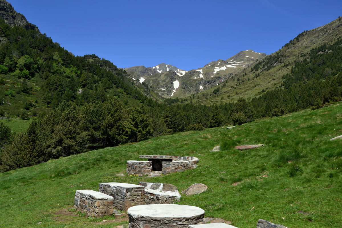
A Canillo hamlet above the Ransol road
Els Plans, the way into the Vall del Riu

- Parish
- Canillo
- Road
- CS-260 towards Ransol, then CS-261
Map
Where Els Plans is
The dashed line is the border with France and Spain. The Valira valley runs down from Pas de la Casa to Sant Julià, with Ordino and La Massana in the northern valley. Every number opens its guide.
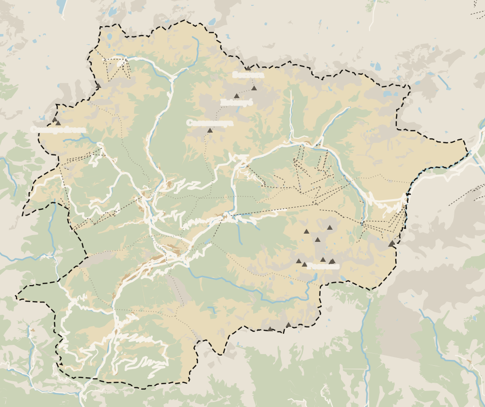 1Canillo 2Soldeu 3El Tarter 4Ransol 5Prats 6El Forn 7L'Aldosa de Canillo 8Els Plans 9Bordes d'Envalira 10Sant Joan de Caselles 11Sant Serni de Canillo 12Meritxell Sanctuary 13Roc del Quer viewpoint 14Canillo Tibetan bridge 15Mon(t) Magic 16Palau de Gel 17Motorcycle Museum 18Incles valley 19Espai Galobardes
Map data © OpenStreetMap contributors (ODbL)
- 1CanilloParish 1 of 7, covering 120.86 km²
- 2SoldeuHome of the Avet run and the 2027 World Cup
- 3El TarterÀliga run, FIS-approved in 2013
- 4Ransol5 km from Canillo, gateway to the Coma
- 5PratsSant Miquel, rustic Romanesque with metre-thick walls
- 6El FornIts own village fiesta since 2025
- 7L'Aldosa de CanilloNot to be confused with L'Aldosa in La Massana
- 8Els PlansA Canillo hamlet above the Ransol road
- 9Bordes d'EnvaliraA Canillo hamlet with its own ski sector
- 10Sant Joan de Caselles11th and 12th centuries, on the edge of Canillo
- 11Sant Serni de Canillo27-metre bell tower, free entry
- 12Meritxell SanctuaryMinor basilica since 2014
- 13Roc del Quer viewpointCanillo, Montaup road, km 6.5
- 14Canillo Tibetan bridge603 m long, 158 m high
- 15Mon(t) MagicGrandvalira family park, Canillo sector
- 16Palau de GelCanillo, avinguda Sant Joan de Caselles
- 17Motorcycle MuseumCanillo, gondola building
- 18Incles valleyCanillo, by Soldeu and El Tarter
- 19Espai GalobardesGondola building, Canillo
Els Plans is a small hamlet in Canillo parish, reached by the CS-260 towards Ransol and then the CS-261 to the left. What brings people up is the path to the lakes and hut of the Vall del Riu, which the Comú de Canillo gives as 6 km, about 2 h 45 and 720 m of ascent, and the hut itself is unstaffed with 10 places.
I wouldn't go up to Els Plans to see the hamlet, I'd go up to walk. In good summer weather I'd leave the car here, follow the Vall del Riu to the lakes and come back the same way, without counting on a bed in a 10-place unstaffed hut.
What I would check before going
Els Plans: the quick answer
Full read: 2 min
- Els Plans is a hamlet in Canillo, above the turning for Ransol.
- You get there on the CS-260 and then the CS-261 to the left.
- It's the start of the 6 km walk to the Vall del Riu lakes, with 720 m of ascent.
The practical bit
Worth knowing about Els Plans
-
01 Most beautiful
The Vall del Riu lakes
The Comú suggests Els Plans as the start of the path to the Vall del Riu lakes and hut, 6 km with 720 m of climbing. It's proper mountain walking, not a stroll.
-
02 My tip
Look for the red windows
According to the Comú's walking guide, the path starts beside some stone houses with red windows. That's your landmark for finding the right trailhead.
-
03 Getting there
Ransol is next door
Els Plans and Ransol share the turning off the main road. Ransol has medieval houses and the road up the Coma, with more walks and a picnic area.
Ransol and the Coma de Ransol
You won’t find Els Plans in many guidebooks, and that’s fair enough. It has no listed church and no shops. What it does have is a good position, high above the Ransol turning, and a path that leads into one of Canillo’s lake valleys. Here’s where it is, how to reach it and when it’s worth the drive.
Where Els Plans is and how to get up
Els Plans belongs to the parish of Canillo. The Comú treats it as a settlement in its own right, and in October 2026 it called its residents to their own meeting at the Font del Ribàs, apart from Ransol or L’Aldosa. To get there, the Comú’s walking guide says to leave the main road on the CS-260 towards Ransol and, further up, fork left onto the CS-261.
For where it sits among the other villages of the Valira d’Orient valley, see Canillo, Andorra’s largest parish.
From Els Plans to the Vall del Riu lakes
This is why you come. The Comú’s first suggested route to the Vall del Riu lakes and mountain hut starts from the village of Els Plans, beside some stone houses with red windows. It’s 6 km, about 2 h 45 of walking and 720 m of ascent, so bring proper boots and a realistic pace.
At the top is the Vall del Riu hut, unstaffed, free and open all year, with 10 places, according to the Comú. Its huts page describes driving as far as Els Plans de Ransol and then walking for roughly two hours. It’s the same valley that the Canillo Tibetan bridge spans far below, seen from the inside.
I’d do it in summer. Andorra Turisme recommends routes above 1,700 m from late June to late September, and outside that window snow can linger. Follow the Andorran police’s mountain advice too, which I summarise in is Andorra safe.
To sleep close to everything, search places to stay in El Tarter on Expedia and filter by area before price.
What’s near Els Plans
Els Plans shares its turning with Ransol and the Coma de Ransol, with medieval houses, the church of Sant Jaume and a side road up the Coma with more walks. Back down on the main road are L’Aldosa de Canillo and El Tarter, which has the accommodation and the Grandvalira lifts. For a full day, I’d walk to the Vall del Riu in the morning and wander round Ransol on the way back.
If you still need a way in, check train and coach tickets to Andorra la Vella from where you are.
If you are short on time, see the best tours in El Tarter and pick one that fits your day.
Where the bus does not go, a car does: compare car hire in Andorra la Vella before you arrive rather than at the desk.
To sleep close to everything, search places to stay in El Tarter on Booking.com and filter by area before price.
The Vall del Riu walk from Els Plans
| Detail | Figure |
|---|---|
| Distance | 6 km |
| Time | 2 h 45 |
| Ascent | 720 m |
| Start | Beside stone houses with red windows |
| Destination | Vall del Riu lakes and hut |
Comú de Canillo walking guide, checked on 28-09-2026.
Test yourself
What people often get wrong about Els Plans
0/3 Pick before you peek.
-
Els Plans is part of the village of Ransol.
See the answer
False. It's a separate settlement in Canillo parish. The Comú meets its residents on their own, at the Font del Ribàs.
-
The walk from Els Plans to the Vall del Riu climbs more than 700 m.
See the answer
True. The Comú's walking guide gives 720 m of ascent over 6 km.
-
The Vall del Riu hut is staffed and has to be booked.
See the answer
False. It's unstaffed, free and open all year, with 10 places, according to the Comú de Canillo.
Quick questions about Els Plans
Where is Els Plans in Andorra?
In the parish of Canillo. From the main road you take the CS-260 towards Ransol and then the CS-261 to the left, according to the Comú's walking guide.
What is there to do in Els Plans?
Mainly the walk to the Vall del Riu lakes and hut, 6 km, about 2 h 45 and 720 m of ascent. The hamlet itself has no listed sights.
Can you stay overnight at the Vall del Riu hut?
It's an unstaffed hut, open all year and free, with 10 places according to the Comú de Canillo. You park at Els Plans and walk for about two hours.
Are Els Plans and Ransol the same place?
No. They're separate settlements in Canillo that share the turning off the main road, and the Comú holds a separate residents' meeting for each.
When is the best time for the Vall del Riu walk?
Andorra Turisme recommends routes above 1,700 m from late June to late September. Outside that window there can still be snow.
0 of 290 Andorra guides
Your next stamp
- El Forn
- L'Aldosa de Canillo
- Ransol
- Roc del Quer viewpoint
- Els Vilars
- Palau de Gel
- Prats
- Sant Serni de Canillo
- Places to visit
- Things to do
- Most beautiful places
- Prettiest villages
- Andorra la Vella
- UNESCO World Heritage
- Map
- Escaldes-Engordany
- Where is Andorra?
- Is Andorra a country?
- Parishes
- Casa de la Vall
- Margineda bridge
- Old town
- Santa Coloma church
- Towns and villages
- Population
- Size
- Mountains
- Language
- Andorra in one day
- Canillo
- Espai Columba
- History
- Margineda rock shelter
- Sant Esteve church
- Co-princes
- Soldeu
- Weekend break
- Andorra in 3 days
- El Tarter
- Political system
- Andorra in 4 days
- Flag
- A week in Andorra
- Facts
- Public holidays
- Sant Julià de Lòria
- Currency and payments
- EU and Schengen
- Bordes d'Envalira
- Entry requirements
- Prices and budget
- On a budget
- Sant Joan de Caselles
- Santa Coloma
- Ski holidays
- Tourist tax
- Mobile and roaming
- Tourist information
- Healthcare
- Meritxell Sanctuary
- With a dog
- Packing list
- Safety
- How to get there
- Scams
- From Barcelona
- Bus from Barcelona
- Day trip from Barcelona
- From Madrid
- From Toulouse
- Encamp
- Flights
- La Margineda
- La Massana
- Romanesque churches
- Andorra-La Seu airport
- Caldea deals
- Canillo Tibetan bridge
- Museums in Andorra
- Pal
- Pas de la Casa
- Arinsal
- Caldea restaurants
- Driving
- Grau Roig
- Mon(t) Magic
- Nearest airports
- By train
- Erts
- Les Bons
- Road conditions
- Motorcycle Museum
- Parking
- Sispony
- Vila
- Anyós
- Incles valley
- La Mosquera
- Petrol
- El Tremat
- Getting around
- Juclar lakes
- L'Aldosa (La Massana)
- Buses
- Els Cortals d'Encamp
- Sant Climent de Pal
- Bus station
- Sant Cristòfol d'Anyós
- Casa Rull
- Shopping
- Farga Rossell
- Sant Vicenç d'Enclar
- Santa Eulàlia d'Encamp
- What to buy
- Customs allowances
- La Massana Còmic
- Sant Romà de les Bons
- Car Museum
- Cigarettes
- Comapedrosa
- Electronics
- Alcohol
- Casa Cristo
- Clothes and sports shops
- Iron Route
- Coll d'Ordino
- Perfume
- Sacred Art Museum
- Shopping centres
- Funicamp
- Supermarkets
- Avinguda Meritxell
- Encamp Tibetan bridge
- Avinguda Carlemany (Vivand)
- Envalira pass
- Auvinyà
- Bici Lab Andorra
- Ordino
- Skiing
- With kids
- Zip lines
- Fontaneda
- For couples
- Hotel Grau Roig
- La Cortinada
- Ski pass
- Via ferratas
- Climbing
- Hotel Piolets Soldeu Centre
- Llorts
- Nagol
- Nightlife
- Ski season
- El Serrat
- Grandvalira
- Horse riding
- Hotel Himàlaia Soldeu
- Juberri
- Aixovall
- Mountain biking
- Pal Arinsal
- Sornàs
- Sport Hotel Hermitage & Spa
- Aixirivall
- Ansalonga
- Hotel Soldeu Maistre
- Ordino Arcalís
- Road cycling
- Bixessarri
- Hotel Les Closes
- Naturland
- Segudet
- Arans
- Hotel Espel
- Llumeneres
- Tobotronc
- Abba Ordino Babot Hotel
- Casa d'Areny-Plandolit
- Cross-country skiing
- Miniature Museum
- Skiing with kids
- Tarter Mountain Suites
- Cal Pal
- Free walking tour
- Pessons lakes
- Sant Corneli i Sant Cebrià
- Sant Serni de Nagol
- Ski lessons
- Where to stay
- Canòlich Sanctuary
- Hotels in Andorra la Vella
- Sant Iscle i Santa Victòria
- Sant Martí de la Cortinada
- Ski hire
- Hotels in Escaldes
- Juberri Gardens
- Llorts iron mine
- Sant Julià i Sant Germà
- Webcams
- Hotels in Soldeu
- Sant Antoni de la Grella
- Snow report
- Sorteny valley
- Hotels in El Tarter
- Sant Andreu del Prat del Campanar
- Tristaina lakes
- Escaldes-Engordany Art Centre
- Hotels in Canillo
- Night skiing
- Tristaina solar viewpoint
- Espai Caldes
- Freeride
- Hotels in Encamp
- Espai Galobardes
- Hotels in Pas de la Casa
- Ski touring
- Casa de la Muntanya
- Hotels in La Massana
- Snowshoeing
- Government Exhibition Hall
- Hotels in Arinsal and Pal
- Snow activities
- Après-ski
- Engordany
- Hotels in Ordino
- Medieval bridges
- Nature parks
- Hotels in Sant Julià de Lòria
- Lakes
- Sant Romà dels Vilars
- Viewpoints
- Where to eat
- Caldea
- Restaurants in Andorra la Vella
- Borda restaurants
- Inúu
- Cheap hotels
- Food
- Hiking
- Spas and thermal baths
- Weather and climate
- Engolasters lake
- Pas de la Casa weather
- Spa hotels
- Trinxat
- Events
- Luxury hotels
- Sant Miquel d'Engolasters
- Ski resort weather
- Wine
- Best time to visit
- Family hotels
- Madriu valley
- All inclusive
- Estany de l'Illa
- In winter
- Apartments
- Coronallacs
- In spring
- Ski World Cup
- Christmas
- Hostels
- In summer
- Mountain huts
- Camping and rural stays
- Easy walks
- In autumn
- New Year
- Family walks
- Festes majors
- In January
- GR11 and other GRs
- In February
- National day
- Around Andorra
- GRP round Andorra
- In March
- Midsummer fire festival
- Carnival
- In April
- In May
- Travessa d'Encamp
- In June
- In July
- In August
- In September
- In October
- In November
- In December

Questions about Els Plans? Write to me
If something does not add up or a fact is missing, write to me and I will answer myself.
My email sergiolepone@gmail.com
By
Tourism graduate with a master’s in Tourism Management and Planning from the University of Málaga, who has travelled across Europe. He writes every guide from official sources and his own judgement.
Published on . Updated on . Facts checked on .
Sources
Some links in this guide are affiliate links: if you book through them, the site earns a commission at no extra cost to you. Affiliate disclosure
Photos: Angela Llop (CC BY-SA 2.0), via Wikimedia Commons.