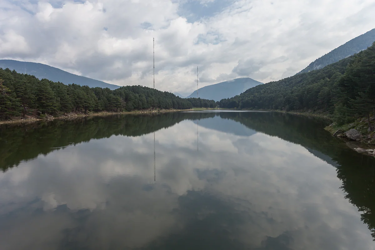
Above Escaldes-Engordany
Engolasters lake, the Andorran lake anyone can reach
Engolasters lake (Llac d'Engolasters) sits above Escaldes-Engordany on the boundary with Encamp and is the most accessible lake in Andorra, 7 hectares in size and the only large one below 2,000 m. You can drive up on the CS-200 or walk about 2 km from Encamp. Swimming is banned because FEDA's power station draws water from it.
In 30 seconds
Full read: 3 min
- Engolasters lake covers 7 ha and is the only large lake in Andorra below 2,000 m.
- Drive up the CS-200 from Escaldes or walk about 2 km from Encamp.
- Swimming is banned because FEDA draws water from it.
- Its 178 m dam was built in 1934.
This is the lake I'd send anyone who isn't planning proper mountain walking in Andorra. Drive up in the late afternoon, stroll round the water without hurrying and stop at Sant Miquel on the way down, which is on the same road.

Before you go
What I would keep in mind
-
01 Most beautiful
The only big lake below 2,000 m
Andorra Turisme calls it the most accessible lake in the country and the only one of the large lakes below 2,000 m. It's the easiest way to see an Andorran mountain lake.
lakes in Andorra -
02 My tip
Leave the swimming kit behind
Swimming is strictly banned because of the water intake and the sluice for FEDA's power station. It's a reservoir with a dam, not a beach.
-
03 To save money
Walk up from Encamp
The path starts opposite the Car Museum in Encamp, joins the GR-11 and reaches the lake in about 2 km. Around two hours there and back, and no parking to pay for.
Encamp, the Funicamp parish -
04 Getting there
Parking right by the water
The Madriu valley's official site mentions the Camp del Serrat car park beside the lake. The CS-200 climbs from the first roundabout on the CG-2 in Escaldes.
What I would book
My ranking, scored
What I'd do at Engolasters
My own scores out of 10, for what each plan adds to a half-day visit and how easily it fits in. Only activities with an official listing.
0 of 5 seen
-
Walking round the lake
Seven hectares of water among pines, flat and easy. It's what you come for, and it's free.
9.0 out of 10
-
Stopping at Sant Miquel d'Engolasters
A 12th-century Romanesque church with a 17 m bell tower, on the same road. Entry is free.
8.8 out of 10
-
Walking up from Encamp
About 2 km with 350 m of climbing, joining the GR-11 and passing the Borda de Cresper. A good warm-up.
8.0 out of 10
-
Heading into the Madriu from the Engolasters plateau
From the Font de la Closa picnic area, the Coll Jovell path and the Canal de la Tosa path lead into the valley.
7.8 out of 10
-
Guided Hydroelectric Trail
A tour inside the dam with FEDA. A good idea, but its museum is listed as closed for works, so check before you go.
7.0 out of 10
Andorra has dozens of lakes, and nearly all of them ask for boots, hours of climbing and some luck with the weather. Engolasters is the exception. You drive up, park beside it and within ten minutes you’re walking along the water among the pines. For anyone visiting Andorra without mountain plans, it’s the lake I’d put on the itinerary.
Andorra’s easy lake
Andorra Turisme calls it the most accessible lake in the Principality. It covers 7 hectares and is the only one of the country’s large lakes lying below 2,000 m. It sits above Escaldes-Engordany on the boundary with Encamp, surrounded by a plateau of old stone barns, the church of Sant Miquel and the paths of the Madriu.
What you can’t do is swim. It’s strictly banned, because the lake holds the water intake and sluice for FEDA’s power station. I think that’s worth saying plainly, since in photos it looks like a mountain beach and it isn’t one.
How to get to Engolasters lake
By car from Escaldes, follow the CG-2 to the first roundabout and turn onto the Engolasters road, the CS-200. The Madriu valley’s official website lists the Camp del Serrat car park next to the lake, plus rough parking on the Engolasters plateau at the Font de la Closa picnic area.
On foot, the classic route starts in Encamp opposite the Car Museum. It’s about 2 km, 1.9 on the route sheet, with around 350 m of ascent, and Andorra Turisme allows 1 h 15 up and 45 minutes back. The path heads south across streams and a couple of roads, then joins the GR-11, so you follow red and white waymarks. It passes the Borda de Cresper. The recommended season is June to September, stretching to May and October if the weather allows. If you’re staying in Encamp, it’s the best way up.
A dam, a power station and a legend
The lake is glacial in origin, but a lot of what you see is man-made. In 1934 the Forces Hidroelèctriques d’Andorra built a 178 m dam with the largest head of water in the country, and for decades it was central to Andorra’s electricity supply. A small wagon carried materials and workers up to the keepers’ hut and ran from 1930 to 1999.
FEDA runs the Engolasters Hydroelectric Trail, a guided 90-minute walk through the inside of the dam and along the channels, for up to 30 people and available in English. According to Andorra Turisme it runs on Saturdays in May, June and September and daily in July and August, closed on Mondays. Be warned that the same site lists the Electricity Museum as closed for works, so I’d check with FEDA before relying on it.
Then there’s the legend, which I love. A village is said to have been swallowed by the water, and witches bathed naked in the lake at night, turning any man who came to watch into a black cat. According to the same listing, they left at the start of the 20th century, just as the dam and power station arrived.
When and how to go
The footpath is recommended from June to September, stretching to May and October if the weather allows. You can drive up for most of the year, but remember that from 1 November to 15 May the country requires snow chains or winter tyres, which matters if you’re driving a hire car up from Toulouse or Barcelona. I prefer the lake in autumn and early in the day, with the water still and nobody about, to a Sunday lunchtime in August.
If you cycle, Andorra Turisme has route sheets for a road ride from Escaldes-Engordany to Engolasters and a mountain-bike route from Encamp to the lake via Les Pardines. The road ride uses the same CS-200 that passes Sant Miquel, so the church is right on your way.
More to do nearby
On the same road stands Sant Miquel d’Engolasters, built in the 12th century, its 17 m bell tower easy to spot from the road. Once the winter season ends, an adventure park opens beside the lake with zip lines and balance games, aimed mainly at children.
For more mountain, paths from the Engolasters plateau lead into the Madriu valley. To compare with Andorra’s higher and tougher lakes, see my guide to lakes in Andorra.
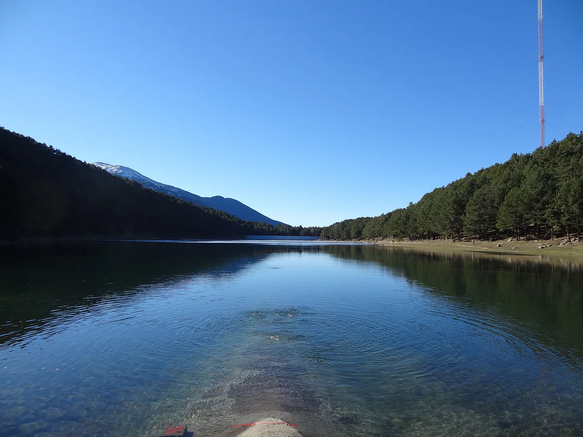
Engolasters lake on a clear day, the water crystal clear and pine-clad slopes rising on either side
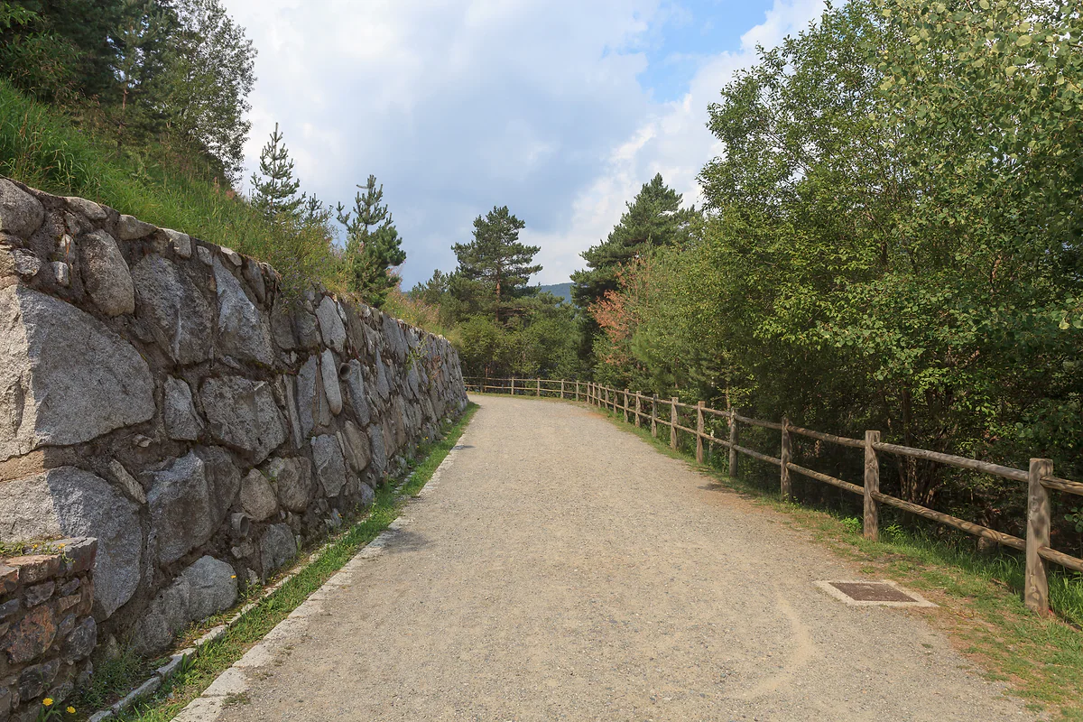
The Les Pardines path, a flat earth trail between Encamp and Escaldes, with a stone wall and trees
Getting to Engolasters lake
| How | From | Details |
|---|---|---|
| Car | Escaldes-Engordany | CG-2 to the first roundabout, then the Engolasters road, CS-200 |
| On foot | Encamp, opposite the Car Museum | 1.9 km on the route sheet, +350 m, easy, about 2 h return |
| Parking | Camp del Serrat | Beside the lake |
Andorra Turisme and the Madriu valley's official website, checked on 29-09-2026. The walk is recommended from June to September.
The lake in numbers
| Fact | Figure |
|---|---|
| Area | 7 ha |
| Dam length | 178 m |
| Dam built | 1934 |
| Service wagon in use | 1930 to 1999 |
Andorra Turisme listings for the lake, the walk and the Hydroelectric Trail.
Test yourself
True or false?
0/4 Pick before you peek.
-
Engolasters is Andorra's largest lake.
See the answer
False. It covers 7 ha. The largest in the country is the first of the Juclar lakes, at 21 ha, according to Andorra Turisme.
-
You can swim in Engolasters in summer.
See the answer
False. Swimming is strictly banned because of FEDA's water intake and sluice.
-
The Engolasters dam is more than 150 m long.
See the answer
True. The route sheet gives it a length of 178 m and dates it to 1934.
-
A local legend tells of witches bathing in the lake.
See the answer
True. Andorra Turisme retells the story of a village swallowed by the water and witches who turned nosy men into black cats.
- Area of the lake
- 7 ha
- Length of the dam
- 178 m
- Year the dam was built
- 1934
Map
Where Engolasters lake is
The dashed line is the border with France and Spain. The Valira valley runs down from Pas de la Casa to Sant Julià, with Ordino and La Massana in the northern valley. Every number opens its guide.
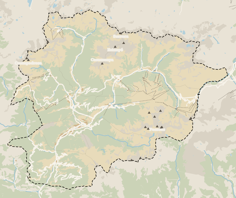 1Escaldes-Engordany 2Avinguda Carlemany (Vivand) 3Engordany 4Els Vilars 5Caldea 6Engolasters lake 7Sant Miquel d'Engolasters 8Madriu valley
 Map data © OpenStreetMap contributors (ODbL)
- 1Escaldes-EngordanyParish 7 of 7
- 2Avinguda Carlemany (Vivand)Escaldes-Engordany
- 3EngordanyA district of Escaldes-Engordany
- 4Els VilarsA hamlet in Escaldes-Engordany
- 5CaldeaThermal spa in Escaldes-Engordany
- 6Engolasters lakeAbove Escaldes-Engordany
- 7Sant Miquel d'Engolasters12th-century Romanesque
- 8Madriu valleyUNESCO World Heritage Site since 2004
0 of 269 Andorra guides
Your next stamp
- Lakes
- Easy walks
- Hiking
- Juclar lakes
- Tristaina lakes
- A week in Andorra
- Climbing
- Places to visit
- Things to do
- Most beautiful places
- Prettiest villages
- Andorra la Vella
- UNESCO World Heritage
- Map
- Escaldes-Engordany
- Where is Andorra?
- Is Andorra a country?
- Parishes
- Casa de la Vall
- Margineda bridge
- Old town
- Santa Coloma church
- Towns and villages
- Population
- Size
- Mountains
- Language
- Andorra in one day
- Canillo
- Espai Columba
- History
- Margineda rock shelter
- Sant Esteve church
- Co-princes
- Soldeu
- Weekend break
- Andorra in 3 days
- El Tarter
- Political system
- Andorra in 4 days
- Flag
- Ransol
- Facts
- Prats
- El Forn
- Public holidays
- Sant Julià de Lòria
- Currency and payments
- L'Aldosa de Canillo
- Els Plans
- EU and Schengen
- Bordes d'Envalira
- Entry requirements
- Prices and budget
- On a budget
- Sant Joan de Caselles
- Santa Coloma
- Ski holidays
- Tourist tax
- Mobile and roaming
- Sant Serni de Canillo
- Tourist information
- Healthcare
- Meritxell Sanctuary
- With a dog
- Packing list
- Safety
- How to get there
- Scams
- From Barcelona
- Bus from Barcelona
- Day trip from Barcelona
- From Madrid
- From Toulouse
- Encamp
- Flights
- La Margineda
- La Massana
- Roc del Quer viewpoint
- Romanesque churches
- Andorra-La Seu airport
- Canillo Tibetan bridge
- Museums in Andorra
- Pal
- Pas de la Casa
- Arinsal
- Driving
- Grau Roig
- Mon(t) Magic
- Nearest airports
- By train
- Erts
- Les Bons
- Palau de Gel
- Road conditions
- Motorcycle Museum
- Parking
- Sispony
- Vila
- Anyós
- Incles valley
- La Mosquera
- Petrol
- El Tremat
- Getting around
- L'Aldosa (La Massana)
- Buses
- Els Cortals d'Encamp
- Sant Climent de Pal
- Bus station
- Sant Cristòfol d'Anyós
- Casa Rull
- Shopping
- Farga Rossell
- Sant Vicenç d'Enclar
- Santa Eulàlia d'Encamp
- What to buy
- Customs allowances
- La Massana Còmic
- Sant Romà de les Bons
- Car Museum
- Cigarettes
- Comapedrosa
- Electronics
- Alcohol
- Casa Cristo
- Clothes and sports shops
- Iron Route
- Coll d'Ordino
- Perfume
- Sacred Art Museum
- Shopping centres
- Funicamp
- Supermarkets
- Avinguda Meritxell
- Encamp Tibetan bridge
- Avinguda Carlemany (Vivand)
- Envalira pass
- Auvinyà
- Bici Lab Andorra
- Ordino
- Skiing
- With kids
- Zip lines
- Fontaneda
- For couples
- La Cortinada
- Ski pass
- Via ferratas
- Llorts
- Nagol
- Nightlife
- Ski season
- El Serrat
- Grandvalira
- Horse riding
- Juberri
- Aixovall
- Mountain biking
- Pal Arinsal
- Sornàs
- Aixirivall
- Ansalonga
- Ordino Arcalís
- Road cycling
- Bixessarri
- Naturland
- Segudet
- Arans
- Llumeneres
- Tobotronc
- Casa d'Areny-Plandolit
- Cross-country skiing
- Miniature Museum
- Skiing with kids
- Cal Pal
- Free walking tour
- Pessons lakes
- Sant Serni de Nagol
- Ski lessons
- Where to stay
- Canòlich Sanctuary
- Hotels in Andorra la Vella
- Sant Martí de la Cortinada
- Ski hire
- Hotels in Escaldes
- Juberri Gardens
- Llorts iron mine
- Webcams
- Hotels in Soldeu
- Snow report
- Sorteny valley
- Hotels in El Tarter
- Hotels in Canillo
- Night skiing
- Tristaina solar viewpoint
- Freeride
- Hotels in Encamp
- Hotels in Pas de la Casa
- Ski touring
- Hotels in La Massana
- Snowshoeing
- Hotels in Arinsal and Pal
- Snow activities
- Après-ski
- Engordany
- Hotels in Ordino
- Medieval bridges
- Nature parks
- Els Vilars
- Hotels in Sant Julià de Lòria
- Sant Romà dels Vilars
- Viewpoints
- Where to eat
- Caldea
- Restaurants in Andorra la Vella
- Borda restaurants
- Inúu
- Cheap hotels
- Food
- Spas and thermal baths
- Weather and climate
- Pas de la Casa weather
- Spa hotels
- Trinxat
- Events
- Luxury hotels
- Sant Miquel d'Engolasters
- Ski resort weather
- Wine
- Best time to visit
- Family hotels
- Madriu valley
- All inclusive
- Estany de l'Illa
- In winter
- Apartments
- Coronallacs
- In spring
- Ski World Cup
- Christmas
- Hostels
- In summer
- Mountain huts
- Camping and rural stays
- In autumn
- New Year
- Family walks
- Festes majors
- In January
- GR11 and other GRs
- In February
- National day
- Around Andorra
- GRP round Andorra
- In March
- Midsummer fire festival
- Carnival
- In April
- In May
- Travessa d'Encamp
- In June
- In July
- In August
- In September
- In October
- In November
- In December
Frequently asked questions
How do you get to Engolasters lake?
By car, take the Engolasters road (CS-200) from the first roundabout on the CG-2 in Escaldes-Engordany; there's parking at Camp del Serrat by the lake. On foot, start in Encamp opposite the Car Museum.
Can you swim in Engolasters lake?
No. Andorra Turisme says swimming is strictly prohibited because of the water intake and sluice for FEDA's power station.
How long is the walk to Engolasters lake?
From Encamp it's about 2 km with roughly 350 m of ascent. Andorra Turisme allows 1 h 15 up and 45 minutes down, around two hours in all.
Which parish is Engolasters lake in?
Andorra Turisme places it above Escaldes-Engordany, and the walking route starts in Encamp. It sits on the boundary between the two parishes.
Is Engolasters a good family walk?
Yes. The loop round the lake is flat, and after the winter season an adventure park with zip lines and balance games opens beside it, aimed mainly at children.
Is Engolasters a natural lake?
It's glacial in origin, but since 1934 it has had a 178 m dam, which made it part of the country's power supply, with Andorra's biggest head of water.
By
Tourism graduate with a master’s in Tourism Management and Planning from the University of Málaga, who has travelled across Europe. He writes every guide from official sources and his own judgement.
Published on . Facts checked on .
Sources
Photos: Luis Miguel Bugallo Sánchez (CC BY-SA 3.0); Don-vip (CC BY-SA 3.0); Luis Miguel Bugallo Sánchez (CC BY-SA 3.0), via Wikimedia Commons.