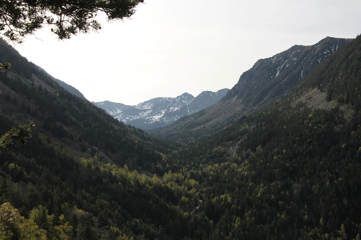
UNESCO World Heritage Site since 2004
The Madriu valley, Andorra's only World Heritage Site, on foot
The Madriu-Perafita-Claror valley is Andorra's only World Heritage Site, listed by UNESCO in 2004 as a cultural landscape. It covers 4,247 hectares, close to 10% of the country, across four parishes, and has no roads. The busiest entrance is in Escaldes-Engordany, and inside you'll find cobbled paths, stone barns, more than thirty lakes and five mountain huts.
In 30 seconds
Full read: 4 min
- The Madriu-Perafita-Claror valley has been Andorra's only World Heritage Site since 2004.
- It covers 4,247 ha, close to 10% of the country, and vehicles are banned.
- The main entrance is the Camí de la Muntanya in Escaldes-Engordany.
- It has five mountain huts; l'Illa is the only staffed one.
- The best season runs from late June to late September.
If you only do one mountain walk in Andorra, I'd make it this one. Go in from Escaldes early, climb the cobbled path to the barns at Ràmio or the Fontverd hut and come back the same way, no overnight needed.

Before you go
What I would keep in mind
-
01 Most beautiful
The cobbled path
The valley's official site and Andorra Turisme agree that its old cobbled path, shared in places with the GR7 and GR11, is one of its defining features.
-
02 To save money
It costs nothing to go in
The valley is free and so is the visitor centre. The only charge is for the forestry track up to Claror on the Sant Julià side, outside the protected area.
-
03 Getting there
By bus to the trailhead
From Escaldes, the La Plana bus stop is 200 m from the Camí de la Muntanya, the main entrance. There's no public transport into the valley from Sant Julià.
Escaldes-Engordany -
04 My tip
Call in at Borda Gabriel first
Since 1 October 2025 the visitor centre has been on Carrer de l'Obac in Escaldes. It opens Monday to Friday, it's free, and staff will advise on routes and conditions.
-
05 Worth the splurge
A night at the l'Illa hut
The valley's only staffed hut stands at 2,488 m beside the country's second-largest lake. A night there is the best way to see the Madriu empty.
Estany de l'Illa
My ranking, scored
Ways into the Madriu, depending on what you want
My own scores out of 10, for what each entrance offers a first-time visitor and how easy the trailhead is to reach. Entrances from the valley's official website.
0 of 5 seen
-
Camí de la Muntanya (Escaldes)
The main and most direct entrance, with a barrier car park and a bus stop 200 m away. It puts you straight on the cobbled path to Entremesaigües and Ràmio.
9.2 out of 10
-
Circuit de les Fonts (Escaldes)
From the last bend of the Engolasters road, along the Camí dels Matxos to Coll Jovell. Good if you've already driven up to the lake.
8.6 out of 10
-
Grau Roig via the Pessons lakes (Encamp)
In from the top, through the Pessons cirque to the l'Illa hut. One for experienced hillwalkers, not a stroll.
8.4 out of 10
-
La Comella and Prat Primer (Andorra la Vella)
Free parking by the Comella picnic area and a steep climb to Prat Primer, then down into Claror.
7.8 out of 10
-
Naturland top station (Sant Julià)
From the south side, with the paid forestry track up to Claror. The option if you're already at Naturland.
7.2 out of 10
Of everything there is to see in Andorra, the Madriu is the hardest to explain to someone who only knows the shopping streets. It’s a whole valley with no roads, where people spent centuries grazing flocks, growing crops and forging iron, and which has survived largely intact. It joined the UNESCO list in 2004, and no other Andorran site has joined it since. Best of all, its main gateway is in Escaldes, a short walk from the town centre.
A whole valley under protection
The Madriu-Perafita-Claror valley extends over 4,247 hectares, close to 10% of Andorra, shared between Sant Julià de Lòria, Andorra la Vella, Encamp and Escaldes-Engordany. It follows the catchment of the River Madriu, runs 12 km end to end and climbs 1,855 m to the Pic de la Portelleta at 2,905 m. Around it lies a further buffer zone of 4,092 ha.
The official website makes a point I think matters, that preserving a major valley in its entirety is a one-off in the Pyrenees. Around 99% of the land is communal. The remaining 1%, just over 42 ha on the valley floor in Escaldes, belongs to about thirty private owners, so keep off the meadows and leave the barns alone.
What is there to see in the Madriu?
First, the cobbled path, shared in places with the GR7 and GR11, which both the official site and Andorra Turisme single out as one of the landscape’s great assets. Then the traces of the old way of life, restored shepherds’ huts, stone barns, plots enclosed by dry-stone walls, milking pens and pastures. At La Farga you’ll find remains of the valley’s ironworking past.
Nature holds its own too. The official site counts more than thirty lakes, including the Estany de l’Illa, the second-largest in the country, and says the valley is home to 70% of Andorra’s catalogued animal species. The route sheets mention chamois, roe deer, mouflon, wild boar, foxes and marmots. For how it fits with the country’s other listings, see Andorra’s UNESCO World Heritage.
Where to go in
Vehicles are banned, so you enter on foot. The main entrance from Escaldes is the Camí de la Muntanya, about 50 m from the junction of the Engolasters road (CS-200) and the Plana road, where there’s a barrier car park. By bus, get off at La Plana, 200 m away. Another popular gateway is at the last bend of the Engolasters road, from the pay-and-display car park at the Circuit de les Fonts along the Camí dels Matxos. Two more paths leave from the Font de la Closa on the Engolasters plateau.
You can also enter from Andorra la Vella via La Comella and Prat Primer, from Encamp via Grau Roig, Les Pardines or the Cortals, and from Sant Julià via Naturland. On that southern side a forestry track climbs from the Font dels Traginers on the Spanish border to La Rabassa and Claror, and from there you walk via the Coll de Finestres and Camp Ramonet to Pic Negre, where the protected area begins. The tourist board lists that driveable stretch as paid, with tickets from the Sant Julià tourist office or the kiosk at Naturland’s top car park.
The classic walk from Escaldes
Andorra Turisme’s Vall del Madriu route starts 30 m above the junction of the Comella and Plana road with the Engolasters road. It follows the cobbled path to the Entremesaigües barns, leaves the Perafita valley on the right and carries on to the Ràmio barns, the Fontverd hut, the Farga shelter and the Riu dels Orris hut, ending at the Bova lake. The full route is 13.6 km with 1,180 m of ascent and is graded hard.
You don’t need to go all the way. I’d walk to Ràmio or Fontverd, which already give you the cobbles and the woods, and come back the same way. If you’d rather cross the valley hut to hut, the Coronallacs trek starts right here.
When to go and the ground rules
The official advice is to keep to routes above 1,700 m between the end of June and the end of September, with some leeway into May and October if the weather and ground are kind. Guided walks run from May to October with booking. In winter the valley belongs to snowshoers and ski tourers.
Camping needs permission from the parish council, in Andorra la Vella and Escaldes only for more than 3 tents over 2 nights, and on the Sant Julià side it’s never allowed. Hunting and fishing are permitted with a licence, and from September to February the official site asks walkers to stay on marked paths and wear bright colours. To sleep inside the valley, read up on mountain huts in Andorra.
Since 1 October 2025 the visitor centre has been at Borda Gabriel on Carrer de l’Obac in Escaldes-Engordany. It opens Monday to Friday, 9:00 to 13:00 and 13:30 to 16:30 from Easter to 1 November, and 8:00 to 15:00 in winter. It’s free and screens a documentary about the valley.
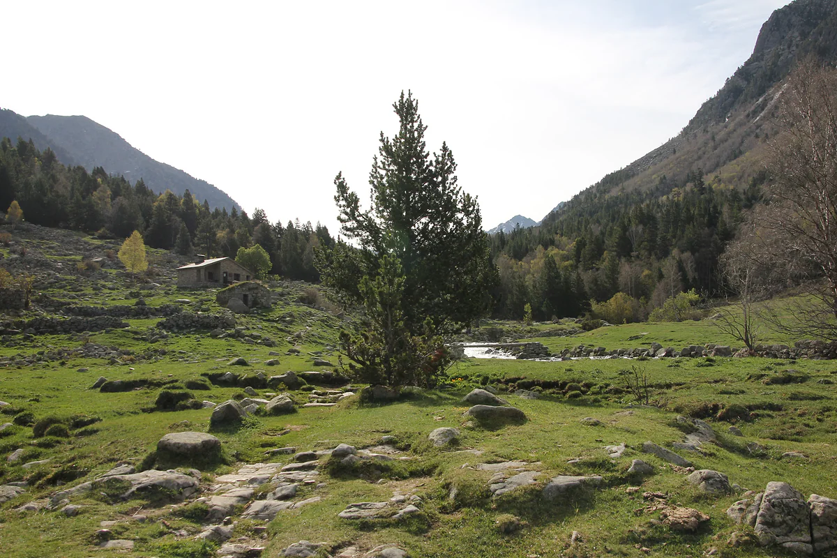
A boulder-strewn meadow with a mountain pine and a stone barn in the Madriu valley, beside the river
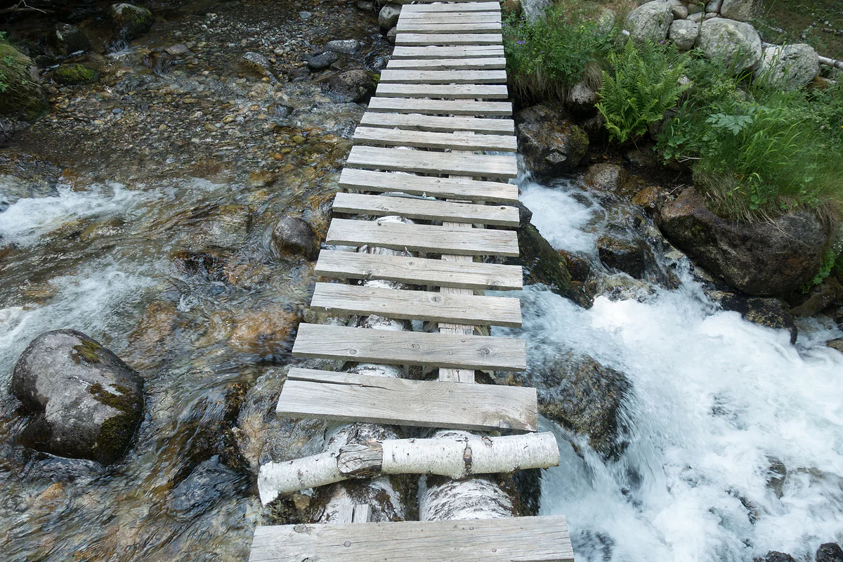
A wooden log footbridge over the Riu de Claror on a hiking route in the Madriu valley
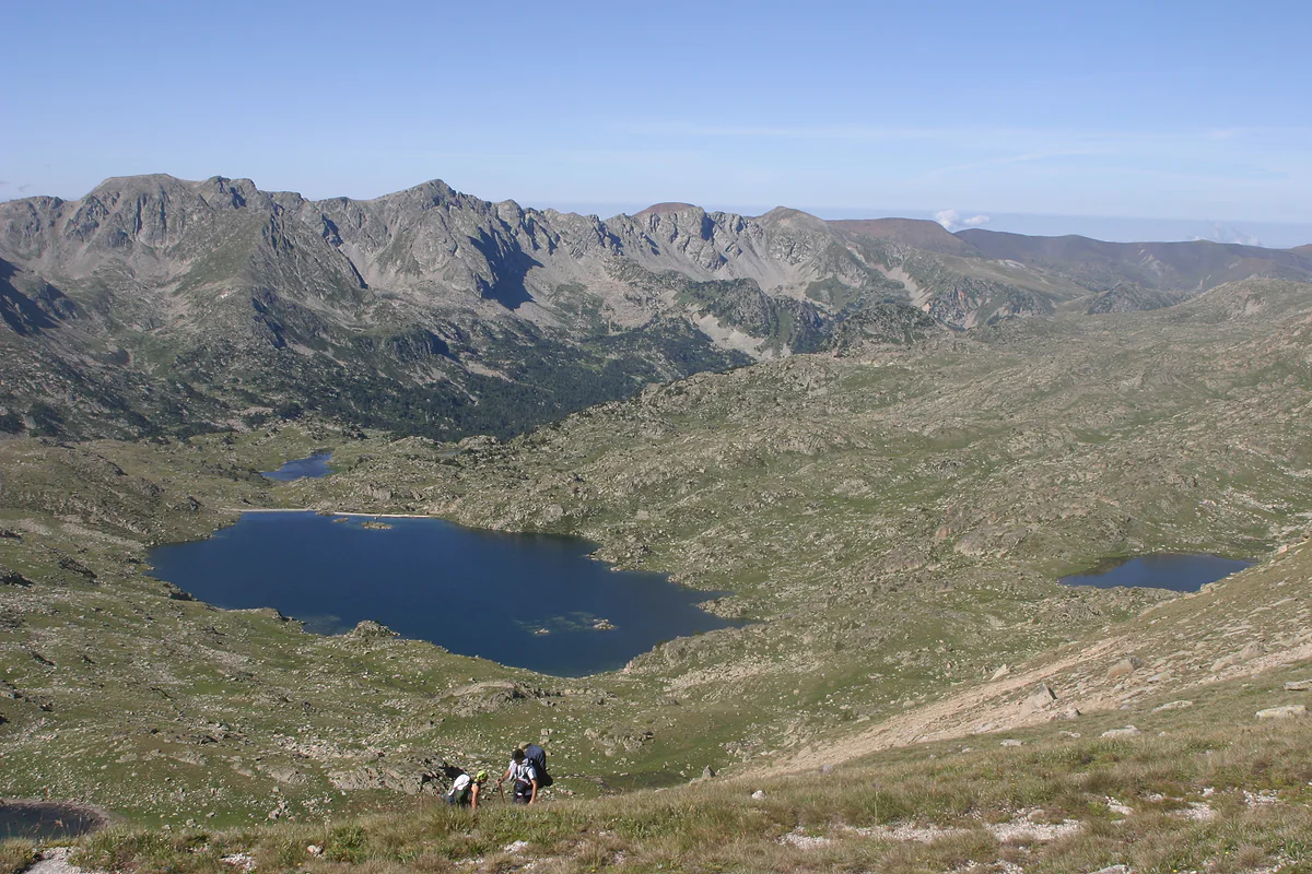
The Estany de l'Illa, a large high mountain lake surrounded by meadows and rocky ridges
Mountain huts in the Madriu valley
| Hut | Altitude | Type | Places |
|---|---|---|---|
| L'Illa | 2,488 m | Staffed, open all year | About 60 (50 staffed, 10 free) |
| Claror | 2,280 m | Unstaffed | 20 |
| Riu dels Orris | 2,230 m | Unstaffed | 10 |
| Perafita | 2,200 m | Unstaffed, by the Estany de la Nou | 10 |
| Fontverd | 1,880 m | Unstaffed | About 14 |
Valley's official website (source, Andorran government), checked on 29-09-2026. The buffer zone also has Prat Primer, Ensagents, Montmalús and Les Agols, all unstaffed.
The valley in numbers
| Fact | Figure |
|---|---|
| Protected area | 4,247 ha |
| Buffer zone | 4,092 ha |
| Communal ownership | About 99% |
| Length end to end | 12 km |
| Height range | 1,855 m |
| Lakes | More than thirty |
madriu-perafita-claror.ad and Andorra Turisme, checked on 29-09-2026.
Test yourself
True or false?
0/4 Pick before you peek.
-
The Madriu valley covers about half of Andorra.
See the answer
False. It's 4,247 ha, close to 10% of the country. With its 4,092 ha buffer zone, the whole comes to nearly a fifth.
-
Almost all the land in the valley is communally owned.
See the answer
True. The official site gives 99% communal ownership; the rest, about 42 ha on the valley floor, belongs to private owners.
-
You can drive into the valley on open tracks.
See the answer
False. Vehicle access is banned. The only driveable stretch is a forestry track on the Sant Julià side, listed as paid access by the tourist board, which stops at Claror, outside the protected area.
-
The Estany de l'Illa, inside the valley, is Andorra's second-largest lake.
See the answer
True. The valley's official site says so, and counts more than thirty lakes within its boundaries.
- Area of the protected valley
- 4,247 ha
- Year of UNESCO listing
- 2004
- Pic de la Portelleta, the highest point
- 2,905 m
- Of the land is communally owned
- 99%
Map
Where Madriu valley is
The dashed line is the border with France and Spain. The Valira valley runs down from Pas de la Casa to Sant Julià, with Ordino and La Massana in the northern valley. Every number opens its guide.
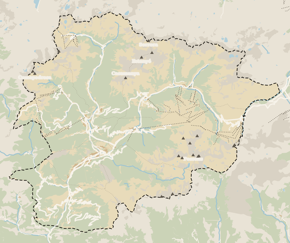 1Escaldes-Engordany 2Avinguda Carlemany (Vivand) 3Engordany 4Els Vilars 5Caldea 6Engolasters lake 7Sant Miquel d'Engolasters 8Madriu valley
 Map data © OpenStreetMap contributors (ODbL)
- 1Escaldes-EngordanyParish 7 of 7
- 2Avinguda Carlemany (Vivand)Escaldes-Engordany
- 3EngordanyA district of Escaldes-Engordany
- 4Els VilarsA hamlet in Escaldes-Engordany
- 5CaldeaThermal spa in Escaldes-Engordany
- 6Engolasters lakeAbove Escaldes-Engordany
- 7Sant Miquel d'Engolasters12th-century Romanesque
- 8Madriu valleyUNESCO World Heritage Site since 2004
What to see
What to see in Madriu valley
0 of 269 Andorra guides
Your next stamp
- UNESCO World Heritage
- Escaldes-Engordany
- Hiking
- Places to visit
- Hotels in Escaldes
- Andorra in one day
- Sorteny valley
- Margineda rock shelter
- Things to do
- Most beautiful places
- Prettiest villages
- Andorra la Vella
- Map
- Where is Andorra?
- Is Andorra a country?
- Parishes
- Casa de la Vall
- Margineda bridge
- Old town
- Santa Coloma church
- Towns and villages
- Population
- Size
- Mountains
- Language
- Canillo
- Espai Columba
- History
- Sant Esteve church
- Co-princes
- Soldeu
- Weekend break
- Andorra in 3 days
- El Tarter
- Political system
- Andorra in 4 days
- Flag
- Ransol
- A week in Andorra
- Facts
- Prats
- El Forn
- Public holidays
- Sant Julià de Lòria
- Currency and payments
- L'Aldosa de Canillo
- Els Plans
- EU and Schengen
- Bordes d'Envalira
- Entry requirements
- Prices and budget
- On a budget
- Sant Joan de Caselles
- Santa Coloma
- Ski holidays
- Tourist tax
- Mobile and roaming
- Sant Serni de Canillo
- Tourist information
- Healthcare
- Meritxell Sanctuary
- With a dog
- Packing list
- Safety
- How to get there
- Scams
- From Barcelona
- Bus from Barcelona
- Day trip from Barcelona
- From Madrid
- From Toulouse
- Encamp
- Flights
- La Margineda
- La Massana
- Roc del Quer viewpoint
- Romanesque churches
- Andorra-La Seu airport
- Canillo Tibetan bridge
- Museums in Andorra
- Pal
- Pas de la Casa
- Arinsal
- Driving
- Grau Roig
- Mon(t) Magic
- Nearest airports
- By train
- Erts
- Les Bons
- Palau de Gel
- Road conditions
- Motorcycle Museum
- Parking
- Sispony
- Vila
- Anyós
- Incles valley
- La Mosquera
- Petrol
- El Tremat
- Getting around
- Juclar lakes
- L'Aldosa (La Massana)
- Buses
- Els Cortals d'Encamp
- Sant Climent de Pal
- Bus station
- Sant Cristòfol d'Anyós
- Casa Rull
- Shopping
- Farga Rossell
- Sant Vicenç d'Enclar
- Santa Eulàlia d'Encamp
- What to buy
- Customs allowances
- La Massana Còmic
- Sant Romà de les Bons
- Car Museum
- Cigarettes
- Comapedrosa
- Electronics
- Alcohol
- Casa Cristo
- Clothes and sports shops
- Iron Route
- Coll d'Ordino
- Perfume
- Sacred Art Museum
- Shopping centres
- Funicamp
- Supermarkets
- Avinguda Meritxell
- Encamp Tibetan bridge
- Avinguda Carlemany (Vivand)
- Envalira pass
- Auvinyà
- Bici Lab Andorra
- Ordino
- Skiing
- With kids
- Zip lines
- Fontaneda
- For couples
- La Cortinada
- Ski pass
- Via ferratas
- Climbing
- Llorts
- Nagol
- Nightlife
- Ski season
- El Serrat
- Grandvalira
- Horse riding
- Juberri
- Aixovall
- Mountain biking
- Pal Arinsal
- Sornàs
- Aixirivall
- Ansalonga
- Ordino Arcalís
- Road cycling
- Bixessarri
- Naturland
- Segudet
- Arans
- Llumeneres
- Tobotronc
- Casa d'Areny-Plandolit
- Cross-country skiing
- Miniature Museum
- Skiing with kids
- Cal Pal
- Free walking tour
- Pessons lakes
- Sant Serni de Nagol
- Ski lessons
- Where to stay
- Canòlich Sanctuary
- Hotels in Andorra la Vella
- Sant Martí de la Cortinada
- Ski hire
- Juberri Gardens
- Llorts iron mine
- Webcams
- Hotels in Soldeu
- Snow report
- Hotels in El Tarter
- Tristaina lakes
- Hotels in Canillo
- Night skiing
- Tristaina solar viewpoint
- Freeride
- Hotels in Encamp
- Hotels in Pas de la Casa
- Ski touring
- Hotels in La Massana
- Snowshoeing
- Hotels in Arinsal and Pal
- Snow activities
- Après-ski
- Engordany
- Hotels in Ordino
- Medieval bridges
- Nature parks
- Els Vilars
- Hotels in Sant Julià de Lòria
- Lakes
- Sant Romà dels Vilars
- Viewpoints
- Where to eat
- Caldea
- Restaurants in Andorra la Vella
- Borda restaurants
- Inúu
- Cheap hotels
- Food
- Spas and thermal baths
- Weather and climate
- Engolasters lake
- Pas de la Casa weather
- Spa hotels
- Trinxat
- Events
- Luxury hotels
- Sant Miquel d'Engolasters
- Ski resort weather
- Wine
- Best time to visit
- Family hotels
- All inclusive
- Estany de l'Illa
- In winter
- Apartments
- Coronallacs
- In spring
- Ski World Cup
- Christmas
- Hostels
- In summer
- Mountain huts
- Camping and rural stays
- Easy walks
- In autumn
- New Year
- Family walks
- Festes majors
- In January
- GR11 and other GRs
- In February
- National day
- Around Andorra
- GRP round Andorra
- In March
- Midsummer fire festival
- Carnival
- In April
- In May
- Travessa d'Encamp
- In June
- In July
- In August
- In September
- In October
- In November
- In December
Frequently asked questions
How do you get to the Madriu valley?
The main entrance is the Camí de la Muntanya in Escaldes-Engordany, about 50 m from where the Engolasters road (CS-200) meets the Plana road. There's a barrier car park and the La Plana bus stop 200 m away.
Can you drive into the Madriu valley?
No. The official website describes it as a walkers' landscape where vehicle access is banned. On the Sant Julià side a forestry track reaches Claror, outside the protected area, and the tourist board lists it as paid access.
Why is the Madriu valley a World Heritage Site?
UNESCO listed it in 2004 as a cultural landscape. It preserves cobbled paths, barns, shepherds' huts, dry-stone walls and traces of ironworking, and its official site stresses that a whole valley is protected, unique in the Pyrenees.
What's the best walk in the Madriu valley?
The classic goes from Escaldes along the cobbled path to the barns at Entremesaigües and Ràmio, the Fontverd hut and the Riu dels Orris hut. The full route to the Bova lake is 13.6 km with 1,180 m of ascent.
When is the best time to walk in the Madriu?
Andorra Turisme recommends routes above 1,700 m from late June to late September, stretching to May and October if the weather and ground allow.
Can you wild camp in the Madriu valley?
You need permission from the parish council. In Andorra la Vella and Escaldes it's only required for more than 3 tents over 2 nights; on the Sant Julià side camping isn't allowed at all.
How many huts are there in the Madriu?
Five inside the valley, one staffed, l'Illa, and four unstaffed, Fontverd, Riu dels Orris, Perafita and Claror. The buffer zone has four more.
By
Tourism graduate with a master’s in Tourism Management and Planning from the University of Málaga, who has travelled across Europe. He writes every guide from official sources and his own judgement.
Published on . Facts checked on .
Sources
Photos: Ferran Llorens (CC BY-SA 2.0); Ferran Llorens (CC BY-SA 2.0); Kent Wang (CC BY-SA 2.0); Bernardo Reis (CC BY-SA 3.0), via Wikimedia Commons.