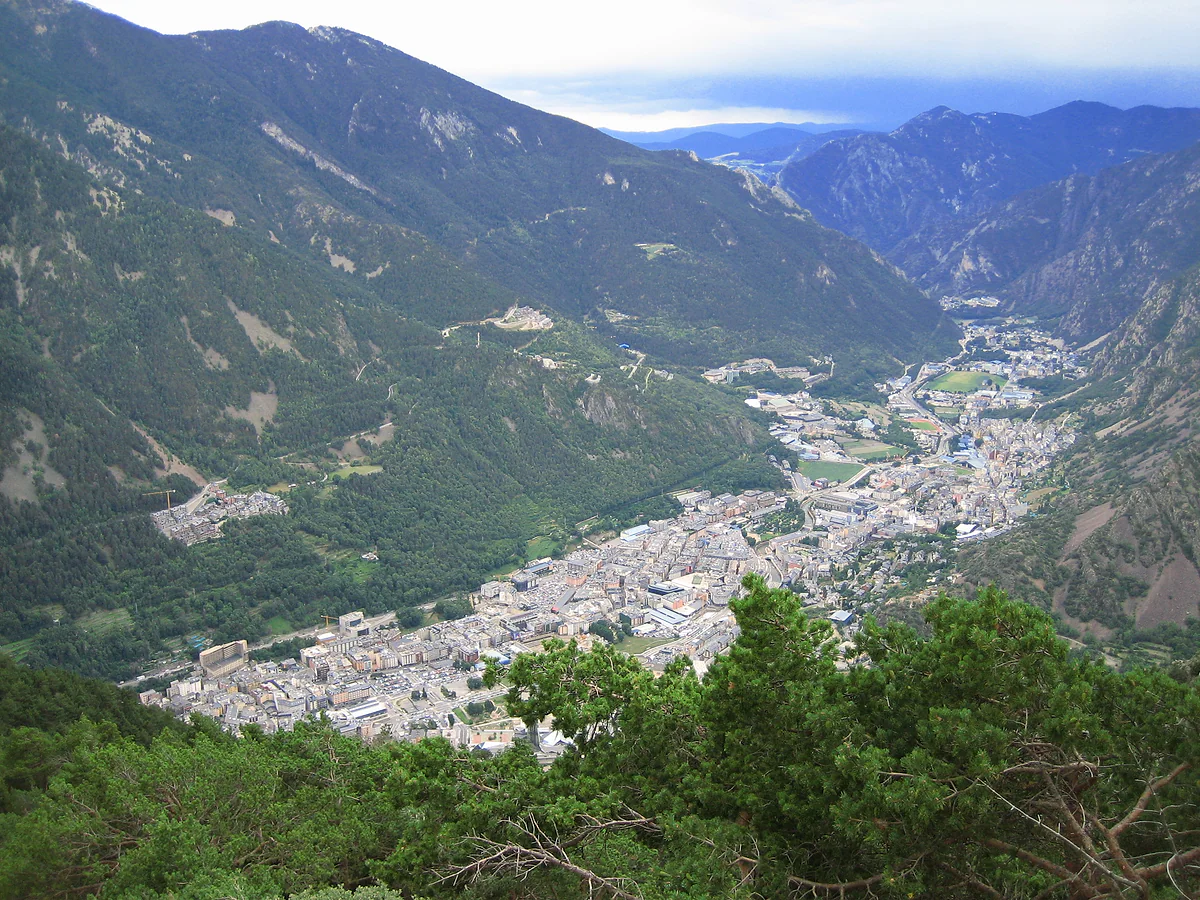
Seven parishes between Spain and France
Map of Andorra, valley by valley
On a map of Europe, Andorra is a speck in the eastern Pyrenees, with Catalonia to the south and the French départements of Ariège and Pyrénées-Orientales to the north. It covers 468 km² and has seven parishes and three main rivers, the Valira del Nord, the Valira d'Orient and the Gran Valira. Below is my own map of the whole country.
In 30 seconds
Full read: 3 min
- Andorra lies in the eastern Pyrenees between Catalonia and France.
- It covers 468 km² in seven parishes, with Andorra la Vella in the middle.
- The border with Spain is 63.7 km long and the one with France 56.6 km.
- You drive in on the N-145 from Spain or the N-22, N-20 or N-320 from France.
I'd build a mental map in three pieces. The middle, with the capital and Escaldes; the eastern arm, with Canillo, Encamp and Pas de la Casa heading for France; and the northern arm, with Ordino and La Massana. Sant Julià is the southern door into Spain.

Before you go
What I would keep in mind
-
01 Getting there
Two ways in by road, one on each side
From Spain you enter on the N-145 from La Seu d'Urgell. From France it's the N-22, N-20 or N-320, the last one through the Puymorens tunnel. The full picture is in how to get to Andorra.
how to get to Andorra -
02 My tip
The bus map is the most useful one
The government publishes its national bus timetables as a 12-page PDF with route maps and stops. Seven lines leave Andorra la Vella or Escaldes for every parish.
Andorra buses -
03 Most beautiful
See the whole shape from above
From the Comella or Roc del Quer viewpoints, the shape of the valleys makes more sense than on any map. Roadside viewpoints have relief panels and Braille.
best viewpoints in Andorra
What I would book
To find Andorra on a map of Europe, follow the mountain chain that divides Spain from France and look closely, because 468 km² is about the size of a thumbprint at that scale. On a road map of Spain it sits just above Lleida province, tucked against La Seu d’Urgell. Here I’ll pin it down, show you how to read its valleys, which is what matters for getting around, and give you a map with everything this guide covers.
Where exactly is Andorra?
In the south-west of the continent, at the heart of the eastern Pyrenees, as the tourist board puts it. Spain lies to the south, along 63.7 km of border with Catalonia, and France to the north, along 56.6 km shared by Ariège and Pyrénées-Orientales. Both figures come from the Spanish foreign ministry’s country profile. How Andorra relates to each neighbour, and which cities are close, is in where is Andorra.
What a flat map can’t show is height. The country averages 1,996 m, and even its lowest point, on the southern border, is 840 m up. That’s why road maps mislead. A short hop as the crow flies can mean half an hour of hairpins.
How to read my map
I read it by valleys. The Spanish foreign ministry lists three main rivers, the Valira del Nord, the Valira d’Orient and the Gran Valira, and every parish lives along one of them. The Valira d’Orient, for instance, is the one you look down on from the Roc del Quer viewpoint in Canillo. Place the valleys and you’ve placed the country. When I plan a day here, I plan it one valley at a time, and I’d suggest you do the same, grouping sights that share a river rather than ones that merely look close on paper.
My map marks the seven parishes, the villages and every place with its own page in this guide. In the centre, Andorra la Vella and Escaldes-Engordany run into each other. To the east are Canillo, the largest parish at 120.86 km², and Encamp, which stretches to Pas de la Casa on the French border, some 25 km from Encamp village. Ordino is to the north, La Massana to the north-west with Pal and Arinsal, and Sant Julià to the south. What each one offers is in the parishes of Andorra.
Where do you cross into Andorra?
By road, and only from two sides. The Spanish way in is the N-145, a short run from La Seu d’Urgell to the southern border at Sant Julià. The French side comes in from the north-east towards Pas de la Casa, fed by three French roads, among them the N-320 through the Puymorens tunnel. The border posts never close, and from 1 November to 15 May your car needs snow chains or winter tyres, which the Foreign Office also points out. The flights, coaches and trains that get you to that border are in how to get to Andorra.
The maps I’d take
Without a car, the national bus map is the one you need. The government publishes its September 2026 timetables as a 12-page PDF with route maps and stops. There are seven lines, from the L1 between Escaldes and Sant Julià to the L7 to La Massana, plus an express and a night bus. I explain them in buses in Andorra.
For walking, the route sheets on the tourist board’s website give height gain, distance and the starting point with coordinates. And to get your bearings without any paper at all, head for a viewpoint, where the shape of the valleys makes sense at a glance. The best are in the best viewpoints in Andorra.
Three things the map won’t tell you
First, there’s no airport. Your map may show Andorra-La Seu, but it’s in La Seu d’Urgell, outside the country, and its 2026-27 routes haven’t been confirmed. Second, Grau Roig and Els Cortals d’Encamp look like villages on many maps, yet Encamp’s parish council doesn’t count either among its settlements. Third, the Madriu valley, which looks like an empty green patch between the roads, is anything but empty. It’s the country’s only World Heritage site.
If you’d rather see every village listed by parish, without a map, try towns and villages in Andorra. To see how much ground the country covers and how it compares with others, try how big Andorra is.
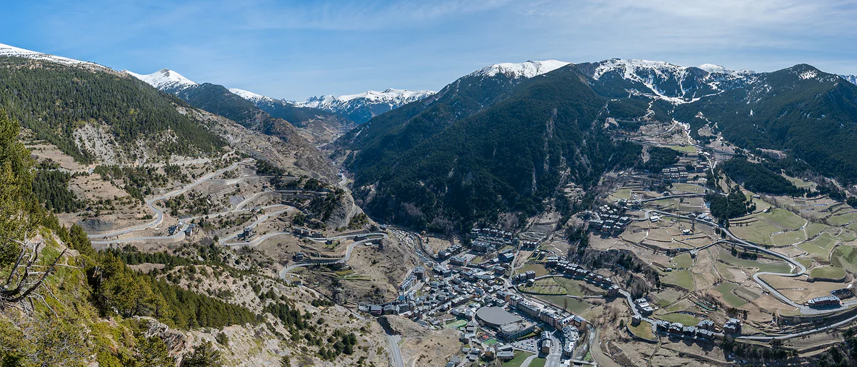
Canillo on the valley floor, with terraced meadows, zigzag roads and snowy peaks in the distance
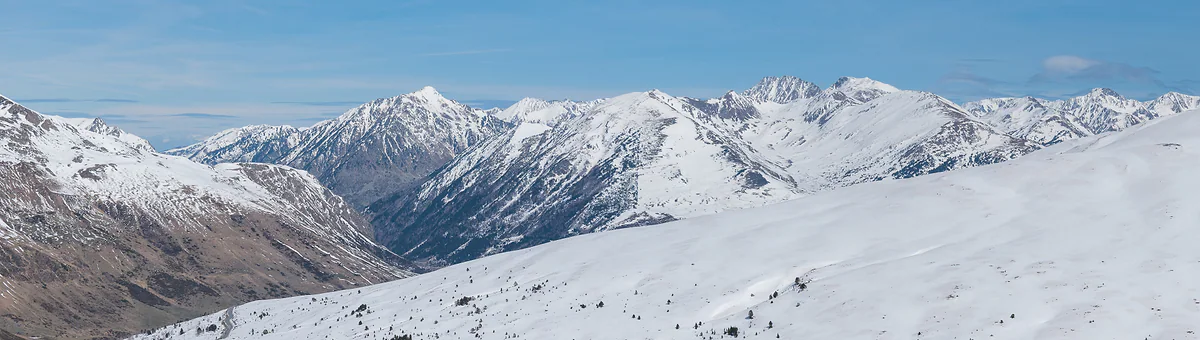
Snowy peaks seen from the Port d'Envalira in winter, with white slopes under a clear sky
The seven parishes on the map
| Parish | Position | National bus |
|---|---|---|
| Canillo | East, Valira d'Orient valley; the largest | L3 Andorra la Vella-Soldeu |
| Encamp | East, out to Pas de la Casa on the French border | L2, and L4 to Pas de la Casa |
| Ordino | North, Valira del Nord valley | L6 Andorra la Vella-Ordino |
| La Massana | North-west, towards Arinsal and Pal | L5 to Arinsal and L7 to La Massana |
| Andorra la Vella | Centre; the capital and the smallest | Where most lines start |
| Escaldes-Engordany | Centre, joined to the capital | L1 Escaldes-Sant Julià |
| Sant Julià de Lòria | South, on the Catalan border | L1 and the Bus Exprés |
Bus lines from the tourist board and the government (mid-season timetable, September 2026). Parish positions are as on my map.
Roads worth marking on your map
| Road | What for |
|---|---|
| N-145 | The way in from Spain via La Seu d'Urgell |
| N-22, N-20, N-320 | The way in from France; the N-320 through the Puymorens tunnel |
| CG-3 | Up to Ordino Arcalís |
| CS-200 | The Engolasters road, the usual way into the Madriu |
Snow chains or winter tyres are compulsory from 1-11 to 15-5.
Test yourself
True or false?
0/3 Pick before you peek.
-
Andorra borders three countries.
See the answer
False. Only two, Spain to the south and France to the north. The Spanish border is 63.7 km long and the French one 56.6 km.
-
Canillo is Andorra's largest parish.
See the answer
True. The tourist board gives it 120.86 km², more than a quarter of the country. The smallest is Andorra la Vella.
-
Andorra has its own airport inside the country.
See the answer
False. It doesn't. The nearest, Andorra-La Seu, is in La Seu d'Urgell in Spain, and its 2026-27 routes haven't been confirmed.
- Area of the country
- 468 km²
- Border with Spain
- 63.7 km
- Border with France
- 56.6 km
- Main rivers, all called Valira
- 3
Map
All seven parishes, valley by valley
The dashed line is the border with France and Spain. The Valira valley runs down from Pas de la Casa to Sant Julià, with Ordino and La Massana in the northern valley. Every number opens its guide.
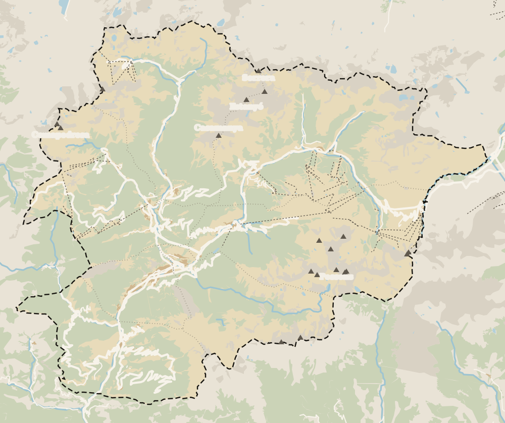 1Andorra la Vella 2Escaldes-Engordany 3Old town 4Canillo 5Soldeu 6El Tarter 7Ransol 8Prats 9El Forn 10Sant Julià de Lòria 11L'Aldosa de Canillo 12Els Plans 13Bordes d'Envalira 14Santa Coloma 15Encamp 16La Margineda 17La Massana 18Pal 19Pas de la Casa 20Arinsal 21Grau Roig 22Erts 23Les Bons 24Sispony 25Vila 26Anyós 27La Mosquera 28El Tremat 29L'Aldosa (La Massana) 30Els Cortals d'Encamp 31Avinguda Meritxell 32Avinguda Carlemany (Vivand) 33Auvinyà 34Ordino 35Fontaneda 36La Cortinada 37Llorts 38Nagol 39El Serrat 40Juberri 41Aixovall 42Sornàs 43Aixirivall 44Ansalonga 45Bixessarri 46Segudet 47Arans 48Llumeneres 49Engordany 50Els Vilars
 Map data © OpenStreetMap contributors (ODbL)
- 1Andorra la VellaParish 5 of 7
- 2Escaldes-EngordanyParish 7 of 7
- 3Old townWhere the capital began
- 4CanilloParish 1 of 7, covering 120.86 km²
- 5SoldeuHome of the Avet run and the 2027 World Cup
- 6El TarterÀliga run, FIS-approved in 2013
- 7Ransol5 km from Canillo, gateway to the Coma
- 8PratsSant Miquel, rustic Romanesque with metre-thick walls
- 9El FornIts own village fiesta since 2025
- 10Sant Julià de LòriaParish 6 of 7, on the Spanish border
- 11L'Aldosa de CanilloNot to be confused with L'Aldosa in La Massana
- 12Els PlansA Canillo hamlet above the Ransol road
- 13Bordes d'EnvaliraA Canillo hamlet with its own ski sector
- 14Santa ColomaAndorra la Vella, down the valley
- 15EncampParish 2 of 7, about 82 km²
- 16La MarginedaAndorra la Vella, by the Gran Valira
- 17La MassanaParish 4 of 7, at 1,240 m
- 18PalHistoric village above 1,500 m
- 19Pas de la CasaPart of Encamp parish, 25 km from the village
- 20ArinsalSki base and gateway to the natural park
- 21Grau RoigA spot in Encamp parish by the Envalira tunnel
- 22ErtsHalfway between La Massana and Arinsal
- 23Les BonsEncamp settlement and historic group
- 24SisponyOn record since 1162
- 25VilaSettlement in Encamp parish
- 26AnyósSouth slope of La Massana
- 27La MosqueraSettlement in Encamp parish
- 28El TrematSettlement in Encamp parish
- 29L'Aldosa (La Massana)Not to be confused with L'Aldosa de Canillo
- 30Els Cortals d'EncampMountain area in Encamp parish
- 31Avinguda MeritxellAndorra la Vella
- 32Avinguda Carlemany (Vivand)Escaldes-Engordany
- 33AuvinyàA pedestrian village above the Sant Julià valley
- 34OrdinoParish 3 of 7, a UNESCO Biosphere Reserve
- 35FontanedaA small village in Sant Julià de Lòria
- 36La CortinadaOne of Ordino's eight villages
- 37LlortsOne of Ordino's eight villages
- 38NagolA hamlet on the eastern slope of Sant Julià de Lòria
- 39El SerratOne of Ordino's eight villages
- 40JuberriA village on the southern slope of Sant Julià de Lòria
- 41AixovallA Sant Julià de Lòria village beside the Gran Valira
- 42SornàsOne of Ordino's eight villages
- 43AixirivallA Sant Julià de Lòria village above the town
- 44AnsalongaOne of Ordino's eight villages
- 45BixessarriA Sant Julià de Lòria village on the CG-6
- 46SegudetOne of Ordino's eight villages
- 47AransOne of Ordino's eight villages
- 48LlumeneresA Sant Julià de Lòria village higher up than Nagol
- 49EngordanyA district of Escaldes-Engordany
- 50Els VilarsA hamlet in Escaldes-Engordany
0 of 269 Andorra guides
Your next stamp
- Where is Andorra?
- Around Andorra
- Where to stay
- Parishes
- Size
- Andorra in 3 days
- Skiing
- Places to visit
- Things to do
- Most beautiful places
- Prettiest villages
- Andorra la Vella
- UNESCO World Heritage
- Escaldes-Engordany
- Is Andorra a country?
- Casa de la Vall
- Margineda bridge
- Old town
- Santa Coloma church
- Towns and villages
- Population
- Mountains
- Language
- Andorra in one day
- Canillo
- Espai Columba
- History
- Margineda rock shelter
- Sant Esteve church
- Co-princes
- Soldeu
- Weekend break
- El Tarter
- Political system
- Andorra in 4 days
- Flag
- Ransol
- A week in Andorra
- Facts
- Prats
- El Forn
- Public holidays
- Sant Julià de Lòria
- Currency and payments
- L'Aldosa de Canillo
- Els Plans
- EU and Schengen
- Bordes d'Envalira
- Entry requirements
- Prices and budget
- On a budget
- Sant Joan de Caselles
- Santa Coloma
- Ski holidays
- Tourist tax
- Mobile and roaming
- Sant Serni de Canillo
- Tourist information
- Healthcare
- Meritxell Sanctuary
- With a dog
- Packing list
- Safety
- How to get there
- Scams
- From Barcelona
- Bus from Barcelona
- Day trip from Barcelona
- From Madrid
- From Toulouse
- Encamp
- Flights
- La Margineda
- La Massana
- Roc del Quer viewpoint
- Romanesque churches
- Andorra-La Seu airport
- Canillo Tibetan bridge
- Museums in Andorra
- Pal
- Pas de la Casa
- Arinsal
- Driving
- Grau Roig
- Mon(t) Magic
- Nearest airports
- By train
- Erts
- Les Bons
- Palau de Gel
- Road conditions
- Motorcycle Museum
- Parking
- Sispony
- Vila
- Anyós
- Incles valley
- La Mosquera
- Petrol
- El Tremat
- Getting around
- Juclar lakes
- L'Aldosa (La Massana)
- Buses
- Els Cortals d'Encamp
- Sant Climent de Pal
- Bus station
- Sant Cristòfol d'Anyós
- Casa Rull
- Shopping
- Farga Rossell
- Sant Vicenç d'Enclar
- Santa Eulàlia d'Encamp
- What to buy
- Customs allowances
- La Massana Còmic
- Sant Romà de les Bons
- Car Museum
- Cigarettes
- Comapedrosa
- Electronics
- Alcohol
- Casa Cristo
- Clothes and sports shops
- Iron Route
- Coll d'Ordino
- Perfume
- Sacred Art Museum
- Shopping centres
- Funicamp
- Supermarkets
- Avinguda Meritxell
- Encamp Tibetan bridge
- Avinguda Carlemany (Vivand)
- Envalira pass
- Auvinyà
- Bici Lab Andorra
- Ordino
- With kids
- Zip lines
- Fontaneda
- For couples
- La Cortinada
- Ski pass
- Via ferratas
- Climbing
- Llorts
- Nagol
- Nightlife
- Ski season
- El Serrat
- Grandvalira
- Horse riding
- Juberri
- Aixovall
- Mountain biking
- Pal Arinsal
- Sornàs
- Aixirivall
- Ansalonga
- Ordino Arcalís
- Road cycling
- Bixessarri
- Naturland
- Segudet
- Arans
- Llumeneres
- Tobotronc
- Casa d'Areny-Plandolit
- Cross-country skiing
- Miniature Museum
- Skiing with kids
- Cal Pal
- Free walking tour
- Pessons lakes
- Sant Serni de Nagol
- Ski lessons
- Canòlich Sanctuary
- Hotels in Andorra la Vella
- Sant Martí de la Cortinada
- Ski hire
- Hotels in Escaldes
- Juberri Gardens
- Llorts iron mine
- Webcams
- Hotels in Soldeu
- Snow report
- Sorteny valley
- Hotels in El Tarter
- Tristaina lakes
- Hotels in Canillo
- Night skiing
- Tristaina solar viewpoint
- Freeride
- Hotels in Encamp
- Hotels in Pas de la Casa
- Ski touring
- Hotels in La Massana
- Snowshoeing
- Hotels in Arinsal and Pal
- Snow activities
- Après-ski
- Engordany
- Hotels in Ordino
- Medieval bridges
- Nature parks
- Els Vilars
- Hotels in Sant Julià de Lòria
- Lakes
- Sant Romà dels Vilars
- Viewpoints
- Where to eat
- Caldea
- Restaurants in Andorra la Vella
- Borda restaurants
- Inúu
- Cheap hotels
- Food
- Hiking
- Spas and thermal baths
- Weather and climate
- Engolasters lake
- Pas de la Casa weather
- Spa hotels
- Trinxat
- Events
- Luxury hotels
- Sant Miquel d'Engolasters
- Ski resort weather
- Wine
- Best time to visit
- Family hotels
- Madriu valley
- All inclusive
- Estany de l'Illa
- In winter
- Apartments
- Coronallacs
- In spring
- Ski World Cup
- Christmas
- Hostels
- In summer
- Mountain huts
- Camping and rural stays
- Easy walks
- In autumn
- New Year
- Family walks
- Festes majors
- In January
- GR11 and other GRs
- In February
- National day
- GRP round Andorra
- In March
- Midsummer fire festival
- Carnival
- In April
- In May
- Travessa d'Encamp
- In June
- In July
- In August
- In September
- In October
- In November
- In December
Frequently asked questions
Where is Andorra on a map of Europe?
In the eastern Pyrenees, in south-west Europe. It sits between Catalonia to the south and the French départements of Ariège and Pyrénées-Orientales to the north, directly above La Seu d'Urgell.
Which countries border Andorra?
Two, Spain and France. The border with Catalonia is 63.7 km long and the French one 56.6 km, according to the Spanish foreign ministry.
How is Andorra divided?
Into seven parishes. Canillo and Encamp lie to the east, Ordino and La Massana to the north and north-west, Andorra la Vella and Escaldes-Engordany in the centre, and Sant Julià de Lòria in the south by the Spanish border.
Where can I get a map of Andorra?
The government publishes the national bus timetables as a PDF with route maps and stops, and the tourist board has an online map of businesses. My own map is on this page.
What rivers run through Andorra?
Three main ones, the Valira del Nord, the Valira d'Orient and the Gran Valira. The lowest point in the country, at 840 m, is where the Runer meets the Valira.
Is Andorra part of Spain on the map?
No. It's an independent country bordering Catalonia to the south and France to the north. It shares the Catalan language with its southern neighbour but isn't part of Spain.
By
Tourism graduate with a master’s in Tourism Management and Planning from the University of Málaga, who has travelled across Europe. He writes every guide from official sources and his own judgement.
Published on . Facts checked on .
Sources
Photos: Gertjan R. (CC BY-SA 3.0); Krzysztof Golik (CC BY-SA 4.0); Krzysztof Golik (CC BY-SA 4.0), via Wikimedia Commons.