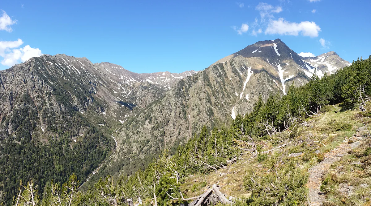
A 15.42 km² natural park in La Massana
Comapedrosa, 2,942 metres above Arinsal
Andorra's highest mountain is Comapedrosa, 2,942 m, in La Massana parish. It gives its name to a 15.42 km² natural park that starts at Arinsal, with lakes, waterfalls, three mountain huts and an easy family trail. The ascent to the summit takes about 8 hours on the GR 11, is graded very hard and is best from late May to October.
In 30 seconds
Full read: 4 min
- Andorra's highest mountain is Comapedrosa, 2,942 m, in La Massana.
- Its natural park protects 15.42 km², has three huts and is free to enter from Arinsal.
- The summit takes about 8 hours and is graded very hard; best from late May to October.
- For families, the interpretation trail is 1.2 km and under an hour.
If you're not an experienced hillwalker, don't aim for the summit on day one. Walk up to the Estany de les Truites and the hut, have lunch there in summer and decide with the view in front of you. I'd keep the top for a long day with a settled forecast and a dawn start.

Before you go
What I would keep in mind
-
01 Worth the splurge
Stand on the roof of Andorra
The 2,942 m summit takes about 8 hours on the GR 11 and a final ridge marked in yellow. On top stands La gran fita, an iron sculpture holding three stones, with a viewpoint table.
mountains in Andorra -
02 To save money
The park is free to enter
There's no charge. The interpretation trail, 1.2 km and under an hour, has ten panels and a children's treasure hunt, Salva la Serenalla, available all year.
family walks in Andorra -
03 Most beautiful
Andorra's highest lake
According to the Comú, the park has six groups of lakes, including the highest in Andorra, Més Amunt dels Forcats at 2,714 m. The Estany de les Truites sits beside the hut.
lakes in Andorra -
04 My tip
A hut with beds and meals in summer
The staffed Comapedrosa hut is at 2,260 m, sleeps 49 and serves meals in summer. It's booked through the Pal Arinsal website and is a stop on the GR 11, the GRP and the Coronallacs.
mountain huts in Andorra
What I would book
My ranking, scored
Comapedrosa walks, depending on what you're after
My marks out of 10, weighing reward against effort. Figures from Andorra Turisme and the Comú de La Massana. Opinion, not an official ranking.
0 of 5 seen
-
Comapedrosa summit
Andorra's highest point, with views across the Pyrenees and the La gran fita sculpture. About 8 hours and very hard.
9.3 out of 10
-
Estany de les Truites and the hut
The usual path from the Arinsal ski-sector car park, with the lake beside the staffed hut. The best return on effort.
8.8 out of 10
-
Pic de Medacorba
Over 2,900 m where Andorra, Catalonia and Ariège meet, the peak of the three nations. Andorra Turisme calls it the country's most technical.
8.2 out of 10
-
Interpretation trail
1.2 km, under an hour, ten panels and a children's game, from the Riu Pollós picnic area to the Arinsal dam.
7.9 out of 10
-
Roca de la Sabina viewpoint
At 1,896 m and reachable by car, with Braille and tactile panels, and a stargazing spot too.
7.5 out of 10
Most people searching for Andorra’s highest mountain want a number, and the number is 2,942 m. But Comapedrosa is much more than its summit. It’s a whole natural park that begins where Arinsal’s houses end, and you can enjoy it in an hour with children or on a long, serious mountain day.
What is the highest mountain in Andorra?
Comapedrosa, at 2,942 m. The natural park, the Comú de La Massana and the Spanish Foreign Ministry’s country profile all agree, and the ministry adds that Andorra has 65 peaks over 2,500 m. It sits in the north-west of the country, in La Massana parish, at the head of the Arinsal valley. There’s more on the other summits in mountains in Andorra.
The Comú’s tourism website tells a story I really like. The first recorded ascent was on 22 September 1858, by the six members of the Spanish-Andorran commission marking out the border, who mistakenly believed the line ran over the top. Three Spaniards, Brigadier José Mellid de Bolaño, Antonio de Moner and José López, and three Andorrans, the síndic Francesc Duran, the deputy síndic Joan Moles and one Josep Povida.
Climbing to the summit, honestly
Andorra Turisme allows about 8 hours for the ascent and grades it very hard, with around 1,372 m of climbing. You start on the Prats Sobirans forest track, following the GR 11, and climb to the Collet de Comapedrosa past the Pla de l’Estany streams. Staying on the GR 11 brings you to the staffed hut; from there you drop west, pass the Estany Negre pool and a boulder field, and at the junction take the right-hand ridge, marked with yellow dots, to the top. You come down the same way.
The Comú’s website puts it well, the climb isn’t technically difficult, but it is tiring. The best season runs from late May to October. At the top waits La gran fita, an iron sculpture by Joan Canal holding three stones, one from the peak itself, one from the River Valira and one from the sea, set on a panoramic viewpoint table.
What can you do in the park without going to the top?
Plenty. Comapedrosa Natural Park protects 15.42 km² of high mountains, with forest, lakes and waterfalls, and it’s free to enter. With children, the interpretation trail is a 1.2 km loop, takes under an hour and runs from the Riu Pollós picnic area to the Arinsal dam past ten panels. It also has a treasure hunt, Salva la Serenalla, available all year, and hides one of Andorra’s seven tamarros.
A step up is the walk I’d do first, from the Arinsal ski-sector car park to the Estany de les Truites and the staffed Comapedrosa hut at 2,260 m. The hut opened in 1992, sleeps 49, serves meals in summer and is a stop on the GR 11, the GRP, the GRT and the Coronallacs. It’s listed with the others in mountain huts in Andorra.
Lakes, waterfalls and three nations
The Comú’s tourism website counts six groups of lakes in the park, including Andorra’s highest, Més Amunt dels Forcats at 2,714 m, and highlights the waterfalls on the Pollós and Comapedrosa rivers. Comapedrosa also belongs to the Three Nations Pyrenean Park, with the Sorteny valley, Catalonia’s Alt Pirineu and the Ariège Pyrenees. Its emblem is Pic de Medacorba, over 2,900 m, where the three territories meet. Andorra Turisme calls it the country’s most technical peak, on a 6,180 m loop with 1,344 m of ascent.
A sky with the Starlight label
The parish holds Starlight Reserve and Destination status, and the park is the reason. Andorra Turisme highlights its very low light pollution and points to two stargazing spots in the parish, one above Arinsal at Roca de la Sabina and one above Pal at Coll de la Botella. In June, Arinsal hosts the Andorra Comapedrosa astronomy festival. If you’re staying in the valley, it’s the perfect excuse for a night out of a different kind.
Getting there and when to go
You drive to Arinsal and follow the signs to the park from there. By bus, national line L5 runs to Arinsal from Andorra la Vella. For anything above 1,700 m, Andorra Turisme’s advice is the window from late June until September is out, widening to May and October if weather and ground are kind. Outside those months this is winter high-mountain terrain. One practical note for British walkers, your GHIC won’t be accepted in Andorra, so for a day like this check that your travel insurance includes medical treatment in Andorra. The country’s other protected areas are in Andorra national parks.
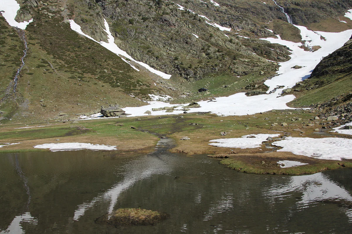
A small lake in the Comapedrosa park during the thaw, snowfields on the slopes reflected in the water
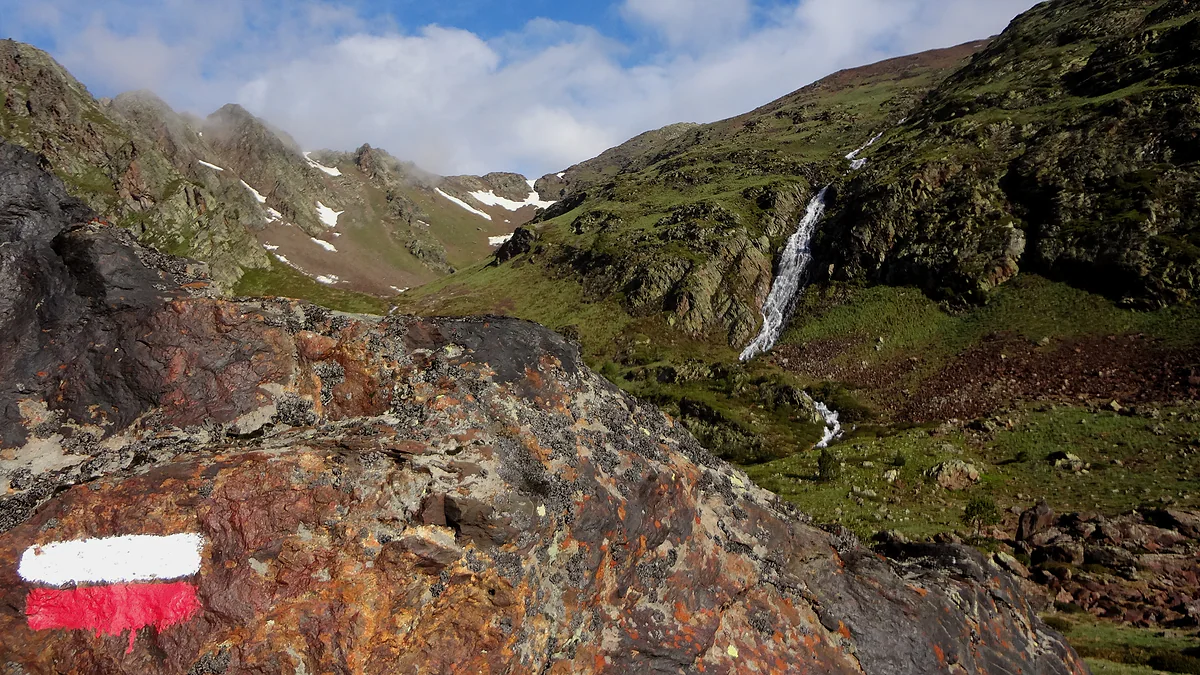
Red-and-white long-distance trail waymark on the climb to Comapedrosa, with a waterfall in the valley
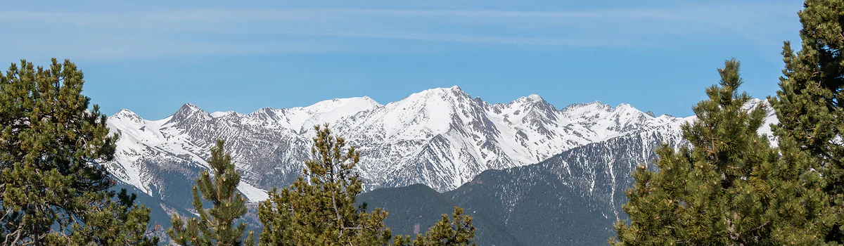
The snowy Comapedrosa massif seen from the Coll d'Ordino, framed by pines under a blue sky
Comapedrosa in numbers
| Fact | Figure | Source |
|---|---|---|
| Summit altitude | 2,942 m | Comapedrosa Natural Park |
| Protected area | 15.42 km² | Comapedrosa Natural Park |
| Mountain huts | 3, one staffed | Andorra Turisme |
| Staffed hut | 2,260 m, 49 places, opened 1992 | Comú de La Massana |
| Andorra's highest lake | Més Amunt dels Forcats, 2,714 m | Comú de La Massana |
| First recorded ascent | 22-9-1858 | Comú de La Massana |
Routes with official figures
| Route | Distance | Time or ascent | Difficulty |
|---|---|---|---|
| Interpretation trail | 1.2 km loop | Under 1 hr | Easy |
| Comapedrosa summit | Out and back on the same path | About 8 hr, +1,372 m | Very hard |
| Pic de Medacorba | 6,180 m loop | +1,344 m | Most technical in Andorra |
Andorra Turisme. It recommends routes above 1,700 m from late June to late September, or May to October if weather and ground allow.
Test yourself
True or false?
0/4 Pick before you peek.
-
Comapedrosa is over 3,000 m high.
See the answer
False. It's 2,942 m, according to the park and the Comú de La Massana. Andorra has no 3,000 m summit.
-
The first recorded ascent of Comapedrosa was in the 19th century.
See the answer
True. On 22 September 1858, by the Spanish-Andorran commission marking out the border, according to the Comú's tourism website.
-
Andorra's highest lake is in Comapedrosa Natural Park.
See the answer
True. It's Més Amunt dels Forcats, at 2,714 m, according to the Comú de La Massana.
-
You need a ticket to enter the park.
See the answer
False. Andorra Turisme describes it as free to access, following the signs from Arinsal.
- Comapedrosa summit
- 2,942 m
- Protected area of the park
- 15.42 km²
- Andorra's highest lake
- 2,714 m
- First recorded ascent
- 1858
Map
Where Comapedrosa is
The dashed line is the border with France and Spain. The Valira valley runs down from Pas de la Casa to Sant Julià, with Ordino and La Massana in the northern valley. Every number opens its guide.
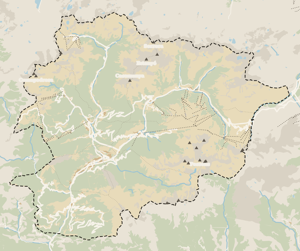 1La Massana 2Pal 3Arinsal 4Erts 5Sispony 6Anyós 7L'Aldosa (La Massana) 8Farga Rossell 9La Massana Còmic 10Comapedrosa
 Map data © OpenStreetMap contributors (ODbL)
- 1La MassanaParish 4 of 7, at 1,240 m
- 2PalHistoric village above 1,500 m
- 3ArinsalSki base and gateway to the natural park
- 4ErtsHalfway between La Massana and Arinsal
- 5SisponyOn record since 1162
- 6AnyósSouth slope of La Massana
- 7L'Aldosa (La Massana)Not to be confused with L'Aldosa de Canillo
- 8Farga RossellTemporarily closed for repairs
- 9La Massana CòmicJoan Pieras museum, free entry
- 10ComapedrosaA 15.42 km² natural park in La Massana
0 of 269 Andorra guides
Your next stamp
- Mountains
- La Massana
- Nature parks
- Envalira pass
- Arinsal
- Size
- Engolasters lake
- A week in Andorra
- Places to visit
- Things to do
- Most beautiful places
- Prettiest villages
- Andorra la Vella
- UNESCO World Heritage
- Map
- Escaldes-Engordany
- Where is Andorra?
- Is Andorra a country?
- Parishes
- Casa de la Vall
- Margineda bridge
- Old town
- Santa Coloma church
- Towns and villages
- Population
- Language
- Andorra in one day
- Canillo
- Espai Columba
- History
- Margineda rock shelter
- Sant Esteve church
- Co-princes
- Soldeu
- Weekend break
- Andorra in 3 days
- El Tarter
- Political system
- Andorra in 4 days
- Flag
- Ransol
- Facts
- Prats
- El Forn
- Public holidays
- Sant Julià de Lòria
- Currency and payments
- L'Aldosa de Canillo
- Els Plans
- EU and Schengen
- Bordes d'Envalira
- Entry requirements
- Prices and budget
- On a budget
- Sant Joan de Caselles
- Santa Coloma
- Ski holidays
- Tourist tax
- Mobile and roaming
- Sant Serni de Canillo
- Tourist information
- Healthcare
- Meritxell Sanctuary
- With a dog
- Packing list
- Safety
- How to get there
- Scams
- From Barcelona
- Bus from Barcelona
- Day trip from Barcelona
- From Madrid
- From Toulouse
- Encamp
- Flights
- La Margineda
- Roc del Quer viewpoint
- Romanesque churches
- Andorra-La Seu airport
- Canillo Tibetan bridge
- Museums in Andorra
- Pal
- Pas de la Casa
- Driving
- Grau Roig
- Mon(t) Magic
- Nearest airports
- By train
- Erts
- Les Bons
- Palau de Gel
- Road conditions
- Motorcycle Museum
- Parking
- Sispony
- Vila
- Anyós
- Incles valley
- La Mosquera
- Petrol
- El Tremat
- Getting around
- Juclar lakes
- L'Aldosa (La Massana)
- Buses
- Els Cortals d'Encamp
- Sant Climent de Pal
- Bus station
- Sant Cristòfol d'Anyós
- Casa Rull
- Shopping
- Farga Rossell
- Sant Vicenç d'Enclar
- Santa Eulàlia d'Encamp
- What to buy
- Customs allowances
- La Massana Còmic
- Sant Romà de les Bons
- Car Museum
- Cigarettes
- Electronics
- Alcohol
- Casa Cristo
- Clothes and sports shops
- Iron Route
- Coll d'Ordino
- Perfume
- Sacred Art Museum
- Shopping centres
- Funicamp
- Supermarkets
- Avinguda Meritxell
- Encamp Tibetan bridge
- Avinguda Carlemany (Vivand)
- Auvinyà
- Bici Lab Andorra
- Ordino
- Skiing
- With kids
- Zip lines
- Fontaneda
- For couples
- La Cortinada
- Ski pass
- Via ferratas
- Climbing
- Llorts
- Nagol
- Nightlife
- Ski season
- El Serrat
- Grandvalira
- Horse riding
- Juberri
- Aixovall
- Mountain biking
- Pal Arinsal
- Sornàs
- Aixirivall
- Ansalonga
- Ordino Arcalís
- Road cycling
- Bixessarri
- Naturland
- Segudet
- Arans
- Llumeneres
- Tobotronc
- Casa d'Areny-Plandolit
- Cross-country skiing
- Miniature Museum
- Skiing with kids
- Cal Pal
- Free walking tour
- Pessons lakes
- Sant Serni de Nagol
- Ski lessons
- Where to stay
- Canòlich Sanctuary
- Hotels in Andorra la Vella
- Sant Martí de la Cortinada
- Ski hire
- Hotels in Escaldes
- Juberri Gardens
- Llorts iron mine
- Webcams
- Hotels in Soldeu
- Snow report
- Sorteny valley
- Hotels in El Tarter
- Tristaina lakes
- Hotels in Canillo
- Night skiing
- Tristaina solar viewpoint
- Freeride
- Hotels in Encamp
- Hotels in Pas de la Casa
- Ski touring
- Hotels in La Massana
- Snowshoeing
- Hotels in Arinsal and Pal
- Snow activities
- Après-ski
- Engordany
- Hotels in Ordino
- Medieval bridges
- Els Vilars
- Hotels in Sant Julià de Lòria
- Lakes
- Sant Romà dels Vilars
- Viewpoints
- Where to eat
- Caldea
- Restaurants in Andorra la Vella
- Borda restaurants
- Inúu
- Cheap hotels
- Food
- Hiking
- Spas and thermal baths
- Weather and climate
- Pas de la Casa weather
- Spa hotels
- Trinxat
- Events
- Luxury hotels
- Sant Miquel d'Engolasters
- Ski resort weather
- Wine
- Best time to visit
- Family hotels
- Madriu valley
- All inclusive
- Estany de l'Illa
- In winter
- Apartments
- Coronallacs
- In spring
- Ski World Cup
- Christmas
- Hostels
- In summer
- Mountain huts
- Camping and rural stays
- Easy walks
- In autumn
- New Year
- Family walks
- Festes majors
- In January
- GR11 and other GRs
- In February
- National day
- Around Andorra
- GRP round Andorra
- In March
- Midsummer fire festival
- Carnival
- In April
- In May
- Travessa d'Encamp
- In June
- In July
- In August
- In September
- In October
- In November
- In December
Frequently asked questions
What is the highest mountain in Andorra?
Comapedrosa, 2,942 m, in La Massana parish, inside Comapedrosa Natural Park. The Comú, the park itself and the Spanish Foreign Ministry's country profile all give that height.
How long does it take to climb Comapedrosa?
About 8 hours, according to Andorra Turisme, which grades it very hard. You start on the Prats Sobirans forest track, follow the GR 11 to the hut and finish along a ridge waymarked with yellow dots.
When is the best time to climb Comapedrosa?
From late May to October, according to Andorra Turisme. For any route above 1,700 m it generally recommends late June to late September.
Do you have to pay to enter Comapedrosa Natural Park?
No. It's free to access. You drive to Arinsal and follow the signs to the park from there.
Can you stay overnight on Comapedrosa?
Yes. The staffed Comapedrosa hut, at 2,260 m, sleeps 49 and serves meals in summer, and is booked through the Pal Arinsal website. The park's other two huts are unstaffed.
Is Comapedrosa suitable for a family walk?
The summit isn't, but the park is. The interpretation trail is 1.2 km, takes under an hour and has a treasure hunt, Salva la Serenalla, available all year. It starts at the Riu Pollós picnic area.
By
Tourism graduate with a master’s in Tourism Management and Planning from the University of Málaga, who has travelled across Europe. He writes every guide from official sources and his own judgement.
Published on . Facts checked on .
Sources
Photos: Ferran Llorens (CC BY-SA 2.0); Ferran Llorens (CC BY-SA 2.0); Isidro Jabato (CC BY-SA 3.0); Krzysztof Golik (CC BY-SA 4.0), via Wikimedia Commons.