Prehistoric site by the Gran Valira
The Margineda rock shelter, where Andorra begins
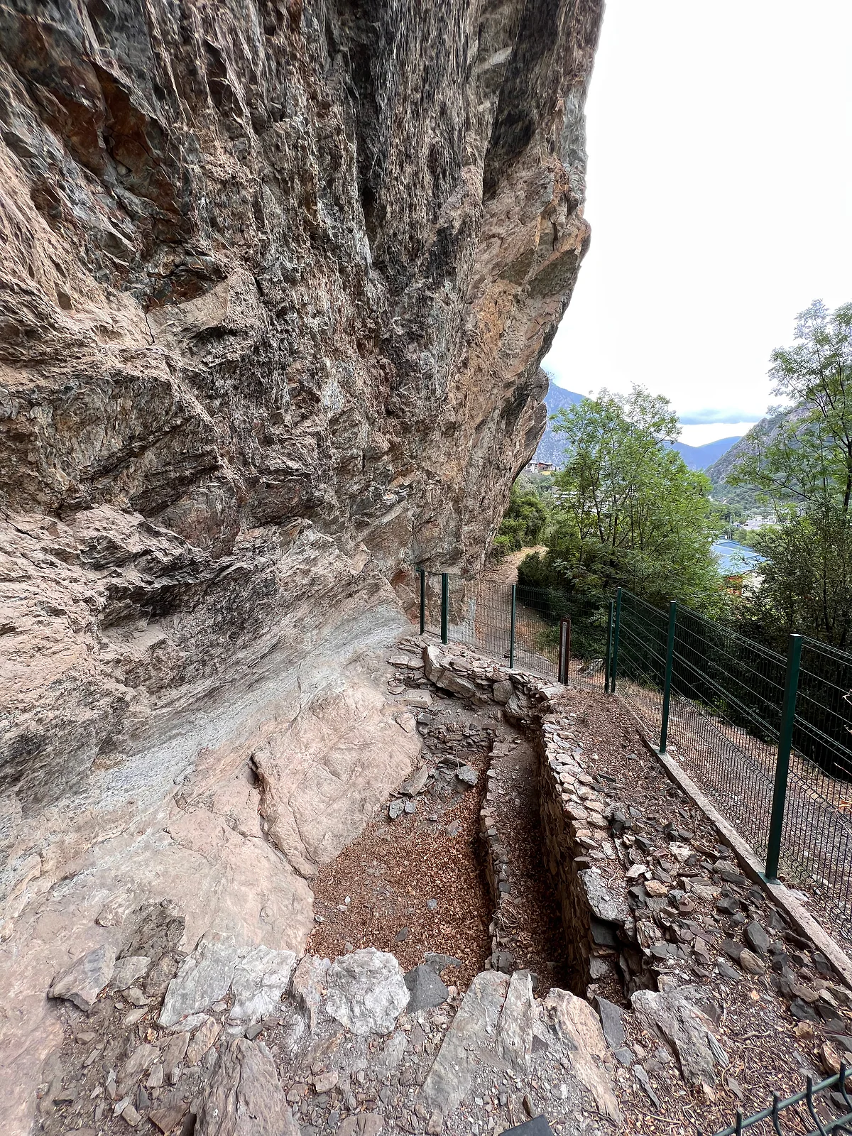
The Balma de la Margineda is a rock shelter beside the Gran Valira, near the Margineda bridge, where Andorra's first inhabitants, hunter-gatherers, lived between 10,000 and 4,000 BC. It was discovered in 1959, lies five minutes' walk from the Margineda roundabout and can be seen for free from outside.
In 30 seconds
Full read: 3 min
- The Balma de la Margineda is a rock shelter with traces of Andorra's first inhabitants, from 10,000 to 4,000 BC.
- It was discovered in 1959 and lies by the Gran Valira near the Margineda bridge.
- It's free to see from outside, five minutes' walk from the Margineda roundabout.
- Don't mix it up with the Roureda, a nearby medieval dig open only in summer.
Don't expect a museum. It's an overhang with an information board and a fenced path, and that's the charm. I'd see it on the same walk as the bridge, knowing what I'm looking at, because without the context it's just a rock.

Before you go
What I would keep in mind
-
01 Most beautiful
The first footsteps in these valleys
The Andorra la Vella tourist office calls it the setting for humankind's first steps in these valleys. People used it from the Epipalaeolithic to the early Neolithic, between 10,000 and 4,000 BC.
-
02 To save money
Visible from the road
It's five minutes on foot from the Margineda roundabout and clearly visible from the road, according to the capital's tourist office. There's nothing to pay.
-
03 My tip
Not to be confused with the Roureda
The tourist board page titled «Margineda archaeological site» is about the Roureda, a medieval hamlet dig open only in July and August. The rock shelter is a separate, prehistoric site close by.
La Margineda -
04 Getting there
Right by the medieval bridge
It sits near the Margineda bridge along the Gran Valira, close to the Camí dels Pujols, an easy path. Everything here is a short walk.
Margineda bridge
What I would book
If Andorra has a starting point, it’s here. Not a castle or a church, but an overhang by the river where a band of hunters took shelter some twelve thousand years ago. The capital’s tourism website calls it the great unknown of Andorran heritage, and it’s right. Hardly anyone stops, and it’s five minutes from a roundabout.
A shelter under the rock
A balma is a natural rock shelter, a ledge of rock jutting out over a protected space beneath. The one at la Margineda sits beside the Gran Valira, near the Margineda bridge and the Camí dels Pujols, a path the tourist board rates as easy. The photo on this page shows what you’ll find, an overhang with prehistoric remains beside a fenced path.
Don’t look for a ticket desk or an interpretation centre. The capital’s tourist office says it’s five minutes’ walk from the Margineda roundabout and clearly visible from the road. No official source publishes opening times or prices, and none are needed.
Why does it matter so much?
Because this is where Andorra’s first inhabitants have been documented. According to the tourist board, the shelter was found in 1959 and study revealed occupation from the Epipalaeolithic, around 10,000 BC, to the first farming groups of the early Neolithic, thousands of years later. The same source rates it among the most important prehistoric sites in Andorra and the Pyrenees.
The tourist board lists it, with El Cedre in Santa Coloma and l’Antiux in Escaldes-Engordany, among the country’s earliest settlements. The government’s museum site lists it with other digs, the Roc d’Enclar among them, that explain Andorra’s past. And the tourist board’s Sant Julià de Lòria page adds that it keeps traces of prehistoric painting, though it gives no detail and I wouldn’t bank on seeing them from outside.
What gets me is the time span. Between these hunters and the Pareatges of 1278, which created the Principality, lie more than ten thousand years. Everything you see in Andorra la Vella fits into the last breath of that story. For the full thread, from the shelter to the 1993 constitution, see my history of Andorra.
The setting says something too. A shelter by the river, on the valley floor and on the natural route south, the same line the royal road would take millennia later and the road to La Seu d’Urgell takes today. That’s my interpretation, not the official line, but standing there with the medieval bridge a few metres away, it’s hard not to see it.
Rock shelter or Roureda? Don’t mix them up
People mix these two up all the time, search engines too. The tourist board page titled «Margineda archaeological site» isn’t about the shelter at all but about the Roureda, a 12th-to-14th-century village site, open only for guided tours in July and August. The shelter is a separate, prehistoric site nearby. I cover both on my page about la Margineda.
Which parish is it in?
The official sources don’t agree. The tourist board lists it among the highlights of Sant Julià de Lòria, while the Andorra la Vella tourist office includes it in its Arc Patrimonial and OpenStreetMap puts its information board in la Margineda. I won’t assign it a parish. What matters is that it’s beside la Margineda, just south of the capital.
How to see it
On foot is easiest. The Arc Patrimonial, about five kilometres from Santa Coloma, has it as its southern end, and from there the route loops back over the new bridge and the medieval one. If you’re driving, park near the Margineda roundabout and walk five minutes. Come in good light, since the overhang is in shade and harder to make out late in the day.
If you’ve got the afternoon, I’d do the parish in date order. Start here with the hunters, walk up to the medieval bridge and the Roureda, then carry on to Santa Coloma for the Romanesque church and Espai Columba, and finish in the capital’s old town with the parliament house. It’s the same few kilometres of valley, and you’ll have covered twelve thousand years of Andorra without once getting in the car.
A final tip for families. Tell the children who lived here and when before you arrive. Without the story it’s just a rock; with it, it’s the oldest place they’ll set foot on all holiday.
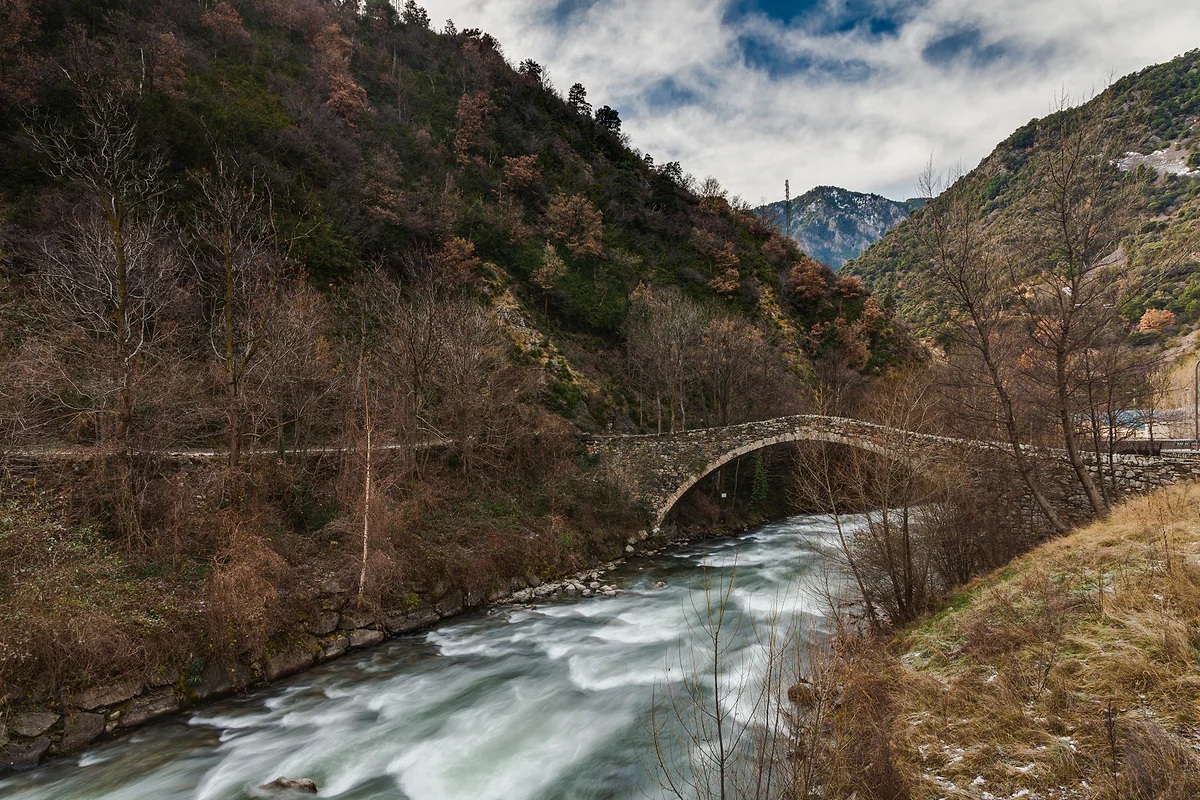
The medieval Margineda bridge, a single stone arch spanning the Gran Valira river
Test yourself
True or false?
0/3 Pick before you peek.
-
People lived at the Margineda rock shelter around twelve thousand years ago.
See the answer
True. The tourist board dates the first occupation to the Epipalaeolithic, around 10,000 BC, and the last to the first farming communities of the early Neolithic, several thousand years later.
-
The Balma de la Margineda is a medieval village.
See the answer
False. It's a prehistoric shelter. The nearby medieval hamlet is the Roureda de la Margineda, from the 12th to 14th centuries.
-
You need a ticket to see the rock shelter.
See the answer
False. You see it from outside, and the Andorra la Vella tourist office says it's clearly visible from the road.
- Earliest documented human presence
- 10,000 BC
- Year of discovery
- 1959
- On foot from the Margineda roundabout
- 5 min
Map
Where Margineda rock shelter is
The dashed line is the border with France and Spain. The Valira valley runs down from Pas de la Casa to Sant Julià, with Ordino and La Massana in the northern valley. Every number opens its guide.
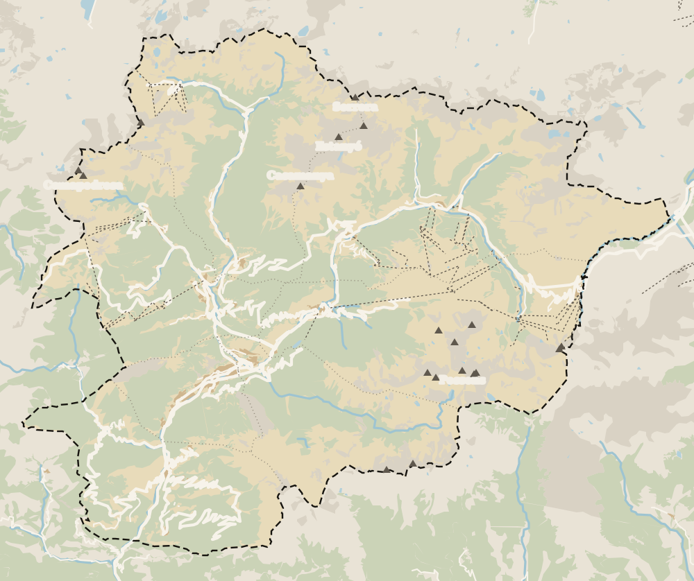 1Margineda bridge 2Margineda rock shelter 3La Margineda
 Map data © OpenStreetMap contributors (ODbL)
0 of 269 Andorra guides
Your next stamp
- La Margineda
- History
- Sant Romà dels Vilars
- Old town
- Madriu valley
- Escaldes-Engordany
- Medieval bridges
- Andorra la Vella
- Places to visit
- Things to do
- Most beautiful places
- Prettiest villages
- UNESCO World Heritage
- Map
- Where is Andorra?
- Is Andorra a country?
- Parishes
- Casa de la Vall
- Margineda bridge
- Santa Coloma church
- Towns and villages
- Population
- Size
- Mountains
- Language
- Andorra in one day
- Canillo
- Espai Columba
- Sant Esteve church
- Co-princes
- Soldeu
- Weekend break
- Andorra in 3 days
- El Tarter
- Political system
- Andorra in 4 days
- Flag
- Ransol
- A week in Andorra
- Facts
- Prats
- El Forn
- Public holidays
- Sant Julià de Lòria
- Currency and payments
- L'Aldosa de Canillo
- Els Plans
- EU and Schengen
- Bordes d'Envalira
- Entry requirements
- Prices and budget
- On a budget
- Sant Joan de Caselles
- Santa Coloma
- Ski holidays
- Tourist tax
- Mobile and roaming
- Sant Serni de Canillo
- Tourist information
- Healthcare
- Meritxell Sanctuary
- With a dog
- Packing list
- Safety
- How to get there
- Scams
- From Barcelona
- Bus from Barcelona
- Day trip from Barcelona
- From Madrid
- From Toulouse
- Encamp
- Flights
- La Massana
- Roc del Quer viewpoint
- Romanesque churches
- Andorra-La Seu airport
- Canillo Tibetan bridge
- Museums in Andorra
- Pal
- Pas de la Casa
- Arinsal
- Driving
- Grau Roig
- Mon(t) Magic
- Nearest airports
- By train
- Erts
- Les Bons
- Palau de Gel
- Road conditions
- Motorcycle Museum
- Parking
- Sispony
- Vila
- Anyós
- Incles valley
- La Mosquera
- Petrol
- El Tremat
- Getting around
- Juclar lakes
- L'Aldosa (La Massana)
- Buses
- Els Cortals d'Encamp
- Sant Climent de Pal
- Bus station
- Sant Cristòfol d'Anyós
- Casa Rull
- Shopping
- Farga Rossell
- Sant Vicenç d'Enclar
- Santa Eulàlia d'Encamp
- What to buy
- Customs allowances
- La Massana Còmic
- Sant Romà de les Bons
- Car Museum
- Cigarettes
- Comapedrosa
- Electronics
- Alcohol
- Casa Cristo
- Clothes and sports shops
- Iron Route
- Coll d'Ordino
- Perfume
- Sacred Art Museum
- Shopping centres
- Funicamp
- Supermarkets
- Avinguda Meritxell
- Encamp Tibetan bridge
- Avinguda Carlemany (Vivand)
- Envalira pass
- Auvinyà
- Bici Lab Andorra
- Ordino
- Skiing
- With kids
- Zip lines
- Fontaneda
- For couples
- La Cortinada
- Ski pass
- Via ferratas
- Climbing
- Llorts
- Nagol
- Nightlife
- Ski season
- El Serrat
- Grandvalira
- Horse riding
- Juberri
- Aixovall
- Mountain biking
- Pal Arinsal
- Sornàs
- Aixirivall
- Ansalonga
- Ordino Arcalís
- Road cycling
- Bixessarri
- Naturland
- Segudet
- Arans
- Llumeneres
- Tobotronc
- Casa d'Areny-Plandolit
- Cross-country skiing
- Miniature Museum
- Skiing with kids
- Cal Pal
- Free walking tour
- Pessons lakes
- Sant Serni de Nagol
- Ski lessons
- Where to stay
- Canòlich Sanctuary
- Hotels in Andorra la Vella
- Sant Martí de la Cortinada
- Ski hire
- Hotels in Escaldes
- Juberri Gardens
- Llorts iron mine
- Webcams
- Hotels in Soldeu
- Snow report
- Sorteny valley
- Hotels in El Tarter
- Tristaina lakes
- Hotels in Canillo
- Night skiing
- Tristaina solar viewpoint
- Freeride
- Hotels in Encamp
- Hotels in Pas de la Casa
- Ski touring
- Hotels in La Massana
- Snowshoeing
- Hotels in Arinsal and Pal
- Snow activities
- Après-ski
- Engordany
- Hotels in Ordino
- Nature parks
- Els Vilars
- Hotels in Sant Julià de Lòria
- Lakes
- Viewpoints
- Where to eat
- Caldea
- Restaurants in Andorra la Vella
- Borda restaurants
- Inúu
- Cheap hotels
- Food
- Hiking
- Spas and thermal baths
- Weather and climate
- Engolasters lake
- Pas de la Casa weather
- Spa hotels
- Trinxat
- Events
- Luxury hotels
- Sant Miquel d'Engolasters
- Ski resort weather
- Wine
- Best time to visit
- Family hotels
- All inclusive
- Estany de l'Illa
- In winter
- Apartments
- Coronallacs
- In spring
- Ski World Cup
- Christmas
- Hostels
- In summer
- Mountain huts
- Camping and rural stays
- Easy walks
- In autumn
- New Year
- Family walks
- Festes majors
- In January
- GR11 and other GRs
- In February
- National day
- Around Andorra
- GRP round Andorra
- In March
- Midsummer fire festival
- Carnival
- In April
- In May
- Travessa d'Encamp
- In June
- In July
- In August
- In September
- In October
- In November
- In December
Frequently asked questions
What is the Balma de la Margineda?
A rock shelter by the Gran Valira near la Margineda, which the tourist board counts among the most important prehistoric sites in Andorra and the Pyrenees. It shows people living there between 10,000 and 4,000 BC.
Can you visit the Margineda rock shelter?
You see it from outside. The Andorra la Vella tourist office says it's five minutes' walk from the Margineda roundabout and clearly visible from the road. No opening times or ticket prices are published.
When was the Balma de la Margineda discovered?
In 1959, according to the tourist board. Studying it revealed Andorra's first inhabitants, from the Epipalaeolithic to the early Neolithic.
Which parish is it in?
It's beside la Margineda, at the southern edge of Andorra la Vella towards Sant Julià de Lòria. The tourist board lists it among Sant Julià's highlights, while the capital's tourist office includes it on its Arc Patrimonial route, so I wouldn't assign it a parish.
Are there prehistoric paintings?
The tourist board's Sant Julià de Lòria page says it keeps traces of prehistoric painting. It gives no more detail, and I wouldn't promise you'll spot them from outside.
By
Tourism graduate with a master’s in Tourism Management and Planning from the University of Málaga, who has travelled across Europe. He writes every guide from official sources and his own judgement.
Published on . Facts checked on .
Sources
Photos: Walmaul (CC BY-SA 4.0); Diego Delso (CC BY-SA 4.0), via Wikimedia Commons.