Long-distance trails
The GR11 through Andorra, and the other long-distance trails that cross it
The GR11, the Senda Pirenaica, crosses the Pyrenees along the Spanish side in 47 stages, from Cabo Higuer to Cap de Creus. It enters Andorra at 2,545 m near the Port de Vallcivera, and the Andorran stretch is 28 km with 1,734 m of ascent and 3,187 m of descent, according to Andorra Turisme. The GR7, the GRP and two cross-border GRTs share the country.
In 30 seconds
Full read: 3 min
- The GR11 covers 28 km of Andorra, with 1,734 m of ascent and 3,187 m of descent.
- It enters the country at 2,545 m near the Port de Vallcivera.
- Andorra has five GR trails plus the Pyrenean Haute Route.
- The hut passport is stamped along the GR11, GR7 and GRP.
If you're walking the whole GR11, Andorra is just another couple of stages; if not, I wouldn't fixate on it. To get to know the country on foot, the GRP loop or a few days on the GRT 2 from Incles make more sense.

Before you go
What I would keep in mind
-
01 My tip
Get the mountain hut passport stamped
The passport is free from tourist offices and covers the GR11, GR7 and GRP. Fill it with each hut's stamp and you'll get a certificate in Andorra la Vella.
mountain huts in Andorra -
02 Getting there
The GRT 2 starts at a railway station
La Volta als Estanys begins at L'Hospitalet-près-l'Andorre in France and returns there after roughly 14 hours of walking over three stages.
train to Andorra -
03 Most beautiful
The stretch it shares with the Madriu
The cobbled path through the Madriu valley coincides in places with the GR7 and GR11. It's the section with the most history of all.
Madriu valley -
04 Watch out
Your GHIC won't cover a rescue
Andorra is outside the EU and GOV.UK confirms the GHIC and EHIC aren't valid. For a trek, take insurance that names mountain rescue.
healthcare in Andorra
What I would book
For plenty of walkers, Andorra is simply a stretch of the GR11. The trail that crosses the Pyrenees from sea to sea passes through the country in more than a day of hard walking and leaves it with far more descent than ascent behind it. But the GR11 isn’t alone here, and if you’re not doing the whole Pyrenean Way there are four other long-distance trails to choose from.
What the GR11 is
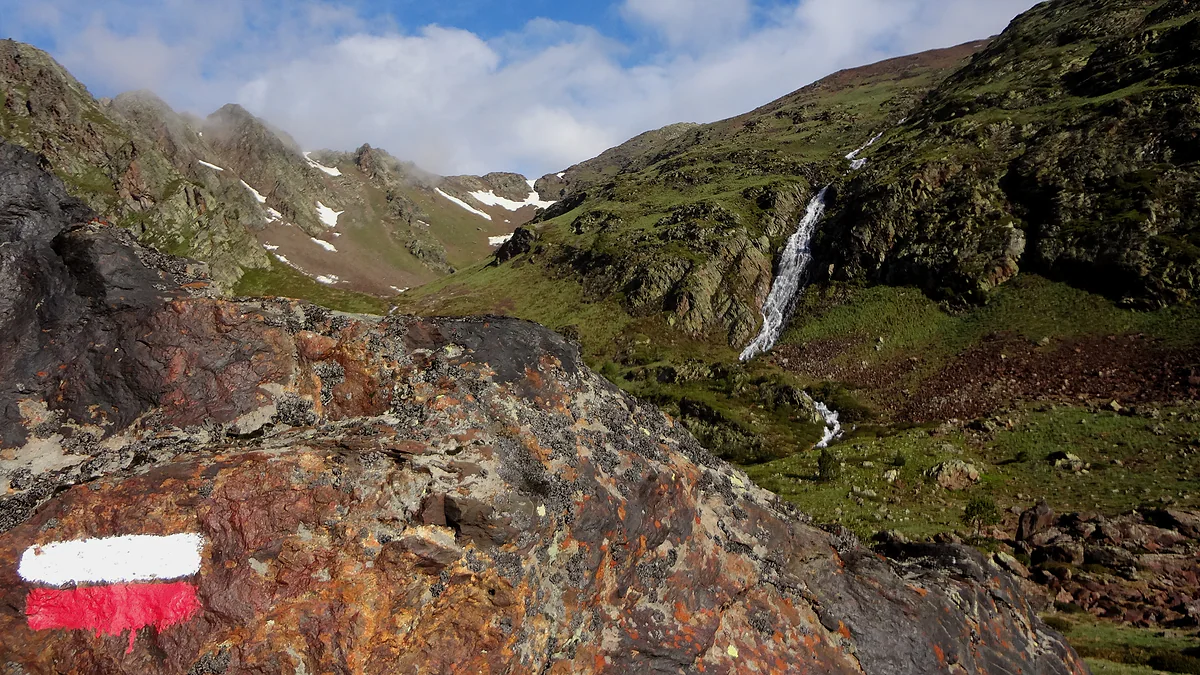
It’s the Senda Pirenaica, the long-distance trail along the southern side of the Pyrenees, from the Atlantic at Cabo Higuer to the Mediterranean at Cap de Creus. It’s split into 47 stages and waymarked with the red and white stripes used on every GR. Andorra Turisme gives it its own route sheet and counts it among the country’s five long-distance trails.
On its Andorran section, that sheet says the GR11 starts at 2,545 m near the Port de Vallcivera and measures 28 km, with 1,734 m of ascent and 3,187 m of descent, graded hard and taking more than a day. It’s a figure worth reading slowly, because almost twice as much downhill as uphill punishes your knees more than your lungs.
Where does the GR11 run in Andorra?
The official sheet doesn’t describe the line step by step, but the country’s other route sheets keep mentioning it. The Comapedrosa climb from Arinsal uses the Prats Sobirans track and the GR11, and the staffed Comapedrosa hut sits on its path. In Ordino, the waymarked Iron Route section between Llorts and La Cortinada carries its stripes, and the snowshoe route to the Coll d’Ordino climbs it from the village.
Further east, the route from Encamp up to Engolasters lake joins the GR11, and the cobbled path through the Madriu valley shares stretches with both the GR7 and the GR11. If you only want a taste without a heavy pack, that Madriu section from Escaldes is the one I’d walk, since it pairs the GR with the country’s only World Heritage Site.
Andorra’s other GR trails
The GR7 is part of the European E4 path, which runs from Greece to Gibraltar. In Andorra it’s about 40 km long, entering from France at the Portella Blanca, 2,521 m, and crossing the country from east to south to the Farga de Moles on the Catalan border, at 850 m. On the Pessons cirque, for instance, the lakes route follows its stripes.
The GRP is Andorra’s own trail, a circular loop of about 110 km in seven stages linking the huts. It has so much to it that it gets a page to itself, the GRP round Andorra.
The two cross-border trails are the most original. The GRT 1, the Route of the 3 Nations, links Andorra, the Ariège and the Pallars in three to five stages, starting from El Serrat, Llorts or La Massana and crossing the Comapedrosa park, the Alt Pirineu park and the Ariège regional park. The GRT 2, La Volta als Estanys, is nearly 14 hours of walking in three stages from L’Hospitalet-près-l’Andorre, over the Port d’Incles and past the Juclar hut. The Pyrenean Haute Route completes the list with its own route sheet.
Huts and the hut passport
The whole system relies on about thirty mountain huts, most of them unstaffed and open all year, and four staffed ones. The free mountain hut passport from tourist offices is stamped at huts along the GR11, GR7 and GRP, and when you hand it in completed at the Andorra la Vella office you get a certificate and a small gift. I’ve set out the huts themselves in mountain huts in Andorra.
When and how I’d walk it
The Andorran GR11 runs mostly above 2,000 m, so its season is the high-mountain one, which Andorra Turisme puts at July, August and September plus the tail end of June, with May and October only if the weather allows. In June, snow can linger on the highest cols.
For British walkers, one detail matters on a trek. The GHIC doesn’t work in Andorra, so sort out travel insurance with mountain rescue before you book the flight. And if you’re not walking the GR11 end to end, I’d give Andorra two or three days of the GRT 2 or the GRP, which were designed to show the country rather than just cross it.
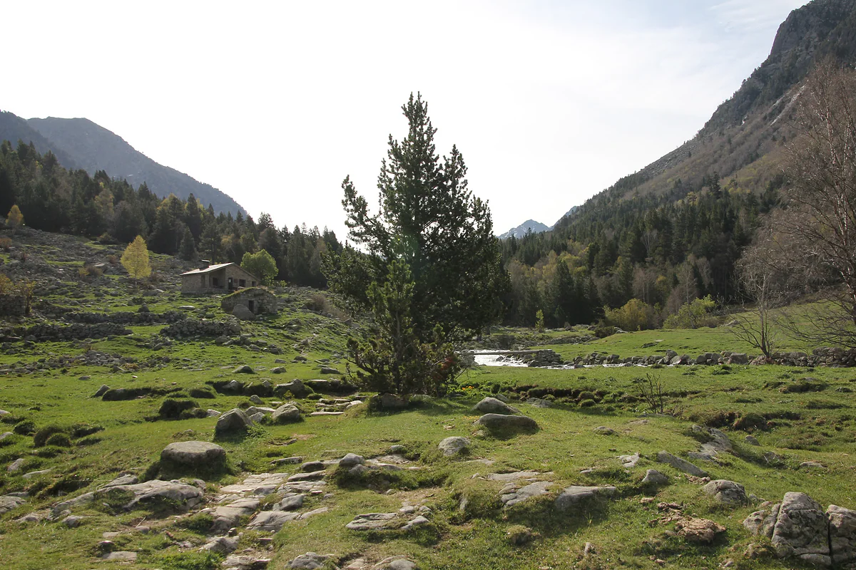
A boulder-strewn meadow with a mountain pine and a stone barn in the Madriu valley, beside the river
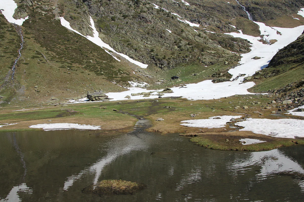
A small lake in the Comapedrosa park during the thaw, snowfields on the slopes reflected in the water
Long-distance trails through Andorra
| Trail | What it is | In Andorra | From the official sheet |
|---|---|---|---|
| GR11 | Pyrenean Way, Atlantic to Mediterranean, 47 stages | Enters at 2,545 m near the Port de Vallcivera | 28 km, +1,734 m / −3,187 m, hard |
| GR7 | Part of the E4, Greece to Gibraltar | Portella Blanca (2,521 m) to Farga de Moles (850 m) | About 40 km |
| GRP | Loop round the whole country | Seven stages hut to hut | About 110 km |
| GRT 1, Route of the 3 Nations | Andorra, Ariège and Pallars | Starts at El Serrat, Llorts or La Massana | 3 to 5 stages |
| GRT 2, La Volta als Estanys | Andorra and France from L'Hospitalet | Via the Port d'Incles and Juclar | Nearly 14 hrs over 3 stages |
Andorra Turisme route sheets checked on 29-09-2026. The GR7 sheet gives 44 km and an obviously wrong height figure, so I use the text's 'about 40 km'.
Test yourself
True or false?
0/3 Pick before you peek.
-
The GR11 follows the French side of the Pyrenees.
See the answer
False. It runs along the southern side, from the Cantabrian coast at Cabo Higuer to the Mediterranean at Cap de Creus, in 47 stages.
-
The GR7 is part of the European E4 path from Greece to Gibraltar.
See the answer
True. That's how Andorra Turisme presents it. It enters Andorra at the Portella Blanca, 2,521 m, and leaves at the Farga de Moles, 850 m.
-
Andorra has only one long-distance trail.
See the answer
False. It has five, the GR11, GR7, GRP and the cross-border GRT 1 and GRT 2, plus the Pyrenean Haute Route.
- GR11 stages from the Atlantic to the Mediterranean
- 47
- Andorran stretch of the GR11
- 28 km
- Altitude where it enters Andorra
- 2,545 m
0 of 269 Andorra guides
Your next stamp
- GRP round Andorra
- Hiking
- Where is Andorra?
- Map
- Skiing
- How to get there
- From Barcelona
- Places to visit
- Things to do
- Most beautiful places
- Prettiest villages
- Andorra la Vella
- UNESCO World Heritage
- Escaldes-Engordany
- Is Andorra a country?
- Parishes
- Casa de la Vall
- Margineda bridge
- Old town
- Santa Coloma church
- Towns and villages
- Population
- Size
- Mountains
- Language
- Andorra in one day
- Canillo
- Espai Columba
- History
- Margineda rock shelter
- Sant Esteve church
- Co-princes
- Soldeu
- Weekend break
- Andorra in 3 days
- El Tarter
- Political system
- Andorra in 4 days
- Flag
- Ransol
- A week in Andorra
- Facts
- Prats
- El Forn
- Public holidays
- Sant Julià de Lòria
- Currency and payments
- L'Aldosa de Canillo
- Els Plans
- EU and Schengen
- Bordes d'Envalira
- Entry requirements
- Prices and budget
- On a budget
- Sant Joan de Caselles
- Santa Coloma
- Ski holidays
- Tourist tax
- Mobile and roaming
- Sant Serni de Canillo
- Tourist information
- Healthcare
- Meritxell Sanctuary
- With a dog
- Packing list
- Safety
- Scams
- Bus from Barcelona
- Day trip from Barcelona
- From Madrid
- From Toulouse
- Encamp
- Flights
- La Margineda
- La Massana
- Roc del Quer viewpoint
- Romanesque churches
- Andorra-La Seu airport
- Canillo Tibetan bridge
- Museums in Andorra
- Pal
- Pas de la Casa
- Arinsal
- Driving
- Grau Roig
- Mon(t) Magic
- Nearest airports
- By train
- Erts
- Les Bons
- Palau de Gel
- Road conditions
- Motorcycle Museum
- Parking
- Sispony
- Vila
- Anyós
- Incles valley
- La Mosquera
- Petrol
- El Tremat
- Getting around
- Juclar lakes
- L'Aldosa (La Massana)
- Buses
- Els Cortals d'Encamp
- Sant Climent de Pal
- Bus station
- Sant Cristòfol d'Anyós
- Casa Rull
- Shopping
- Farga Rossell
- Sant Vicenç d'Enclar
- Santa Eulàlia d'Encamp
- What to buy
- Customs allowances
- La Massana Còmic
- Sant Romà de les Bons
- Car Museum
- Cigarettes
- Comapedrosa
- Electronics
- Alcohol
- Casa Cristo
- Clothes and sports shops
- Iron Route
- Coll d'Ordino
- Perfume
- Sacred Art Museum
- Shopping centres
- Funicamp
- Supermarkets
- Avinguda Meritxell
- Encamp Tibetan bridge
- Avinguda Carlemany (Vivand)
- Envalira pass
- Auvinyà
- Bici Lab Andorra
- Ordino
- With kids
- Zip lines
- Fontaneda
- For couples
- La Cortinada
- Ski pass
- Via ferratas
- Climbing
- Llorts
- Nagol
- Nightlife
- Ski season
- El Serrat
- Grandvalira
- Horse riding
- Juberri
- Aixovall
- Mountain biking
- Pal Arinsal
- Sornàs
- Aixirivall
- Ansalonga
- Ordino Arcalís
- Road cycling
- Bixessarri
- Naturland
- Segudet
- Arans
- Llumeneres
- Tobotronc
- Casa d'Areny-Plandolit
- Cross-country skiing
- Miniature Museum
- Skiing with kids
- Cal Pal
- Free walking tour
- Pessons lakes
- Sant Serni de Nagol
- Ski lessons
- Where to stay
- Canòlich Sanctuary
- Hotels in Andorra la Vella
- Sant Martí de la Cortinada
- Ski hire
- Hotels in Escaldes
- Juberri Gardens
- Llorts iron mine
- Webcams
- Hotels in Soldeu
- Snow report
- Sorteny valley
- Hotels in El Tarter
- Tristaina lakes
- Hotels in Canillo
- Night skiing
- Tristaina solar viewpoint
- Freeride
- Hotels in Encamp
- Hotels in Pas de la Casa
- Ski touring
- Hotels in La Massana
- Snowshoeing
- Hotels in Arinsal and Pal
- Snow activities
- Après-ski
- Engordany
- Hotels in Ordino
- Medieval bridges
- Nature parks
- Els Vilars
- Hotels in Sant Julià de Lòria
- Lakes
- Sant Romà dels Vilars
- Viewpoints
- Where to eat
- Caldea
- Restaurants in Andorra la Vella
- Borda restaurants
- Inúu
- Cheap hotels
- Food
- Spas and thermal baths
- Weather and climate
- Engolasters lake
- Pas de la Casa weather
- Spa hotels
- Trinxat
- Events
- Luxury hotels
- Sant Miquel d'Engolasters
- Ski resort weather
- Wine
- Best time to visit
- Family hotels
- Madriu valley
- All inclusive
- Estany de l'Illa
- In winter
- Apartments
- Coronallacs
- In spring
- Ski World Cup
- Christmas
- Hostels
- In summer
- Mountain huts
- Camping and rural stays
- Easy walks
- In autumn
- New Year
- Family walks
- Festes majors
- In January
- In February
- National day
- Around Andorra
- In March
- Midsummer fire festival
- Carnival
- In April
- In May
- Travessa d'Encamp
- In June
- In July
- In August
- In September
- In October
- In November
- In December
Frequently asked questions
Where does the GR11 go in Andorra?
It enters at 2,545 m near the Port de Vallcivera, in the Comapedrosa area, and route sheets place it at the Comapedrosa hut, on the Iron Route in Ordino, on the climb to the Coll d'Ordino, near Engolasters lake and on the Madriu valley's cobbled path.
How long is the GR11 in Andorra?
Andorra Turisme gives 28 km for the Andorran stretch, with 1,734 m of ascent and 3,187 m of descent, graded hard and taking more than a day.
What other GR trails are there in Andorra?
Five in all. The GR11, the GR7 (east to south, about 40 km), the GRP (the loop round the country), the GRT 1 (Route of the 3 Nations) and the GRT 2 (La Volta als Estanys), plus the Pyrenean Haute Route.
Are there huts on the GR11 in Andorra?
Yes. The staffed Comapedrosa hut is on its line, and the country has about thirty huts, most of them unstaffed and open all year. The hut passport is stamped along the GR11, GR7 and GRP.
When can you walk the GR11 through Andorra?
High summer. Andorra Turisme recommends routes above 1,700 m from late June to late September, and much of this stretch runs well above that.
How do I get to the start of the GRT 2?
It starts at L'Hospitalet-près-l'Andorre in France, which has a railway station. From Andorra you can join it at Soldeu, with a link path to the Siscaró hut, or from the head of the Incles valley.
By
Tourism graduate with a master’s in Tourism Management and Planning from the University of Málaga, who has travelled across Europe. He writes every guide from official sources and his own judgement.
Published on . Facts checked on .
Sources
Photos: Isidro Jabato (CC BY-SA 3.0); Ferran Llorens (CC BY-SA 2.0); Ferran Llorens (CC BY-SA 2.0), via Wikimedia Commons.