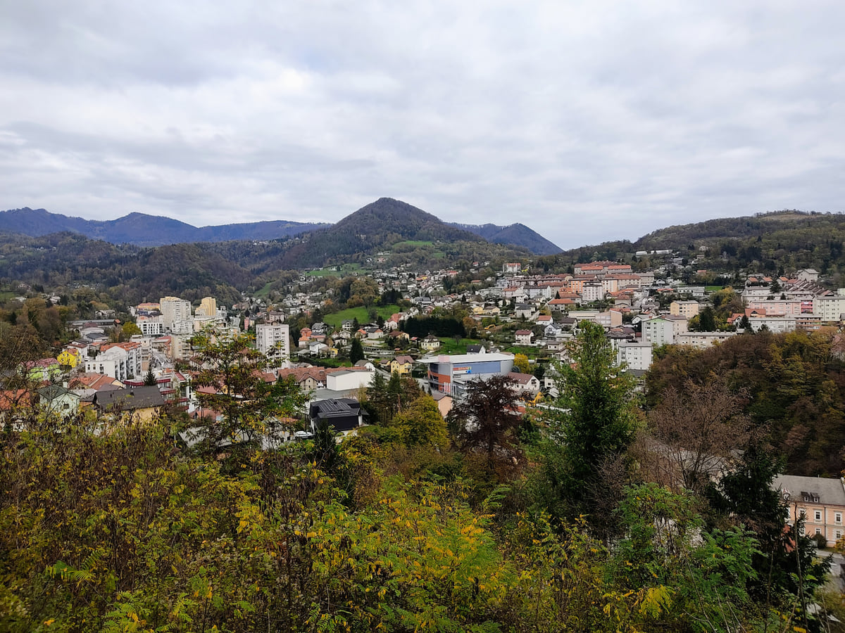
Zasavska statistical region
Zasavje, the Sava mining valley that hardly anyone visits

- Municipalities
- 4
- Population (1-1-2026)
- 56,927
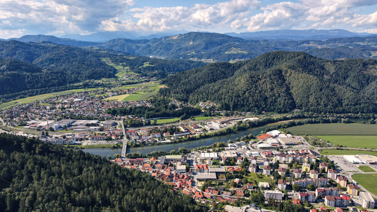
Zasavje is Slovenia's smallest region, the mining valley of the Sava: 485 km², four municipalities (Trbovlje, Hrastnik, Zagorje ob Savi and Litija) and 56,927 people in 2026. It drew the fewest tourists of any region in 2025, 7,923 arrivals, and what it offers is working-class Slovenia: mines, brass bands, the Pot Srečno trail, Mt Kum and the country's geometric centre in Litija.
Zasavje isn't a holiday region, and I wouldn't sell it as one. But a day here, with Litija's Sitarjevec mine and the miners' flats in Trbovlje, shows a Slovenia you won't see at Bled. With so few places to stay, I'd sleep in Ljubljana.
The essentials in a few lines
Full read: 3 min
- Zasavje is Slovenia's smallest statistical region, at 485 km² with four municipalities.
- Its towns are Trbovlje, Hrastnik, Zagorje ob Savi and Litija, all in the Sava valley.
- It had 7,923 tourist arrivals in 2025, the lowest figure in the country.
- The highlights are in Litija, with the Sitarjevec mine and the geometric centre of Slovenia.
My ranking, scored
What I would do in Zasavje
My own marks out of 10, weighing what you can only see here and what it adds for someone travelling through central Slovenia. Opinion, not an official rating.
0 of 4 seen
-
Sitarjevec mine (Litija)
One of the most mineral-rich mines in the world according to Litija's tourist centre, with over 60 minerals and crystals of cinnabar, cerussite and mercury.
8.4 out of 10
-
Geometric centre and Geoss park
The GEOSS monument at Slivna and, beside it, the largest adventure park in Slovenia, with a 915 m zipline.
8.0 out of 10
-
Pot Srečno
29.7 km of mining trail across four municipalities, easy to walk in sections, from 4.9 km in Zagorje to 9.3 km in Hrastnik.
7.6 out of 10
-
Muzej Hrastnik
Free, with classrooms from 1920 and 1960, the war in Zasavje and the largest marionette collection of the local troupe active from 1946 to 1977.
7.2 out of 10
Bookings I would make
What I would check before going
The practical bit
Worth knowing about Zasavje
-
01 Most beautiful
The geometric centre of Slovenia
At Slivna, in Litija municipality, the GEOSS monument marks the country's geometric centre, surrounded by Slovenian national symbols and wide views, according to Litija's tourist information centre.
Litija -
02 My tip
Pot Srečno, a 29.7 km miners' trail
A themed walking route links Laško, Hrastnik, Trbovlje and Zagorje ob Savi through their mining heritage, named after the miners' greeting «srečno». Zagorje municipality gives its length as 29.7 km.
Trbovlje -
03 To save money
Hrastnik's museum is free
Muzej Hrastnik, with displays on schooling in Zasavje, the Second World War and a large marionette collection, charges no admission, according to the municipality.
Hrastnik -
04 Worth the splurge
A Zasavje menu
Some restaurants in Hrastnik serve a Zasavje menu of local dishes, such as funšterc, the «miner's sun», and krumpantoč, a potato steak. Dol pri Hrastniku has a museum that doubles as a restaurant.
Hrastnik -
05 Getting there
The smallest region
At 485 km², Zasavje is the smallest statistical region of a country that measures 20,271 km², according to the Government and SURS.
how big is Slovenia -
06 Getting there
Small in people too
Zasavje has 56,927 residents, under 3 % of the 2,135,107 Slovenia had on 1 January 2026, according to SURS.
Slovenia population
What to see in Zasavje in one day
I would start in Litija. The tourist centre describes the Sitarjevec mine as one of the richest in the world for variety of minerals, with more than 60 kinds and crystals of cinnabar, cerussite, native lead and copper and mercury on show in the visitor section. Close by at Slivna, the GEOSS monument marks the geometric centre of the country, and next to it is Slovenia’s largest adventure park, with seven treetop courses and a 915 m zipline. At Klenik, near Vače, stands an enlarged replica of the Vače situla, one of the most important archaeological finds in Slovenia; the original is in the National Museum in Ljubljana. Litija’s town museum covers the old Sava raftsmen, the railway and the mine.
In the afternoon, Hrastnik. Muzej Hrastnik is free and includes a classroom from 1920 and another from 1960, a room on the Second World War in Zasavje and the largest marionette collection of the local troupe that performed from 1946 to 1977. At Dol pri Hrastniku, the tourist board mentions a museum that is also a restaurant, with exhibits and wall paintings on local history and typical regional cooking.
Zasavje’s four municipalities
Trbovlje is the largest town, with 13,665 people, and the government lists it among the country’s major towns. Zagorje ob Savi is the most populous municipality, with 16,347, and Hrastnik the smallest, with 8,755. Litija, with 15,890 people spread over 107 settlements, is the largest by area and the most organised for visitors, with its own tourist information centre.
All four share the river and the mining past, and they are proud of it. The miners’ greeting, «srečno», gives its name to a walking trail that links them, and all four receive very few tourists according to SURS; Hrastnik itself suggests sleeping in mountain huts, private rooms or neighbouring towns. Litija belongs to this region in SURS’s current classification, while its neighbour Šmartno pri Litiji, home of Bogenšperk Castle, counts as Central Slovenia.
Miners, brass bands and photographers
What strikes me most about Zasavje is not in a display case. Hrastnik boasts two brass bands, the miners’ band, nearly 160 years old according to the municipality, and the glassworkers’ band, at 80, plus choirs over a century old. Its photographic club is among the three oldest in the country.
The municipality also suggests a heritage route taking in a Roman shrine, several churches, the Rižnar house and the Mlakar flat, a miner’s home protected as a local monument, as well as the miners’ memorial. It points out that the valley has Natura 2000 areas, isolated rock outcrops and chestnut trees that end up at autumn chestnut gatherings. In Litija, the tourist centre keeps the charcoal-burning tradition alive at Dole pri Litiji, with events in May and September and a black bread you can taste on the spot.
To sleep close to everything, search places to stay in Ljubljana on Expedia and filter by area before price.
Pot Srečno, Mt Kum and other trails
Pot Srečno is a 29.7 km themed trail linking Laško, Hrastnik, Trbovlje and Zagorje ob Savi along their mining heritage; Zagorje municipality splits it into 7.7 km in Laško, 9.3 in Hrastnik, 7.8 in Trbovlje and 4.9 in Zagorje. Litija adds, according to its tourist centre, 340 km of walking trails and 380 km of cycling routes. And the tourist board mentions a long-distance trail climbing from Bizeljsko to the summit of Kum, the mountain that dominates the region.
Getting there and where to stay
Zasavje lies in the Sava corridor east of Ljubljana, and Southern Railway trains towards Celje and Maribor follow the valley. With so little accommodation, my advice is to visit on a day trip from Ljubljana and head back to the capital to sleep, or stay in Litija if you want an early start at the mine. For me, Zasavje is the best excuse to leave the classic route of a Slovenia trip and see the working-class side of Slovenia that hardly anyone shows you.
If you are short on time, see the best tours in Ljubljana and pick one that fits your day.
To sleep close to everything, search places to stay in Ljubljana on Booking.com and filter by area before price.
Zasavje's 4 municipalities
| Municipality | Population (1-1-2026) | km² | Largest settlement | Arrivals 2025 |
|---|---|---|---|---|
| Zagorje ob Savi | 16,347 | 147.2 | Zagorje ob Savi (5,995) | 4,527 |
| Trbovlje | 15,935 | 58.2 | Trbovlje (13,665) | 1,039 |
| Litija | 15,890 | 221.3 | Litija (6,732) | 1,953 |
| Hrastnik | 8,755 | 58.5 | Hrastnik (4,667) | 404 |
SURS (SiStat): population, area and settlements on 1-1-2026 and tourist arrivals in 2025, checked on 04-10-2026. Litija belongs to Zasavje in SURS's current classification; Šmartno pri Litiji is in Central Slovenia.
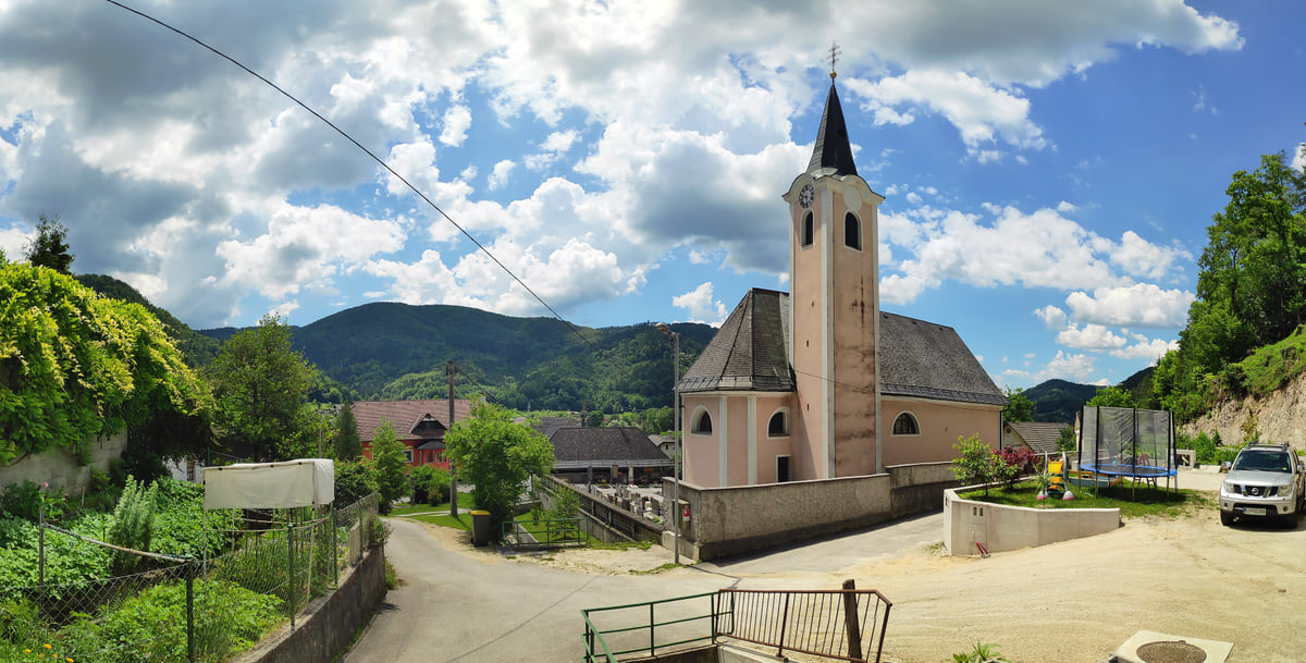
The church in the village of Sava, Litija municipality, with its bell tower and the green hills of the Sava valley behind
Test yourself
What people often get wrong about Zasavje
0/3 Pick before you peek.
-
Zasavje is Slovenia's smallest statistical region.
See the answer
True. It covers 485 km² according to SURS, the smallest of the twelve regions.
-
The geometric centre of Slovenia is in Ljubljana.
See the answer
False. It is at Slivna, in Litija municipality, marked by the GEOSS monument.
-
Hrastnik had more tourists than Trbovlje in 2025.
See the answer
False. According to SURS, Trbovlje had 1,039 arrivals and Hrastnik 404, the lowest of the four.
What to see
Zasavje, place by place
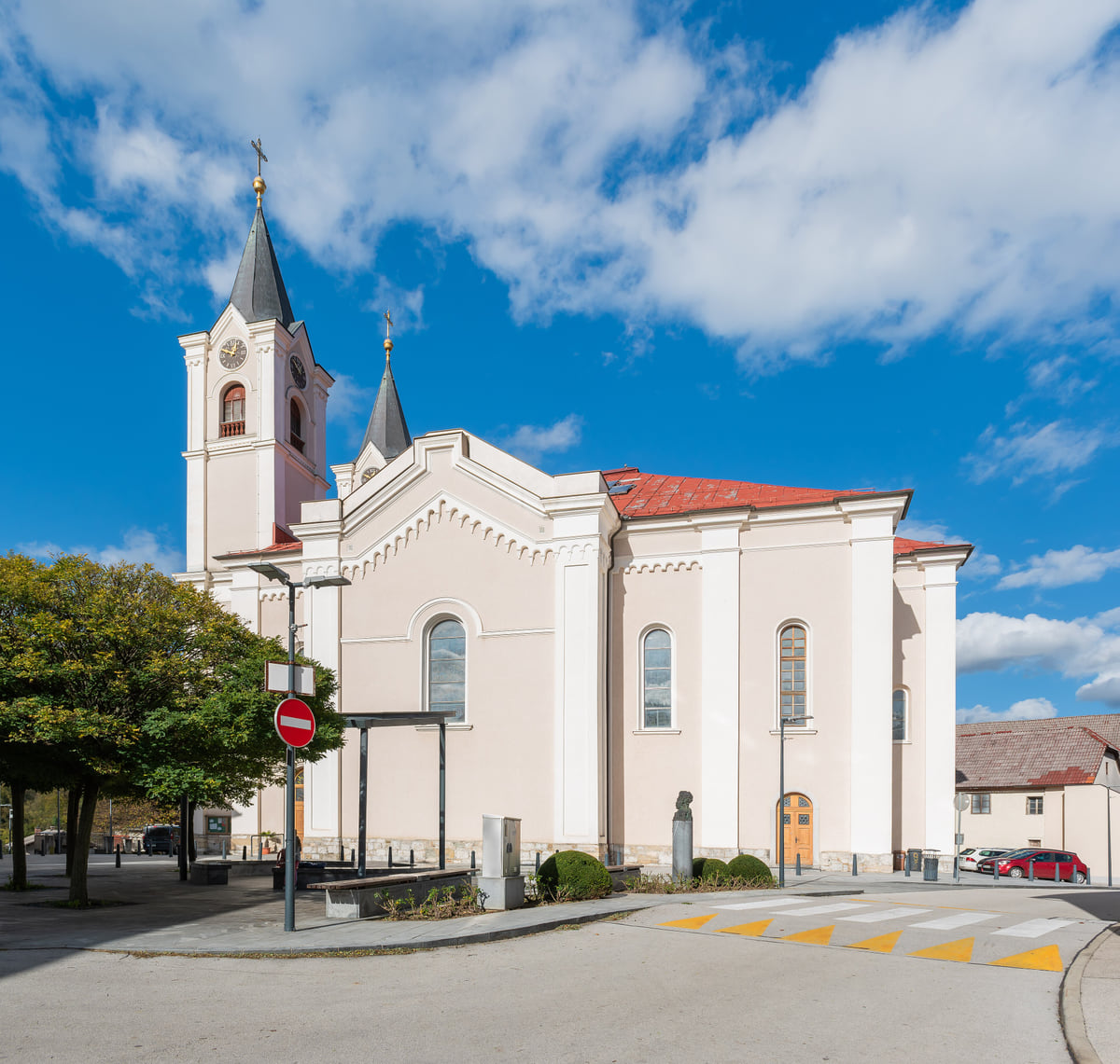
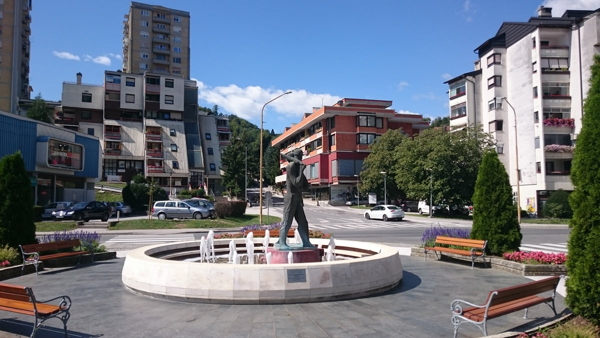
- Area, the smallest of the 12 regions
- 485 km²
- Residents on 1 January 2026
- 56,927
- Tourist arrivals in 2025
- 7,923
- Length of the Pot Srečno mining trail
- 29.7 km
Common questions about Zasavje
What is Zasavje?
The Zasavska statistical region, in the Sava valley in central Slovenia. It is the country's smallest region, at 485 km², made up of Trbovlje, Hrastnik, Zagorje ob Savi and Litija. Like every Slovenian region, it has no government of its own.
What is there to see in Zasavje?
The Sitarjevec mine and the geometric centre of Slovenia in Litija, Muzej Hrastnik, the museum-restaurant at Dol pri Hrastniku and the Pot Srečno mining trail. Just next door, in Central Slovenia, is Bogenšperk Castle.
Why does Zasavje get so few tourists?
SURS does not say why, but my reading is that it is an industrial, former mining region with no headline sight known abroad and little accommodation; Hrastnik itself points visitors to mountain huts, private rooms and neighbouring towns.
Where is the geometric centre of Slovenia?
At Slivna, a settlement of 127 people in Litija municipality. The GEOSS monument stands there, with a treetop adventure park next to it.
What food is typical of Zasavje?
Hrastnik municipality recommends funšterc, known as the miner's sun, krumpantoč, a kind of potato steak, and local black pudding. In Litija, the tourist centre highlights the black bread of the charcoal burners.
What is Mt Kum?
The summit that overlooks Zasavje, reached by a long-distance trail from the Bizeljsko wine district, according to the tourist board. I have not confirmed its exact height or municipality in an official source, so I am not giving them.
0 of 425 Slovenia guides
Your next stamp
- Trbovlje
- Posavje
- Hrastnik
- Litija
- Sevnica
- Savinjska
- Velenje
- Zagorje ob Savi
- Bogenšperk Castle
- Bogojina
- Debeli rtič
- Ig pile dwellings
- Jeruzalem
- Kolpa River
- Koper
- Lake Cerknica
- Lipica
- Ljubljana
- Ljubljana to Bled
- Mariborsko Pohorje
- Mount Snežnik
- Palace Portorož
- Park of Military History
- Plečnik House
- Postojna
- Postojna Cave
- Škocjan Caves
- Štanjel
- Tartini Square
- Županova jama
- Izola
- Kamnik
- Karst
- Ljubljana to Postojna
- Lovrenc Lakes
- Maribor
- Portorož
- Predjama Castle
- Things to do in Ljubljana
- Travel guide
- Vilenica Cave
- Celje
- Cerknica
- Domžale
- Ljubljana in a day
- Ljubljana to Piran
- Piran
- Slovenian Istria
- Strunjan
- Things to do
- Activities
- Ankaran
- Grosuplje
- Ljubljana in two days
- Pivka
- Sečovlje salt pans
- Brežice Castle
- Getting around Ljubljana
- Ilirska Bistrica
- Mežica Mine
- Most beautiful places
- Novo mesto
- Sevnica Castle
- Terme Olimia
- Vrhnika
- Žiče Charterhouse
- Dolenjska
- Ig
- Prettiest villages
- Ptuj
- Sežana
- Divača
- Medvode
- Murska Sobota
- World Heritage
- Hrpelje-Kozina
- Logatec
- Map
- Mengeš
- Brezovica
- Komen
- Where is Slovenia
- Bled
- Brežice
- Čatež ob Savi
- Celje Castle
- Coal Mining Museum
- Gorenjska
- Hotels in Piran
- Hrastovlje
- Karawanken Geopark
- Koroška
- Kostanjevica Cave
- Kostel Castle
- Krokar primeval forest
- Kurentovanje
- Lent
- Ljubljana Castle
- Ljubljana Cathedral
- Logar Valley
- Oldest vine in the world
- Olimje
- Otočec
- Regions
- Rimske Toplice
- Rinka Waterfall
- Rogla
- Sava River
- Slovenj Gradec
- Topolšica
- Velika Planina
- Goriška
- Krško
- Lake Bled
- Municipalities
- Podravje
- Prešeren Square
- Ravne na Koroškem
- Restaurants in Piran
- Škocjan Inlet
- Volčji Potok Arboretum
- Bled Island
- Cities
- Mežica
- Pomurje
- Socerb Castle
- Bled Castle
- Coast and Karst
- Dravograd
- Kostanjevica na Krki
- Population
- Notranjska
- Ojstrica viewpoint
- Radlje ob Dravi
- Size
- Central Slovenia
- Language
- Mislinja
- Plečnik's Ljubljana
- Slovenska Bistrica
- Vila Bled
- Currency
- Grand Hotel Toplice
- Ormož
- EU and Schengen
- Hotel Savica Garni
- Hotels in Bled
- Pohorje
- Haloze
- History
- Restaurants in Bled
- Flag and symbols
- Hoče-Slivnica
- Bizeljsko
- Bohinj
- Christmas in Ljubljana
- City Hotel Ljubljana
- Gorjanci
- Kranj
- Krka River
- Laško
- Moravske Toplice
- Ptuj Castle
- Public holidays
- Rajhenburg Castle
- Šentilj
- Slovenia beaches
- Šmartno pri Litiji
- Uršlja Gora
- Brdo Castle
- Independence Day
- Lake Bohinj
- Ljubljana Festival
- Radenci
- Rogaška Slatina
- Day trips from Ljubljana
- Jesenice
- Lendava
- Podčetrtek
- Savica waterfall
- Time zone
- Dobrna
- Facts
- Ljubljana nightlife
- Ljutomer
- Nova Gorica
- Vogel
- Bohinjska Bistrica
- Gornja Radgona
- Ljubljana Old Town
- Slovenia and Croatia
- Solkan
- Zreče
- Grad
- Sabotin
- Slovenia, Italy and Austria
- Slovenske Konjice
- Stara Fužina
- Trnovo
- Goričko
- Holidays and tours
- Hotels in Bohinj
- Škofja Loka
- Vitanje
- Škofja Loka Castle
- Slovenia or Slovakia
- Šoštanj
- Veržej
- Slovenian phrases
- Slovenia in 3 days
- Bela krajina
- Caves in Slovenia
- Črnomelj
- Dragon Bridge
- Gorje
- Hiking
- Hotels in Maribor
- Kozjansko Regional Park
- Kranjska Gora
- Lake Ptuj
- Ljubljana Marshes
- Slovenia in 5 days
- Vinarium Tower
- Where to stay in Ljubljana
- Žalec
- Metlika
- Slovenia castles
- Slovenia in a week
- Slovenian Mountain Trail
- Triple Bridge
- Vintgar Gorge
- Vršič Pass
- Where to eat in Ljubljana
- Best viewpoints in Slovenia
- Central Market
- Juliana Trail
- Lake Jasna
- Road trip
- Semič
- Žirovnica
- Kočevje
- Metelkova
- Motorhome
- Museums in Slovenia
- Naklo
- Soča rafting
- Tržič
- Zelenci
- Jezersko
- Kostel
- Lake Planšar
- Skiing
- Slovenia with kids
- Slovenian Alpine Museum
- Tivoli Park
- Best time to visit
- Cerklje na Gorenjskem
- Cycling
- Dolenjske Toplice
- Ljubljanica river
- Mojstrana
- Šenčur
- Krvavec
- National Gallery
- Parenzana
- Peričnik waterfall
- Šmarješke Toplice
- Weather
- National and University Library
- Paragliding
- Slovenia in winter
- Strmol Castle
- Trebnje
- Vrata valley
- Climbing
- Events
- Martuljek waterfalls
- Žale
- Fly fishing
- In January
- Ljubljana museums
- National Museum of Slovenia
- Rateče
- Bovec
- Festival Lent
- Golf
- Hotels in Ptuj
- In February
- Kamnik-Savinja Alps
- Nature parks
- Parking in Ljubljana
- Pekel Cave
- Planica
- Snežnik Castle
- Solčava
- Gornji Grad
- In March
- Kranjska Gora ski resort
- Lakes
- Trenta
- Ziplines
- Alpe Adria Trail
- Hotels in Kranjska Gora
- In April
- Kanin
- Nazarje
- Waterfalls
- In May
- Rivers
- Virje waterfall
- Vransko
- Hotels in Bovec
- In June
- Mountains
- Šentjur
- Dobra Vila Bovec
- In July
- Ljubljana Card
- Mozirje
- Spas
- In August
- Nebesa Chalets
- Rečica ob Savinji
- In September
- Kobarid
- Šmartno ob Paki
- In October
- Kobarid Museum
- Hiša Franko
- In November
- In December
- Radovljica
- Železniki
- In spring
- Museum of Apiculture
- Žiri
- In summer
- Kropa
- Tolmin
- Brezje
- In autumn
- Metaldays
- Tolmin Gorges
- Begunje
- Javorca church
- Slovenia in 10 days
- Most na Soči
- Two weeks in Slovenia
- Idrija
- Ljubljana Marathon
- How to get there
- Idrija mercury mine
- Wild Lake
- Cerkno
- Flights
- Laufarji
- Divje babe
- Franja Partisan Hospital
- Ljubljana Airport
- Ajdovščina
- Nearby airports
- Venice to Ljubljana
- Vipava
- Vipavski Križ
- Zagreb to Ljubljana
- Brda
- Trains to Slovenia
- Getting around
- Šmartno
- Dobrovo Castle
- Trains
- Buses
- Julian Alps
- Car hire
- Triglav National Park
- Driving
- Pokljuka
- Triglav Lakes
- Vignette
- Mount Triglav
- Taxis
- Distances
- Soča Valley
- Soča River
- Trieste to Ljubljana
- Kozjak Waterfall
- Vienna to Ljubljana
- Boka Waterfall
- Budapest to Ljubljana
- Ljubljana to Maribor
- Walk of Peace
- Bled to Bohinj
- Mangart
- Lake Krn
- Prices and budget
- Slovenia on a budget
- Vipava Valley
- Free things to do
- Otlica Natural Window
- Entry requirements
- Rihemberk Castle
- Customs
- Safety
- Scams
- Bears
- Healthcare
- Mobile and roaming
- Plugs
- Packing list
- What to buy
- Hotels
- Campsites
- Farm stays
- Mountain huts
- Food
- Bled cream cake
- Wine
- Potica
- Prekmurska gibanica
- Štruklji
- Carniolan sausage
- Idrija žlikrofi
- Beer
- Tipping

Questions about Zasavje? Write to me
If something does not add up or a fact is missing, write to me and I will answer myself.
My email sergiolepone@gmail.com
By
Tourism graduate with a master’s in Tourism Management and Planning from the University of Málaga, who has travelled across Europe. He writes every guide from official sources and his own judgement.
Published on . Updated on . Facts checked on .
Sources
Some links in this guide are affiliate links: if you book through them, the site earns a commission at no extra cost to you. Affiliate disclosure
Photos: Viktar Palstsiuk (CC BY-SA 4.0); Petar Milošević (CC BY-SA 4.0), via Wikimedia Commons.