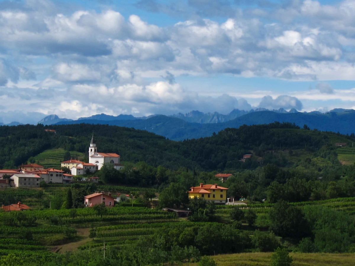
Slovenia's regions are 12 statistical ones, which divide its 212 municipalities but have no government of their own. Travellers also use the historical regions, such as Štajerska, Primorska or Prekmurje, and the tourist board's four macro-destinations. Gorenjska, home to Bled and the Julian Alps, had the most tourists in 2025 (1,672,712 arrivals), followed by central Slovenia and the coast.
The essentials in a few lines
Full read: 2 min
- Slovenia has 12 statistical regions with no regional government.
- Gorenjska had the most tourists in 2025; the central region has the most people.
- Historical names such as Štajerska, Prekmurje and Primorska are used as travel areas.
For a first week-long trip I'd stick to three regions, Gorenjska, central Slovenia and the coast with the Karst. The rest aren't any worse, but they need more time, and the east with its spa towns works better as a second visit.

My key points
What the official sites leave out
-
01 Most beautiful
Gorenjska, the lakes region
Upper Carniola holds Bled, Bohinj and Kranjska Gora, and in 2025 it had more tourist arrivals than any other region, according to SURS.
Gorenjska -
02 My tip
They aren't counties
The government admits that the regions written into the constitution have never been set up. The current 12 are statistical, so you won't find regional capitals or welcome signs.
municipalities of Slovenia -
03 To save money
The quieter east
Podravje, Pomurje and Savinjska have spa towns, vineyards and cities such as Maribor and Ptuj with far fewer visitors than the Alps. I'd save them for a second trip.
Slovenian Styria
Which region to pick for your trip
For a first week, I’d combine Gorenjska, the central region and the coast with the Karst. If mountains and rivers are your thing, add Goriška, with the Soča Valley and the Brda vineyards. If you’re after spas, wine and fewer people, head east to Savinjska, Podravje and Pomurje. And if you like places few visitors reach, the south-east, with Dolenjska, Kočevje and Bela Krajina, has forests and rivers that deserve a trip of their own. How they all fit together is in the map of Slovenia. How many people live in each and how big the country is are in Slovenia population and how big is Slovenia.
The 12 official regions
These are the official division that splits the 212 municipalities with no gaps or overlaps, and the one with data on population, area and tourism. What they are not is counties. The constitution provides for regions as a tier of local government, but the government itself acknowledges they have never been created for lack of political consensus. So I use them as a framework for the territory, and each has its own page, starting with the most visited, Gorenjska, the Upper Carniola of the lakes.
The numbers help. The central region, with Ljubljana, is the most populous, with 573,209 people on 1 January 2026. Gorenjska had the most tourists in 2025, 1,672,712 arrivals, followed by the central region and by the coast and Karst, which I cover in the Slovenian coast and Karst. At the other end, Zasavje, along the Sava, is the smallest at 485 km² and had only 7,923 arrivals.
The historical regions
When a Slovene mentions Štajerska, Primorska or Prekmurje, they mean historical regions, which have no published official boundaries but which everyone uses. Slovenian Styria (Štajerska) is the east around Maribor, and the statistical region of Podravje is its closest match; Primorska is the Littoral, with the Karst and Goriška; Prekmurje is the land beyond the Mura, in Pomurje; and Carniola, first recorded in 973 and a duchy from 1364, gives its name to Upper Carniola, which is Gorenjska. On this site I treat them as travel areas, and you’ll find the east in Podravje, Slovenian Styria.
To sleep close to everything, search places to stay in Bled on Expedia and filter by area before price.
The four macro-destinations
The third approach is the Tourist Board’s, which organises the country into four macro-destinations, Alpine Slovenia, Ljubljana and Central Slovenia, Mediterranean and Karst Slovenia, and Thermal Pannonian Slovenia, with 36 leading destinations. They’re useful because they match what travellers are looking for, but they slice regions in half. Idrija, for example, goes with Ljubljana and Rogla with the Alps. In 2025 Alpine Slovenia took 2,553,073 arrivals, just over twice the thermal east.
If you are short on time, see the best tours in Bled and pick one that fits your day.
To sleep close to everything, search places to stay in Bled on Booking.com and filter by area before price.
Slovenia's 12 statistical regions
| Region (SURS) | Travel name | Population 1 Jan 2026 | km² | Arrivals 2025 |
|---|---|---|---|---|
| Gorenjska | Upper Carniola, Julian Alps | 209,939 | 2,137 | 1,672,712 |
| Osrednjeslovenska | Central Slovenia, Ljubljana | 573,209 | 2,334 | 1,547,866 |
| Obalno-kraška | Coast and Karst | 120,092 | 1,043 | 1,132,389 |
| Goriška | Soča Valley, Brda, Vipava | 117,783 | 2,325 | 621,023 |
| Savinjska | Celje, Logar Valley, spas | 263,107 | 2,301 | 576,951 |
| Podravska | Maribor, Ptuj, Slovenian Styria | 332,747 | 2,170 | 470,755 |
| Pomurska | Prekmurje | 112,740 | 1,336 | 327,138 |
| Posavska | Posavje, Brežice | 76,028 | 968 | 247,105 |
| Jugovzhodna Slovenija | Dolenjska, Bela Krajina, Kočevje | 148,903 | 2,675 | 168,020 |
| Primorsko-notranjska | Notranjska, Postojna | 53,458 | 1,456 | 159,129 |
| Koroška | Slovenian Carinthia | 70,174 | 1,041 | 56,170 |
| Zasavska | Zasavje | 56,927 | 485 | 7,923 |
SURS, population and area by region and arrivals by municipality added together (municipalities without published data aren't counted). Checked on 4 October 2026.
The Tourist Board's four macro-destinations
| Macro-destination | Arrivals 2025 | Overnight stays 2025 |
|---|---|---|
| Alpine Slovenia | 2,553,073 | 6,456,580 |
| Ljubljana & Central Slovenia | 1,713,841 | 3,558,025 |
| Mediterranean & Karst Slovenia | 1,477,116 | 4,080,865 |
| Thermal Pannonian Slovenia | 1,249,900 | 3,747,841 |
SURS, arrivals and overnight stays by tourist macro-destination, 2025.
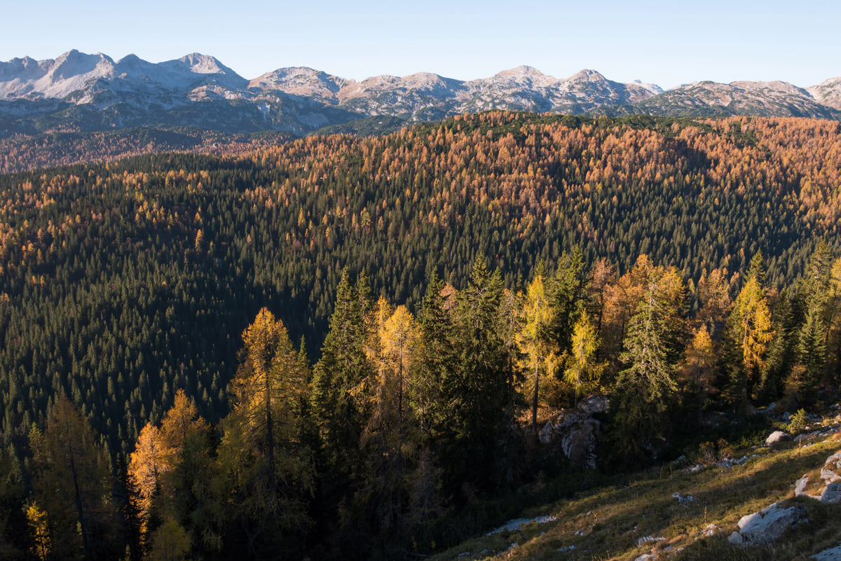
Golden larches in autumn in the Triglav Seven Lakes Valley, with a sea of forest and the Julian Alps peaks in the distance
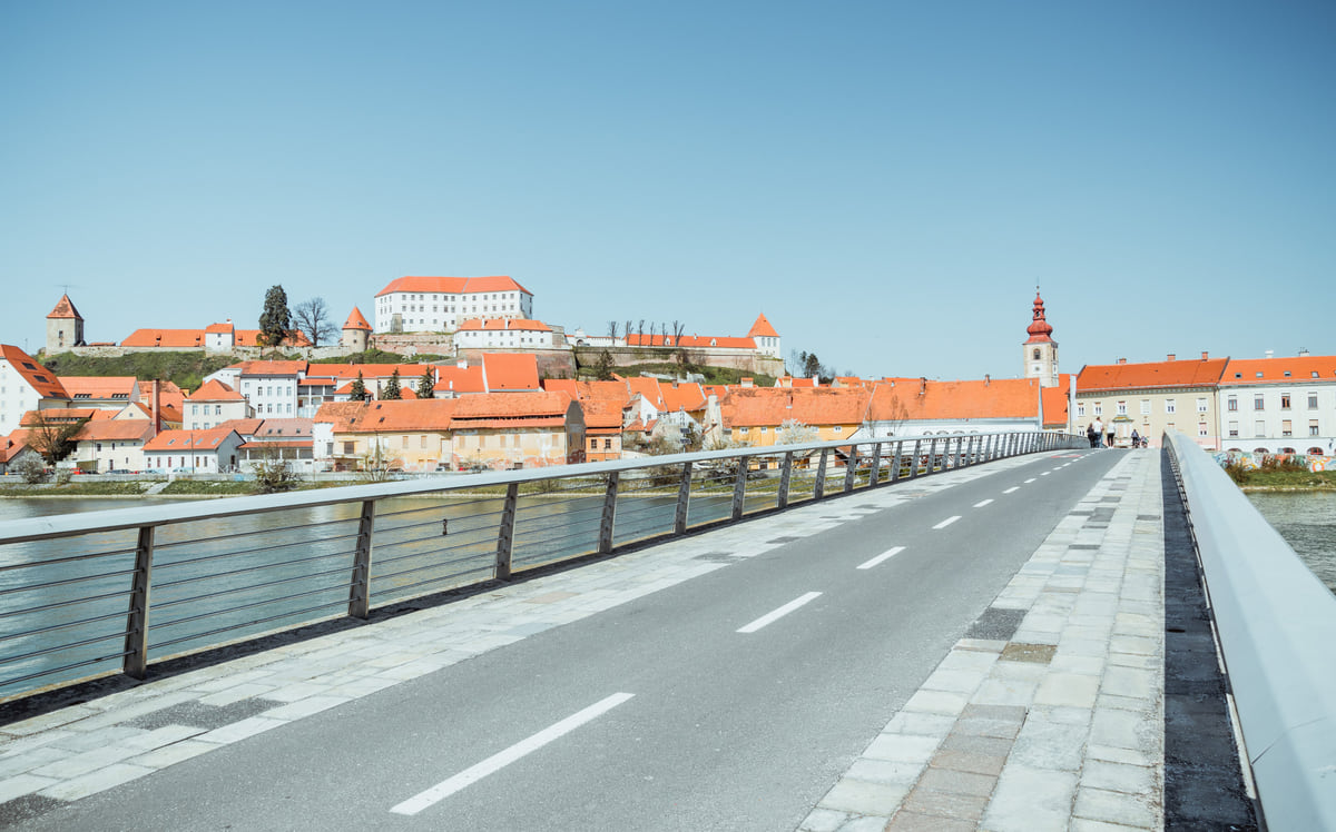
Ptuj Castle and the old town rooftops above the Drava, seen from a bridge with a cycle and footpath
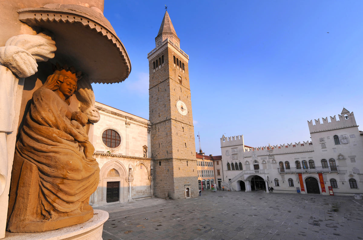
Tito Square in Koper with the cathedral bell tower and the Praetorian Palace, and a stone sculpture in the foreground
Test yourself
True or false?
0/3 Pick before you peek.
-
Slovenia's regions have their own governments and parliaments.
See the answer
False. They're statistical. The government admits the regions in the constitution have never been created.
-
The region with the most tourists in 2025 was Ljubljana's.
See the answer
False. It was Gorenjska, with 1,672,712 arrivals, ahead of the central region's 1,547,866, according to SURS.
-
Zasavje is the smallest statistical region by area.
See the answer
True. At 485 km², it's the smallest of the 12 according to SURS.
Map
Slovenia, from the Julian Alps to the Adriatic
The Julian Alps, Triglav and the Soča valley lie to the north-west; Ljubljana sits in the centre; the Karst, its caves and the 47 km of coast are to the south-west, and Maribor, Ptuj and the Prekmurje plains to the east. Every number opens its guide.
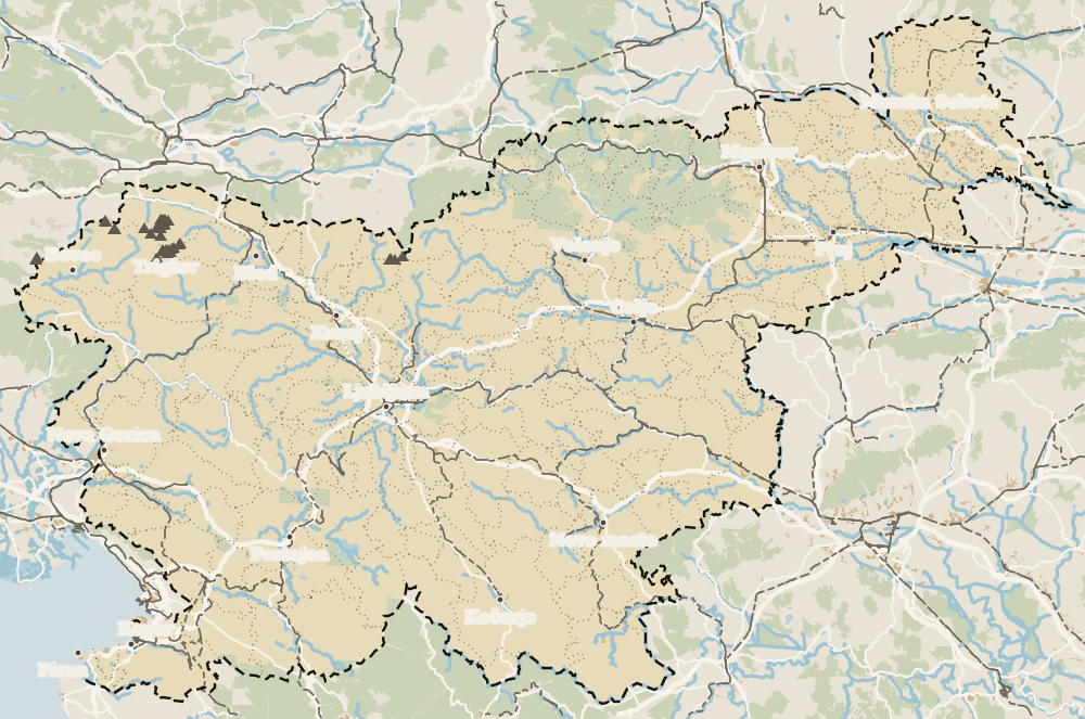 1Dolenjska 2Posavje 3Savinjska 4Gorenjska 5Koroška 6Goriška 7Podravje 8Pomurje
Map data © OpenStreetMap contributors (ODbL)
- Statistical regions
- 12
- Residents of the central region
- 573,209
- Arrivals in Gorenjska in 2025
- 1,672,712
- Tourist Board macro-destinations
- 4
Frequently asked questions
How many regions does Slovenia have?
Twelve statistical regions according to SURS. They have no government of their own; the government says the regions foreseen in the constitution have not been created for lack of political consensus.
What is the most beautiful region of Slovenia?
For me, Gorenjska, with Bled, Bohinj, Kranjska Gora and Triglav National Park. Goriška, with the Soča Valley and Brda, runs it very close.
What are Styria, Prekmurje and Carniola?
Historical regions with no official published boundaries. Slovenian Styria (Štajerska) is roughly the east, Prekmurje is the land beyond the Mura and Upper Carniola is Gorenjska.
Which is the most populated region of Slovenia?
Osrednjeslovenska, the central region, with 573,209 residents on 1 January 2026 according to SURS. Next comes Podravska, Maribor's region, with 332,747.
What are Slovenia's tourist macro-destinations?
The four big areas the Tourist Board uses: Alpine Slovenia, Ljubljana and Central Slovenia, Mediterranean and Karst Slovenia, and Thermal Pannonian Slovenia.
0 of 425 Slovenia guides
Your next stamp
- Map
- Municipalities
- Travel guide
- Hotels
- Hiking
- Skiing
- Central Slovenia
- Bogenšperk Castle
- Bogojina
- Debeli rtič
- Ig pile dwellings
- Jeruzalem
- Kolpa River
- Koper
- Lake Cerknica
- Lipica
- Ljubljana
- Ljubljana to Bled
- Mariborsko Pohorje
- Mount Snežnik
- Palace Portorož
- Park of Military History
- Plečnik House
- Postojna
- Postojna Cave
- Škocjan Caves
- Štanjel
- Tartini Square
- Trbovlje
- Županova jama
- Izola
- Kamnik
- Karst
- Ljubljana to Postojna
- Lovrenc Lakes
- Maribor
- Portorož
- Predjama Castle
- Things to do in Ljubljana
- Vilenica Cave
- Zagorje ob Savi
- Celje
- Cerknica
- Domžale
- Hrastnik
- Ljubljana in a day
- Ljubljana to Piran
- Piran
- Slovenian Istria
- Strunjan
- Things to do
- Activities
- Ankaran
- Grosuplje
- Litija
- Ljubljana in two days
- Pivka
- Sečovlje salt pans
- Velenje
- Brežice Castle
- Getting around Ljubljana
- Ilirska Bistrica
- Mežica Mine
- Most beautiful places
- Novo mesto
- Sevnica Castle
- Terme Olimia
- Vrhnika
- Žiče Charterhouse
- Dolenjska
- Ig
- Prettiest villages
- Ptuj
- Sežana
- Divača
- Medvode
- Murska Sobota
- Posavje
- World Heritage
- Hrpelje-Kozina
- Logatec
- Mengeš
- Brezovica
- Komen
- Savinjska
- Where is Slovenia
- Bled
- Brežice
- Čatež ob Savi
- Celje Castle
- Coal Mining Museum
- Gorenjska
- Hotels in Piran
- Hrastovlje
- Karawanken Geopark
- Koroška
- Kostanjevica Cave
- Kostel Castle
- Krokar primeval forest
- Kurentovanje
- Lent
- Ljubljana Castle
- Ljubljana Cathedral
- Logar Valley
- Oldest vine in the world
- Olimje
- Otočec
- Rimske Toplice
- Rinka Waterfall
- Rogla
- Sava River
- Slovenj Gradec
- Topolšica
- Velika Planina
- Goriška
- Krško
- Lake Bled
- Podravje
- Prešeren Square
- Ravne na Koroškem
- Restaurants in Piran
- Škocjan Inlet
- Volčji Potok Arboretum
- Bled Island
- Cities
- Mežica
- Pomurje
- Sevnica
- Socerb Castle
- Bled Castle
- Coast and Karst
- Dravograd
- Kostanjevica na Krki
- Population
- Notranjska
- Ojstrica viewpoint
- Radlje ob Dravi
- Size
- Language
- Mislinja
- Plečnik's Ljubljana
- Slovenska Bistrica
- Vila Bled
- Currency
- Grand Hotel Toplice
- Ormož
- Zasavje
- EU and Schengen
- Hotel Savica Garni
- Hotels in Bled
- Pohorje
- Haloze
- History
- Restaurants in Bled
- Flag and symbols
- Hoče-Slivnica
- Bizeljsko
- Bohinj
- Christmas in Ljubljana
- City Hotel Ljubljana
- Gorjanci
- Kranj
- Krka River
- Laško
- Moravske Toplice
- Ptuj Castle
- Public holidays
- Rajhenburg Castle
- Šentilj
- Slovenia beaches
- Šmartno pri Litiji
- Uršlja Gora
- Brdo Castle
- Independence Day
- Lake Bohinj
- Ljubljana Festival
- Radenci
- Rogaška Slatina
- Day trips from Ljubljana
- Jesenice
- Lendava
- Podčetrtek
- Savica waterfall
- Time zone
- Dobrna
- Facts
- Ljubljana nightlife
- Ljutomer
- Nova Gorica
- Vogel
- Bohinjska Bistrica
- Gornja Radgona
- Ljubljana Old Town
- Slovenia and Croatia
- Solkan
- Zreče
- Grad
- Sabotin
- Slovenia, Italy and Austria
- Slovenske Konjice
- Stara Fužina
- Trnovo
- Goričko
- Holidays and tours
- Hotels in Bohinj
- Škofja Loka
- Vitanje
- Škofja Loka Castle
- Slovenia or Slovakia
- Šoštanj
- Veržej
- Slovenian phrases
- Slovenia in 3 days
- Bela krajina
- Caves in Slovenia
- Črnomelj
- Dragon Bridge
- Gorje
- Hotels in Maribor
- Kozjansko Regional Park
- Kranjska Gora
- Lake Ptuj
- Ljubljana Marshes
- Slovenia in 5 days
- Vinarium Tower
- Where to stay in Ljubljana
- Žalec
- Metlika
- Slovenia castles
- Slovenia in a week
- Slovenian Mountain Trail
- Triple Bridge
- Vintgar Gorge
- Vršič Pass
- Where to eat in Ljubljana
- Best viewpoints in Slovenia
- Central Market
- Juliana Trail
- Lake Jasna
- Road trip
- Semič
- Žirovnica
- Kočevje
- Metelkova
- Motorhome
- Museums in Slovenia
- Naklo
- Soča rafting
- Tržič
- Zelenci
- Jezersko
- Kostel
- Lake Planšar
- Slovenia with kids
- Slovenian Alpine Museum
- Tivoli Park
- Best time to visit
- Cerklje na Gorenjskem
- Cycling
- Dolenjske Toplice
- Ljubljanica river
- Mojstrana
- Šenčur
- Krvavec
- National Gallery
- Parenzana
- Peričnik waterfall
- Šmarješke Toplice
- Weather
- National and University Library
- Paragliding
- Slovenia in winter
- Strmol Castle
- Trebnje
- Vrata valley
- Climbing
- Events
- Martuljek waterfalls
- Žale
- Fly fishing
- In January
- Ljubljana museums
- National Museum of Slovenia
- Rateče
- Bovec
- Festival Lent
- Golf
- Hotels in Ptuj
- In February
- Kamnik-Savinja Alps
- Nature parks
- Parking in Ljubljana
- Pekel Cave
- Planica
- Snežnik Castle
- Solčava
- Gornji Grad
- In March
- Kranjska Gora ski resort
- Lakes
- Trenta
- Ziplines
- Alpe Adria Trail
- Hotels in Kranjska Gora
- In April
- Kanin
- Nazarje
- Waterfalls
- In May
- Rivers
- Virje waterfall
- Vransko
- Hotels in Bovec
- In June
- Mountains
- Šentjur
- Dobra Vila Bovec
- In July
- Ljubljana Card
- Mozirje
- Spas
- In August
- Nebesa Chalets
- Rečica ob Savinji
- In September
- Kobarid
- Šmartno ob Paki
- In October
- Kobarid Museum
- Hiša Franko
- In November
- In December
- Radovljica
- Železniki
- In spring
- Museum of Apiculture
- Žiri
- In summer
- Kropa
- Tolmin
- Brezje
- In autumn
- Metaldays
- Tolmin Gorges
- Begunje
- Javorca church
- Slovenia in 10 days
- Most na Soči
- Two weeks in Slovenia
- Idrija
- Ljubljana Marathon
- How to get there
- Idrija mercury mine
- Wild Lake
- Cerkno
- Flights
- Laufarji
- Divje babe
- Franja Partisan Hospital
- Ljubljana Airport
- Ajdovščina
- Nearby airports
- Venice to Ljubljana
- Vipava
- Vipavski Križ
- Zagreb to Ljubljana
- Brda
- Trains to Slovenia
- Getting around
- Šmartno
- Dobrovo Castle
- Trains
- Buses
- Julian Alps
- Car hire
- Triglav National Park
- Driving
- Pokljuka
- Triglav Lakes
- Vignette
- Mount Triglav
- Taxis
- Distances
- Soča Valley
- Soča River
- Trieste to Ljubljana
- Kozjak Waterfall
- Vienna to Ljubljana
- Boka Waterfall
- Budapest to Ljubljana
- Ljubljana to Maribor
- Walk of Peace
- Bled to Bohinj
- Mangart
- Lake Krn
- Prices and budget
- Slovenia on a budget
- Vipava Valley
- Free things to do
- Otlica Natural Window
- Entry requirements
- Rihemberk Castle
- Customs
- Safety
- Scams
- Bears
- Healthcare
- Mobile and roaming
- Plugs
- Packing list
- What to buy
- Campsites
- Farm stays
- Mountain huts
- Food
- Bled cream cake
- Wine
- Potica
- Prekmurska gibanica
- Štruklji
- Carniolan sausage
- Idrija žlikrofi
- Beer
- Tipping

Questions about Slovenia? Write to me
I read every email. If a fact is wrong or missing, tell me and I will check it.
My email sergiolepone@gmail.com
By
Tourism graduate with a master’s in Tourism Management and Planning from the University of Málaga, who has travelled across Europe. He writes every guide from official sources and his own judgement.
Published on . Updated on . Facts checked on .
Sources
Some links in this guide are affiliate links: if you book through them, the site earns a commission at no extra cost to you. Affiliate disclosure
Photos: neiljs (CC BY 2.0); Dreamy Pixel (CC BY 4.0); focusonmore.com (CC BY 2.0); TICKoper (CC BY-SA 4.0), via Wikimedia Commons.