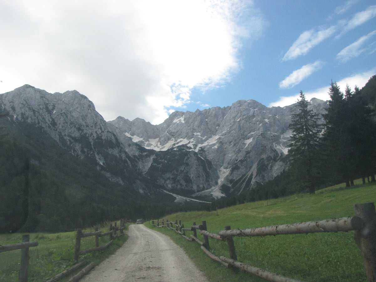
Kamnik and the Upper Savinja Valley
The Kamnik-Savinja Alps, Slovenia's other great range

- Highest peak
- Grintovec, 2,558 m
- Rank
- Slovenia's second-highest range
Map
Where Kamnik-Savinja Alps is
The Julian Alps, Triglav and the Soča valley lie to the north-west; Ljubljana sits in the centre; the Karst, its caves and the 47 km of coast are to the south-west, and Maribor, Ptuj and the Prekmurje plains to the east. Every number opens its guide.
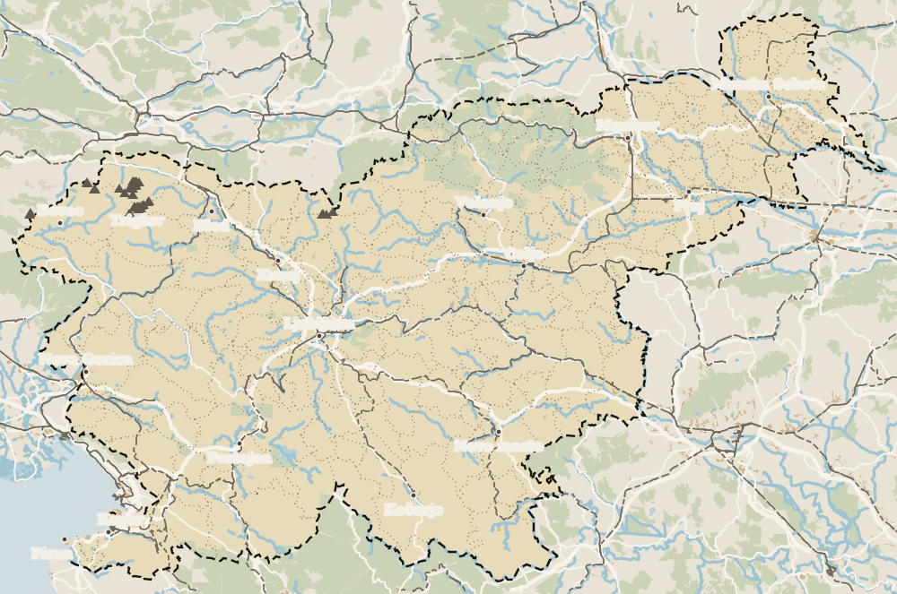 1Celje 2Velenje 3Savinjska 4Laško 5Rogaška Slatina 6Podčetrtek 7Dobrna 8Zreče 9Slovenske Konjice 10Vitanje 11Šoštanj 12Žalec 13Kamnik-Savinja Alps 14Pekel Cave 15Solčava 16Gornji Grad 17Nazarje 18Vransko 19Šentjur 20Mozirje 21Rečica ob Savinji 22Šmartno ob Paki
Map data © OpenStreetMap contributors (ODbL)
- 1CeljeTown in Savinjska
- 2VelenjeTown in Savinjska
- 3SavinjskaSavinjska statistical region
- 4LaškoSavinja valley
- 5Rogaška SlatinaSpa town in Savinjska
- 6PodčetrtekSotla valley, Savinjska
- 7DobrnaSpa town in Savinjska
- 8ZrečePohorje, Savinjska
- 9Slovenske KonjiceDravinja valley, Savinjska
- 10VitanjePohorje, Savinjska
- 11ŠoštanjŠalek valley, Savinjska
- 12ŽalecSavinja valley
- 13Kamnik-Savinja AlpsKamnik and the Upper Savinja Valley
- 14Pekel CaveKarst cave in Savinjska
- 15SolčavaUpper Savinja valley
- 16Gornji GradUpper Savinja valley
- 17NazarjeUpper Savinja valley
- 18VranskoLower Savinja valley
- 19ŠentjurSavinjska, near Celje
- 20MozirjeUpper Savinja Valley
- 21Rečica ob SavinjiUpper Savinja Valley
- 22Šmartno ob PakiPaka Valley, Savinjska
The Kamnik-Savinja Alps are Slovenia's second-highest mountain range, according to the Slovenian Tourist Board, with peaks over 2,000 m between Kamnik, the Upper Savinja Valley and Jezersko. The highest is Grintovec, 2,558 m, and below it open glacial valleys such as Logar Valley and the Kamniška Bistrica valley, with more than 500 climbing routes.
For me they are the great, quieter alternative to the Julian Alps. I'd go in through Logar Valley for the Rinka waterfall and through the Kamniška Bistrica valley to reach a saddle, and for the summits I'd hire a mountain guide, as the tourist board advises.
What I would check before going
The essentials in a few lines
Full read: 2 min
- Slovenia's second-highest mountain chain.
- Grintovec, 2,558 m, the highest peak.
- Logar Valley, Rinka and the Kamniška Bistrica valley.
- More than 500 climbing routes.
The practical bit
Before you go to Savinjska, this
-
01 Most beautiful
The roof of the range
Grintovec's southern slope is called Streha, the roof, because of its shape, and the summit is known as accessible because it needs no fixed protection, according to Kamnik tourism.
-
02 Worth the splurge
The Archduke's Table
In the Kamniška Bistrica valley there's a stone table called the Archduke's Table, where Archduke Charles II and his entourage ate after a hunt.
-
03 Getting there
The best-known glacial valley
Logar Valley, on the north side of the range, is one of the most beautiful glacial valleys in Europe according to the tourist board, with the Rinka waterfall at its head.
Logar Valley -
04 My tip
A guide for the summits
The tourist board recommends climbing the 2,000 m peaks with mountain guides.
Bookings I would make
What the Kamnik-Savinja Alps are
The tourist board speaks of peaks above 2,000 m, best climbed with mountain guides, and of an amphitheatre of summits enclosing the Upper Savinja Valley. The highest is Grintovec, at 2,558 m. Tourism in Kamnik explains that it’s popular because no pegs are needed to reach the top, and that its southern slope is called Streha, the roof, because of its shape. The heart of the range has more than 500 climbing routes.
From Kamnik and the Kamniška Bistrica valley
From the south, the gateway is the valley of the Kamniška Bistrica, a 33 km river that Kamnik tourism counts among the cleanest in the country. You can drink straight from its spring, a kilometre downstream is the Predaselj gorge, where the river cuts up to 30 m deep, and in the side valley of the Kamniška Bela the Orglice waterfall drops 30 m. Routes lead from the spring to saddles with mountain huts, such as the Kamnik Saddle, and to peaks like Brana and Planjava. Above the valley spreads the shepherds’ plateau of Velika planina. Lower down stands a stone table known as the Archduke’s Table, where Archduke Charles II and his entourage ate after one of their many hunts in the valley.
From Logar Valley and the Upper Savinja
To the north, the range wraps around the valleys of Solčava. Logar Valley, a glacial valley and landscape park, ends below the walls where the 90 m Rinka waterfall falls. Beside it lie Robanov kot, another glacial valley, and Matkov kot, where people try archery beneath the peaks. The Solčava Panoramic Road is, according to the tourist board, the area’s route with the finest views. In Solčava, which belongs to the UN Tourism Best Tourism Villages network, the Rinka Centre has an exhibition on how people in the Savinja Alps live alongside nature. The same board explains that Slovenia’s largest waterfalls are found mainly in the Julian Alps and in this range.
If you are staying the night, see the best hotel deals in Kamnik for your dates: the well-placed rooms go fast.
Seeing them without climbing
You don’t have to climb to enjoy them. From the Menina planina plateau, on the border between Kranjska and Štajerska, a viewing tower on Vivodnik gives a sweeping view of the Kamnik-Savinja Alps, according to the tourist board.
Fitting them into a trip
I’d use two bases, one in Kamnik and one in the Upper Savinja Valley, in Savinjska. Three or four days are enough to see both sides of the range properly, and experienced hikers can add a summit with a guide.
So you do not lose the morning at the ticket office, browse tickets and tours in Kamnik on GetYourGuide.
If you are staying the night, see the best hotel deals in Kamnik for your dates: the well-placed rooms go fast.
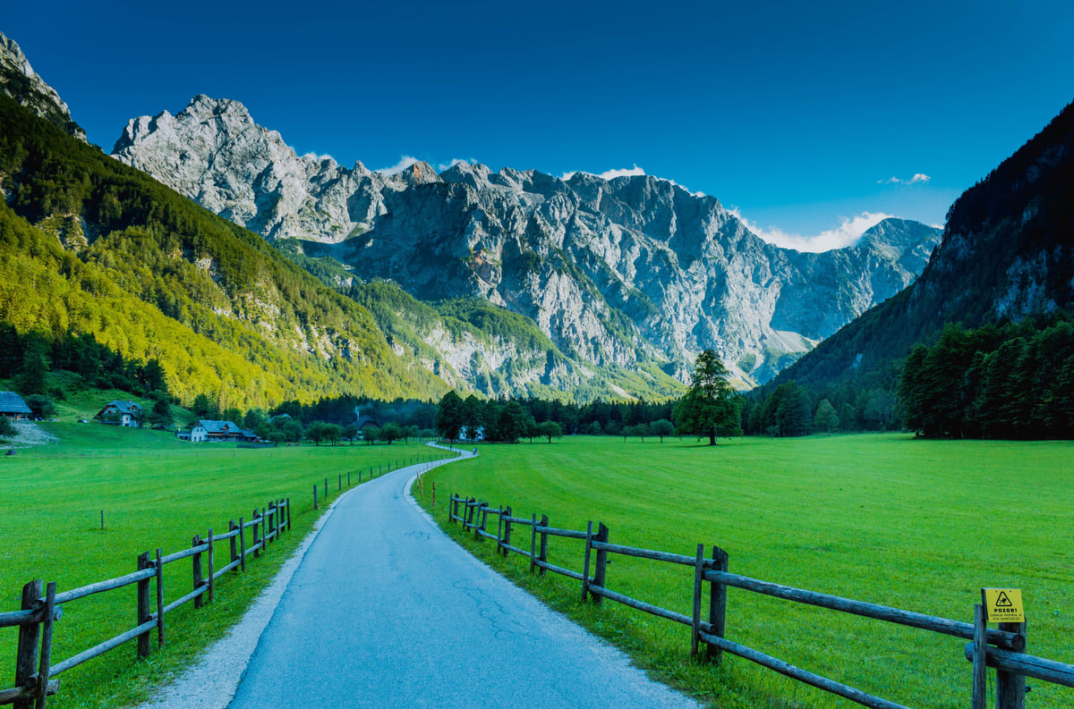
A track between wooden fences through the meadows of the Logar Valley, ringed by forest and Kamnik-Savinja Alps walls
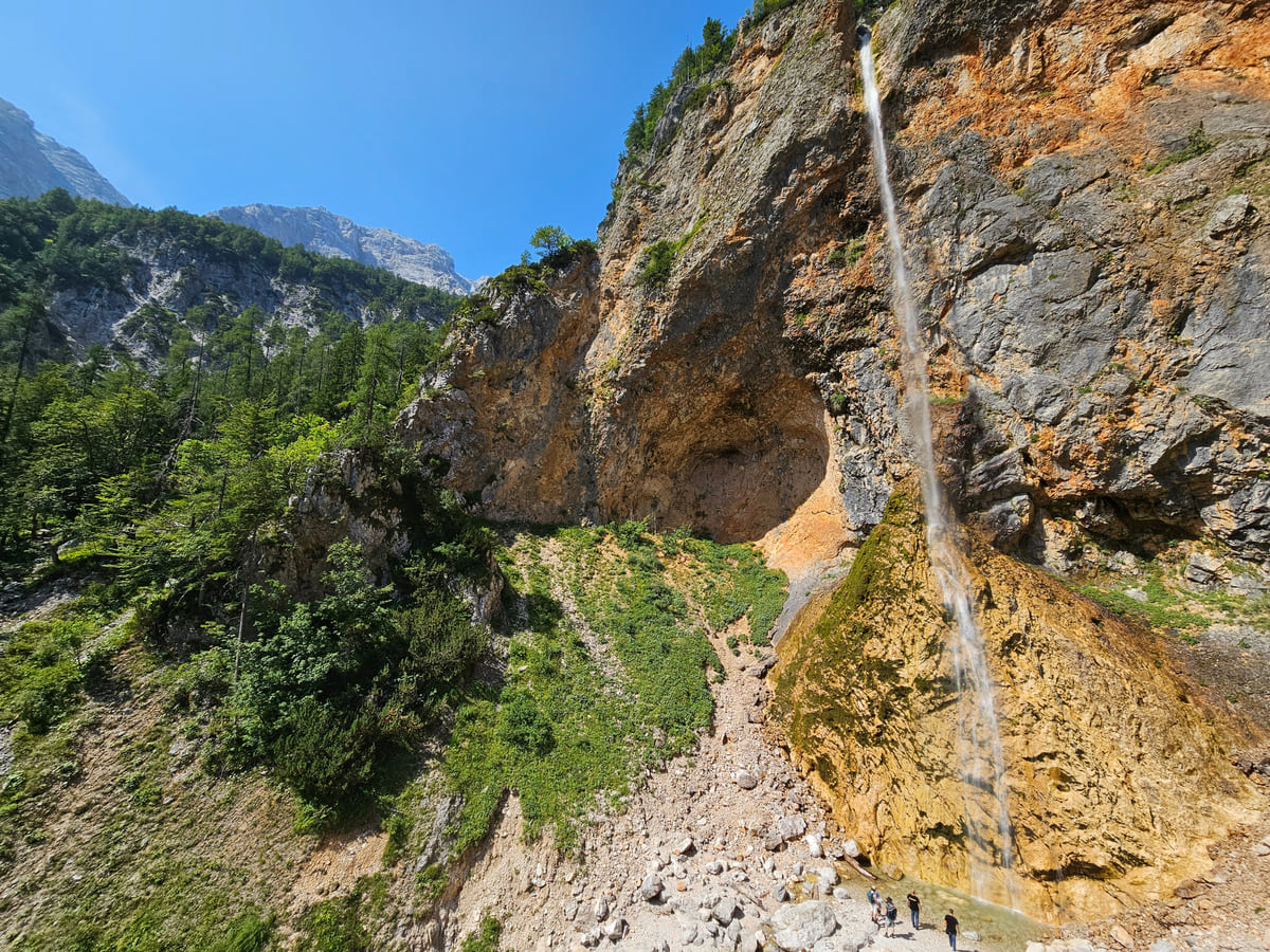
The Rinka waterfall falling down an orange rock face at the head of the Logar Valley, with forest and blue sky
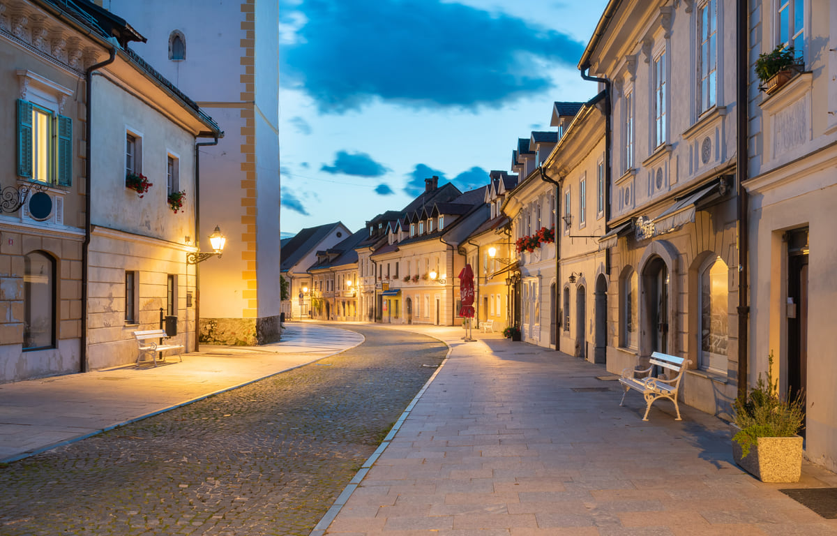
Šutna street in Kamnik at dusk, with the street lamps lit, colourful façades and the curving cobbled pavement
Test yourself
True or false?
0/3 Pick before you peek.
-
Grintovec is the highest mountain in Slovenia.
See the answer
False. It's the highest in the Kamnik-Savinja Alps, the country's second range. Slovenia's highest peak is in the Julian Alps.
-
The climb up Grintovec doesn't need fixed protection.
See the answer
True. Kamnik tourism says it's popular because of its easy access, with no pegs needed.
-
The Orglice waterfall is about 30 m high.
See the answer
True. It's in the side valley of the Kamniška Bela, according to Kamnik tourism.
Frequently asked questions
What is the highest mountain?
Grintovec, at 2,558 m, according to Kamnik tourism. Its southern slope is called Streha because of its shape, the roof of the Kamnik-Savinja Alps.
How do you get into the range?
From Kamnik up the Kamniška Bistrica valley, from the Upper Savinja Valley via Solčava and Logar Valley, and from Jezersko in the west.
What can you see without climbing the peaks?
Logar Valley and the Rinka waterfall, the Solčava Panoramic Road, the Kamniška Bistrica spring, the Predaselj gorge, the Orglice waterfall and the Velika planina shepherds' plateau.
Is there climbing?
Yes. Kamnik tourism speaks of more than 500 climbing routes in the heart of the range.
What is Velika planina?
A shepherds' plateau above Kamnik that the tourist board lists alongside the range and Logar Valley among the area's highlights.
0 of 425 Slovenia guides
Your next stamp
- Mountains
- Logar Valley
- Julian Alps
- Savinjska
- Mount Snežnik
- Gornji Grad
- Solčava
- Waterfalls
- Bogenšperk Castle
- Bogojina
- Debeli rtič
- Ig pile dwellings
- Jeruzalem
- Kolpa River
- Koper
- Lake Cerknica
- Lipica
- Ljubljana
- Ljubljana to Bled
- Mariborsko Pohorje
- Palace Portorož
- Park of Military History
- Plečnik House
- Postojna
- Postojna Cave
- Škocjan Caves
- Štanjel
- Tartini Square
- Trbovlje
- Županova jama
- Izola
- Kamnik
- Karst
- Ljubljana to Postojna
- Lovrenc Lakes
- Maribor
- Portorož
- Predjama Castle
- Things to do in Ljubljana
- Travel guide
- Vilenica Cave
- Zagorje ob Savi
- Celje
- Cerknica
- Domžale
- Hrastnik
- Ljubljana in a day
- Ljubljana to Piran
- Piran
- Slovenian Istria
- Strunjan
- Things to do
- Activities
- Ankaran
- Grosuplje
- Litija
- Ljubljana in two days
- Pivka
- Sečovlje salt pans
- Velenje
- Brežice Castle
- Getting around Ljubljana
- Ilirska Bistrica
- Mežica Mine
- Most beautiful places
- Novo mesto
- Sevnica Castle
- Terme Olimia
- Vrhnika
- Žiče Charterhouse
- Dolenjska
- Ig
- Prettiest villages
- Ptuj
- Sežana
- Divača
- Medvode
- Murska Sobota
- Posavje
- World Heritage
- Hrpelje-Kozina
- Logatec
- Map
- Mengeš
- Brezovica
- Komen
- Where is Slovenia
- Bled
- Brežice
- Čatež ob Savi
- Celje Castle
- Coal Mining Museum
- Gorenjska
- Hotels in Piran
- Hrastovlje
- Karawanken Geopark
- Koroška
- Kostanjevica Cave
- Kostel Castle
- Krokar primeval forest
- Kurentovanje
- Lent
- Ljubljana Castle
- Ljubljana Cathedral
- Oldest vine in the world
- Olimje
- Otočec
- Regions
- Rimske Toplice
- Rinka Waterfall
- Rogla
- Sava River
- Slovenj Gradec
- Topolšica
- Velika Planina
- Goriška
- Krško
- Lake Bled
- Municipalities
- Podravje
- Prešeren Square
- Ravne na Koroškem
- Restaurants in Piran
- Škocjan Inlet
- Volčji Potok Arboretum
- Bled Island
- Cities
- Mežica
- Pomurje
- Sevnica
- Socerb Castle
- Bled Castle
- Coast and Karst
- Dravograd
- Kostanjevica na Krki
- Population
- Notranjska
- Ojstrica viewpoint
- Radlje ob Dravi
- Size
- Central Slovenia
- Language
- Mislinja
- Plečnik's Ljubljana
- Slovenska Bistrica
- Vila Bled
- Currency
- Grand Hotel Toplice
- Ormož
- Zasavje
- EU and Schengen
- Hotel Savica Garni
- Hotels in Bled
- Pohorje
- Haloze
- History
- Restaurants in Bled
- Flag and symbols
- Hoče-Slivnica
- Bizeljsko
- Bohinj
- Christmas in Ljubljana
- City Hotel Ljubljana
- Gorjanci
- Kranj
- Krka River
- Laško
- Moravske Toplice
- Ptuj Castle
- Public holidays
- Rajhenburg Castle
- Šentilj
- Slovenia beaches
- Šmartno pri Litiji
- Uršlja Gora
- Brdo Castle
- Independence Day
- Lake Bohinj
- Ljubljana Festival
- Radenci
- Rogaška Slatina
- Day trips from Ljubljana
- Jesenice
- Lendava
- Podčetrtek
- Savica waterfall
- Time zone
- Dobrna
- Facts
- Ljubljana nightlife
- Ljutomer
- Nova Gorica
- Vogel
- Bohinjska Bistrica
- Gornja Radgona
- Ljubljana Old Town
- Slovenia and Croatia
- Solkan
- Zreče
- Grad
- Sabotin
- Slovenia, Italy and Austria
- Slovenske Konjice
- Stara Fužina
- Trnovo
- Goričko
- Holidays and tours
- Hotels in Bohinj
- Škofja Loka
- Vitanje
- Škofja Loka Castle
- Slovenia or Slovakia
- Šoštanj
- Veržej
- Slovenian phrases
- Slovenia in 3 days
- Bela krajina
- Caves in Slovenia
- Črnomelj
- Dragon Bridge
- Gorje
- Hiking
- Hotels in Maribor
- Kozjansko Regional Park
- Kranjska Gora
- Lake Ptuj
- Ljubljana Marshes
- Slovenia in 5 days
- Vinarium Tower
- Where to stay in Ljubljana
- Žalec
- Metlika
- Slovenia castles
- Slovenia in a week
- Slovenian Mountain Trail
- Triple Bridge
- Vintgar Gorge
- Vršič Pass
- Where to eat in Ljubljana
- Best viewpoints in Slovenia
- Central Market
- Juliana Trail
- Lake Jasna
- Road trip
- Semič
- Žirovnica
- Kočevje
- Metelkova
- Motorhome
- Museums in Slovenia
- Naklo
- Soča rafting
- Tržič
- Zelenci
- Jezersko
- Kostel
- Lake Planšar
- Skiing
- Slovenia with kids
- Slovenian Alpine Museum
- Tivoli Park
- Best time to visit
- Cerklje na Gorenjskem
- Cycling
- Dolenjske Toplice
- Ljubljanica river
- Mojstrana
- Šenčur
- Krvavec
- National Gallery
- Parenzana
- Peričnik waterfall
- Šmarješke Toplice
- Weather
- National and University Library
- Paragliding
- Slovenia in winter
- Strmol Castle
- Trebnje
- Vrata valley
- Climbing
- Events
- Martuljek waterfalls
- Žale
- Fly fishing
- In January
- Ljubljana museums
- National Museum of Slovenia
- Rateče
- Bovec
- Festival Lent
- Golf
- Hotels in Ptuj
- In February
- Nature parks
- Parking in Ljubljana
- Pekel Cave
- Planica
- Snežnik Castle
- In March
- Kranjska Gora ski resort
- Lakes
- Trenta
- Ziplines
- Alpe Adria Trail
- Hotels in Kranjska Gora
- In April
- Kanin
- Nazarje
- In May
- Rivers
- Virje waterfall
- Vransko
- Hotels in Bovec
- In June
- Šentjur
- Dobra Vila Bovec
- In July
- Ljubljana Card
- Mozirje
- Spas
- In August
- Nebesa Chalets
- Rečica ob Savinji
- In September
- Kobarid
- Šmartno ob Paki
- In October
- Kobarid Museum
- Hiša Franko
- In November
- In December
- Radovljica
- Železniki
- In spring
- Museum of Apiculture
- Žiri
- In summer
- Kropa
- Tolmin
- Brezje
- In autumn
- Metaldays
- Tolmin Gorges
- Begunje
- Javorca church
- Slovenia in 10 days
- Most na Soči
- Two weeks in Slovenia
- Idrija
- Ljubljana Marathon
- How to get there
- Idrija mercury mine
- Wild Lake
- Cerkno
- Flights
- Laufarji
- Divje babe
- Franja Partisan Hospital
- Ljubljana Airport
- Ajdovščina
- Nearby airports
- Venice to Ljubljana
- Vipava
- Vipavski Križ
- Zagreb to Ljubljana
- Brda
- Trains to Slovenia
- Getting around
- Šmartno
- Dobrovo Castle
- Trains
- Buses
- Car hire
- Triglav National Park
- Driving
- Pokljuka
- Triglav Lakes
- Vignette
- Mount Triglav
- Taxis
- Distances
- Soča Valley
- Soča River
- Trieste to Ljubljana
- Kozjak Waterfall
- Vienna to Ljubljana
- Boka Waterfall
- Budapest to Ljubljana
- Ljubljana to Maribor
- Walk of Peace
- Bled to Bohinj
- Mangart
- Lake Krn
- Prices and budget
- Slovenia on a budget
- Vipava Valley
- Free things to do
- Otlica Natural Window
- Entry requirements
- Rihemberk Castle
- Customs
- Safety
- Scams
- Bears
- Healthcare
- Mobile and roaming
- Plugs
- Packing list
- What to buy
- Hotels
- Campsites
- Farm stays
- Mountain huts
- Food
- Bled cream cake
- Wine
- Potica
- Prekmurska gibanica
- Štruklji
- Carniolan sausage
- Idrija žlikrofi
- Beer
- Tipping

Questions about Savinjska? Write to me
If something does not add up or a fact is missing, write to me and I will answer myself.
My email sergiolepone@gmail.com
By
Tourism graduate with a master’s in Tourism Management and Planning from the University of Málaga, who has travelled across Europe. He writes every guide from official sources and his own judgement.
Published on . Updated on . Facts checked on .
Sources
Some links in this guide are affiliate links: if you book through them, the site earns a commission at no extra cost to you. Affiliate disclosure
Photos: Swedenb (CC BY-SA 3.0); Jernej Furman from Maribor, Slovenia (CC BY 2.0); MPhernambucq (CC BY-SA 3.0); Krzysztof Golik (CC BY-SA 4.0), via Wikimedia Commons.