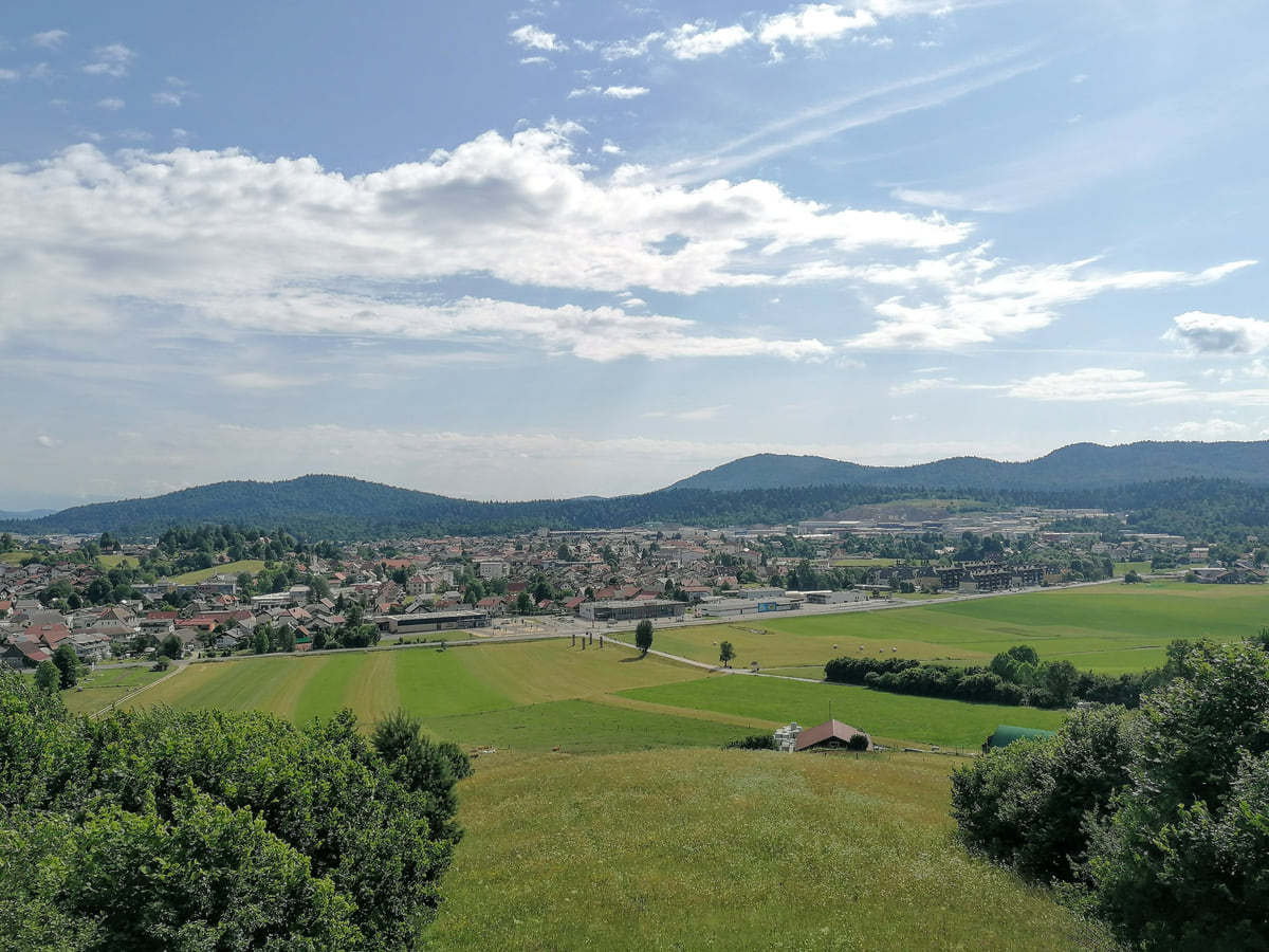
Central Slovenia town
Logatec, the town on the road between Ljubljana and the Karst

- Population
- 10,107 the town, 15,129 the municipality
- Municipality
- 173 km² and 19 settlements
Map
Where Logatec is
The Julian Alps, Triglav and the Soča valley lie to the north-west; Ljubljana sits in the centre; the Karst, its caves and the 47 km of coast are to the south-west, and Maribor, Ptuj and the Prekmurje plains to the east. Every number opens its guide.
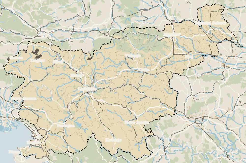 1Ljubljana 2Kamnik 3Domžale 4Grosuplje 5Vrhnika 6Ig 7Medvode 8Logatec 9Mengeš 10Brezovica 11Šmartno pri Litiji 12Ljubljana Marshes
Map data © OpenStreetMap contributors (ODbL)
- 1LjubljanaCapital of Slovenia
- 2KamnikTown in central Slovenia
- 3DomžaleTown in central Slovenia
- 4GrosupljeCentral Slovenia town
- 5VrhnikaCentral Slovenia town
- 6IgCentral Slovenia village
- 7MedvodeCentral Slovenia town
- 8LogatecCentral Slovenia town
- 9MengešCentral Slovenia village
- 10BrezovicaCentral Slovenia municipality
- 11Šmartno pri LitijiCentral Slovenia municipality
- 12Ljubljana MarshesLandscape park in central Slovenia
Things to see in Logatec, about 30 km from Ljubljana: the Planinsko polje, a karst field of some 11 km² that floods; Vranja jama cave; the Roman fort at Lanišče, the only rebuilt one of the Roman Alpine walls; and an avenue of 290 lime trees. It was Roman Longaticum, on the road from Emona to Aquileia. The town has 10,107 people and its municipality 15,129.
I'd start with the Planinsko polje and Vranja jama, the most striking sights, and come back via Kalce to climb up to the Lanišče fort. In town a stroll along the lime avenue and through Dolnji Logatec is enough. If the polje is flooded, all the better.
If you only read this
Full read: 4 min
- Logatec has 10,107 people and was Roman Longaticum.
- Lanišče has the only rebuilt fort of the Roman walls of the Julian Alps.
- Its avenue of 290 lime trees is linked to Napoleon's wedding.
- The Planinsko polje and Vranja jama lie within the municipality.
What I would book
My key points
Before you go to Logatec, this
-
01 Most beautiful
A polje that turns into a lake
The Planinsko polje floods several times a year, mostly in spring and autumn, and the water can stay for up to two months. The river Unica emerges from Planina Cave and vanishes down about 150 sinkholes.
-
02 Most beautiful
Olms in daylight
Olms live in Vranja jama, near Laze. When the water rises it reaches the entrance hall, and they can sometimes be seen in daylight. In winter ice stalactites form.
-
03 Getting there
The same wall at Vrhnika
Lanišče was part of the Claustra Alpium Iuliarum, the Roman wall system that runs for more than 10 km with 62 towers in the Vrhnika area.
Vrhnika -
04 My tip
Frequent buses on weekdays
On a Monday in late October 2026 there were 56 departures from Ljubljana to Logatec, but only 12 on the Saturday. At weekends, check the timetable first.
What to see: the Planinsko polje and Vranja jama
At the southern tip of the municipality, the Planinsko polje is a karst polje of about 11 km², at around 450 m, shared by Logatec, Postojna and Cerknica. The river Unica emerges from Planina Cave, winds across the plain and disappears down about 150 sinkholes. Several times a year, mostly in spring and autumn, the polje floods, and the water can stay for up to two months. It is the only place in Slovenia where a small threatened bulb plant grows, it has 78 species of butterfly and it is in the Natura 2000 network for the corncrake. The Unica is also prized by fly fishermen.
On the northern edge of the polje, near Laze and about 7 km from Logatec, Vranja jama opens a huge mouth at the bottom of a collapsed sinkhole. Entry is free with proper footwear and kit, and olms live in its lowest passage; they can sometimes be seen in daylight when the water rises into the entrance hall. In winter, cold air from the Mrzla jama forms ice stalactites.
The Roman fort at Lanišče
Near Kalce, at Lanišče, stands an almost square fort of 19.6 by 19.7 m with walls 1.6 m thick, built between the second half of the 3rd century and the early 4th. It closed the main road between Emona and Aquileia, halfway between Longaticum and the fortress of Ad Pirum at Hrušica. It was part of the Claustra Alpium Iuliarum, the late Roman chain of walls and towers running from present-day Rijeka to the Soča valley, which can also be seen at Vrhnika.
It was rebuilt in the early 1970s, and the municipality presents it as the only reconstructed example of the system in Slovenia. There are good views to the east from the site.
The lime avenue and the town
At the entrance to town, beside the old Trieste road, runs one of the longest tree-lined avenues in Slovenia, with 290 lime trees along 1.9 km. Local tradition says they were planted around 1805 to mark Napoleon’s marriage to Marie Louise of Austria, hence the names Louise’s avenue and later Napoleon’s avenue. During the Illyrian Provinces, from 1809 to 1813, Logatec briefly had its own municipality.
The Southern Railway reached Trieste in 1857 and put the carters out of business, but it brought sawmills, as many as nine, and Logatec station was built in 1897. In 1883 Emperor Franz Joseph, on his way to Idrija, slept at the Ipavec house in Gornji Logatec. After the fire of 1876, which destroyed most of the town, Friulian timber merchants arrived, and cast-iron fountains such as the Tollazzi one date from that time.
In Dolnji Logatec, St Nicholas’ church, first recorded in 1526, is a late Baroque building from the end of the 18th century, enlarged after the First World War. Opposite, a column topped by a bronze statue of the saint has stood in the square since 2006. The Renaissance castle in Gornji Logatec, owned in turn by the Kobenzl, Coronini and Windisch-Graetz families, is now private. The town’s holiday is 20 September, recalling the move of the district court from Planina in 1875, and there is a private military museum with one of the largest collections in the country.
To sleep close to everything, search places to stay in Logatec on Expedia and filter by area before price.
Logatec, on the road since Roman times
Logatec has 10,107 residents, and the municipality 15,129 across 19 settlements and 173 km², according to SURS. The municipality calls itself the heart of Notranjska, where the Alpine and Dinaric worlds meet, although statistically it belongs to central Slovenia. It borders Vrhnika, Idrija, Žiri, Ajdovščina, Postojna, Cerknica, Gorenja vas-Poljane and Dobrova-Polhov Gradec.
Its history is that of a crossroads. In the Iron Age there were hillforts on Velike Bukve, Brst and Strmica. The Romans had a staging post here, the mansio Longaticum, on the road from Emona, today’s Ljubljana, to Aquileia, and a small settlement in Gornji Logatec. That double origin explains the town’s split into Gornji and Dolnji Logatec. The name first appears in writing in 1265, as border land between the Patriarch of Aquileia and the Duke of Carinthia.
In the 16th century the Turks plundered Jakovica and Laze, in 1559, and Logatec had a toll house and a post station on the road from Ljubljana to Trieste and Gorizia. When Trieste became a free port in 1719, the carters filled the road. In March 1797 General Bernadotte, later King of Sweden, issued a proclamation here to the people of Carniola in French, German and Slovene.
Walks and getting there from Ljubljana
To the north-west, the Žejna dolina near Hotedršica is a boggy valley in the Natura 2000 network at about 575 m. Sekirica hill, 545 m, has footpaths, cross-country ski tracks when it snows and four ski jumps, and according to the municipality, Ženček and Sekirica are among the best places in Slovenia to learn paragliding. Logatec also has an indoor wind tunnel, Aerodium, where you fly with an instructor up to nine metres off the ground.
Logatec is about 30 km from Ljubljana on the coast motorway. By bus, the Ljubljana bus station search showed 56 departures on Monday 26 October 2026, taking 31 to 47 minutes, and 12 on Saturday 31 October. From here, Postojna and Lake Cerknica are close by. With 10,107 people, it is one of the country’s 18 towns of more than 10,000, as I explain in Slovenia’s cities.
If you are short on time, see the best tours in Logatec and pick one that fits your day.
To sleep close to everything, search places to stay in Logatec on Booking.com and filter by area before price.
What to see in and around Logatec
| Place | What it is |
|---|---|
| Lanišče fort (Kalce) | Roman fort of the 3rd and 4th centuries, the only rebuilt one of the Claustra |
| Napoleon's lime avenue | 290 lime trees along 1.9 km at the entrance to town |
| Church of St Nicholas (Dolnji Logatec) | Late Baroque church from the end of the 18th century |
| Planinsko polje | Karst polje of about 11 km² that floods |
| Vranja jama (Laze) | Free-entry cave with olms |
| Žejna dolina (Hotedršica) | Boggy valley in the Natura 2000 network |
| Church of the Three Kings | Former pilgrimage church of about 1698 |
Visit Logatec and the municipality of Logatec, checked on 19 Oct 2026.
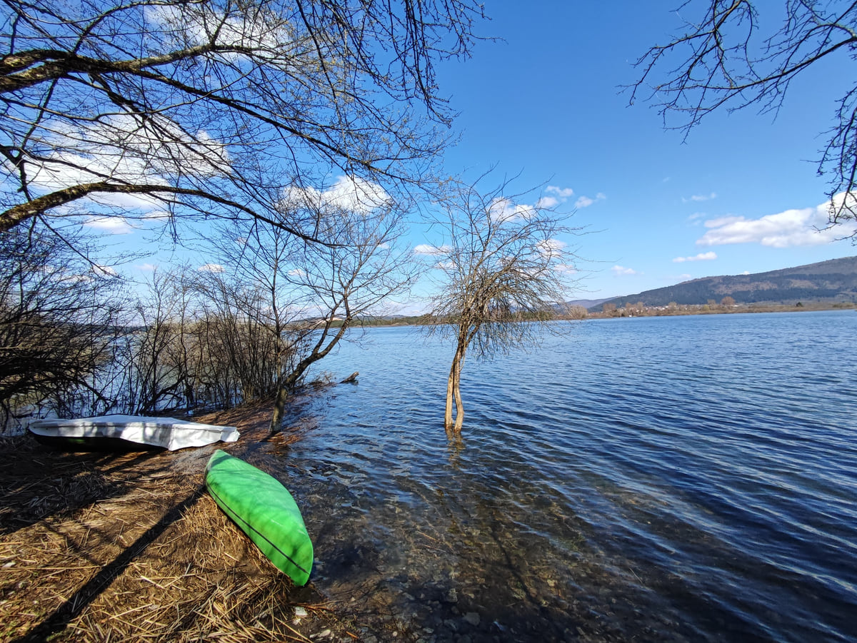
The shore of Lake Cerknica with two small boats on the grass, bare trees standing in the water and hills beyond
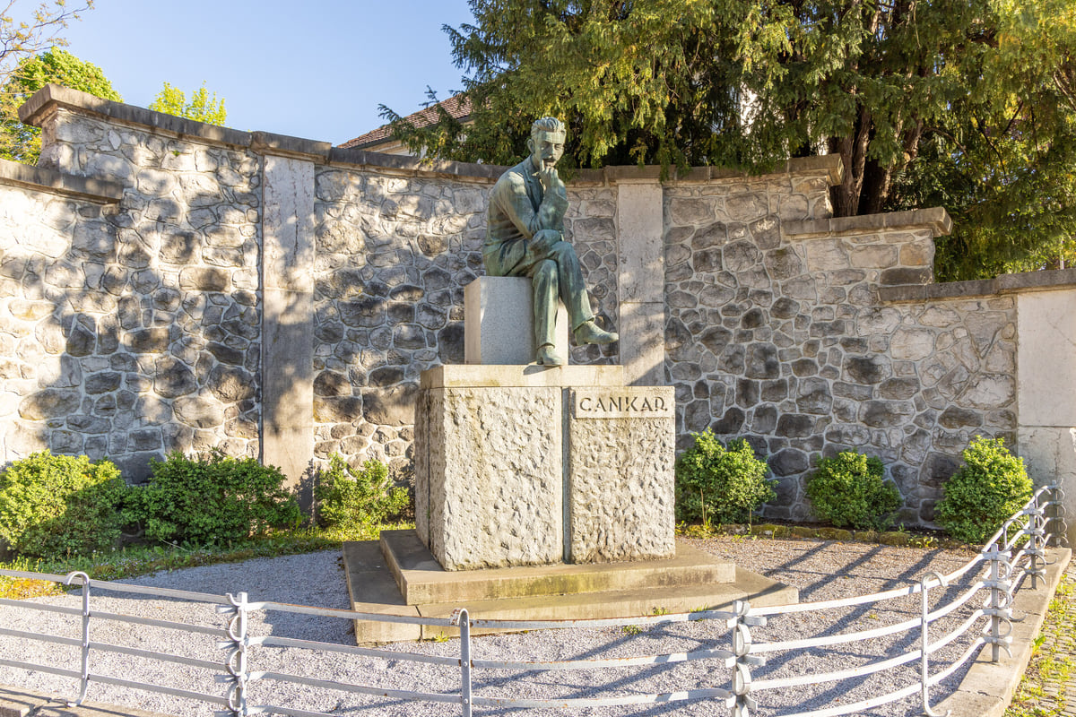
Monument to the writer Ivan Cankar against a stone wall in Vrhnika, the town where he was born in 1876
Test yourself
True or false?
0/3 Pick before you peek.
-
The Lanišče fort is the only large-scale rebuilt fort of the Claustra Alpium Iuliarum.
See the answer
True. It was rebuilt in the early 1970s, and the municipality presents it as the only reconstructed piece of that system in Slovenia.
-
The Planinsko polje lies entirely within Logatec municipality.
See the answer
False. Logatec, Postojna and Cerknica share it; the river Unica forms the boundary between them for much of its course.
-
Emperor Franz Joseph spent a night in Logatec.
See the answer
True. In 1883, on his way to Idrija, he stayed at the Ipavec house in Gornji Logatec, according to the municipality.
- People in the town
- 10,107
- Lime trees on Napoleon's avenue
- 290
- Planinsko polje, about
- 11 km²
- First written record
- 1265
Common questions about Logatec
What is there to see in Logatec?
In town, Napoleon's lime avenue, St Nicholas' church and Dolnji Logatec, the outside of the castle in Gornji Logatec and the military museum. Around it, the Roman fort at Lanišče, the Planinsko polje, Vranja jama cave and the Žejna dolina.
What is the Planinsko polje?
A karst polje of about 11 km² shared by the municipalities of Logatec, Postojna and Cerknica. The river Unica flows out of Planina Cave, crosses it and disappears down about 150 sinkholes, and the polje usually floods in spring and autumn.
What was the Claustra Alpium Iuliarum?
A late Roman system of walls and towers that closed the passes into Italy, running from present-day Rijeka to the Soča valley. Lanišče, near Kalce, has its only fort rebuilt on a large scale.
Why is it called Napoleon's avenue?
Local tradition says the lime trees were planted around 1805 to mark Napoleon's marriage to Marie Louise of Austria. It was first called Louise's avenue and later Napoleon's.
How do I get to Logatec from Ljubljana?
By car on the motorway towards the coast, about 30 km. By bus, the Ljubljana bus station search showed 56 departures on Monday 26 October 2026, taking 31 to 47 minutes, and 12 on Saturday 31 October.
Can I go into Vranja jama?
Yes, entry is free, but you need proper footwear and kit. It lies about 7 km south of Logatec, near Laze, at the bottom of a collapsed sinkhole. After heavy rain it floods up to the entrance hall.
0 of 425 Slovenia guides
Your next stamp
- Ajdovščina
- Vrhnika
- Sežana
- Brezovica
- Things to do
- Trebnje
- Litija
- Things to do in Ljubljana
- Bogenšperk Castle
- Bogojina
- Debeli rtič
- Ig pile dwellings
- Jeruzalem
- Kolpa River
- Koper
- Lake Cerknica
- Lipica
- Ljubljana
- Ljubljana to Bled
- Mariborsko Pohorje
- Mount Snežnik
- Palace Portorož
- Park of Military History
- Plečnik House
- Postojna
- Postojna Cave
- Škocjan Caves
- Štanjel
- Tartini Square
- Trbovlje
- Županova jama
- Izola
- Kamnik
- Karst
- Ljubljana to Postojna
- Lovrenc Lakes
- Maribor
- Portorož
- Predjama Castle
- Travel guide
- Vilenica Cave
- Zagorje ob Savi
- Celje
- Cerknica
- Domžale
- Hrastnik
- Ljubljana in a day
- Ljubljana to Piran
- Piran
- Slovenian Istria
- Strunjan
- Activities
- Ankaran
- Grosuplje
- Ljubljana in two days
- Pivka
- Sečovlje salt pans
- Velenje
- Brežice Castle
- Getting around Ljubljana
- Ilirska Bistrica
- Mežica Mine
- Most beautiful places
- Novo mesto
- Sevnica Castle
- Terme Olimia
- Žiče Charterhouse
- Dolenjska
- Ig
- Prettiest villages
- Ptuj
- Divača
- Medvode
- Murska Sobota
- Posavje
- World Heritage
- Hrpelje-Kozina
- Map
- Mengeš
- Komen
- Savinjska
- Where is Slovenia
- Bled
- Brežice
- Čatež ob Savi
- Celje Castle
- Coal Mining Museum
- Gorenjska
- Hotels in Piran
- Hrastovlje
- Karawanken Geopark
- Koroška
- Kostanjevica Cave
- Kostel Castle
- Krokar primeval forest
- Kurentovanje
- Lent
- Ljubljana Castle
- Ljubljana Cathedral
- Logar Valley
- Oldest vine in the world
- Olimje
- Otočec
- Regions
- Rimske Toplice
- Rinka Waterfall
- Rogla
- Sava River
- Slovenj Gradec
- Topolšica
- Velika Planina
- Goriška
- Krško
- Lake Bled
- Municipalities
- Podravje
- Prešeren Square
- Ravne na Koroškem
- Restaurants in Piran
- Škocjan Inlet
- Volčji Potok Arboretum
- Bled Island
- Cities
- Mežica
- Pomurje
- Sevnica
- Socerb Castle
- Bled Castle
- Coast and Karst
- Dravograd
- Kostanjevica na Krki
- Population
- Notranjska
- Ojstrica viewpoint
- Radlje ob Dravi
- Size
- Central Slovenia
- Language
- Mislinja
- Plečnik's Ljubljana
- Slovenska Bistrica
- Vila Bled
- Currency
- Grand Hotel Toplice
- Ormož
- Zasavje
- EU and Schengen
- Hotel Savica Garni
- Hotels in Bled
- Pohorje
- Haloze
- History
- Restaurants in Bled
- Flag and symbols
- Hoče-Slivnica
- Bizeljsko
- Bohinj
- Christmas in Ljubljana
- City Hotel Ljubljana
- Gorjanci
- Kranj
- Krka River
- Laško
- Moravske Toplice
- Ptuj Castle
- Public holidays
- Rajhenburg Castle
- Šentilj
- Slovenia beaches
- Šmartno pri Litiji
- Uršlja Gora
- Brdo Castle
- Independence Day
- Lake Bohinj
- Ljubljana Festival
- Radenci
- Rogaška Slatina
- Day trips from Ljubljana
- Jesenice
- Lendava
- Podčetrtek
- Savica waterfall
- Time zone
- Dobrna
- Facts
- Ljubljana nightlife
- Ljutomer
- Nova Gorica
- Vogel
- Bohinjska Bistrica
- Gornja Radgona
- Ljubljana Old Town
- Slovenia and Croatia
- Solkan
- Zreče
- Grad
- Sabotin
- Slovenia, Italy and Austria
- Slovenske Konjice
- Stara Fužina
- Trnovo
- Goričko
- Holidays and tours
- Hotels in Bohinj
- Škofja Loka
- Vitanje
- Škofja Loka Castle
- Slovenia or Slovakia
- Šoštanj
- Veržej
- Slovenian phrases
- Slovenia in 3 days
- Bela krajina
- Caves in Slovenia
- Črnomelj
- Dragon Bridge
- Gorje
- Hiking
- Hotels in Maribor
- Kozjansko Regional Park
- Kranjska Gora
- Lake Ptuj
- Ljubljana Marshes
- Slovenia in 5 days
- Vinarium Tower
- Where to stay in Ljubljana
- Žalec
- Metlika
- Slovenia castles
- Slovenia in a week
- Slovenian Mountain Trail
- Triple Bridge
- Vintgar Gorge
- Vršič Pass
- Where to eat in Ljubljana
- Best viewpoints in Slovenia
- Central Market
- Juliana Trail
- Lake Jasna
- Road trip
- Semič
- Žirovnica
- Kočevje
- Metelkova
- Motorhome
- Museums in Slovenia
- Naklo
- Soča rafting
- Tržič
- Zelenci
- Jezersko
- Kostel
- Lake Planšar
- Skiing
- Slovenia with kids
- Slovenian Alpine Museum
- Tivoli Park
- Best time to visit
- Cerklje na Gorenjskem
- Cycling
- Dolenjske Toplice
- Ljubljanica river
- Mojstrana
- Šenčur
- Krvavec
- National Gallery
- Parenzana
- Peričnik waterfall
- Šmarješke Toplice
- Weather
- National and University Library
- Paragliding
- Slovenia in winter
- Strmol Castle
- Vrata valley
- Climbing
- Events
- Martuljek waterfalls
- Žale
- Fly fishing
- In January
- Ljubljana museums
- National Museum of Slovenia
- Rateče
- Bovec
- Festival Lent
- Golf
- Hotels in Ptuj
- In February
- Kamnik-Savinja Alps
- Nature parks
- Parking in Ljubljana
- Pekel Cave
- Planica
- Snežnik Castle
- Solčava
- Gornji Grad
- In March
- Kranjska Gora ski resort
- Lakes
- Trenta
- Ziplines
- Alpe Adria Trail
- Hotels in Kranjska Gora
- In April
- Kanin
- Nazarje
- Waterfalls
- In May
- Rivers
- Virje waterfall
- Vransko
- Hotels in Bovec
- In June
- Mountains
- Šentjur
- Dobra Vila Bovec
- In July
- Ljubljana Card
- Mozirje
- Spas
- In August
- Nebesa Chalets
- Rečica ob Savinji
- In September
- Kobarid
- Šmartno ob Paki
- In October
- Kobarid Museum
- Hiša Franko
- In November
- In December
- Radovljica
- Železniki
- In spring
- Museum of Apiculture
- Žiri
- In summer
- Kropa
- Tolmin
- Brezje
- In autumn
- Metaldays
- Tolmin Gorges
- Begunje
- Javorca church
- Slovenia in 10 days
- Most na Soči
- Two weeks in Slovenia
- Idrija
- Ljubljana Marathon
- How to get there
- Idrija mercury mine
- Wild Lake
- Cerkno
- Flights
- Laufarji
- Divje babe
- Franja Partisan Hospital
- Ljubljana Airport
- Nearby airports
- Venice to Ljubljana
- Vipava
- Vipavski Križ
- Zagreb to Ljubljana
- Brda
- Trains to Slovenia
- Getting around
- Šmartno
- Dobrovo Castle
- Trains
- Buses
- Julian Alps
- Car hire
- Triglav National Park
- Driving
- Pokljuka
- Triglav Lakes
- Vignette
- Mount Triglav
- Taxis
- Distances
- Soča Valley
- Soča River
- Trieste to Ljubljana
- Kozjak Waterfall
- Vienna to Ljubljana
- Boka Waterfall
- Budapest to Ljubljana
- Ljubljana to Maribor
- Walk of Peace
- Bled to Bohinj
- Mangart
- Lake Krn
- Prices and budget
- Slovenia on a budget
- Vipava Valley
- Free things to do
- Otlica Natural Window
- Entry requirements
- Rihemberk Castle
- Customs
- Safety
- Scams
- Bears
- Healthcare
- Mobile and roaming
- Plugs
- Packing list
- What to buy
- Hotels
- Campsites
- Farm stays
- Mountain huts
- Food
- Bled cream cake
- Wine
- Potica
- Prekmurska gibanica
- Štruklji
- Carniolan sausage
- Idrija žlikrofi
- Beer
- Tipping

Questions about Logatec? Write to me
I read every email. If a fact is wrong or missing, tell me and I will check it.
My email sergiolepone@gmail.com
By
Tourism graduate with a master’s in Tourism Management and Planning from the University of Málaga, who has travelled across Europe. He writes every guide from official sources and his own judgement.
Published on . Updated on . Facts checked on .
Sources
Some links in this guide are affiliate links: if you book through them, the site earns a commission at no extra cost to you. Affiliate disclosure
Photos: Andrejj (CC BY-SA 4.0); Ajznponar (CC0); Yerpo (CC BY-SA 4.0), via Wikimedia Commons.