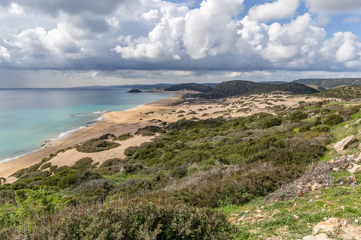
Famagusta district, in the north of Cyprus
The Karpas Peninsula, the north-eastern finger of Cyprus
The Karpas Peninsula (Karpasia in Greek, Karpaz in Turkish) is the long strip of land that forms the north-east of Cyprus, in the north of the island. The Technical Committee on Cultural Heritage has restored the church of Agios Philon in ancient Karpasia, the churches of Afendrika and Apostolos Andreas Monastery at the tip.
In 30 seconds
Full read: 2 min
- Karpas is the long peninsula of north-east Cyprus, in the north of the island.
- Ancient Karpasia stood here, with the church of Agios Philon.
- The bicommunal committee has restored its basilicas and Apostolos Andreas Monastery.
- Golden Beach is its great beach.
- You get there by car via the Deryneia crossing.
The peninsula needs a whole day and I wouldn't rush it. I'd drive straight to the tip in the morning and come back via Golden Beach, Rizokarpaso and Agios Philon, stopping wherever the light is best.

Before you go
What I would keep in mind
-
01 Most beautiful
Agios Philon by the sea
A 12th-century Byzantine church built over the 5th-century cathedral basilica of ancient Karpasia, with marble floors in opus sectile.
-
02 Getting there
Apostolos Andreas at the tip
St Andrew's monastery closes off the peninsula, restored between 2014 and 2016 with money from both communities.
Apostolos Andreas Monastery -
03 My tip
Kantara at the start
Kantara Castle, the easternmost of the three in the Kyrenia range, sits in the hills at the base of the peninsula.
Kantara Castle -
04 Money
Fuel and cash
It's a long drive and prices are in Turkish lira, though euros are usually taken. Fill up first and carry some cash.
Cyprus currency
What I would book
The Karpas Peninsula is the long finger the island stretches out to the north-east, and all of it lies in the north of Cyprus. Exploring it means crossing the Green Line by car, taking the insurance and documents listed in crossing to Northern Cyprus, while the general advice is in Northern Cyprus.
Karpasia, the city that named the peninsula
The bicommunal Technical Committee on Cultural Heritage explains that the ancient city of Karpasia gave its name to the whole peninsula and lay about 3.5 km north-east of the village of Rizokarpaso (Dipkarpaz). Only a small part has been dug, between 1935 and 1938. The most visible piece is Agios Philon, a 12th-century Byzantine church raised over the nave of a 5th-century cathedral basilica, with a baptistery and marble floors in opus sectile. The sea has swallowed the atrium, which tells you how close to the water the city stood. The committee consolidated it between May 2018 and January 2019.
About 20 km to the south-west, the rural basilica of Agia Triada belonged to that bishopric, and the committee has cleaned and secured its mosaics.
Afendrika and the churches of the area
On the north coast of the peninsula, Afendrika holds the remains of a harbour town that the British archaeologist David George Hogarth, in 1889, and the Cypriot scholar Ieronymos Peristianis, in 1910, identified with the Ourania of ancient writers. Three ruined churches survive, Panagia Afendrika, Asomatos and Agios Georgios, which the committee made safe with emergency works in late 2020.
The church of Archangelos Michael, the main one in the Karpasia area according to the committee, is really two churches joined together. One is Byzantine, with a dome and an apse with features rarely found on Cyprus, and the other was added around 1794.
To sleep close to everything, search places to stay in Protaras on Expedia and filter by area before price.
Golden Beach and the donkeys
Golden Beach, about 14 km in a straight line from Rizokarpaso, is the beach in every photo of Karpas. English Wikipedia calls it one of the island’s most remote and says the peninsula is a nesting ground for loggerhead and green turtles and home to the Karpas donkey. I have no official source for those details, so I leave them attributed and without figures.
The end of the road
At the tip stands Apostolos Andreas Monastery, and in the hills at the base of the peninsula, Kantara Castle. From the Deryneia crossing to Rizokarpaso it’s about 70 km in a straight line, more by road. Opening times and prices for the sites aren’t published anywhere I can cite, and I’d head back to sleep in Protaras.
If you are short on time, see the best tours in Karpas Peninsula and pick one that fits your day.
Where the bus does not go, a car does: compare car hire in Protaras before you arrive rather than at the desk.
To sleep close to everything, search places to stay in Protaras on Booking.com and filter by area before price.
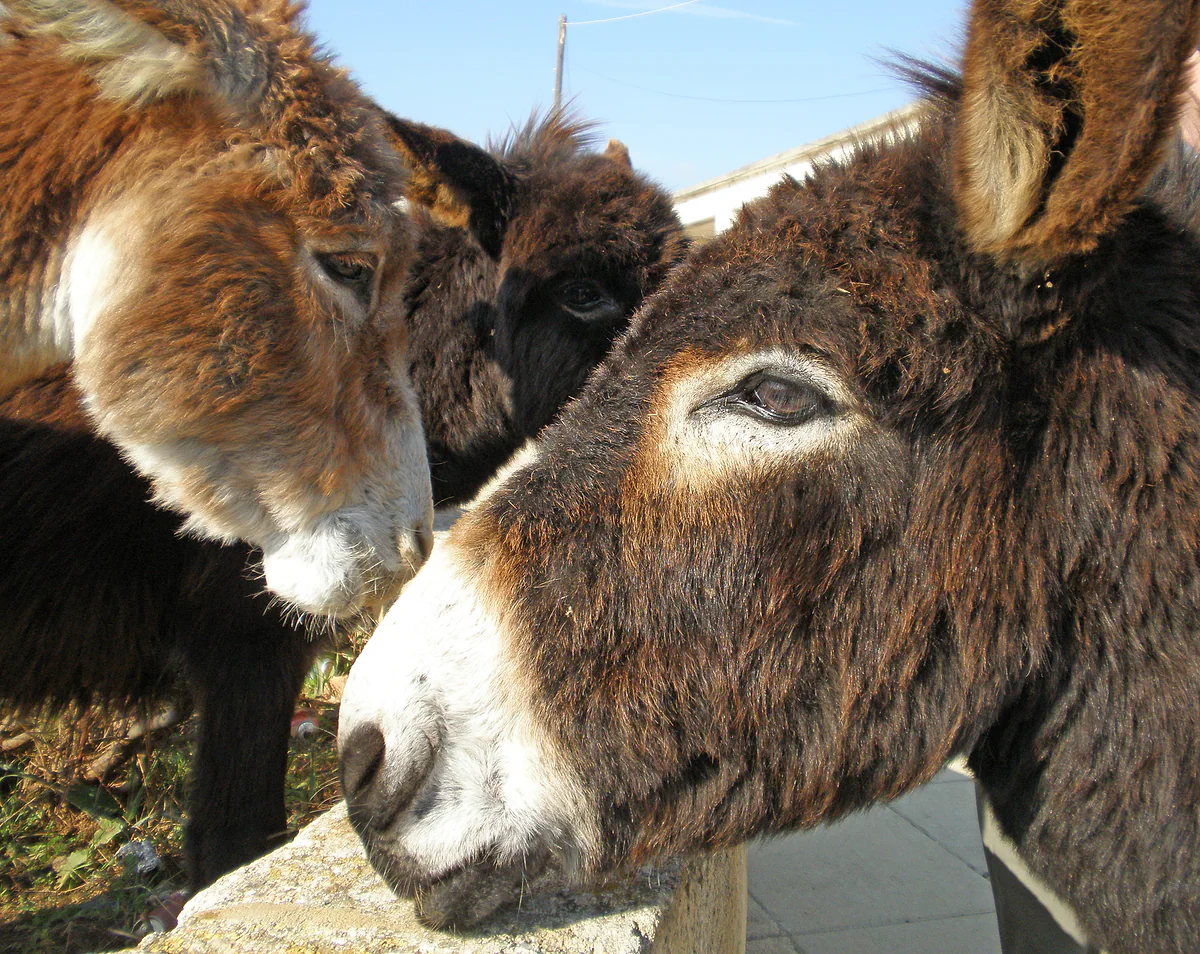
Two brown donkeys leaning over a wall on the Karpas Peninsula, in the north-east of Cyprus, looking at the camera
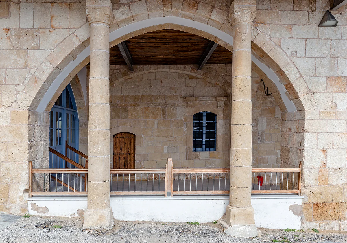
The pointed-arch porch of a building at Apostolos Andreas Monastery, in pale stone, with wooden doors and a balcony
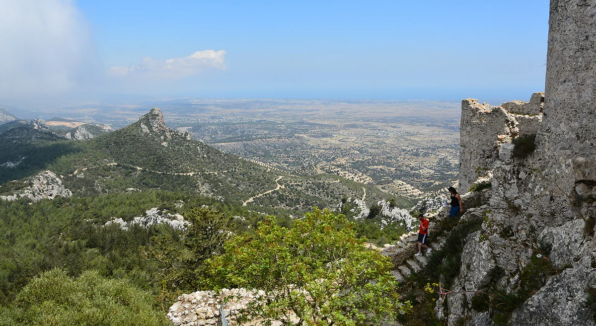
The view from Kantara Castle over the Kyrenia range and the plain down to the sea, beside a wall of the fortress
What the bicommunal committee has restored on Karpas
| Site | What it is | Works |
|---|---|---|
| Agios Philon | 12th-century church over the 5th-century cathedral basilica of ancient Karpasia | May 2018 to January 2019 |
| Afendrika | Ancient Ourania with three churches, Panagia Afendrika, Asomatos and Agios Georgios | October to December 2020 |
| Agia Triada | Mosaics of a rural basilica under the see of Karpasia | From October 2018 |
| Archangelos Michael | Twin church, Byzantine and 1794, the main church of the Karpasia area | October 2019 to October 2020 |
| Apostolos Andreas | St Andrew's monastery, at the tip | September 2014 to November 2016 |
Technical Committee on Cultural Heritage, project sheets and 2022 brochure, checked on 4 October 2026.
Straight-line distances
| Stretch | Distance |
|---|---|
| Rizokarpaso to Agios Philon | About 3.5 km |
| Rizokarpaso to Golden Beach | About 14 km |
| Rizokarpaso to Apostolos Andreas | About 19 km |
| Deryneia crossing to Rizokarpaso | About 70 km |
Worked out from OpenStreetMap coordinates, checked on 4 October 2026. By road they're a good deal longer.
Test yourself
True or false?
0/3 Pick before you peek.
-
Ancient Karpasia gave its name to the peninsula.
See the answer
True. So says the Technical Committee on Cultural Heritage, which places it about 3.5 km from Rizokarpaso.
-
Afendrika is identified with the ancient city of Ourania.
See the answer
True. The British archaeologist David George Hogarth in 1889 and the Cypriot scholar Ieronymos Peristianis in 1910 made the identification, according to the committee.
-
Karpas is in south-west Cyprus.
See the answer
False. It's the north-eastern end of the island.
- Excavations at Karpasia
- 1935-1938
- Church of Agios Philon
- 12th c.
- Deryneia to Rizokarpaso
- 70 km
Map
Where Karpas Peninsula is
The grey strip with green dashes across the island is the UN buffer zone, the Green Line; to the north is the part of the island not under the control of the Government of the Republic. The Troodos fill the centre and west. Every number opens its guide.
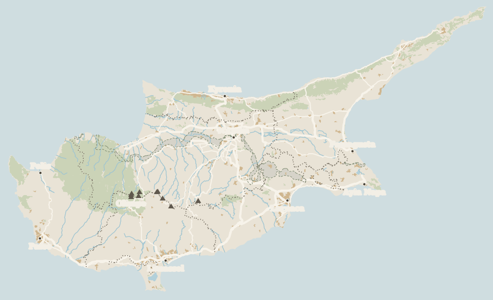 1Salamis 2Karpas Peninsula 3Ayia Napa 4Famagusta district 5Famagusta 6Cape Greco 7Protaras 8Paralimni 9Deryneia 10Kokkinochoria
 Map data © OpenStreetMap contributors (ODbL)
- 1SalamisFamagusta district, in the north of Cyprus
- 2Karpas PeninsulaFamagusta district, in the north of Cyprus
- 3Ayia NapaSouth-east coast, Famagusta district
- 4Famagusta districtSouth-east Cyprus
- 5FamagustaMain town of Famagusta district
- 6Cape GrecoBetween Ayia Napa and Protaras
- 7ProtarasFamagusta district
- 8ParalimniFamagusta district
- 9DeryneiaFamagusta district
- 10KokkinochoriaInland Famagusta district
What to see
What to see in Karpas Peninsula
0 of 421 Cyprus guides
Your next stamp
- Apostolos Andreas
- Famagusta district
- Kantara Castle
- Cyprus beaches
- Famagusta
- Places to visit
- Crossing to the north
- Map
- Almyra Hotel
- Anassa Hotel
- Anastasia Beach
- Aphrodite Hills Resort
- Bellapais Abbey
- Cap St Georges
- Church of St Lazarus
- Columbia Beach Resort
- Commandaria
- Coral Beach Hotel
- Cypriot food
- Dome Beach
- Four Seasons Limassol
- Golden Bay
- Grecian Park
- Hilton Nicosia
- Kourion
- Kyrenia Castle
- Larnaca
- Lefkara lace
- Limassol
- Limassol Carnival
- Meze
- Omodos
- Panagia Angeloktisti
- Selimiye Mosque
- Soli
- St Barnabas Monastery
- Weather
- Wine routes
- Atlantica Miramare
- Büyük Han
- Cheap eats
- Cyprus in winter
- Finikoudes
- Halloumi
- Kataklysmos
- Limassol Castle
- Narcissos
- Nissi Beach Resort
- Olympic Lagoon Paphos
- Othello Tower
- Sanctuary of Apollo Hylates
- Sea temperature
- Things to do
- Vouni
- Vouni Palace
- Alion Beach
- Cypriot desserts
- Cyprus in spring
- Elias Beach
- Golden Coast
- Koilani
- Kolossi Castle
- Lala Mustafa Pasha Mosque
- Larnaca Castle
- Leonardo Laura Beach
- Limassol old town
- Limassol Wine Festival
- Most beautiful places
- Souvla
- St Hilarion Castle
- Arsos
- Buffavento Castle
- Crystal Springs
- Cypriot wine
- Cyprus in summer
- Easter in Cyprus
- Episkopi
- Kition
- Kleftiko
- Limanaki Beach
- Molos promenade
- Pafos Aphrodite Festival
- Pagona
- Prettiest villages
- St Raphael Resort
- Adams Beach
- Akrotiri peninsula
- Alasia Hotel
- Bellapais
- Cyprus in autumn
- Elysium Hotel
- Green Monday
- Independence Day
- Limassol Marina
- Pierides Museum
- Sheftalia
- Sunrise Pearl
- UNESCO World Heritage
- Vasa Koilaniou
- Akrotiri salt lake
- Amathus Beach
- Christmas
- Cyprus in January
- Grecian Bay
- Larnaca Archaeological Museum
- Limassol old port
- Lofou
- Venus Beach Hotel
- Vrissiana
- Asterias Beach
- Capo Bay
- Cypriot coffee
- Cyprus in February
- Kamares Aqueduct
- Kefalos Beach
- Lania
- Limassol Archaeological Museum
- Parklane
- St Nicholas of the Cats
- Where is Cyprus
- Alexander the Great
- Carob Mill
- Cyprus in March
- Districts
- Hala Sultan Tekke
- Lady's Mile
- Tsokkos Gardens
- Zivania
- Beer
- Cavo Maris
- Cyprus in April
- Germasogeia
- King Evelthon
- Larnaca Salt Lake
- Pissouri
- Towns and villages
- Amathus
- Anogyra
- Athena Beach
- Cyprus in May
- Mackenzie beach
- Population
- Archaeological sites
- Cyprus in June
- King Jason
- Limassol beaches
- Size
- Zenobia wreck
- Aliathon Resort
- Castles in Cyprus
- Cyprus in July
- Governor's Beach
- Languages
- Larnaca beaches
- Annabelle Hotel
- Cyprus in August
- Monasteries in Cyprus
- Name
- Azia Resort
- Cyprus in September
- Museums in Cyprus
- Capital Coast Resort
- Cyprus in October
- Pyla
- Cyprus in November
- Kiti
- Cyprus in December
- Lefkara
- Choirokoitia
- Tochni
- Flag
- How to get there
- Kalavasos
- Krasochoria
- Salamis
- Aphrodite
- Flights
- Stavrovouni Monastery
- Kornos
- Larnaca Airport
- Limassol District
- Larnaca district
- Paphos Airport
- Pyrga
- Airport transfers
- Athienou
- Ferry
- Odou
- Cruises
- Kato Drys
- Getting around
- Vavla
- Buses
- Zygi
- Taxis
- Agios Irakleidios
- Car hire
- Paphos district
- Driving
- Paphos
- Kato Paphos
- Parking
- Cycling
- Paphos old town (Ktima)
- Paphos Archaeological Park
- Road trip
- Distances
- Tombs of the Kings
- Agia Kyriaki and St Paul's Pillar
- Paphos Byzantine Museum
- Paphos beaches
- Geroskipou
- Cyprus Wine Museum
- Greek or Turkish?
- Peyia (Pegeia)
- Coral Bay
- History
- Sea caves, Peyia
- The division
- Agios Georgios, Peyia
- Political system
- Akamas peninsula
- Religion
- Blue Lagoon, Akamas
- Public holidays
- Baths of Aphrodite
- Time
- Currency and payments
- Lara beach
- Avakas Gorge
- EU and Schengen
- Entry requirements
- Polis Chrysochous
- Facts
- Latchi
- Neo Chorio
- Aphrodite's Rock
- Palaepaphos (Kouklia)
- Paphos Castle
- Paphos Archaeological Museum
- Agia Solomoni Catacomb
- Kathikas
- Drouseia
- Ineia
- Diarizos Valley
- Pano Panagia
- The north
- Where to eat
- Where to stay
- Chrysorrogiatissa Monastery
- Hotels in Ayia Napa
- Agios Neophytos Monastery
- Green Line
- Hotels in Protaras
- British bases
- Hotels in Limassol
- Tala
- Ercan airport
- Hotels in Larnaca
- Lempa
- Hotels in Paphos
- Hotels in the north
- Pano Arodes
- Hotels in Coral Bay
- Kritou Terra
- Kyrenia district
- Hotels in Polis and Latchi
- Kyrenia
- Lysos
- Hotels in Nicosia
- Lapithos
- Pomos
- Cedar Valley
- Hotels in the Troodos
- Ayia Napa
- Best time to visit
- Luxury hotels
- North Nicosia
- Agrotourism
- All-inclusive hotels
- Thalassa Museum
- Adults-only hotels
- Apartments
- Ayia Napa Monastery
- Varosha
- Ayia Napa Sculpture Park
- Family hotels
- Morphou
- Boutique hotels
- Nissi Beach
- Beachfront hotels
- Events
- Makronissos
- Ayia Napa sea caves
- Cheap hotels
- Love Bridge
- Villas
- Ayia Napa beaches
- Campsites
- Cape Greco
- Safety
- Konnos Bay
- Scams and pitfalls
- Cyclops Cave
- Healthcare
- Mobile and roaming
- Free things to do
- What to buy
- With a dog
- Accessible Cyprus
- Plugs
- Tipping
- Protaras
- Tourist information
- Fig Tree Bay
- Packing list
- Prices and budget
- Profitis Ilias Church
- Cyprus on a budget
- Protaras beaches
- Shopping
- Paralimni
- With kids
- Deryneia
- For couples
- Kokkinochoria
- Weddings
- Nightlife
- Sotira
- Liopetri
- Package holidays
- Day trips
- Frenaros
- Nicosia district
- Avgorou
- Boat trips
- Nicosia
- Jeep safari
- Venetian walls
- Famagusta Gate
- Ledra Street
- Laiki Geitonia
- Cyprus Museum
- Byzantine Museum, Nicosia
- St John's Cathedral
- Archbishop's Palace
- 3 days
- Museums in Nicosia
- 5 days
- Chrysaliniotissa
- Leventis Museum
- One week
- 10 days
- Leventis Gallery
- Kornesios house
- Two weeks
- National Struggle Museum
- Ömeriye Mosque
- Faneromeni Church
- Shacolas observatory
- Tamassos
- Idalion
- Machairas Monastery
- Fikardou
- Lythrodontas
- Tilliria
- Kato Pyrgos
- Troodos Mountains
- Mount Olympus
- Troodos Square
- Skiing in Cyprus
- Troodos Geopark
- Painted churches of Troodos
- Kykkos Monastery
- Makarios's tomb
- Trooditissa Monastery
- Platres
- Prodromos
- Foini
- Treis Elies
- Marathasa valley
- Solea valley
- Agios Nikolaos tis Stegis
- Panagia Asinou
- Panagia Podithou
- Archangelos Michael, Pedoulas
- Panagia tou Moutoulla
- Agios Ioannis Lampadistis
- Kalopanayiotis
- Pedoulas
- Moutoullas
- Kakopetria
- Galata
- Evrychou
- Pitsilia
- Stavros tou Agiasmati
- Panagia tou Araka
- Timios Stavros, Pelendri
- Transfiguration church, Palaichori
- Palaichori
- Askas
- Lagoudera
- Polystypos
- Alona
- Agros
- Kyperounta
- Louvaras
- Hiking in Cyprus
- Artemis Trail
- Atalante Trail
- Persephone Trail
- Teisia tis Madaris
- Waterfalls in Cyprus
- Caledonia Waterfall
- Nature parks in Cyprus
- Viewpoints in Cyprus
- Diving in Cyprus
- Water sports in Cyprus
- Water parks in Cyprus
- Golf in Cyprus
Frequently asked questions
Where is the Karpas Peninsula?
It's the north-eastern end of Cyprus, a long, narrow strip of land. It lies in the northern part of the island, which the Republic's government hasn't controlled since 1974.
What is there to see on the Karpas Peninsula?
Ancient Karpasia and the church of Agios Philon, the churches of Afendrika, the Agia Triada mosaics, Rizokarpaso, Golden Beach and, at the tip, Apostolos Andreas Monastery.
What is Golden Beach?
The peninsula's great sandy beach, about 14 km from Rizokarpaso in a straight line. English Wikipedia calls it one of the island's most remote beaches and says loggerhead and green turtles nest on the peninsula.
Are there wild donkeys on Karpas?
English Wikipedia describes the Karpas donkey as a symbol of Cyprus and mentions joint campaigns by both communities to protect it. I have no official source on numbers or where to see them.
How do I get to the Karpas Peninsula from the south?
By car, crossing at Deryneia near Paralimni. Rizokarpaso is about 70 km away in a straight line, and you'll need separate insurance for the north.
Can you stay overnight on Karpas?
Spain's foreign ministry passes on the Republic's warning about accommodation built on Greek Cypriot property in the north. I'd do the peninsula as a long day trip from Protaras.
By
Tourism graduate with a master’s in Tourism Management and Planning from the University of Málaga, who has travelled across Europe. He writes every guide from official sources and his own judgement.
Published on . Facts checked on .
Sources
- Technical Committee on Cultural Heritage, Agios Philon (PDF)
- Technical Committee on Cultural Heritage, Afendrika churches (PDF)
- Technical Committee on Cultural Heritage, Agia Triada mosaics (PDF)
- Technical Committee on Cultural Heritage, Archangelos Michael (PDF)
- Gov.uk, Cyprus entry requirements
- Wikipedia, Karpas Peninsula [secondary]
Some links in this guide are affiliate links: if you book through them, the site earns a commission at no extra cost to you. Affiliate disclosure
Photos: Michal Klajban (CC BY-SA 4.0); Amanda Slater from Coventry, West Midlands, UK (CC BY-SA 2.0); Michal Klajban (CC BY-SA 4.0); Mike McBey (CC BY 2.0), via Wikimedia Commons.