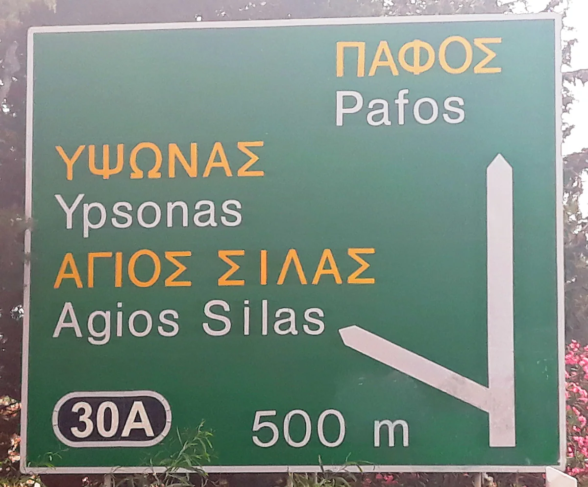
As the crow flies, from OpenStreetMap
Distances in Cyprus, from one end to the other
Larnaca to Ayia Napa is about 35 km in a straight line, and Larnaca Airport to Ayia Napa about 38 km, using OpenStreetMap coordinates. The island is small, with Paphos to Ayia Napa about 145 km, but road distances are longer, especially if you cross the Troodos.
In 30 seconds
Full read: 3 min
- Larnaca to Ayia Napa is about 35 km in a straight line.
- Nicosia to Limassol is about 62 km, and Limassol to Paphos about 57 km.
- End to end in the Republic, Paphos to Ayia Napa, is about 145 km.
- Mountain roads stretch distances a lot.
I wouldn't trust straight-line kilometres in the mountains. On the coast and the motorway they're close enough to reality, but in the Troodos a short hop can take half a morning.

Before you go
What I would keep in mind
-
01 Getting there
The big one, Larnaca to Ayia Napa
About 35 km in a straight line from town and about 38 km from the airport. Protaras is about 6 km from Ayia Napa.
airport transfers in Cyprus -
02 My tip
Limassol, the halfway house
Limassol is about 57 km from Paphos and 60 km from Larnaca, with Troodos Square about 30 km away. For day trips in every direction, it's the most balanced base.
getting around Cyprus -
03 Most beautiful
The mountains are closer than you think
Platres and Omodos are both about 27 km from Limassol in a straight line. The road is longer, but either makes an easy morning trip.
prettiest villages in Cyprus
One of the most searched questions about Cyprus is how far Ayia Napa is from Larnaca, and it makes sense, because it’s the journey almost everyone landing at Larnaca for a beach holiday has to make. Here’s that one and the other distances I use when planning, all worked out in a straight line from OpenStreetMap coordinates. You won’t find driving times here, because no official source I can cite publishes them.
How to read these distances
All of them are in a straight line, between the points OpenStreetMap assigns to each town, village or airport. On the road they’re always a little longer. Along the coast and on the motorway the difference is small, but in the Troodos a mountain road can double both distance and time. Treat them as a quick way of knowing what’s close and what isn’t.
The east coast, Larnaca to Protaras
Larnaca to Ayia Napa is about 35 km in a straight line, and Larnaca Airport to Ayia Napa about 38 km. Protaras is right next door, about 6 km from Ayia Napa. With those figures, Larnaca is the obvious airport for an east-coast beach holiday, and how to make that first trip is in airport transfers in Cyprus.
If you are staying the night, see the best hotel deals in Limassol for your dates: the well-placed rooms go fast.
How far apart are the main towns?
Nicosia is about 37 km from Larnaca, 62 km from Limassol and 97 km from Paphos, all as the crow flies. Limassol is almost exactly as far from Paphos, about 57 km, as from Larnaca, about 60 km, which is why I think it’s the most balanced base for exploring the whole south coast. From one end of the Republic to the other, Paphos to Ayia Napa, it’s about 145 km. End to end, the island measures 240 km, and coast to coast 100, per CYSTAT.
The west, from Paphos to Akamas
From Paphos, Coral Bay is about 10 km away and Aphrodite’s Rock about 22. Polis Chrysochous is around 29 km off, with Latchi 3 km further, and the Baths of Aphrodite, the gateway to Akamas, about 32. Following the coast from Polis, Pomos is about 18 km on and Kato Pyrgos, in the Tilliria, about 29. From Paphos Airport, Polis is about 36 km away, Limassol about 50 and Nicosia 94.
So you do not lose the morning at the ticket office, browse tickets and tours in Limassol on GetYourGuide.
Around Limassol and Larnaca
From Limassol, the ruins of Amathus are about 10 km away, Kourion about 14 and Pissouri about 30, all along the coast towards Paphos. From Larnaca, Kiti and its Panagia Angeloktisti church are about 9 km away, and Lefkara and Choirokoitia about 30 each, on the way to Limassol.
Into the north from Nicosia
If you cross at the capital’s crossing points, Kyrenia is about 19 km away as the crow flies, Morphou about 34 and Famagusta about 53. These are map distances; to take a hire car across you need insurance that’s valid there, as I explain in crossing to northern Cyprus.
If you would rather go at your own pace, see the car hire deals in Limassol: the earlier you book, the more cars are left to choose from.
The mountains, closer than they look
From Limassol, Troodos Square is about 30 km away in a straight line, and Platres and Omodos about 27 km. From Nicosia, Kakopetria is about 48 km. Short on the map, but mountain roads twist and climb, so I’d always allow more time than the kilometres suggest. My favourite villages to stay in up there are in the prettiest villages in Cyprus.
Planning a route
If you’re touring the island, my seven-day suggestion is in the Cyprus road trip, where no stage is longer than 70 km in a straight line. What to know about driving, with the speed limits the European Commission publishes, is in driving in Cyprus, and the overview of getting about without trains is in getting around Cyprus. If you want a ready-made plan built on these distances, pick, longest first, from two weeks in Cyprus, 10 days in Cyprus, one week in Cyprus, 5 days in Cyprus and 3 days in Cyprus.
If you are staying the night, see the best hotel deals in Limassol for your dates: the well-placed rooms go fast.
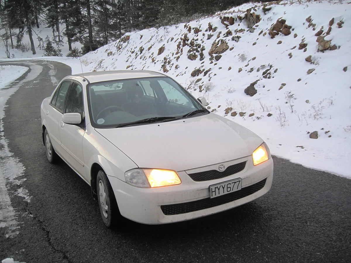
A car on the road climbing Mount Olympus in winter, with a snowy bank and Troodos pine trees behind it
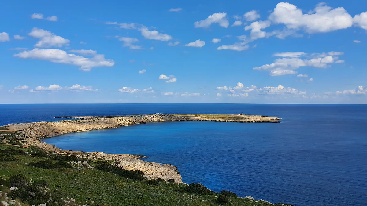
The coastline at Cape Greco in south-east Cyprus, with green scrub, low cliffs and a deep blue sea
Distances between towns in a straight line
| Route | Approximate distance |
|---|---|
| Larnaca to Ayia Napa | 35 km |
| Ayia Napa to Protaras | 6 km |
| Larnaca to Nicosia | 37 km |
| Larnaca to Lefkara | 30 km |
| Larnaca to Limassol | 60 km |
| Nicosia to Limassol | 62 km |
| Nicosia to Ayia Napa | 61 km |
| Nicosia to Paphos | 97 km |
| Limassol to Paphos | 57 km |
| Limassol to Ayia Napa | 94 km |
| Paphos to Polis | 29 km |
| Paphos to Coral Bay | 10 km |
| Paphos to Ayia Napa | 145 km |
My own calculation from OpenStreetMap coordinates (© OpenStreetMap contributors, ODbL), checked on 3 October 2026. Road distances are longer.
Coast to mountains, in a straight line
| Route | Approximate distance |
|---|---|
| Limassol to Troodos Square | 30 km |
| Limassol to Platres | 27 km |
| Limassol to Omodos | 27 km |
| Nicosia to Troodos Square | 52 km |
| Nicosia to Kakopetria | 48 km |
| Troodos Square to Platres | 4 km |
| Troodos Square to Kakopetria | 5 km |
Same method. In the mountains the road can double the straight-line distance.
From the airports, in a straight line
| Route | Approximate distance |
|---|---|
| Larnaca Airport to Larnaca | 6 km |
| Larnaca Airport to Ayia Napa | 38 km |
| Larnaca Airport to Nicosia | 40 km |
| Larnaca Airport to Limassol | 56 km |
| Paphos Airport to Paphos | 9 km |
| Paphos Airport to Coral Bay | 19 km |
| Paphos Airport to Limassol | 50 km |
| Larnaca Airport to Paphos Airport | 103 km |
Same method.
Test yourself
True or false?
0/3 Pick before you peek.
-
Larnaca to Ayia Napa is more than 100 km.
See the answer
False. It's about 35 km in a straight line, according to OpenStreetMap coordinates.
-
Limassol is roughly the same distance from Paphos as from Larnaca.
See the answer
True. About 57 km to Paphos and about 60 km to Larnaca, as the crow flies.
-
The island of Cyprus is 240 km from east to west.
See the answer
True. That's CYSTAT's figure in 'Cyprus in Figures 2025'.
- Larnaca to Ayia Napa, straight line
- 35 km
- Nicosia to Limassol, straight line
- 62 km
- Paphos to Ayia Napa, straight line
- 145 km
- Island length east to west (CYSTAT)
- 240 km
0 of 421 Cyprus guides
Your next stamp
- Airport transfers
- Where to stay
- Road trip
- Larnaca Airport
- Day trips
- 10 days
- One week
- Two weeks
- Almyra Hotel
- Anassa Hotel
- Anastasia Beach
- Aphrodite Hills Resort
- Apostolos Andreas
- Bellapais Abbey
- Cap St Georges
- Church of St Lazarus
- Columbia Beach Resort
- Commandaria
- Coral Beach Hotel
- Cypriot food
- Dome Beach
- Four Seasons Limassol
- Golden Bay
- Grecian Park
- Hilton Nicosia
- Kourion
- Kyrenia Castle
- Larnaca
- Lefkara lace
- Limassol
- Limassol Carnival
- Meze
- Omodos
- Panagia Angeloktisti
- Places to visit
- Selimiye Mosque
- Soli
- St Barnabas Monastery
- Weather
- Wine routes
- Atlantica Miramare
- Büyük Han
- Cheap eats
- Cyprus in winter
- Finikoudes
- Halloumi
- Kantara Castle
- Kataklysmos
- Limassol Castle
- Narcissos
- Nissi Beach Resort
- Olympic Lagoon Paphos
- Othello Tower
- Sanctuary of Apollo Hylates
- Sea temperature
- Things to do
- Vouni
- Vouni Palace
- Alion Beach
- Cypriot desserts
- Cyprus in spring
- Elias Beach
- Golden Coast
- Koilani
- Kolossi Castle
- Lala Mustafa Pasha Mosque
- Larnaca Castle
- Leonardo Laura Beach
- Limassol old town
- Limassol Wine Festival
- Most beautiful places
- Souvla
- St Hilarion Castle
- Arsos
- Buffavento Castle
- Crystal Springs
- Cypriot wine
- Cyprus in summer
- Easter in Cyprus
- Episkopi
- Kition
- Kleftiko
- Limanaki Beach
- Molos promenade
- Pafos Aphrodite Festival
- Pagona
- Prettiest villages
- St Raphael Resort
- Adams Beach
- Akrotiri peninsula
- Alasia Hotel
- Bellapais
- Cyprus in autumn
- Elysium Hotel
- Green Monday
- Independence Day
- Limassol Marina
- Pierides Museum
- Sheftalia
- Sunrise Pearl
- UNESCO World Heritage
- Vasa Koilaniou
- Akrotiri salt lake
- Amathus Beach
- Christmas
- Cyprus in January
- Grecian Bay
- Larnaca Archaeological Museum
- Limassol old port
- Lofou
- Map
- Venus Beach Hotel
- Vrissiana
- Asterias Beach
- Capo Bay
- Cypriot coffee
- Cyprus in February
- Kamares Aqueduct
- Kefalos Beach
- Lania
- Limassol Archaeological Museum
- Parklane
- St Nicholas of the Cats
- Where is Cyprus
- Alexander the Great
- Carob Mill
- Cyprus in March
- Districts
- Hala Sultan Tekke
- Lady's Mile
- Tsokkos Gardens
- Zivania
- Beer
- Cavo Maris
- Cyprus in April
- Germasogeia
- King Evelthon
- Larnaca Salt Lake
- Pissouri
- Towns and villages
- Amathus
- Anogyra
- Athena Beach
- Cyprus in May
- Mackenzie beach
- Population
- Archaeological sites
- Cyprus in June
- King Jason
- Limassol beaches
- Size
- Zenobia wreck
- Aliathon Resort
- Castles in Cyprus
- Cyprus in July
- Governor's Beach
- Languages
- Larnaca beaches
- Annabelle Hotel
- Cyprus in August
- Monasteries in Cyprus
- Name
- Azia Resort
- Cyprus in September
- Museums in Cyprus
- Capital Coast Resort
- Cyprus in October
- Pyla
- Cyprus in November
- Kiti
- Cyprus in December
- Lefkara
- Choirokoitia
- Tochni
- Flag
- How to get there
- Kalavasos
- Krasochoria
- Salamis
- Aphrodite
- Flights
- Karpas Peninsula
- Stavrovouni Monastery
- Kornos
- Limassol District
- Larnaca district
- Paphos Airport
- Pyrga
- Athienou
- Ferry
- Odou
- Cruises
- Kato Drys
- Getting around
- Vavla
- Buses
- Zygi
- Taxis
- Agios Irakleidios
- Car hire
- Paphos district
- Driving
- Paphos
- Kato Paphos
- Parking
- Cycling
- Paphos old town (Ktima)
- Paphos Archaeological Park
- Tombs of the Kings
- Agia Kyriaki and St Paul's Pillar
- Paphos Byzantine Museum
- Paphos beaches
- Geroskipou
- Cyprus Wine Museum
- Greek or Turkish?
- Peyia (Pegeia)
- Coral Bay
- History
- Sea caves, Peyia
- The division
- Agios Georgios, Peyia
- Political system
- Akamas peninsula
- Religion
- Blue Lagoon, Akamas
- Public holidays
- Baths of Aphrodite
- Time
- Currency and payments
- Lara beach
- Avakas Gorge
- EU and Schengen
- Entry requirements
- Polis Chrysochous
- Facts
- Latchi
- Neo Chorio
- Aphrodite's Rock
- Palaepaphos (Kouklia)
- Paphos Castle
- Paphos Archaeological Museum
- Agia Solomoni Catacomb
- Kathikas
- Drouseia
- Ineia
- Diarizos Valley
- Pano Panagia
- The north
- Where to eat
- Chrysorrogiatissa Monastery
- Crossing to the north
- Hotels in Ayia Napa
- Agios Neophytos Monastery
- Green Line
- Hotels in Protaras
- British bases
- Hotels in Limassol
- Tala
- Ercan airport
- Hotels in Larnaca
- Lempa
- Hotels in Paphos
- Hotels in the north
- Pano Arodes
- Hotels in Coral Bay
- Kritou Terra
- Kyrenia district
- Hotels in Polis and Latchi
- Kyrenia
- Lysos
- Hotels in Nicosia
- Lapithos
- Pomos
- Cedar Valley
- Hotels in the Troodos
- Ayia Napa
- Best time to visit
- Famagusta district
- Luxury hotels
- North Nicosia
- Agrotourism
- All-inclusive hotels
- Famagusta
- Thalassa Museum
- Adults-only hotels
- Apartments
- Ayia Napa Monastery
- Varosha
- Ayia Napa Sculpture Park
- Family hotels
- Morphou
- Boutique hotels
- Nissi Beach
- Beachfront hotels
- Events
- Makronissos
- Ayia Napa sea caves
- Cheap hotels
- Love Bridge
- Villas
- Ayia Napa beaches
- Campsites
- Cape Greco
- Safety
- Konnos Bay
- Scams and pitfalls
- Cyclops Cave
- Healthcare
- Mobile and roaming
- Free things to do
- What to buy
- With a dog
- Accessible Cyprus
- Plugs
- Tipping
- Protaras
- Tourist information
- Fig Tree Bay
- Packing list
- Prices and budget
- Profitis Ilias Church
- Cyprus on a budget
- Protaras beaches
- Shopping
- Paralimni
- With kids
- Deryneia
- For couples
- Kokkinochoria
- Weddings
- Nightlife
- Sotira
- Liopetri
- Package holidays
- Frenaros
- Nicosia district
- Avgorou
- Boat trips
- Nicosia
- Jeep safari
- Venetian walls
- Famagusta Gate
- Ledra Street
- Laiki Geitonia
- Cyprus Museum
- Byzantine Museum, Nicosia
- St John's Cathedral
- Archbishop's Palace
- 3 days
- Museums in Nicosia
- 5 days
- Chrysaliniotissa
- Leventis Museum
- Leventis Gallery
- Kornesios house
- National Struggle Museum
- Ömeriye Mosque
- Faneromeni Church
- Shacolas observatory
- Tamassos
- Idalion
- Machairas Monastery
- Fikardou
- Lythrodontas
- Tilliria
- Kato Pyrgos
- Troodos Mountains
- Mount Olympus
- Troodos Square
- Skiing in Cyprus
- Troodos Geopark
- Painted churches of Troodos
- Kykkos Monastery
- Makarios's tomb
- Trooditissa Monastery
- Platres
- Prodromos
- Foini
- Treis Elies
- Marathasa valley
- Solea valley
- Agios Nikolaos tis Stegis
- Panagia Asinou
- Panagia Podithou
- Archangelos Michael, Pedoulas
- Panagia tou Moutoulla
- Agios Ioannis Lampadistis
- Kalopanayiotis
- Pedoulas
- Moutoullas
- Kakopetria
- Galata
- Evrychou
- Pitsilia
- Stavros tou Agiasmati
- Panagia tou Araka
- Timios Stavros, Pelendri
- Transfiguration church, Palaichori
- Palaichori
- Askas
- Lagoudera
- Polystypos
- Alona
- Agros
- Kyperounta
- Louvaras
- Hiking in Cyprus
- Artemis Trail
- Atalante Trail
- Persephone Trail
- Teisia tis Madaris
- Waterfalls in Cyprus
- Caledonia Waterfall
- Nature parks in Cyprus
- Viewpoints in Cyprus
- Cyprus beaches
- Diving in Cyprus
- Water sports in Cyprus
- Water parks in Cyprus
- Golf in Cyprus
Frequently asked questions
How far is Ayia Napa from Larnaca?
About 35 km in a straight line from Larnaca town and about 38 km from the airport, using OpenStreetMap coordinates. The road is a little longer.
How far is Limassol from Nicosia?
About 62 km in a straight line. The road is longer, but it's one of the easiest drives on the island.
How big is Cyprus from end to end?
CYSTAT gives the island 240 km from east to west and 100 km from north to south. Within the Republic, Paphos to Ayia Napa is about 145 km in a straight line.
How far apart are Larnaca and Paphos airports?
About 103 km in a straight line, which is why it pays to fly into the one nearer your hotel.
How long does it take to drive from Limassol to the Troodos?
I don't have an official source for journey times. As the crow flies, Troodos Square is about 30 km from Limassol, but the mountain road is longer and slower.
By
Tourism graduate with a master’s in Tourism Management and Planning from the University of Málaga, who has travelled across Europe. He writes every guide from official sources and his own judgement.
Published on . Facts checked on .
Sources
Some links in this guide are affiliate links: if you book through them, the site earns a commission at no extra cost to you. Affiliate disclosure
Photos: Xaris333 (CC BY-SA 4.0); Dickelbers (CC BY-SA 3.0); Qasinka (CC0), via Wikimedia Commons.