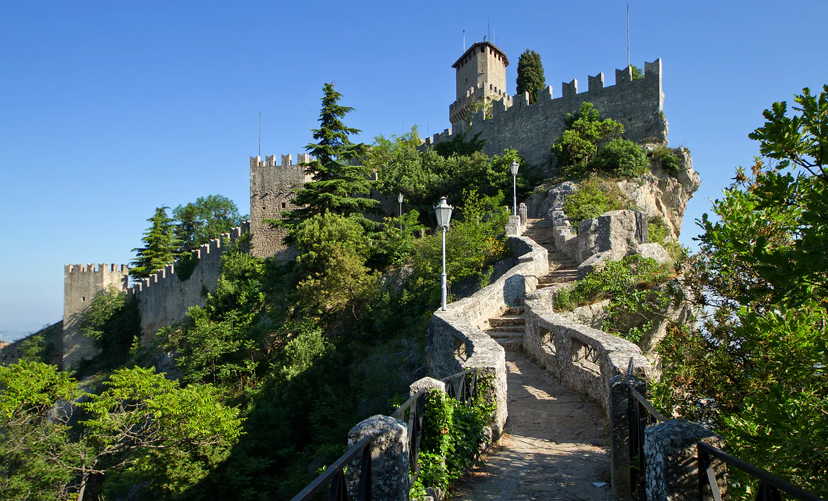
Three hours for the tower walk
Walking in San Marino, from the Titano ridge to the valleys
San Marino's fullest walk links the three towers along the ridge of Mount Titano, on a wall path of just over a kilometre; with visits to the Guaita and the Cesta, there and back from Piazza della Libertà, it takes about three hours. Beyond Titano there are strolls along the old railway line and through the valleys of Faetano and Chiesanuova.
In 30 seconds
Full read: 4 min
- San Marino's key walk links the three towers along the Titano ridge, just over a kilometre of path.
- With visits to the Guaita and the Cesta, there and back from Piazza della Libertà, it takes about three hours.
- From the Cesta woods to the Montale is about twenty minutes of easy path.
- Beyond Titano, the old railway and the parks of Faetano and Chiesanuova make for quiet walks.
I'd do the tower walk in the morning, starting at the Guaita before the groups arrive, and carry on through the woods to the Montale, where the crowds thin out. With a car and half a day more, I'd head down to the Marano park in Faetano to see another side of San Marino.

Before you go
What I would keep in mind
-
01 Most beautiful
The stretch between the Guaita and the Cesta
About 200 metres of battlemented path along the cliff, the Passo delle Streghe or Witches' Passage. It's free and, for me, the best walk in the country.
Witches' Passage in San Marino -
02 My tip
The Rupe trail, unconfirmed
There's a footpath up from Borgo Maggiore to the city, but its only official description is on a website I don't use as a source. Ask at the tourist office before setting off.
Borgo Maggiore and its market -
03 Getting there
Ride the cable car down and spare your knees
If you walk the ridge, you can drop down to Borgo Maggiore on the cable car, which leaves every quarter of an hour. A single is €4 and children under 120 cm ride free.
San Marino cable car -
04 To save money
Walking is free, the towers aren't
The paths are open to all. You only pay to go inside the Guaita and the Cesta, with the €11 State Museums pass; under-18s go free.
San Marino free and cheap
What I would book
- Tours and ticketsGetYourGuide A guided stroll round the centre If you'd like someone to explain the city as you walk; for the ridge and the towers, though, you don't need a guide.
- Places to stayBooking.com A night to walk early The ridge without groups only happens first thing, and that's easy if you're already on top.
My ranking, scored
The walks I'd do in San Marino
My own scores out of 10. They weigh the views, how pleasant the path is and how easily it fits into a visit. Where there's no sourced distance or time, I don't give one.
0 of 7 seen
-
The three towers along the ridge
Just over a kilometre of wall path linking the Guaita, the Cesta and the Montale. About three hours there and back from Piazza della Libertà, going into the first two, according to a private website.
9.4 out of 10
-
From the Cesta woods to the Montale
A path through the trees to the third tower, which you can only see from outside. About twenty minutes and easy, according to unofficial sources. It's where the ridge goes quiet.
8.6 out of 10
-
The old railway tunnel in Borgo Maggiore
The tunnel by the old station of the little blue and white railway can be walked through, according to the government. Short, quirky and full of history.
7.8 out of 10
-
Parco Laiala to Domagnano
A footpath and cycle path on the embankment of the old Rimini to San Marino railway, according to Italian Wikipedia. Flat and away from the tourist traffic.
7.6 out of 10
-
Marano park, Faetano
A green strip along the Marano river, with a footpath laid out for long walks beyond the village, according to the castello's page.
7.2 out of 10
-
Gorgascura and the Molarini mill
In Chiesanuova, lush woodland beside the Fosso Canepa and one of the few watermills in the country with its walls intact.
7.0 out of 10
-
La Pineta on Montecerreto
A nature park in Acquaviva, on the site of the fort where, the castello's page says, the Placito Feretrano was signed in 885.
6.6 out of 10
San Marino isn’t a mountain destination in the Alpine sense, but it makes far more sense on foot than from a coach seat. The country covers 61 km², with a rocky ridge topped by three towers and valleys of woodland and old mills that almost nobody visits. Here are the walks I’d do and, just as plainly, what I couldn’t verify, because I haven’t found an official network of trails with published distances.
The Three Towers walk, the one not to miss
It all starts in Piazza della Libertà. From there you climb towards the Guaita, the First Tower, whose core dates from the 11th century according to the State Museums, and follow the edge of the cliff to the Cesta, Titano’s highest point at 755 metres. According to a private website, the three towers are linked by a wall path of just over a kilometre, and the full route, there and back and going into the first two, takes about three hours.
The stretch I wouldn’t miss is the Passo delle Streghe, about 200 metres of battlemented path between the Guaita and the Cesta. It’s free, you can walk it without entering either tower, and it has the finest view in the country. I explain it in depth in the Witches’ Passage, and the whole group in the Three Towers of San Marino.
On to the Montale, where the crowds fade
Beyond the Cesta, a woodland path leads to the third tower, the Montale. Unofficial sources put it at about twenty minutes on easy ground. The tower can’t be visited inside and isn’t on the pass, which is exactly why fewer people come, and that’s what I like most about this stretch. To get back you can retrace your steps or head down into the city and take the cable car to Borgo Maggiore, which leaves every quarter of an hour.
A word of warning about the climb from below. There’s also a path, the Rupe trail, from Borgo Maggiore up to the city on foot. The trouble is that only the tourist board describes it, on a website I don’t use as a source, so I’d rather give you no distance, climb or time than guess. Ask at the tourist office before you set off.
Two short walks without leaving the capital
If you’re not doing the whole ridge, there are two small options. From car park P9, a private website quoting the parking office mentions the Via delle Scalette, more than 300 steps up to the centre, as an alternative to the two panoramic lifts. And the capital’s castello doesn’t end at the walls. According to its government page, to the west it has the Montecchio park, open to everyone, and the Fosso di Canepa, an untouched stretch of woodland where old disused mills still stand. It’s a side of the City of San Marino that almost nobody who comes up on the coach ever sees.
Walking the old railway
San Marino once had a train. The little blue and white railway ran from Rimini to the capital from 1932 and stopped in 1944, according to Italian Wikipedia. What matters for walkers is that the line is still there. In Borgo Maggiore, the tunnel by the old station on Piazza Grande can be walked through, as the castello’s page says. Further down, in Serravalle, a footpath and cycle path follows the old railway embankment from Parco Laiala to Domagnano. It’s flat, peaceful and shows you countryside day-trippers never see.
The castelli valleys
With a car and half a day, it’s worth dropping down to the castelli in the south and west. In Faetano, the Marano park follows the river, and the castello’s page mentions a footpath designed for long walks out of the village. Lake Faetano, the country’s fishing lake, sits on the same Marano road. Chiesanuova has 114 hectares of woodland and the Gorgascura area, where the Molarini watermill still stands on the bank of the Fosso Canepa with its walls intact, a rarity in the country. In Acquaviva there’s La Pineta, the park on the summit of Montecerreto. I go through them one by one in the nine castelli of San Marino.
When to walk and what to bring
I’d choose May, June or September, with average highs between 19 and 25 °C in the Arpae series quoted by English Wikipedia. In July and August the average high goes above 26 °C, so I’d set out very early. In winter expect cold and, above 400 or 500 metres, snow most years. And I’d wear shoes with decent grip, because almost everything is cobbles, slopes and steps.
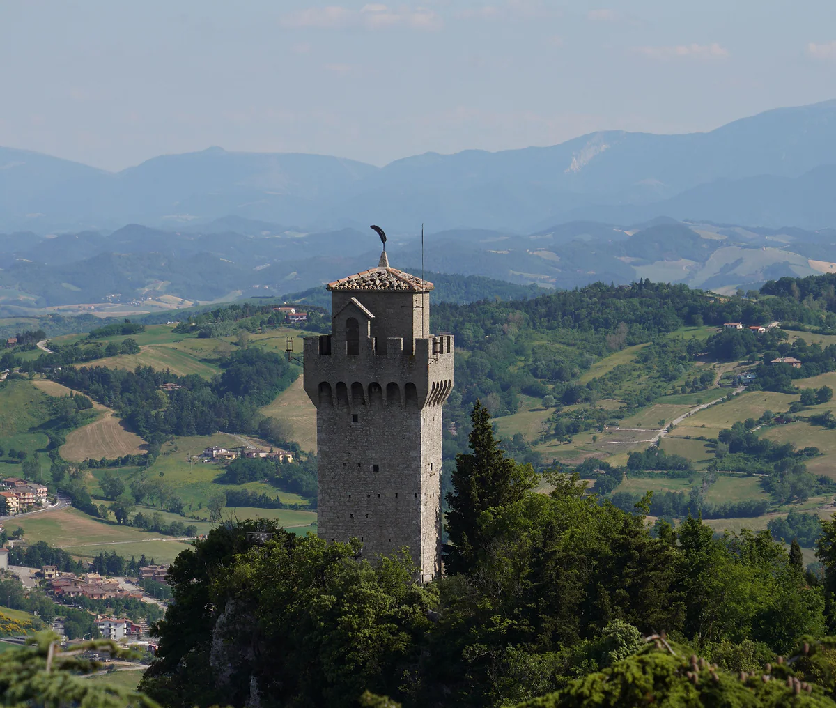
The Montale, the third tower, rising from the woods of Monte Titano with the hills and the Apennines behind.
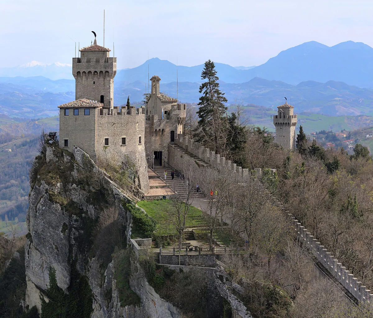
The Cesta, the second tower, with its feather-shaped weathervane and wall walk, and the Montale rising among the trees behind.
What I know about each walk
| Walk | Starting point | Time or distance | Source |
|---|---|---|---|
| Three towers | Piazza della Libertà | Path just over 1 km; about 3 hrs with visits | Private website; official museums for the towers |
| Passo delle Streghe | Between Guaita and Cesta | About 200 m | Private website |
| Cesta to Montale | Second Tower | About 20 minutes | Private website and Wikipedia |
| Railway tunnel | Piazza Grande, Borgo Maggiore | No figure | Government of San Marino |
| Parco Laiala to Domagnano | Parco Laiala, Serravalle | No figure | Italian Wikipedia |
| Marano park | Faetano | No figure | Government of San Marino |
| Rupe trail | Borgo Maggiore | No usable source | To be confirmed |
I haven't found an official network of waymarked trails with published distances. Where a figure is missing, I don't make one up.
Temperature and rain in San Marino
| Month | Average high | Rainy days |
|---|---|---|
| April | 15.0 °C | 7.9 |
| May | 19.6 °C | 8.6 |
| June | 25.0 °C | 4.8 |
| September | 20.6 °C | 6.8 |
| October | 15.6 °C | 7.1 |
2006-2023 series credited to Arpae Emilia-Romagna in English Wikipedia; days with at least 1 mm of rain.
Test yourself
True or false?
0/3 Pick before you peek.
-
The path linking San Marino's three towers is over five kilometres long.
See the answer
False. It's a wall path of just over a kilometre, according to a private website. What stretches the route to around three hours are the tower visits.
-
You can walk through a tunnel of San Marino's old railway.
See the answer
True. The Borgo Maggiore castello page says the tunnel by the old station of the little blue and white railway can be walked through.
-
You have to pay to walk the passage between the Guaita and the Cesta.
See the answer
False. The path is free. You only pay to go inside the towers, with the €11 State Museums pass.
- Wall path linking the three towers
- 1 km
- Tower walk with visits, there and back
- 3 hrs
- Path from the Cesta to the Montale
- 20 min
- Woodland in Chiesanuova
- 114 ha
Map
Where Walking trails is
Every number opens its guide. The towers sit on the ridge, the city beside them and Borgo Maggiore below, linked by the cable car.
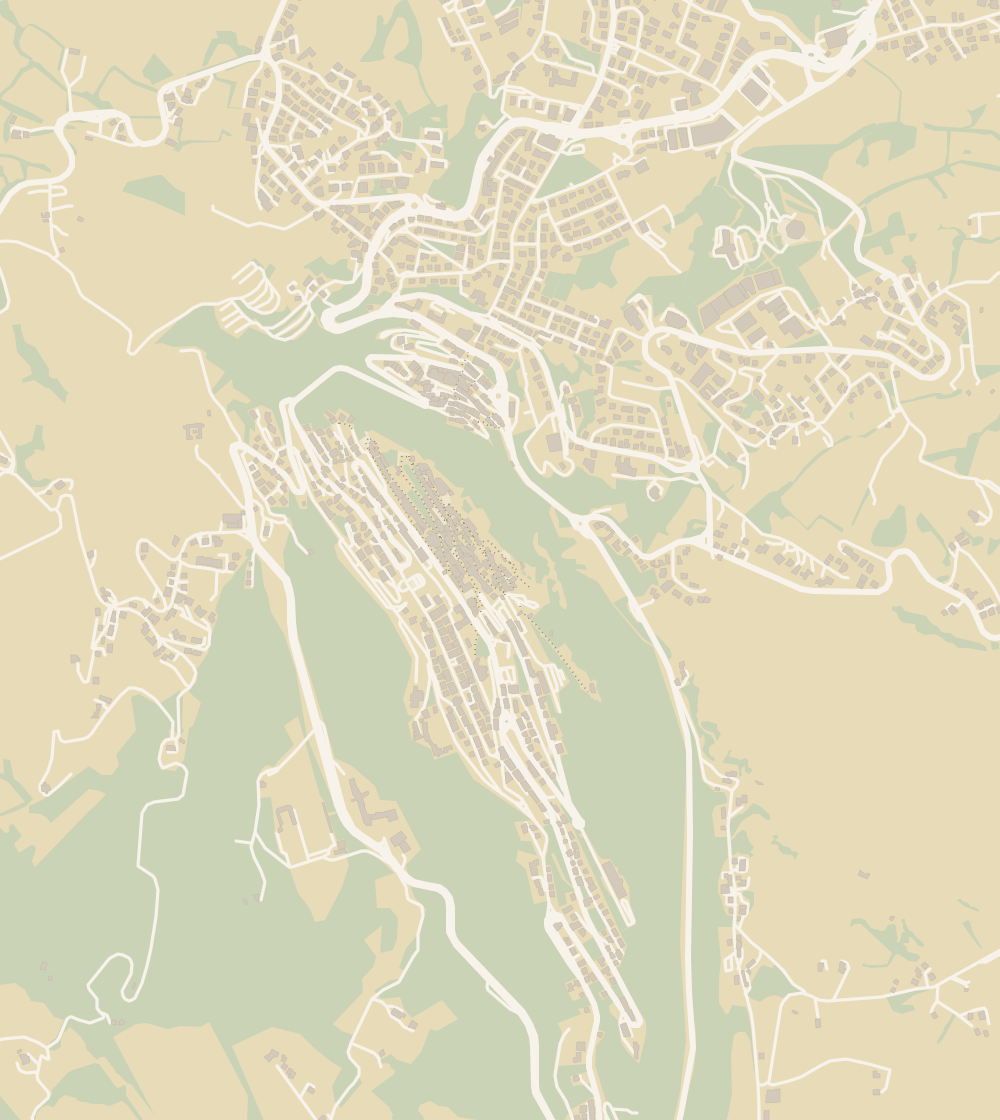 1The Three Towers 2Guaita Tower 3Cesta Tower and Arms Museum 4City of San Marino 5Montale Tower 6Borgo Maggiore 7Witches' Passage 8Palazzo Pubblico 9Changing of the guard 10Basilica of Saint Marinus 11Mount Titano 12Museums 13State Museum 14San Francesco Art Gallery 15Torture Museum 16Cable car (funivia) 17Quirky museums 18Stamp and Coin Museum 19National Gallery 20Valdragone 21San Giovanni sotto le Penne 22Medieval Days 23Christmas 24Hotel Titano 25Grand Hotel San Marino 26Hotel Rosa 27Hotel Crocenzi 28Hotel La Rocca 29Porta San Francesco 30Cava dei Balestrieri 31Map 32Teatro Titano 33Church of San Quirino 34Trenino Bianco Azzurro 35Consolazione Sanctuary 36University 37Prison 38Piazza della Libertà
 Map data © OpenStreetMap contributors (ODbL)
- 1The Three TowersTwo open inside, the third only from outside
- 2Guaita TowerAn 11th-century fortress that was a jail until 1970
- 3Cesta Tower and Arms MuseumThe top of Mount Titano, at 755 metres
- 4City of San MarinoWorld Heritage since 2008
- 5Montale TowerNo ticket, no hours, no pass
- 6Borgo MaggioreA cable car to the capital every 15 minutes
- 7Witches' PassageAbout 200 metres of battlements, no ticket
- 8Palazzo PubblicoClosed for restoration in 2026
- 9Changing of the guardNo timetable in any reliable source
- 10Basilica of Saint MarinusNeoclassical, begun in 1826, free to enter
- 11Mount Titano755 metres at the top of the Cesta
- 12MuseumsOne €11 ticket, seven venues
- 13State MuseumOpen to the public since 1899
- 14San Francesco Art GalleryIn the Franciscan cloister since 1966
- 15Torture MuseumMore than 100 original instruments
- 16Cable car (funivia)Closed from 21 to 23 October 2026
- 17Quirky museumsThree private museums with their own websites
- 18Stamp and Coin MuseumStamps since 1877, on the €11 pass
- 19National GalleryOpened on 7 July 2018
- 20ValdragoneA curazia of Borgo Maggiore
- 21San Giovanni sotto le PenneA curazia of Borgo Maggiore, below the towers
- 22Medieval DaysJuly, the old town and free entry
- 23Christmas28 November to 6 January, with a caveat
- 24Hotel TitanoOpen since 30 September 1894
- 25Grand Hotel San MarinoA hot tub on the third-floor terrace
- 26Hotel RosaFamily-run and open all year since 1965
- 27Hotel Crocenzi1 km from the cable car, 3 km from the old town
- 28Hotel La RoccaNot the Rocca, but on the road up to it
- 29Porta San FrancescoA guard post since 1361
- 30Cava dei BalestrieriThe crossbowmen's range since 1965
- 31MapNine castelli in 61 km²
- 32Teatro Titano2026-27 season from 22 October
- 33Church of San QuirinoOn the 5-cent coin
- 34Trenino Bianco AzzurroRimini to the City, 1932 to 1944
- 35Consolazione SanctuaryConsecrated on 11 June 1967
- 36UniversityCreated by law on 31 October 1985
- 37PrisonEmpty on the day the European inspectors arrived
- 38Piazza della LibertàIt used to be called the Pianello
0 of 108 San Marino guides
Your next stamp
- The Three Towers
- Montale Tower
- Mount Titano
- Witches' Passage
- Things to do
- Map
- Getting around
- One day
- Two days
- Guaita Tower
- Cesta Tower and Arms Museum
- The 9 castelli
- City of San Marino
- Borgo Maggiore
- Palazzo Pubblico
- Serravalle
- Changing of the guard
- Dogana
- Acquaviva
- Basilica of Saint Marinus
- Chiesanuova
- Domagnano
- Faetano
- Fiorentino
- Montegiardino
- Museums
- State Museum
- San Francesco Art Gallery
- Torture Museum
- Cable car (funivia)
- Quirky museums
- Viewpoints
- Murata
- Stamp and Coin Museum
- Cailungo
- National Gallery
- Valdragone
- Best time to visit
- Getting there
- Ventoso
- Rimini to San Marino
- San Giovanni sotto le Penne
- Weather
- In winter
- With kids
- In summer
- Parking
- Passport stamp
- Rainy day
- Nightlife
- Phone and roaming
- Casino
- Gualdicciolo
- Money
- Coins and stamps
- Torraccia
- Falciano
- Shopping and tax-free
- Rovereta
- Lake Faetano
- Events
- Beaches
- Medieval Days
- Christmas
- MotoGP
- Where to stay
- Hotel Titano
- Where to eat
- Food
- Grand Hotel San Marino
- Luxury hotels
- Free and cheap
- Hotel iDesign
- Day trips
- Hotel Rosa
- Safety and rules
- Hotel Crocenzi
- Language
- Entry requirements
- Hotel La Rocca
- Healthcare and emergencies
- Plugs and voltage
- Is it a country?
- Opening hours
- Porta San Francesco
- Tap water
- Cava dei Balestrieri
- Post office
- Cost of a trip
- Flag
- Teatro Titano
- Accessibility
- Church of San Quirino
- History
- Captains Regent
- Trenino Bianco Azzurro
- With a dog
- Consolazione Sanctuary
- Facts
- University
- Weddings
- Wine
- Prison
- Camping
- Piazza della Libertà
- Is it worth visiting?
- Constitution
Frequently asked questions
Is San Marino good for walking?
Yes, on a small scale. The key route links the three towers along the Titano ridge, just over a kilometre of wall path, and beyond the mountain there are walks along the old railway and through the castelli parks.
How long does it take to walk the Three Towers of San Marino?
About three hours from Piazza della Libertà to the Montale and back, going into the Guaita and the Cesta, according to a private website. Without going inside the towers, a good deal less.
Can you walk up from Borgo Maggiore to San Marino?
There's a path, the Rupe trail, but its only official description is on a website I haven't been able to use as a source. I'd confirm it at the tourist office; the safe alternative is the cable car.
Is the walk to the third tower difficult?
According to unofficial sources, the path from the Cesta to the Montale is easy and takes about twenty minutes through the woods. The tower can't be visited inside.
Are there walking tours of San Marino?
There are organised trips from Rimini and the coast that include a stroll round the centre. For the ridge and the towers I don't think you need a guide, because the path simply runs from one tower to the next.
When is the best time to walk in San Marino?
I'd pick May, June or September, with average highs between 19 and 25 °C according to Arpae data. November is the wettest month, and in winter it often snows above 400-500 metres.
By
Tourism graduate with a master’s in Tourism Management and Planning from the University of Málaga, who has travelled across Europe. He writes every guide from official sources and his own judgement.
Published on . Facts checked on .
Sources
Photos: trolvag (CC BY-SA 3.0); Commonists (CC BY-SA 4.0); Terragio67 (CC BY-SA 4.0), via Wikimedia Commons.