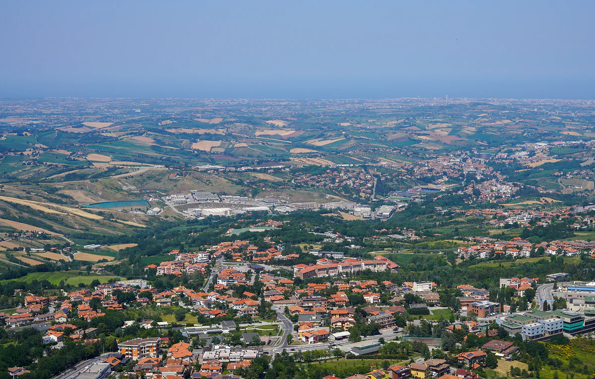
Nine castelli in 61 km²
Map of San Marino, from Titano down to the Dogana border
San Marino is in north-east Italy, just inland from the Adriatic coast, bordered by the province of Rimini to the west, north and east and by Pesaro and Urbino to the south. Its capital runs along the ridge of Mount Titano, 27 km from Rimini airport, and the country is divided into nine castelli. Below is my map of the city and Borgo Maggiore, with a pin for every sight.
In 30 seconds
Full read: 3 min
- San Marino is in north-east Italy by Rimini, surrounded by the provinces of Rimini and Pesaro and Urbino.
- It borders only Italy and covers 61.19 km², divided into nine castelli.
- The capital lies along the ridge of Mount Titano, with the highest point at 755 metres, at the Cesta.
- You enter at Dogana, beside the road up from Rimini, about 22 km from the Rimini Sud exit.
I'd picture the map vertically rather than flat. At the top, on the ridge, the capital and its towers; halfway down, Borgo Maggiore and the cable car; and at the bottom, on the plain, Serravalle and Dogana with the road up from Rimini. Almost everything you'll visit is in the top layer.

Before you go
What I would keep in mind
-
01 Getting there
Everything comes in through Dogana
The government places Dogana on the main border with Italy, beside the expressway from Rimini. Cars and the Bonelli bus both pass through, and the bus reaches Dogana 33 minutes after leaving Rimini.
Dogana, the way into San Marino from Italy -
02 My tip
The map below only covers the top of the country
My map takes in the city and Borgo Maggiore, where nearly everything visitors see is found. Serravalle, Dogana and the Falciano outlet sit off the edge, on the plain by the Rimini road.
things to do in San Marino -
03 Most beautiful
The best map of San Marino is the view from the Guaita
From the First Tower's bell tower you see the whole city, the Palazzo Pubblico and the Basilica, and in the distance the Romagna Apennines and castles such as Verucchio. It's the easiest way to work out where you are.
the viewpoints of San Marino -
04 Getting there
Top to bottom by cable car
The city and Borgo Maggiore are 166 metres apart in height, and the cable car covers it on 338 metres of cable, every quarter of an hour, for €4 each way.
San Marino cable car
What I would book
Look for San Marino on a map of Europe and you’ll find a dot inside Italy, just behind Rimini, and that dot is misleading. Up close it’s a mountain with a capital on the ridge, a castello at its foot and seven more spread over the hills, down to the road that brings everything in from the coast. Here’s how to read it, and further down is my map of the part you’ll visit.
Where San Marino is
In north-east Italy, just inland from the Adriatic, level with Rimini. All around it is Italian territory. Rimini province borders it to the west, north and east, and Pesaro and Urbino to the south, which puts it right on the line between Emilia-Romagna and the Marche. It has no coastline and no border other than the Italian one.
Distances are short. Leaving the A14 motorway at Rimini Sud, the SS72 expressway covers roughly 22 km to the historic centre, and Rimini airport is 27 km away. Bologna is roughly 135 km and Ancona 110 km along the coast, according to a tourist information website. The ways to cover them, from the Bonelli bus to trains from Bologna, are in getting to San Marino.
A country on three levels
What helps me make sense of a San Marino map is reading it top to bottom. On the ridge of Mount Titano is the City of San Marino, with the three towers strung along the cliff and the country’s highest point at the Cesta, 755 metres. It’s the area my map covers and the one UNESCO listed, 55 hectares taking in the mountain and the historic centre.
Halfway down, linked by cable car, is Borgo Maggiore, the market castello. Between the two stations there’s a 166-metre drop and 338 metres of cable. And below, on the plain opening towards the coast, lie Serravalle, the largest and most populous castello, and Dogana, which the government places on the main border beside the Rimini expressway. Each of the nine has its own story, told in the guide to the castelli of San Marino.
How to use the map on this page
The map covers the city and Borgo Maggiore, which is where nearly everything of interest to a visitor sits. Each pin is a page of this guide, from the Guaita to the cable car. What falls outside the frame, Dogana, Serravalle and the Falciano outlet, is on the plain and reached by car or on AASS buses.
For the same ground sorted by importance, with scores and times, see things to do in San Marino. And to see the map from the inside, nothing beats the Guaita’s bell tower, which looks over the whole city and, far off, castles such as Verucchio. The other high points I’d look for are in San Marino’s viewpoints.
The bus route, read as a map
The best way I know to grasp the country from the bottom up is to follow the stops of the Rimini bus, which crosses it end to end. After the station and the Arch of Augustus, it calls at Cerasolo, still in Italy, and at the Dogana outlet 26 minutes in. Then come Dogana Confine, Serravalle, the Croce at Domagnano and Borgo Maggiore, before it finishes in the city, first at Murata and then at the old railway station. In 55 minutes you’ve passed through four of the nine castelli without noticing you’d crossed a border. The full timetable is in Rimini to San Marino.
How big is San Marino compared with other countries?
It measures 61.19 km², the sum of its nine castelli, which ranks it third among Europe’s tiniest states, behind the Vatican and Monaco, which covers 2.08 km². So San Marino is nearly thirty times the size of Monaco, and you feel it. Monaco is a city; San Marino has woods, fields, industrial estates and villages, and moving between castelli takes more than your legs.
Getting about on the map
Inside the city everything is on foot, as the centre is a restricted traffic zone. Borgo Maggiore is one cable car ride away, and the rest of the country is served by AASS lines and the SMUVI on-demand service, all set out in getting around San Marino. Behind the wheel, check first where to leave the car in parking in San Marino, because the numbered car park map is the first one you’ll need.
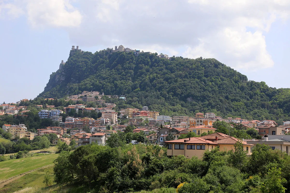
Monte Titano seen from the valley, with its wooded slope, the towers and the town along the ridge and Borgo Maggiore at its foot.
Distances from San Marino
| To | Distance | Source |
|---|---|---|
| Rimini Sud exit on the A14 | About 22 km on the SS72 | sanmarinosite.com |
| Rimini airport | 27 km | sanmarinosite.com |
| San Leo | 22 km | San Leo 2000 |
| Ancona | 110 km along the coast | sanmarinosite.com |
| Bologna | About 135 km on the A14 | sanmarinosite.com |
Road distances come from a private tourist information site; the San Leo figure is from its tourist office.
The nine castelli
| Castello | Area | Residents (30 June 2026) |
|---|---|---|
| Serravalle | 10.53 km² | 11,243 |
| Borgo Maggiore | 9.01 km² | 7,019 |
| Faetano | 7.75 km² | 1,204 |
| City of San Marino | 7.09 km² | 4,158 |
| Domagnano | 6.62 km² | 3,623 |
| Fiorentino | 6.56 km² | 2,593 |
| Chiesanuova | 5.46 km² | 1,187 |
| Acquaviva | 4.86 km² | 2,154 |
| Montegiardino | 3.31 km² | 986 |
Sorted by area. Areas from the San Marino government, population from the Statistics Office.
Test yourself
True or false?
0/3 Pick before you peek.
-
San Marino borders two countries.
See the answer
False. It borders only Italy, which surrounds it, with the province of Rimini to the west, north and east and Pesaro and Urbino to the south.
-
San Marino's largest castello isn't the capital.
See the answer
True. The largest is Serravalle, at 10.53 km², which is also the most populous. The City of San Marino covers 7.09 km².
-
San Marino's highest point is over 1,000 metres.
See the answer
False. It's the summit of Titano where the Cesta stands, 755 metres above sea level according to the State Museums.
- Total area of the nine castelli
- 61.19 km²
- Highest point, at the Second Tower
- 755 m
- To Rimini airport
- 27 km
- Height gained by the cable car
- 166 m
Map
The city and Borgo Maggiore, on Mount Titano
Every number opens its guide. The towers sit on the ridge, the city beside them and Borgo Maggiore below, linked by the cable car.
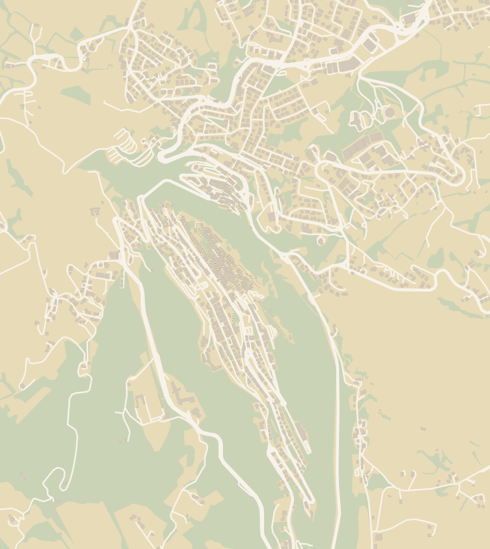 1The Three Towers 2Guaita Tower 3Cesta Tower and Arms Museum 4City of San Marino 5Montale Tower 6Borgo Maggiore 7Witches' Passage 8Palazzo Pubblico 9Changing of the guard 10Basilica of Saint Marinus 11Mount Titano 12Museums 13State Museum 14San Francesco Art Gallery 15Torture Museum 16Cable car (funivia) 17Quirky museums 18Stamp and Coin Museum 19National Gallery 20Valdragone 21San Giovanni sotto le Penne 22Medieval Days 23Christmas 24Hotel Titano 25Grand Hotel San Marino 26Hotel Rosa 27Hotel Crocenzi 28Hotel La Rocca 29Porta San Francesco 30Cava dei Balestrieri 31Map 32Teatro Titano 33Church of San Quirino 34Trenino Bianco Azzurro 35Consolazione Sanctuary 36University 37Prison 38Piazza della Libertà
 Map data © OpenStreetMap contributors (ODbL)
- 1The Three TowersTwo open inside, the third only from outside
- 2Guaita TowerAn 11th-century fortress that was a jail until 1970
- 3Cesta Tower and Arms MuseumThe top of Mount Titano, at 755 metres
- 4City of San MarinoWorld Heritage since 2008
- 5Montale TowerNo ticket, no hours, no pass
- 6Borgo MaggioreA cable car to the capital every 15 minutes
- 7Witches' PassageAbout 200 metres of battlements, no ticket
- 8Palazzo PubblicoClosed for restoration in 2026
- 9Changing of the guardNo timetable in any reliable source
- 10Basilica of Saint MarinusNeoclassical, begun in 1826, free to enter
- 11Mount Titano755 metres at the top of the Cesta
- 12MuseumsOne €11 ticket, seven venues
- 13State MuseumOpen to the public since 1899
- 14San Francesco Art GalleryIn the Franciscan cloister since 1966
- 15Torture MuseumMore than 100 original instruments
- 16Cable car (funivia)Closed from 21 to 23 October 2026
- 17Quirky museumsThree private museums with their own websites
- 18Stamp and Coin MuseumStamps since 1877, on the €11 pass
- 19National GalleryOpened on 7 July 2018
- 20ValdragoneA curazia of Borgo Maggiore
- 21San Giovanni sotto le PenneA curazia of Borgo Maggiore, below the towers
- 22Medieval DaysJuly, the old town and free entry
- 23Christmas28 November to 6 January, with a caveat
- 24Hotel TitanoOpen since 30 September 1894
- 25Grand Hotel San MarinoA hot tub on the third-floor terrace
- 26Hotel RosaFamily-run and open all year since 1965
- 27Hotel Crocenzi1 km from the cable car, 3 km from the old town
- 28Hotel La RoccaNot the Rocca, but on the road up to it
- 29Porta San FrancescoA guard post since 1361
- 30Cava dei BalestrieriThe crossbowmen's range since 1965
- 31MapNine castelli in 61 km²
- 32Teatro Titano2026-27 season from 22 October
- 33Church of San QuirinoOn the 5-cent coin
- 34Trenino Bianco AzzurroRimini to the City, 1932 to 1944
- 35Consolazione SanctuaryConsecrated on 11 June 1967
- 36UniversityCreated by law on 31 October 1985
- 37PrisonEmpty on the day the European inspectors arrived
- 38Piazza della LibertàIt used to be called the Pianello
0 of 108 San Marino guides
Your next stamp
- Is it a country?
- Getting there
- Beaches
- Walking trails
- City of San Marino
- Day trips
- Phone and roaming
- Things to do
- One day
- Two days
- The Three Towers
- Guaita Tower
- Cesta Tower and Arms Museum
- The 9 castelli
- Montale Tower
- Borgo Maggiore
- Witches' Passage
- Palazzo Pubblico
- Serravalle
- Changing of the guard
- Dogana
- Acquaviva
- Basilica of Saint Marinus
- Mount Titano
- Chiesanuova
- Domagnano
- Faetano
- Fiorentino
- Montegiardino
- Museums
- State Museum
- San Francesco Art Gallery
- Torture Museum
- Cable car (funivia)
- Quirky museums
- Viewpoints
- Murata
- Stamp and Coin Museum
- Cailungo
- National Gallery
- Valdragone
- Best time to visit
- Ventoso
- Rimini to San Marino
- San Giovanni sotto le Penne
- Weather
- Getting around
- In winter
- With kids
- In summer
- Parking
- Passport stamp
- Rainy day
- Nightlife
- Casino
- Gualdicciolo
- Money
- Coins and stamps
- Torraccia
- Falciano
- Shopping and tax-free
- Rovereta
- Lake Faetano
- Events
- Medieval Days
- Christmas
- MotoGP
- Where to stay
- Hotel Titano
- Where to eat
- Food
- Grand Hotel San Marino
- Luxury hotels
- Free and cheap
- Hotel iDesign
- Hotel Rosa
- Safety and rules
- Hotel Crocenzi
- Language
- Entry requirements
- Hotel La Rocca
- Healthcare and emergencies
- Plugs and voltage
- Opening hours
- Porta San Francesco
- Tap water
- Cava dei Balestrieri
- Post office
- Cost of a trip
- Flag
- Teatro Titano
- Accessibility
- Church of San Quirino
- History
- Captains Regent
- Trenino Bianco Azzurro
- With a dog
- Consolazione Sanctuary
- Facts
- University
- Weddings
- Wine
- Prison
- Camping
- Piazza della Libertà
- Is it worth visiting?
- Constitution
Frequently asked questions
Where is San Marino on the map of Europe?
In the north-centre of the Italian peninsula, near the Adriatic coast at the level of Rimini. It's the third-smallest country in Europe, after the Vatican and Monaco, at 61.19 km².
Where is San Marino located in Italy?
In the north-east, inland from Rimini, between the regions of Emilia-Romagna and the Marche. The province of Rimini borders it to the west, north and east and Pesaro and Urbino to the south.
Is San Marino on the coast?
No. It's landlocked, with no coastline at all, though from the towers you look out over the plain to the Adriatic beaches. The nearest seaside is around Rimini.
How far is San Marino from Rimini?
About 22 km on the SS72 expressway from the Rimini Sud motorway exit, and 27 km from the airport. On the Rimini-San Marino shuttle it's 55 minutes from Rimini railway station.
How big is San Marino?
61.19 km², the combined area of its nine castelli. The largest is Serravalle at 10.53 km² and the smallest Montegiardino at 3.31 km².
What is the highest point in San Marino?
The summit of Mount Titano where the Cesta, the second tower, stands, at 755 metres above sea level according to the State Museums. Wikipedia gives 739 metres for the mountain, but I go with the official figure.
By
Tourism graduate with a master’s in Tourism Management and Planning from the University of Málaga, who has travelled across Europe. He writes every guide from official sources and his own judgement.
Published on . Facts checked on .
Sources
Photos: Messapi (CC BY 4.0); Francesco Bini (CC BY-SA 4.0), via Wikimedia Commons.